LCH. Communication. Collection des articles des travaux de diplôme Collection of papers of the diploma theses
|
|
|
- Albert Joseph
- il y a 8 ans
- Total affichages :
Transcription
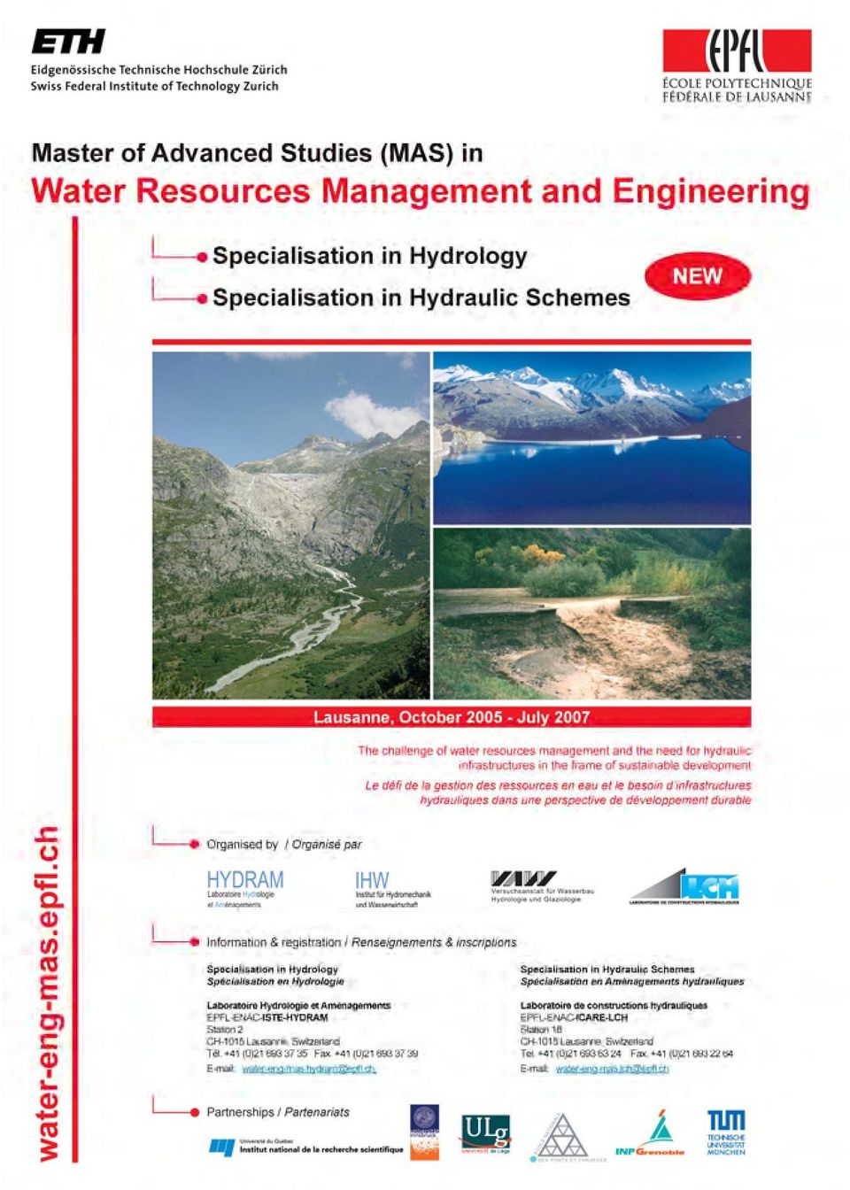
1 LCH Laboratoire de Constructions Hydrauliques Laboratory of Hydraulic Constructions Communication 41 Master of Advanced Studies (MAS) in Water Resources Management and Engineering Edition Collection des articles des travaux de diplôme Collection of papers of the diploma theses Editeur : Prof. Dr A. Schleiss Lausanne, 2010

2 Communications du Laboratoire de Constructions Hydrauliques ISSN Ecole Polytechnique Fédérale de Lausanne Editeur: Prof. Dr A. Schleiss N J.-L. Boillat, P. de Souza Hydraulic System - Modélisation des systèmes hydrauliques à écoulements transitoires en charge N Cycle postgrade en aménagements hydrauliques Collection des articles des travaux de diplôme postgrade N S. Emami Erosion protection downstream of diversion tunnels using concrete prisms - Design criteria based on a systematic physical model study N Ph. Chèvre Influence de la macro-rugosité d'un enrochement sur le charriage et l'érosion en courbe N S. André High velocity aerated flows on stepped chutes with macroroughness elements N Conférence sur la recherche appliquée en relation avec la troisième correction du Rhône - Nouveaux développements dans la gestion des crues N INTERREG IIIB - Projet ALPRESERV. Conférence sur la problématique de la sédimentation dans les réservoirs - Gestion durable des sédiments dans les réservoirs alpins N Master of Advanced Studies (MAS) in hydraulic schemes Collection des articles des travaux de diplôme N S. Sayah Efficiency of brushwood fences in shore protection against windwave induced erosion N P. Manso The influence of pool geometry and induced flow patterns in rock scour by high-velocity plunging jets N M. Andaroodi Standardization of civil engineering works of small high-head hydropower plants and development of an optimization tool N Symposium érosion et protection des rives lacustres Bases de dimensionnement des mesures de protection des rives lacustres N A. Vela Giró Bank protection at the outer side of curved channels by an undulated concrete wall N F. Jordan Modèle de prévision et de gestion des crues - Optimisation des opérations des aménagements hydroélectriques à accumulation pour la réduction des débits de crue

3 PREFACE Les ressources en eau de notre planète doivent être gérées de manière toujours plus efficace et dans une perspective de développement durable. L étude des divers aspects d une telle gestion exige des connaissances de haut niveau tenant compte aussi bien des caractéristiques scientifiques et techniques que des aspects sociaux, économiques et culturels. L objectif général du programme du Master of Advanced Studies (MAS) est de former des spécialistes pour les secteurs public et privé capables de répondre aux besoins actuels et futurs de la société en matière de gestion des ressources en eau. Le programme offrait deux spécialisations, l une en hydrologie et l autre en aménagements hydrauliques. Ce MAS a été organisé conjointement par deux laboratoires de l EPFL, celui d Hydrologie et Aménagements (HYDRAM) du Professeur A. Musy et de Constructions Hydrauliques (LCH) du Professeur A. Schleiss, et de l ETH Zürich par la Chaire Hydrologie et Gestion des ressources en eau (IHW) du Professeur P. Burlando et le Laboratoire Hydraulique, Hydrologie et Glaciologie (VAW) du Professeur H.-E. Minor. Dans la présente communication, les 29 nouveaux diplômés de l édition du MAS (anciennement cycle d études postgrades depuis 1999) présentent le résultat de leur travail de fin d études. Les sujets traités par ces travaux remarquables couvrent le vaste domaine des aménagements hydrauliques et de la gestion des ressources en eau. La haute qualité des travaux réalisés démontre que les nouveaux diplômés MAS ont acquis les compétences scientifiques et professionnelles nécessaires pour gérer des projets complexes dans le domaine des aménagements hydrauliques en qualité de d'ingénieur chef. A ce niveau de connaissances, ils vont certainement contribuer avec succès au grand défi de ce siècle, qui est de satisfaire les besoins vitaux en eau sur notre planète. Nous aimerions remercier toutes les personnes qui ont contribué à l'enseignement, toutes les entreprises et bureaux d ingénieurs qui ont accueilli les étudiants étrangers comme stagiaires et qui ont proposés des sujets d étude. Nous remercions également toutes les personnes qui ont suivi ces travaux de fin d études et participé comme experts au jury. Finalement, nous remercions le Dr Giovanni De Cesare qui a réalisé la compilation finale de la présente communication. Prof. Dr Anton Schleiss Directeur LCH
 est de former des spécialistes pour les secteurs public et privé capables de répondre aux besoins actuels et futurs de la société")
4 FOREWORD The planet's water resources need to be managed through an optimal and sustainable approach. The study of the various aspects of water resources management requires high level knowledge taking into account scientific and technical characteristics as well as social, economic and cultural aspects. This Master of Advanced Studies (MAS) programme aims to form specialists in the public and private sectors capable of responding to current and future needs of the society regarding water resources management. The programme offered two specializations, one in hydrology and the other in hydraulic schemes. This MAS has been organized jointly by the EPFL with the Hydrology and Land Improvement Laboratory (HYDRAM) of Professor A. Musy and the Laboratory of Hydraulic Constructions (LCH) of Professor A. Schleiss, together with the ETH Zürich Chair of Hydrology and Water Resources Management (IHW) of Professor P. Burlando and the Laboratory for Hydraulics, Hydrology and Glaciology (VAW) of Professor H.-E. Minor. In the present communication the 29 newly graduated participants of the MAS edition (formerly postgraduate studies since 1999) present the results of their practical master thesis. The topics treated of these remarkable thesis projects cover the wide field of hydraulic schemes and water resources management. The high quality papers confirm that the new graduated engineers have acquired additional scientific and professional competences required to manage complex projects in the field of hydraulic schemes as chief engineer, which was the purpose of the postgraduate studies. With their knowledge they will certainly contribute with great success to the challenge of this century, which is to satisfy the human vital needs in water all over the world. We would like to thank all lecturers, all companies which have hosted foreign students as trainees and which have proposed the topics for the master thesis works. We thank also all persons who have supervised the thesis projects and participated as experts to the examination committees. Finally we would like to thank Dr. Giovanni De Cesare who prepared the final page compilation of this communication. Prof. Dr Anton Schleiss Director LCH
 programme aims to form specialists in the public and private sectors capable of responding to current and future needs of the society regarding water resources")
5
6

7 TABLE DES MATIERES / TABLE OF CONTENTS 1. Market Potential of a Membrane Based Wastewater Treatment Plant for Decentralized Application in China - An economic evaluation of a potential largescale product 1 Corinna Adler Swiss Federal Institute of Aquatic Science and Technology (Eawag), Dübendorf, Switzerland Jury: Truffer Bernhard (Eawag, Dübendorf), Prof. Matthias Finger (EPFL-MIR, Lausanne), Dominique Guex (EPFL-HYDRAM, Lausanne) 2. Debris flow and protection measures of the Tinière torrent at Villeneuve (VD) 11 Claudia C. Andrade A. Aquavision Engineering, Ecublens, Switzerland Jury: Erik Bollaert (AquaVision Engineering, Ecublens), Philippe Hohl (SESA - Service des eaux, sols et asainissement, Lausanne), Giovanni De Cesare (EPFL-LCH, Lausanne) 3. Bed stabilization with placed blocks, a physical model investigation 23 Laxman Aryal VAW-ETH Zurich Switzerland (Training Place), Katmandu Nepal (Home country) Jury: Tanja Janisch-Breuer (ETHZ-VAW, Zürich), Benno Zarn (Hunziker, Zarn & Partner AG, Aarau), Prof. Hans-Erwin Minor (ETHZ-VAW, Zürich) 4. Analyse et optimisation de l'aménagement hydroélectrique de Fully 33 Sébastien Bassani Stucky SA, Renens, Suisse Jury: Olivier Vallotton (Stucky SA, Renens), Alexandre Oberholzer (EOS, Lausanne), Giovanni De Cesare (EPFL-LCH, Lausanne) 5. Karstwasserwege des Einzugsgebiets Griessental - Auswertung eines Markierversuchs und Abflussmodellierung 41 Rolf Boller Höhlenforscher-Gemeinschaft Unterwalden, Obwalden, Nidwalden, Schweiz, Jury: Prof. Aurèle Parriaux (EPFL-GEOLEP, Lausanne), Werner Balderer (ETHZ-Geologisches Inst., Zürich), Dominique Guex (EPFL-HYDRAM, Lausanne) 6. On the sensitivity analysis of the PMF to the space-time distribution of a PMP - Analysis of the hydrological response of a catchment 51 Jose Agustin Breña Naranjo Laboratoire de Constructions Hydrauliques, Ecole Polytechnique Fédérale de Lausanne, et Hertig &Lador SA, St-Livres, Suisse Jury: Jaques-André Hertig (Hertig et Lador SA, St-Livres), Theodor Sonderegger (BFE, Berne), Dominique Guex (EPFL-HYDRAM, Lausanne) 7. Etude préliminaire concernant la mise en place d une variante de dérivation afin de résoudre à long terme le problème d alluvionnement de la retenue de Tourtemagne 61 Alain Broccard Sierre, Suisse et BINA Engineering SA, Tourtemagne, Suisse Jury: Georges-Alain Zuber (Forces Motrices de la Gougra SA, Sierre), Moritz Steiner (Service de l'énergie et des forces hydrauliques, Sion), Giovanni De Cesare (EPFL-LCH, Lausanne) 8. Ouvrages de protection de berges sur les rivières 73 Sabrina Carvalho Pereira Laboratoire de constructions hydrauliques, École Polytechnique Fédérale de Lausanne, Suisse Jury: Jean-Louis Boillat (EPFL-LCH, Lausanne), Bernard Hagin (indépendant, Lutry), Giovanni De Cesare (EPFL-LCH, Lausanne) i
, Dominique Guex (EPFL-HYDRAM, Lausanne) 2. Debris flow and protection measures of the Tinière torrent at Villeneuve (VD) 11 Claudia C. Andrade A.")
8 9. Instandsetzung eines Druckstollens - Fallbeispiel Tiefencastel West 85 Niculin Cathomen Zürich, Schweiz Jury: Prof. Anton Schleiss (EPFL-LCH, Lausanne), Thomas Marty (ewz, Sils), Giovanni De Cesare (EPFL-LCH, Lausanne) 10. Fonctionnement hydraulique et environnemental d un élargissement local sur le Rhône en aval de Sierre Valais 97 Christel Dischinger ETEC Sàrl, Sion, Suisse Jury: Giovanni De Cesare (EPFL-LCH, Lausanne), Régine Bernard (Bureau ETEC, Sion), Dominique Guex (EPFL-HYDRAM, Lausanne) 11. Conséquences de la rupture de barrages ensablés - Etude théorique, expérimentale et numérique et conseils sur les directives de sécurité 107 Rafael X. M. Duarte Laboratoire de constructions hydrauliques, Ecole polytechnique fédérale de Lausanne, Suisse Jury: Jean-Louis Boillat (EPFL-LCH, Lausanne), Georges Darbre (OFEN, Ittigen), Giovanni De Cesare (EPFL-LCH, Lausanne) 12. La Sarine à l aval du barrage de Schiffenen - Etat actuel et élaboration du concept de mesures 117 Anne Grandin Groupe E SA, 1636 Broc, Suisse Jury: Jean-Claude Kolly (Groupe E SA, Broc), Olivier Overney (Section lacs et cours d eau, Etat, Fribourg), Jean-Louis Boillat (EPFL-LCH, Lausanne) 13. Laminage et contrôle des crues par des barrages voûtes sur la rivière de la Dranse en Valais, Suisse 127 Fadi Hachem Stucky SA, Renens, Suisse Jury: Patrice Droz (Stucky SA, Renens), Khalid Essyad ( Bonnard & Gardel Ingénieurs-conseils SA, Lausanne), Jean-Louis Boillat (EPFL-LCH, Lausanne) 14. Experimental study of outlet discharge regulator of retention works 141 Ramesh Khanal Laboratoire de constructions hydrauliques, Ecole polytechnique fédérale de Lausanne, Suisse Jury: Jean-Louis Boillat (EPFL-LCH, Lausanne), Bernard Hagin (indépendant, Lutry), Giovanni De Cesare (EPFL-LCH, Lausanne) 15. Optimization of Tamanthi multipurpose project, Myanmar - Evaluation of Embankment Dam and Foundation 153 Homeira Mahmoudian Colenco Power Engineering AG, Baden, Switzerland Jury: Karl Steiger (Colenco Power Engineering, Baden), Prof. Raymond Lafitte (indépendant, Lutry), Prof. Anton Schleiss (EPFL-LCH, Lausanne) 16. Étude de variantes pour l'utilisation de la force hydraulique de l'arbogne à l amont de Corcelles - Renouvellement de la concession, réhabilitation de l'installation existante, mise en place d'une nouvelle turbine, électrification, raccordement au réseau 163 Gil Meienberger Avenches, Suisse Jury: Giovanni De Cesare (EPFL-LCH, Lausanne), Vallotton Olivier (Stucky SA, Renens), Jean- Louis Boillat (EPFL-LCH, Lausanne) ii
, Régine Bernard (Bureau ETEC, Sion), Dominique Guex (EPFL-HYDRAM, Lausanne) 11.")
9 17. Flood protection and nature conservation in the Maritza River 169 Christopher S. Meyer, Zurich, Switzerland, IfU ETHZ and BBF Office, Sofia and Plovdiv, Bulgaria Jury: Peter Molnar, Francesca Pellicciotti (ETHZ-IfU, Zurich), Prof. Jorge Ramirez (Colorado State University, Civil Eng., Fort Collins, USA), Prof. Paolo Burlando (ETHZ-IfU, Zurich) 18. Preliminary Hydrological Modelling of River Thur Revitalisation Scheme using the Physically Based Distributed Model PIHM 179 Alanna Teressa Minogue Ecological Engineering Laboratory, Ecole polytechnique fédérale de Lausanne, Switzerland Jury: Prof. Andrew Barry ( EPFL-ECOL, Lausanne), Prof. Clinton Willson (Louisiana State University, USA), Dominique Guex (EPFL-HYDRAM, Lausanne) 19. Hydrokinetic energy from the Rhone River - site assessment and physical modelling 189 Hanane Moukhliss Laboratoire de constructions hydrauliques, Ecole polytechnique fédérale de Lausanne, Suisse Jury: Giovanni De Cesare (EPFL-LCH, Lausanne), Patrice Droz (Stucky SA, Renens), Prof. Anton Schleiss (EPFL-LCH, Lausanne) 20. Verlandungsproblematik in den Stauseen der Kraftwerke Sarganserland - Situationsanalyse und Lösungsvorschläge 201 Philippe J. Müller Nordostschweizerische Kraftwerke AG, Baden, Schweiz Jury: Erich Schmid (NOK, Baden), Henri Pougatsch (Indépendant, Bolligen; ex Office féd. eaux et géologie), Giovanni De Cesare (EPFL-LCH, Lausanne) 21. L eau et ses problématiques dans l enseignement de l aménagement du territoire et de l urbanisme - Premières études pour l élaboration d un didacticiel d enseignement 213 Marion Penelas Carouge, Suisse et ENAC-INTER, Ecole Polytechnique fédérale de Lausanne, Suisse Jury: Jean-Louis Boillat (EPFL-LCH, Lausanne), Bernard Hagin (indépendant, Lutry), Giovanni De Cesare (EPFL-LCH, Lausanne) 22. Protection contre les laves torrentielles et les corps flottants 221 Stéphanie Pérez Laboratoire de constructions hydrauliques, Ecole Polytechnique Fédérale de Lausanne, Suisse et CSD Ingénieurs Conseils SA, Sion, Suisse Jury: Thomas Schneider (CSD, Sion), Bernard Hagin (indépendant, Lutry), Jean-Louis Boillat (EPFL-LCH, Lausanne) 23. Analysis of Hydroclimatic Trends in the Aconcagua river basin, Central Chile 233 Lilian Reyes Carbajal Institute of Environmental Engineering, ETH Zurich, Zürich, Switzerland Jury: Peter Molnar, Francesca Pellicciotti (ETHZ-ifu, Zurich), Prof. Jorge Ramirez (Colorado State University, Civil Eng., Fort Collins, USA), Prof. Paolo Burlando (ETHZ-ifu, Zurich) 24. Morphological development of the Merwedes 247 Paul Smith Ecole Polytechnique Fédérale de Lausanne, Switzerland and DHV B.V., Amersfoort, the Netherlands Jury: Kees Sloff (WL Delft NL), Marius Sokolewicz (DHVB.V., Amersfoort NL), Koen Blanckaert (EPFL-LCH, Lausanne) iii

10 25. The Nile River system water balance from the Equatorial Lakes to Lake Nasser 257 Quentin Stemmet Institute of Environmental Engineering, ETH Zurich, Zürich, Switzerland Jury: Peter Molnar, Francesca Pellicciotti (ETHZ-ifu, Zurich), Prof. Jorge Ramirez (Colorado State University, Civil Eng., Fort Collins, USA), Prof. Paolo Burlando (ETHZ-ifu, Zurich) 26. Surface hoar formation in complex Alpine terrain: A case study 269 Franziska Stössel Swiss Federal Institute for Snow and Avalanche Research Davos, Switzerland Jury: Michi Lehning (SLF, Snow and Permafrost, Davos), Prof. Jorge Ramirez (Colorado State University, Civil Eng., Fort Collins, USA), Prof. Paolo Burlando (ETHZ-ifu, Zurich) 27. Audit Fonctionnel de la STEP de Villette 279 Sébastien Villey GED, Préverenges, Suisse Jury: Michi Lehning (SLF, Snow and Permafrost, Davos), Prof. Jorge Ramirez (Colorado State University, Civil Eng., Fort Collins, USA), Prof. Paolo Burlando (ETHZ-ifu, Zurich) 28. Seitenerosionsereignisse Hochwasser Auswertung der Naturdaten 289 Fabio Wyrsch Versuchsanstalt für Wasserbau, Hydrologie und Glaziologie (VAW), ETH Zürich, Schweiz Jury: Bert Putzar (ETHZ-VAW, Zürich), Daniel Näf (Scherrer Hydrologie AG, Reinach), Prof. Hans-Erwin Minor (ETHZ-VAW, Zürich) 29. Turbinage des eaux potables, développement d une stratégie de dimensionnement, d évaluation économique et de mise en œuvre 297 Parsa Zarian Laboratoire de constructions hydrauliques, Ecole polytechnique fédérale de Lausanne, Suisse Jury: Jerôme Dubois (Hydrocosmos, Vernayaz), Philippe Heller (EPFL-LCH, Lausanne), Bernard Hagin (indépendant, Lutry), Jean-Louis Boillat (EPFL-LCH, Lausanne) iv
, Prof. Jorge Ramirez (Colorado State University, Civil Eng., Fort Collins, USA), Prof. Paolo Burlando (ETHZ-ifu, Zurich) 27.")
11 Market Potential of a Membrane Based Wastewater Treatment Plant for Decentralized Application in China An economic evaluation of a potential large-scale product Potentiel du marché pour une STEP sur base de la technologie membranaire pour une application décentralisé en Chine Une évaluation économique d un article de masse Corinna Adler Swiss Federal Institute of Aquatic Science and Technology Eawag, 8600 Dübendorf, Switzerland ABSTRACT: The successful centralized sanitation concept has shown its limits in transition countries like China. Thus, in water scarce Chinese cities with sludge problems membrane based decentralized wastewater treatment applications can be an alternative solution. Expert interviews conducted in China show that due to large-scale production with quantities higher than pieces these applications can become competitive. Such quantities of sales are realistic in China and the wastewater problem in China can be answered by introducing membrane based treatment facilities. As main market segment all new apartment buildings (300 residents each) in Chinese water scarce cities can be defined with an annual market potential of facilities. Ideal entrance markets are new remote buildings of the environmentally progressive cities Beijing and Tianjin with a potential of treatment applications annually. For economic and environmental reasons Chinese authorities are interested in decentralized solutions and system suppliers are ready to work this market. RESUME: Le concept du STEP centralisé a montré ses limites dans les pays en transition comme la Chine. Ainsi, pour les villes chinoises qui n ont pas suffisant d eau et qui souffrent des problèmes avec la boue d épuration, des STEP décentralisées sur base de la technologie membranaire pourrait être une solution alternative. Les entrevues conduites avec des experts en Chine prouvent qu en raison de la production à grande échelle surpassant des quantités plus que morceaux ces applications peuvent devenir concurrentiel. De telles quantités de ventes sont réalistes en Chine et le problème des eaux usées en Chine peut être répondu en introduisant des STEP sur base de la technologie membranaire. Comme segment du marché principal tous les nouveaux immeubles (300 résidants chacun) dans les villes chinoises rares de l'eau peuvent être défini avec un potentiel annuel du marché de équipements STEP. Les marchés d entrés idéaux sont de nouveaux bâtiments éloignés de centre-ville dans les ville écologiques Pékin et Tianjin avec un potentiel de application STEP annuel. Pour des raisons économiques et environnementales les autorités chinoises sont intéressées d introduire des solutions décentralisées et les fournisseurs de ces systèmes sont prêts à commercialiser ses produits STEP. 1 INTRODUCTION 1.1 General introduction A small problem in China multiplied by 1.3 billion people can turn into a very large problem, while a small solution multiplied by 1.3 billion people can make a very large change. Wastewater currently causes a large problem in China. Solutions to make a change are urgently needed. This study is an attempt contributing to that huge challenge. 1

12 Corinna Adler To accomplish the Water Resources Management Master of Advanced Studies at the Swiss Federal Institute of Technology EPFL a thesis together with the Federal Institute of Aquatic Science and Technology Eawag has been chosen to investigate on urban wastewater in China. Additionally, the study has been supported by the investment company Emerald Technology Ventures with its input regarding market potential estimations. The marketing research institute CBC China Business Centre CBC assisted the study with market analysis and translation services. 1.2 Goal of the study With a wastewater treatment rate of 22%, sanitation in China is poor and leads to extensive environmental consequences. The protection of public health and the conservation of water resources as the main goals of a sanitation system are not achieved. Hence, the Chinese Government is initiating large investments in wastewater treatment. With respect to effectively allocate wastewater investments in urban sanitation the goal of this study is to find out more about the market potential in China for membrane based wastewater systems in decentralized application of urban wastewater treatment. Thereby, drivers for decentralized infrastructure in China, the hype of the membrane technology, as well as the cost and investment side of the wastewater business have been assessed. 2 DEFINITIONS AND METHODS 2.1 General definitions Chinese market information and data has been approached, analyzed and classified with data from the Swiss sanitation system taking over the role of a reference concept. Expert interviews with international system suppliers, Chinese governmental organisations, Chinese and Swiss academics, and Chinese real estate developer companies have been conducted to acquire relevant information. 2.2 Theory on market potential In marketing, the term market refers to the group of consumers or organizations that is interested in the product, has the resources to purchase the product, and is permitted by law or other regulations to acquire the product (Net MBA Online, 2007). The market definition begins with the population respectively the mass of consumers of a product as the largest layer for selling a product. The next smaller layer of a market is the market potential with its share of the total population who has interest in acquiring the product under optimal conditions. Since the market is likely to be composed of consumers whose needs differ, market segmentation is useful in order to better understand those needs and to select the groups within the market that a company will serve (Net MBA Online, 2007). Markets can be segmented according to the measurable costumer characteristics geographic, demographic, and behavioralistic. The treatment of one part of the market as a homogenous group is called mass marketing, offering the same product to all customers. Mass marketing allows economies of scale to be realized through large-scale production and mass distribution. The drawback of mass marketing is that needs and preferences differ and the same offering is unlikely to be viewed as optimal by all customers. 2.3 Investment comparison method The market analysis of this study contains quantitative data like investment and operation costs. As investment costs play a critical role in decision-making the determination and comparison of current and future costs require a proper definition of the cost elements. The official or the market exchange rate is often used to compare prices in different currencies. The official exchange rate between Swiss Franc CHF and Chinese Yuan CNY is 1CHF = 6,348 CNY (China Knowledge, 2007). Since identical volumes of goods and services in different countries correspond to different values when official exchange rate is used, an alternative method of comparing prices across countries has been developed. In this method national currency are converted to a com- 2

13 Market Potential of a Membrane Based Wastewater Treatment Plant for Decentralized Application in China mon unit by using conversion factors that reflect equivalent purchasing power. Purchasing power parity PPP conversion factors are based on prices and expenditure surveys and represent the conversion factors applied to equalize price levels across countries (World Bank Online, 2007). In this study, 0,947 PPP units of Chinese Yuan are required to buy the same amount of goods and services in China as 1 Swiss Franc would buy in Switzerland (1CHF = 0,947 CNY). Investment data found from the Swiss and Chinese wastewater business often were total investment costs without giving any information about interests or other important information like depreciation rates or about the treatment quality. A business-management method therefore was required to compare fixed and variable cost elements of centralized and decentralized wastewater concepts. The classical cost comparison method has been chosen as this static investment evaluation method serves in comparing investment alternatives (Thommen, 1996). The cost comparison method considers average costs of a period respectively of one year. Thus, the fixed investment costs have to be converted into uniformly distributed annual capital charges containing depreciation and interests. For this study, variable costs comprehend annual recurring operation as well as maintenance costs including minor re-investments. 2.4 Survey and stakeholder selection A qualitative survey and a comprehensive primary desk research in literature were the two main data sources of the thesis. Interviews with Swiss, German and Chinese experts have been personally conducted. The aim of the survey and desk research was to collect and assess information about wastewater treatment, membrane technology and market potential information from China. Knowing the views of decision makers and industry experts provides invaluable information in general. For this study having a broad spectrum of strategic information and coherences is more relevant than building up representative information. Hence, the technique of an explorative expert survey has been chosen, whereby the expert interviews were conducted in an open one- to two-hour discussions using a semi-structured and -standardized questionnaire. The interviews were structured in three parts: In Part I, the Chinese centralized sanitation system was discussed and the decentralized concept was evaluated. In Part II, membrane technology in China was assessed and its decentralized application discussed. In Part III experts could give their appraisal where and under what circumstances decentralized applications could be introduced in the Chinese wastewater market. Technical fact sheets were prepared to help conveying information to experts during the interviews (Medilanski et al., 2006). Voice recording was not appreciated by the interviewed experts and therefore no digital record is available. In order to evaluate the qualitative statements of the survey the answers were written down during the interviews. As the interviews usually took place in Chinese, the answers were translated first and then written down. An expert is defined as a person with a specific responsibility for the draft, implementation and control of a problem solution, as well as having privileged access to information (Meuser et al., 1991). For the study four groups were formed out of experts who would play an important role in introducing decentralized membrane based wastewater treatment plants in China: Systems suppliers, authorities, real estate developers, and academics. Representative of those groups have been selected according to availability and especially according to their relevance for this study. In advance, 17 Swiss and German specialists in the fields of wastewater treatment, membrane technology, China and water, China and real estate, large-scale production, and water investments have been interviewed to build up background information, as well as to prepare and test the questionnaire, and to access the right experts. Finally, 22 Chinese stakeholders have been selected and interviewed. 3 DECENTRALIZED, MEMBRANE BASED SANITATION IN CHINA 3.1 Centralized and decentralized sanitation in China Centralized municipal and industrial sanitation in industrialized countries epitomizes a successful concept of protecting water resources and guaranteeing urban hygiene and comfort. One reason the concept is now being challenged are the increasing investment requirements to connect 3

14 Corinna Adler remote areas and to replace aged sewer systems. Another reason is the difficulties of exporting the concept to water-scarce countries experiencing rapid urban growth (Larsen and Gujer, 1997). The official treatment rate in China is indicated to be 45% (People s Daily, 2007). As the efficiency rate of existing wastewater treatment stations is extremely low the realistic treatment rate is only 22% (U.S. Department of Commerce, 2005). Thus, over 50% of existing treatment capacity is unused. Main reasons are the inexistence or the poor conditions of sewer systems. Decentralized sanitation with its modular and flexible character is considered to be an effective way in facing rapid urban growth and with its potential to locally reuse water an additional water resource could be tapped on-site. At life cycle costs comparisons decentralized sanitation could be to some extent even more economic than centralized sanitation. In addition to an extensive social and economical transformation process in industrialized countries, a sudden switch from centralized to decentralized sanitation would lead to large sunk costs combined with a large investment peak for the new system. From an economic perspective this seems to be a rather irrational situation to be called deadlock situation. Thus, no real market for decentralized wastewater concepts opens up in industrialized countries. Figure 2 visualizes the main characteristics of the centralized and decentralized wastewater treatment concepts. Figure 1. Schematized centralized and decentralized wastewater concepts. Countries like China hardly having any wastewater treatment in place (Xu, 2006) or experiencing rapid urban construction development are not struggling with a deadlock situation. Currently, with increasing environmental pressure China needs and wants to invest in urban municipal wastewater treatment. Chinese experts confirm that the wastewater market could absorb decentralized wastewater concepts if the questions on funding of the system, operation and pollution control are solved. Optimized investment allocation in the wastewater business, limited (quantitative) water resource availability and increasing sludge accumulation have been outlined as three main arguments envisaging decentralized wastewater treatment in China s cities. As a consequence it is essential finding a technology that answers problems of water scarce areas and the sludge issue at costs that are even underbidding the benchmark of conventional installation costs. In addition, decentralized applications only form a market potential if public hygiene can be ensured and control frameworks are installed. 3.2 Membrane technology in decentralized application Many technologies could be considered for decentralized wastewater treatment. To answer the water scarcity and the sludge accumulation issue at once, membrane technology is seen among international and Chinese experts as a promising technology. Material separation by means of 4
.")
15 Market Potential of a Membrane Based Wastewater Treatment Plant for Decentralized Application in China membranes is a physical separation process delivering more efficient treatment qualities than conventional technologies (Dohmann, 2002). Additionally, treated water can be reused for nonpotable applications. Membrane technology with its modularity is applicable for space-saving decentralized use. Different prototypes are available in the market for wastewater treatment of 4 up to 500 residents. Technical elements from different supplier companies are taken over for the specification of a membrane based wastewater treatment plant defined in this study (see figure 2) and called TEDE, short word for technological desire. From a technical perspective, the market already provides viable products and no additional or new features need to be invented for the Chinese market. Figure 2. Specification of the on-site wastewater treatment system TEDE Membrane technology for wastewater treatment is interesting for China regarding treatment quality with potential for effluent reuse and the low sludge production quantity. The technology can become even more promising for China if investment costs and the relatively high energy demand could be equalized by standardization and performance improvements of the membranes. The study shows that TEDE for 300 residents is technically feasible and from an operating and controlling position viable. Due to elevated investment costs of membrane technology and little operation and control standards costs are rather high compared with conventional wastewater systems. Besides the cost argument Chinese expert s mention that for rolling out the TEDE application in Chinese cites a reliable technology, a comprehensive distribution and service network and a centralized control framework are required. Thus, the two main challenges are to decrease the costs of the membrane module and finding viable solutions for the operation and control of this decentralized application. Following the experts opinion, TEDE investment costs including installation could be reduced by 20% at annual quantities of more than pieces due to large-scale production in China (standardization, buying power in materials procurement, efficient large-scale production due to larger production facilities, and better manufacturing methods). Additional cost reductions of 10% are possible if quantities produced are more than pieces due to production automation. That means through large-scale production the TEDE application would be on sale for 363 CNY/capita/year in China (see figure 3). 5
 and called TEDE, short")
16 Corinna Adler Figure 3. Annual investment costs new TEDE and centralized sanitation Applying this wishful TEDE product of 384 CHF/capita/year to the reference Swiss sanitation system a theoretical market share between 12% and 24% could be captured with this decentralized application (see figure 4). Total annual sewage disposal costs [CHF/capita/year] Theoretical market potential TEDE in Switzerland Gesamtkosten Kanalisationskosten t Share of total villages/cites with population 100% = 7.36 m Figure 4. Distribution of Swiss centralized sanitation costs (based on Maurer and Herlyn (2006)) China defines water reuse as important and additionally wants to solve the problems with the sludge accumulation. Furthermore, with growing economic welfare increasing quality demand on treated wastewater is demanded. If these three arguments with strong cost effects would be considered in cost comparison calculations, TEDE could be even more competitive to centralized wastewater systems. Besides the economies of the product for successfully rolling out this system, factors like distribution of the large-scale TEDE, operation and maintenance services, and system controls need to be taken into account (Etnier et al., 2005). For further research all these effects should be examined and included into the calculation. 3.3 Market assessment The construction of outdated and new wastewater treatment plants and piping systems in China creates a large market demand for relevant technology and equipment. As shown above, in Swiss sanitation system it could be more economical for 12-24% of the villages and cities to allocate investment funds on the wishful large-scale produced membrane based decentralized applications instead of building a conventional centralized system. Applying this share on the 6

17 Market Potential of a Membrane Based Wastewater Treatment Plant for Decentralized Application in China Chinese wastewater market interesting business opportunities for suppliers of decentralized systems could open up as China is about extending its sanitation system with over 90 billion CNY during the next years (GOV Chinese Government Official Webportal, 2007). System suppliers in China are keen to know where and how big the market potential of on-site wastewater applications is. Authorities also are interested knowing the market potential as they want to optimally allocate governmental funds. Following the methodology described above the segmentation according to the attributes geographic, demographic and the buying motive has been completed. Water scarcity is presented as the relationship between water availability and human population, in other words water availability per capita per year (Falkenmark, 1992). Combining the Falkenmark indicator with the water resource availability data from the statistical yearbook of China gives information about Chinese provinces suffering of water stress or scarcity. The main characteristic of North East and South East of China are water scarcity plus tremendous densely populated cities (321 major cities with around 280 million residents). As these cities are growing fast according to a satellite pattern the conditions for a decentralized wastewater treatment market are given. Through geographic and demographic segmentation arguments the market segment for decentralized wastewater applications new municipal buildings in major Chinese water scarce cities is defined and quantified. From these new buildings 17% are due to urban growth and 83% due to replacement investments (CER Supplement, 2007). Figure 5 shows the water scarce areas of China. Figure 5. China map with water scarce provinces marked The buying motive of Chinese Local Governments points out three different scenarios for the quantification of TEDE sales in the defined market segment. The market potential for the largescale product TEDE and its variable costs is quantified according to three different market segmentation scenarios. The radical scenario assumes that through political regulation the whole market segment new municipal buildings in major Chinese water scarce cities is accessible. This scenario can be seen as the final stage of the market implementation of TEDE. The fair scenario is an intermediate scenario assuming that TEDE is installed in buildings of new apartment buildings due to urbanization. The moderate scenario assumes that for TEDE s market entrance the cities Beijing and Tianjin play a precursor role by installing TEDE in new apartment buildings that are remotely located. This remote location is due to the satellite pattern a cities urbanization is following. Depending on the segmentation scenario radical, fair or moderate buying motive a market potential of more than 151 million CNY per year can be proposed (see figure 6). Variations in the environmental and social assumptions of this study could have a positive effect on market potential calculation as variation of the technical and economic assumptions could have a negative impact. 7

18 Corinna Adler Figure 6. Potential calculation of TEDE product 4 CONCLUSIONS Chinese experts consider the high water requirement for wastewater transport in areas suffering quantitative water scarcity and the increasing sludge accumulation as the main limitation factors of this conventional sanitation system. Additionally, the inefficient use of existing treatment capacity due to poor sanitation systems are an important argument, that centralized wastewater treatment systems alone are not enough in solving China s huge wastewater problem. Experts estimate that decentralized sanitation concepts are a viable solution in compensating gap s from conventional sanitation systems. In this study a decentralized unit is defined to be an apartment building of 300 residents. Chinese experts further assume that the wastewater market in China can absorb decentralized wastewater concepts if the questions of responsibility over the system, operation of the applications and pollution control are solved. Regulations and responsibility concepts to compulsory implement decentralized wastewater treatment in water scarce areas are hardly introduced. Additional regulations by Local Governments could speed up in starting a decentralized sanitation era. To answer the water scarcity and the sludge accumulation issue at once, membrane technology is seen among international and Chinese experts as a promising technology. Material separation by means of membranes is a physical separation process delivering more efficient treatment qualities than conventional technologies. Additionally, treated water can be reused for non-potable applications. Membrane technology with its modularity is applicable for spacesaving decentralized use. From a technical perspective, the market already provides viable products and no additional or new features need to be invented for the Chinese market. Answers from Chinese experts confirm that this membrane based wastewater treatment system could theoretically offer 20% economies of scale through large-scale production if quantities of more than pieces per year can be applied. Exceeding quantities additional cost reduction of 10% would be feasible due to extended production automation. Therefore, an economically interesting effect could be created while decentralized concepts are about outrivaling centralized sanitation systems. After qualitative analyzes on water scarcity and quantitative economies of scale calculations three market segments for this wishful decentralized membrane based wastewater treatment system are derived. The first market segment are 100% of the annual new municipal buildings ( buildings) in the 321 major Chinese water scarcest cities due to the assumption that compulsory regulations for the installation of this system are imposed. Second, following the Swiss reference concept, it is assumed for China that with a buying motive of 12 to 24% of the market new municipal buildings in major Chinese water scarce cities can be worked. This statement is resulting from the analysis that annual new apartment buildings due to pure urbanization (around buildings) are remotely located and following a similar cost distribution pattern as the Swiss system. Third, with a pure economic and probably most realistic - consideration and without any political regulations a recurring annual market potential of 151 million Chinese Yuan can be expected. In this scenario it is assumed that the water scarce and environmentally progressive cities Beijing and Tianjin implement this decentralized wastewater treatment application in new apartment buildings that are due to urbanization remotely located. 8

19 Market Potential of a Membrane Based Wastewater Treatment Plant for Decentralized Application in China With annual new apartment buildings the two neighbour cities deliver sufficient demand to produce the treatment system in large-scale production offering economies of scale of 20%. But large-scale production is not yet realized. Again, one reason is the lacking political regulations favouring decentralized systems and therefore system supplier wait building up production facilities. Another reason is the concerns from authorities and academics about services and controls of systems. They fear that public hygiene cannot be ensured due to the atomized distribution of treatment plants among the country. Reliable solutions regarding this issue are internationally tested in show cases, but these techniques are not yet mature at satisfying prices. Additionally, planning, production and implementation time has not been considered during the product evaluation. The need to act is urgent in China. But even if compulsory regulations for decentralized wastewater treatment by membrane technology would be implemented in China by tomorrow, time required for rolling out a large-scale product starting from a prototype would take one to two years. In order to speed up the roll out of decentralized wastewater treatment applications international system and solution suppliers based in China could in principle start building up pilot schemes. The market potential calculation of this study was an attempt to show system suppliers theoretical quantitative achievements in the Chinese wastewater market with a wishful large-scale product and to support authorities in judging investments in decentralized wastewater applications. From a quantitative as much as qualitative perspective analyzing a theoretical market potential was possible with making a detour to the Swiss sanitation system and with the definition of a bunch of assumptions. Thus, uncertainties like the definition of the buying motives were certainly created. Testing these uncertainties by sensitivity analyzes turned out to be difficult. To quantitatively evaluate the market potential outcome further research would be required. The study assumes that the Chinese Government provides initial funds for decentralized applications by taking over ownership and responsibility for investments and operation. It would be interesting to further analyze financing and organisational alternatives. As financing alternative, for simultaneously speeding up a possible implementation of decentralized wastewater systems, and to overcome potential gaps of a Local Government s budget, international system and solution supplier could offer financing schemes such as the BOT (build-own-transfer) concepts. A small problem in China multiplied by 1.3 billion people can turn into a very large problem, while a small solution multiplied by 1.3 billion people can make a very large change. Following the analysis in this study the large wastewater problem in China can be answered by working the decentralized wastewater market with membrane based treatment applications. An environmental incentive for China is given through the quality of the treated wastewater. An economic incentive for China is stimulated with the reuse potential, with the avoidance of large sludge accumulations, and the redundancy of sewer system to remote urban areas. The proactive participation of high-rank Chinese experts (authorities, academics, real estate developers, and system suppliers) points out under certain constraints - their interest in alternative wastewater solutions. Authorities are interested in decentralized solutions for economic but as well for environmental reasons. System suppliers prepare themselves to be ready for working the market and of course to win the first mover advantages. Thus, solutions like decentralized wastewater treatment with membrane technology could help starting a large change in the Chinese wastewater treatment market REFERENCES CER Supplements Focus Real Estate. Residential s New Directions. China Economic Review CER Supplements January China Knowledge Online (2007). RMB exchange rate. assessed in April Dohmann M Perspektiven für die Membrantechnik Anlagen in der Abwassertechnik Anwendungen in der dezentralen Abwasserbehandlung. Referat anlässlich des Huber AG Symposium in Berching. RWTH Aachen, Germany. Etnier C., Willetts J., Mitchell C.A., Fane S. and Johnstone D.S. (2005). Decentralized Wastewater System Reliability Analysis Handbook. Project No. WU-HAT Prepared for the National Decentralized Water Resources Capacity Development Project NDWRCDP, Washington University, St. Louis, MO, by Stone Environmental, Inc., Montpelier, VT. 9

20 Corinna Adler Falkenmark M. and Widstrand C. (1992). Population and water resources: a delicate balance. Population Bulletin 47 (3). Population Reference Bureau, Washington DC, USA. GOV Chinses Government Official Webportal (2007). The 11th Five Year Plan assessed in April 2007 Larsen T.A. and Gujer W. (1997). The concept of sustainable urban water management. Water Science & Technology, 35(9), Maurer M. and Herlyn A. (2006). Zustand, Kosten und Investitionsbedarf der schweizerischen Abwasserentsorgung. Swiss Federal Institute for Aquatic Science and Technology, Duebendorf, Switzerland. Medilanski E., Chuan I., Mosler H.J., Schertenlieb R., Larsen T. (2006). Wastewater Management in Kunming, China: a Stakeholder Perspective on Measures at the Source. Swiss Federal Institute for Aquatic Science and Technology, Duebendorf, Switzerland. Meuser M. and Nagel U. (1991). Expterteninterviews vielfach erprobt, wenig bedacht. Ein Beitrag zur qualitativen Methodendiskussion. In Detlef Garz and Klaus Kraimer (editors), Qualitative Sozialforschung, Westdeutscher Verlag, Opladen, pages NBS I National Bureau of Statistics of China (2006). China Statistical Yearbook China Statistics Press. NBS II National Bureau of Statistics of China (2006). China Statistical Yearbook on Environment China Statistic Press Net MBA Online (2007). Market Definition. Business Knowledge Center. People s Daily Online (2007). Urban sewage treatment rate reaches % in China. Thommen, J.P Managementorientierte Betriebswirtschaftslehre. Versus Verlag AG, Zürich, Switzerland. U.S.Department of Commerce (2005). Water supply and wastewater treatment market in China. International Trade Administration, Washington D.C., USA. The World Bank Online (2007). Definition Water Resources Management. agepk:149018~pipk:149093~thesitepk:337240,00.html assessed in April Xu F Konzepte zur Wasserversorgung und Abwasserentsorgung für verschiedene Siedlungsstrukturen in China. Dissertation, Rheinisch-Westfälische Technische Hochschule Aachen, Germany. 10

21 Debris flow and protection measures of the Tinière torrent at Villeneuve (VD) Laves torrentielles et mesures de protection sur la Tinière à Villeneuve (VD) Claudia C. Andrade A. Aquavision Engineering, Ecublens, Switzerland ABSTRACT: In the summer of 2006, after prolonged intense rainfall, a debris flow occurred in the middle reach of the Tinière torrent in the city of Villeneuve, Switzerland. The steep bed, fine material landslides, and high volume material available in the basin, combined with high discharges is a perfect scenario for a debris flow. This paper describes a methodology based on research studies, as well as field studies, attempting to asses debris flow events by means of analytical and numerical modeling. Sediment transport equations for steep slopes and analytical debris flow formation formulae are the main tools utilized. Realistic scenarios and mitigation measures are simulated with the numerical model FLO-2D. Results show the risk of the blockage of the Cantonal Highway and the need of a sediment control measure upstream of the urban area. RESUME: En été 2006, après des événements d intenses pluies, une lave torrentielle s est produite sur le tronçon moyen du torrent de la Tinière, sur la ville de Villeneuve en Suisse. Les pentes raides, les matériaux fine des berges et les énormes volumes de matériel disponible sur le bassin versant, combinées avec de fortes précipitations, se sont révèles être un scénario parfait pour la formation d une lave torrentielle. Cet article décrit une méthodologie basée sur des études de recherche, ainsi que des études de terrain, pour estimer des laves torrentielles en utilisant des modèles analytiques et numériques. Les outils utilisés se basent sur des équations de transport solide appliquées sur des pentes raides et des équations analytiques de formation des laves torrentielles. Des scénarios réalistes des mesures constructives ont été simulés avec le modèle mathématique FLO-2D. Les résultats ont montré le risque pour la Route Cantonale et la nécessité de contrôler les flux de sédiments en amont de la zone urbanisée. RESUMEN: En el verano del 2006, luego de una serie de fuertes lluvias, un flujo de detritos se produjo en la parte media del río Tinière, en la ciudad de Villeneuve en Suiza. Las altas pendientes, el material fino de los bordes y los enormes volúmenes de material disponible en la cuenca, combinado con las fuertes precipitaciones, formaron un perfecto escenario para la formación de flujo de detritos. Este artículo, describe una metodología basada en estudios de investigación, como también observaciones de terreno, para evaluar el fenómeno flujo de detritos basado en modelos analíticos y numéricos. Las herramientas empleadas se basan en ecuaciones de transporte de sedimentos y ecuaciones analíticas de formación de dicho fenómeno. Escenarios realistas de medidas de mitigación constructivas han sido simulados con el modelo matemático FLO-2D. Los resultados muestran el alto riesgo para la Ruta Cantonal y la definitiva necesidad de controlar el flujo de materiales sólidos aguas arriba de la zona urbanizada. 1 INTRODUCTION As a result of the hyperconcentrated flow event in July 2006, a general study of the Tinière catchment area has been performed to determine the potential of debris flows during highdischarge events (Aquavision Engineering 2007). Establishment of counter measures to prevent 11
22 Claudia C. Andrade Aramayo a disaster due to debris flows requires the knowledge of the mechanisms of its occurrence and cessation, as well as the characteristics of the flow (e.g., total volume of debris, flow velocity, mixture depth, destructive power, etc.). Two main actual-state scenarios are considered in order to represent the possible debris flow events in the basin. A mitigation measure concept is proposed for the scenarios. It is composed of: a debris retention basin in the middle reach, followed by ramps to reduce the potential damage of debris flows. 2 TINIÈRE DEBRIS FLOW Analysis of natural events suggests that one of the most frequent mechanisms of debris-flow initiation in the European Alps is channel-bed failure, generally triggered by surface water flow. Flume experiments suggest that debris-flow formation by channel failure is characterized by a destabilization of the torrent bed by surface runoff and a rapid transition from intense bedload transport to hyperconcentrated flow and finally to mature debris flow (Armanini 1991). Initiation mechanisms on the Tinière torrent correspond to sliding of deposits on the bed channel and side slopes. A continuous supply of loose material coming from the tributaries and side slopes form deposits that can be suddenly mobilized with a major event. Debris flow initiation due to progressive erosion of the channel bed is characterized by a rapid transition from bed load transport, to hyperconcentrated flow and then to a mature debris flow motion. This process takes place only in the upstream reach of the Tinière torrent. When the mature debris flow experiences a slope reduction of 33 to 16 degrees, it slows down and then continues as a hyperconcentrated flow downstream. Based on sediment concentration and according to Table 1, in this type of flow it is possible to detect wave action and all the particles rest on the bed in a quiescent flow condition. Table 1. Debris flow classification as a function of sediment concentration (O Brien 2006) Sediment Concentration by Volume by Weight Flow Characteristics Flow evident; slow creep sustained mudflow; plastic deformation under its own weight; cohesive; will not spread Mudflow on level surface Flow spreading on level surface; cohesive flow; some mixing Flow mixes easily; shows fluid properties in deformation; spreads on horizontal surface but maintains an inclined fluid surface; large particle (boulder) setting; waves appear but dissipate rapidly Marked settling of gravels and cobbles; spreading nearly Mud complete on horizontal surface; liquid surface with two Flood fluid phases appears; waves travel on surface Separation of water on surface; waves travel easily; most sand and gravel has settled out and moves as bedload Distinct wave action; fluid surface; all particles resting on Water Flood < 0.20 < 0.41 bed in quiescent fluid condition Water flood with conventional suspended load and bedload Concentration values vary from 20 to 40 percent per volume, depending on the reach and high-discharge event. Naturally occurring high-discharge flows of water and sediment in open channels vary over a wide and continuous spectrum of sediment concentration and particle-size distribution. Water floods normally transport mostly fine sediment and in relatively small quantities (as a portion or total flow volume), with suspended sediment having little effect on flow behavior. At the other end of the spectrum, especially in favorable geomorphic settings, high-discharge debris flow and mudflows may transport more sediment than water. 12
23 Debris flow and protection measures of the Tinière torrent at Villeneuve (VD) 3 BASIN CHARACTERISTICS AND HYDROGRAPHIC NETWORK The Tinière basin is located in the Switzerland pre-alpine region on the north-east side of Lake Geneva. Its main torrent, named the Tinière, flows from the peak of Aveneyre through steep slopes before arriving on its alluvial fan, urbanized by the city of Villeneuve, from which it flows into Lake Geneva. The catchment area can be divided into 18 sub-basins. However, only 5 of them have a clear waterway, and they do not have a constant source of water (Figure 1). Consequently, discharges are directly related to rainfall events and snowmelt. Its highest elevation is 2042 m and the outlet is at m. Downstream reach Medium reach Upstream reach Figure 1. Plan view of the Tinière basin Pluvial characteristics of the Tinière basin correspond to a pre-alpine regime. Its average discharges present two maximal peaks. The most pronounced is in April-May when snow smelting occurs and the smaller one occurs in November. The Tinière basin reacts strong and fast to storm events because of its high slopes. It is possible to divide the Tinière torrent into three main reaches with average slopes of 11, 16 and 33 percent (Figure 2). These three reaches have the following features: Downstream reach: is the canalized segment of the torrent and, which runs through Villeneuve. The channel passes under the major traffic arteries of the Freeway A9 and the Cantonal Highway, passing over an important railway and also it passes under several connector bridges. This canalization is lined with quarry stone with slopes from 7 to 9 percent. Middle reach, it starts at the upstream end of the canalized reach and continues until 4000 m from the outlet. Plan Cudray, a small village adjacent to the Tinière torrent, is located in this reach, as well as the junction with Plancudray ravine. For modeling purposes, the upstream boundary of the FLO-2D model is at chainage 3150 m, which is located in this reach. Upstream reach: it has an average slope of 33%, and important tributaries have their junctions with the Tinière in this portion. The torrent is characterized by being entrenched and there is almost no habitation next to it. 13
24 Claudia C. Andrade Aramayo Elevation [m] Downstream reach Middle reach Upstream reach Cantonal highway Freeway Cudray dowstream Cudray upstream FLO-2D model beginnig Canalized segment Average slope: 11% Average slope: 16% Average slope: 33% Distance to Lake Geneva [m] Figure 2. Longitudinal profile of the Tinière torrent Footbridge1 Footbridge 3 Railway Corbaudaz Bridge A9 Freeway Rivaz Bridge Crêt Bridge Muraz Bridge Cantonal Highway Footbridge 2 Figure 3. Main structures located in the downstream reach Station In general, the size fractions in the bed are bigger than the ones in the banks, which show clearly that the capacity of sediment transport in this torrent is large enough to mobilize the material from the banks during a flood. Bed grain sizes show average values for D 50 between 1.2 and 5.1 cm, and for D 90 between 6.5 and 22.5 cm. For the banks, D 50 is relatively homogeneous for most of the samples; they vary between 1.2 and 2.5 cm. Figure 4 depicts the representative grading curve considered for the different sediment analysis. Percent finer [%] Diameter [cm ] Figure 4. Grading curve 4 PAST DEBRIS FLOW EVENTS The study performed by Grot et al. (1997 in Ravot 2006) registered 25 floods in the Tinière basin between 1707 and The gravity of flooding in the downstream reach depends on how much material can be triggered from the tributary ravines. Neither discharge nor material volumes measurements are available. Grot et al. (1997) present a flood-intensity determination cri- 14
25 Debris flow and protection measures of the Tinière torrent at Villeneuve (VD) terion and show a summary of the attested flood effects registered for the Tinière torrent. Accordingly, the 2006 summer event would be classified with an intensity level of 4 on a 1 to 5 intensity scale. In addition, the return period was estimated to be no more than a 30-year-flood. (Ravot 2006) Channel obstruction occurs in the downstream reach due to important sediment deposits at the outlet which regressively reduces the hydraulic capacity during the event causing overflow and inundation. This process may be one of the most risky because it endangers the Cantonal Highway and consequently, the urbanized adjacent area. It appears that floods with hyperconcentrated flows tend to be repeated in groups of 2 or 3 with an interval of a few days or weeks, as seen in 1846, 1927 and Important material volumes produced by debris flows, can not be completely transported downstream by the first event, and the following ones remove what is left. Accordingly, it is possible to establish a sediment activity as follows: First event: debris flow from rills and gullies, resulting in deposition of alluvium material in the middle reach and only a percentage of it is carried to the lake in form of hyperconcentrated flows. Next events have enough sediment to produce a hyperconcentrated phenomenon, reaching the lake. Regular observed flood events since the 17 th century in this torrent induced the construction of different protection schemes in order to delimit the risk in the riverside area. A mature debris flow was observed between Plan Cudray and the upstream limit of the lined channel. This portion of the Tinière is characterized by side banks composed of fine material which could be the reason for this local phenomenon. 4.1 The July 7 th flood The July 7 th 2006 flood presented a hyperconcentrated flow that devastated part of the infrastructure along the Tinière torrent. At some places, the riverbed was deepened by about 2 m down to the bedrock and decreasing bank stability. In addition, the Chevalerettes bridge was devastated by the failure of its left abutment. In the downstream canalized reach of the Tinière, significant sediment deposits occurred, risking the safety of the Freeway A9, the Cantonal Highway and several small bridges. Based on the estimates of the Lausanne University (Ravot 2006), after the July 7 th storm approximately m 3 were deposited on the Tinière bed. Additionally, around m 3 were dug out from the downstream canalized reach. As a result of this event, an amount of m 3 along the torrent is considered to be deposition on the channel bed after this flood. It is believed that sediment concentrations by volume ranged between 20-30% at the downstream reach of the channel. 4.2 Project conception Modeling has been considered only from the middle reach to downstream, because there are no endangered areas in the upstream reach due to the natural entrenchment of the torrent. The model is composed of 2252 grid elements of 20 m x 20 m. In the downstream reach, the canalized part has been modeled with 53 channel elements that are assigned to a specific grid element. For every channel element a surveyed cross-section has been assigned. The FLO-2D package includes a Grid Developer System (GDS) that overlays grid elements on the digital terrain model (DTM), and then interpolates in order to determine the grid element elevations. Cross sections along the torrent were surveyed to correct DTM points at forested areas and for all the structures (bridges and weirs). Six bridges were also included as hydraulic structures. They were simulated by specifying either discharge rating curves or rating tables. After site inspection and in order to simulate realistic scenarios, two cases have been considered: CASE A: Water and sediment are injected at chainage 3164 m, in the middle reach of the Tinière CASE B: Certainly, one of the most dangerous hyperconcentrated flows would be the one triggered by a Plancudray-tributary debris flow that occurs just before the high-flow from 15
26 Claudia C. Andrade Aramayo the upstream reach. The water-sediment mixture would be transported to the canalizedreach in a hyperconcentrated flow form with a high volume concentration. As a result, sediment deposition would take place in the channel, reducing the hydraulic capacity and causing water/sediment overflow into the urbanized area. 5 FLOOD HYDROLOGY AND SEDIMENT YIELD 5.1 Tinière torrent A hydrological study (Sodelo 2007) provided the Tinière torrent hydrographs for different return periods (Figure 5). Discharge [m 3 /s] HQ30 HQ100 EHQ Time [hr] Figure 5. Flood hydrographs for the Tinière torrent Various techniques are employed to predict sediment supply. Field observations can often provide a sufficiently accurate estimate. However, several other criteria have been considered in order to have a full range of volume estimations. These criteria are described as follows: Sediment transport capacity In the literature, two sediment-transport-capacity formulas for moderate to steep slopes are commonly utilized: Smart & Jäggi, and Meyer Peter & Müller. Table 2 shows the sediment volumes and average concentration for each formula. They have been calculated for the middle reach slope = 16 %, an average bed width of 11 m and d 30 = m; d 50 = m; d 90 = m. Table 2. Smart & Jäggi and Meyer Peter & Müller sediment transport capacity results Flood Solids volume [m 3 ] Water volume [m 3 ] tration (average) Volumetric concen- S&J MPM Slope = 9% HQ30 65' ' ' ' HQ100 68' ' ' ' EHQ 138' ' ' 722 1'639' Slope = 16% 30 years 164' ' ' ' years 173' ' ' ' EHQ 351' ' 024 1'639'
27 Debris flow and protection measures of the Tinière torrent at Villeneuve (VD) 352' 580 Slope = 33% 30 years 527' ' ' ' HQ ' ' ' ' EHQ 1'121' 437 1'127' 583 1'124' 510 1'639' Available solids supply Field observations were carried out in order to estimate the solids supply from the Tinière torrent itself, tributaries and banks that can fail during a rainfall event. Then, an occurrence probability is assigned to each sediment supply. Table 3 indicates the volumes and their given probabilities. Table 3. Available supply volumes for different floods and occurrence probability Available supply volume Distance to the lake [m] Vol. Q30 [m 3 ] Vol. Q100 [m 3 ] Vol. EHQ [m 3 ] Occurrence probability 551 6' ' ' 000 high ' ' ' 000 medium ' ' ' 000 low ' ' ' 000 low ' ' ' 000 low ' ' ' 000 medium ' ' ' 000 medium ' ' ' 000 medium ' ' ' 000 medium ' ' ' 000 low ' ' ' 000 high ' ' ' 000 low ' ' ' 000 low ' ' ' 000 high ' 000 3' 000 5' 000 low ' 000 7' ' 000 low ' ' ' 000 low ' ' ' 000 high Another volume approach has also been considered. Concerning the high risk and terrain observations, a probability would be given to each affluent. A probability distribution for a 100- year-event, considering only one affluent activated, gives a value around m 3. Assuming events are independent, and based on the number of torrents that can be activated, for a global approach, it is possible to multiply an average volume of m 3 times the affluent numbers. For a 100-year-flood, it is accepted that 3 to 4 gullies could generate between to m 3 of debris flow. During the July 7 th storm, three ravines were triggered by rainfall in the Tinière with more than m 3 of volume, which validates this hypothesis Debris flow formation There are different approaches to develop debris flow hydrographs based on clear-water hydrographs. Initially, a critical discharge for the debris flow initiation should be calculated. Tognacca (2000) furnishes a threshold criterion for granular debris flows based on gravitational acceleration, solid and water density, mean grain size diameter and channel bed slope. If the critical surface runoff is exceeded, a debris flow can be triggered by entertainment of bed material. 17
28 Claudia C. Andrade Aramayo Besides, based on experimental laboratory results, (Tognacca 1999) presents an empirical approach to evaluate the sediment concentration for maximum transport capacity for very steep channels. This approach only requires the packing concentration of the solids in the subsoil and the bed slope. The packing concentration is directly related to solids porosity. According to literature (Tognacca 1999), a porosity of 30% is resulting in packing concentration of 0.7. Furthermore, the solid discharge can be approached with a clear-water discharge by means of the equation proposed by Tognacca (1999) and Takahashi (1991). Both equations are related to clearwater discharge and volumetric concentration. The application of formulas for the Tinière slopes (9, 16 and 33%) and for the Plancudray ravine s slope are indicated in Table 4. The Takahashi (1991) formula gives larger values than those of Tognacca (1999). This is because the first one has been determined for the front of the debris flow. Since debris flow behavior depends on local given conditions, a prediction of the front location is not possible. Then, an average of both formulas has been considered for all the scenarios. Table 4. Specific critical surface discharge and sediment concentration D50 [cm] Critical discharge [m 3 /s,m] Cv Tognacca 1999 Takahashi 1991 Slope 9% Slope 16% Slope 33% Slope 63% Plancudray ravine Certainly, an important sediment source is the ravine from Plancudray, located at m from the lake. This torrential system was activated in 2005, generating an important debris flow, and bed erosions as a consequence. It presents a maximum and minimum elevation of 1920 m and 567 m, respectively. This ravine varies its slope from 72% to 63% at the junction with the Tinière. Unfortunately, there are not any water/sediment measures available, only a field observation has suggested that an available maximum volume of m 3 can be triggered by a 100- year flood. In order to assign a volume amount that could show the effects when intercepting the hyperconcentrated flood coming from the Tinière itself, a value of m 3 for a HQ100 scenario is adopted. The peak discharges were estimated according to the outlet peak discharge, outlet watershed surface, and the Plancudray watershed surface with the formula (Bravard 1997). This is formulated for calculations of peak discharges coming from the tributaries along torrents. The hydrographs are depicted in Figure 5. 18
29 Debris flow and protection measures of the Tinière torrent at Villeneuve (VD) 6 Discharge [m 3 /s] HQ100 HQ30 EHQ Time [hr] Figure 6. Flood hydrographs for the Plancudray ravine 5.3 Volumes summary The following table summarizes all the criteria and cases proposed for the scenarios modeling. Consequently, for the minimum flood the highest of the limited-supply-criteria value has been chosen, and for the maximum flood, the highest value of all criteria. Table 5. Sediment volume input summary Criteria HQ30 min Case A: Input water + sediment upstream HQ30 max HQ100 min HQ100 max EHQ min Sediment transport capacity 165' ' ' 600 Debris flow formation capacity 185' ' ' 800 EHQ max Supply limited (field observations) 16' ' ' ' ' ' 500 Supply limited (independence of events) 57' ' ' ' ' ' 000 Model input volumes = 57' ' ' ' ' ' 800 Case B: Input water + sediment upstream & water + sediment Plancudrey HQ30 HQ100 EHQ Model input volumes = 41' ' ' MODELING WITH FLO-2D Initially, sediment input volumes have been defined for the cases A and B. The next step has been the definition of the scenarios for every study flood. It is recommended that viscosity and yield stress as function of concentration be analyzed with a viscometer. However, this data is not available. Several researchers performing independent studies have found that the viscosity and yield stress follows an exponential relationship with sediment concentration by volume. The variability of this data is primarily a function of the type and quantity of clay material in the sample. A variety of samples were collected from natural mudflows deposits in the Colorado Rocky Mountains for which values of yield stress and viscosity are given. Sediment sampling analysis of the bed material of the Tinière, revealed low content of silts and clays, consequently the rheology parameters for similar samples were simulated for the Tinière. Model results, such as the mixture depth and velocity at important structures in the urbanized area, were not really sensitive to these rheological parameters and the most critical one was adopted. As a result of rainfall events at the Tinière, even the small ones, sediment deposits in the canalized reach are a constant. These depositions vary between 0.25 and 1 m depth. A set of simu- 19
30 Claudia C. Andrade Aramayo lations with initial channel conditions (clean channel, 0.5 and 0.9 m of depth deposition) were simulated for a hyperconcentrated flow, for a 100-years flood. Simulations showed that the initial condition of the bed plays a determinant role. In order to simulate realistic scenarios, where the channel bed presents always alluvial sediments, bed elevations in the canalized reach were raised to an average value of 0.50 m. Scenarios analysis is composed of two mains phases: Phase 1: detects problem areas, maximum depths and velocities for each Case. Phase 2: simulate the effects of a proposed mitigation-measure implementation for the project-design floods: HQ30, HQ100 and EHQ A mitigation measure concept is composed of several elements with different objectives. The proposed mitigation concept is described as following: One sediment retention basin (Retention volume = ), to retain a certain volume upslope of residential area and to control high-discharge events. It will be an open barrier able to retain grain size sediment larger than 15 cm. Transversal elements, formed by ramps, to decrease vertical and lateral erosion in the channel bed and encourage the deposition. 7 RESULTS In Case A, for all the floods, it was observed that there is only a slight difference between maximum and minimum volumes, even if the volume variation between a maximum and a minimum scenario is three times larger. The reason for this is that the Tinière torrent does not have a natural alluvial fan, but rather flows through the man-made rectangular channel of about 3-4 m depth, so there is practically no specific deposition zone and the affected zones are due to channel overflow. Case B, shows a mature debris flow formation when the Tinière intercepts Plancudray for the three design floods. For a maximum HQ100, the debris-flow front could reach a mixture depth of 5 m and flows 800 m downstream, stopping just before the upstream-canalization limit as a result of the slope reduction. Figure 7 shows the maximum water depth for each element for the scenario HQ100-Case B. The middle reach presents the maximum velocities, approximately 4.5 m/s, which would result a high erosion risk. Urban area Railway Vineyards Freeway A9 Plan Cudray Village Cantonal Highway Urban area Figure 7. Maximum channel and floodplain water depth for HQ100 maximum. When the mitigation measure is modeled, reduction of water depths is clear (Figure 8). Inundated areas do not change considerably for HQ100 with or without sediment retention. However, the concentration of the mixture flowing out of the sediment detention measure is lower, resulting in less sediment deposition in the floodplain. 20
31 Debris flow and protection measures of the Tinière torrent at Villeneuve (VD) Figure 8. Maximum channel and floodplain water depth for HQ100 maximum with the proposed mitigation measure. Table 6. Input-overflow water/sediment comparison Water + sediment input Mixture overflow Scenario Input volume [m 3 Mixture volume Sediment volume [m 3 ] [m 3 ] Water volume ] [m 3 ] % Case B - HQ ' ' 190 8' ' Project - HQ100 (Retention volume = m 3 ) 1 078' ' 280 6' ' Overflow calculations for a project scenario, with a volume retention of m 3, shows a reduction of around m 3 of mixture volume what will be traduced in a reduction of the flooded area. 8 CONCLUSIONS AND RECOMMENDATIONS This study shows the vulnerable points: Cantonal Highway, as well as the upstream sections of the Freeway, Rivaz bridge and Corbaudaz bridge. The formation of a mature debris flow between Plan Cudray and the upstream limit of the canalization represents a high risk process, not only because of the overflow, but also because of erosion that can destabilize embankments, and endanger the habitations in the zone. A common factor for all the scenarios is that the Cantonal Highway is affected. To the north of this highway, there is a street that goes downhill until it arrives at the same level as the railway. This becomes a flow-way for the water-sediment overflow endangering this important communication way. Enlargement of the hydraulic capacity of the Cantonal Highway is not an option, a sediment control in the channel is essential. Results shows a potential flood risk even for small events, and a feasible solution concept to solve the problem by controlling the sediment volume upstream. More mitigation measure concepts should be simulated in order to find the optimal costbenefit solution to the problem. Mitigation measures should consider residual risk associated with extreme events Sediment volumes are a problem itself, but also secondary processes like local deposition (hydraulic capacity reduced); outlet clogging (backwater effect) and erosion must be considered. Formation of debris flow in Tinière basin is not a sediment-supply matter, but rather a water-supply limited case, which means that high discharges will have enough sediment volume 21
32 Claudia C. Andrade Aramayo to cause a disaster. The possibility of increased high flows with climate change should be verified and if confirmed, would accentuate the necessity of finding a construction measure that could reduce the hyperconcentrated flow risk for the city of Villeneuve. 9 REFERENCES Aquavision Engineering (2007): Debris flow mitigation measures in the Tinière torrent. Internal Report, Ecublens, Switzerland (in French) Armanini, G. Di Silvio. (1991): Fluvial hydraulics of mountain regions. Springer-Verlag. Berlin Bezzola, G.R. (2006) Lecture Submodule: Flood protection measures. Debris flows and protection measures Bravard, J.P. and F. Petit (1997) Les cours d eau. Dynamique du système fluvial. Paris, Colin. BWG (2001) Flood Control at Rivers and Streams. Guidelines. Federal office for the environment. ries=vu&nr_publ=7515. Jakob, Matthias & Hungr, Oldrich (2005): Debris-flow hazards and related phenomena. Springer-Verlag. Berlin O Brien, J.S. & Julián. P.Y. (1997): On the importante of mudflow routing. In. C.L Chen (ed.), Debrisflow Hazards Mitigation, Debris-flow hazards mitigation: Mechanics, Prediction, and Assesment; Proceeding 1st International DFHM Conference, San Francisco, CA, USA New York, NY. ASCE O Brien, J.S. (2006): FLO-2D User Manual. Version P.O. Box 66. Nutrioso, AZ United States of America O Brien, J.S. (2006): FLO-2D User Manual. Version P.O. Box 66. Nutrioso, AZ United States of America. Tognacca, C. (1999). Beitrag zur Untersuchung der Entstehungsmechanismen voy Murgängen. Laboratory of hydrauilcs, Hydrology and Glaciology. ETH Zürich. Mitteilung 164 (in german) Tognacca, C., Bezzola, G.R. & Minor, H. E. (2000). Threshold criterion for debris-flow initiation due to channel-bed failure. Debris-flow hazards mitigation / ed. by Gerald F. Wieczorek... [et al.]. Proceeding 2nd International DFHM Conference, Taipei, Taiwan Rottendam A.A. Balkema Ravot, E., Bardou E., Rieille, N., Spinello, I. (2006) Couplage entre les processus de pente et le système hydrographique de la Tinière, commune de Villeneuve. UNIL- Faculté de Géosciences et de l Environnement. CH-1015 Lausanne. Takahashi, T. (1978): Mechanical characteristics of debris flow. Journal of the Hydraulics Division ASCE. HY8. 104(1978)/5-104(1978)/ Takahashi, T. (1991): Debris flow. IAHR Monograph Series. Rottendam A.A. Balkema Sodelo (2007) Analyse hydrologique de la Tinière. Estimation des crues de la Tinière 22
33 Bed stabilization with placed blocks, a physical model investigation Stabilisation du fond de rivière au moyen de blocks Etude basée sur un modèle physique Laxman Aryal VAW-ETH Zurich Switzerland (Training Place), Katmandu Nepal (Home country) ABSTRACT (English): This thesis covers the comparative study on the randomly distributed placed blocks on the flume bed; with and without sediment load during the model test. The data and results from the case study of Landquart River have also been included; to measure the effect of the sediment supply on the stability of block ramp. The author concludes that the stability of the ramp is increased with the sediment supply compared to non sediment supply case. The relation between the ratio of initial and final slope of flume with respect to the different parameters of has been derived. In addition to the relation, the authors proposed a design concept of block ramp using a graph. The design of the block ramp is limited up to the slope of 5 %. RESUME (en français, obligatoire): Cette thèse couvre l'étude comparative des blocs aléatoirement déposés sur le lit d une canalisation avec et sans apport de sédimentaire injecté pendant l'essai sur modèle. Les données et les résultats de l'étude de cas du fleuve de Landquart ont été également inclus dans cette étude pour mesurer l'effet de sédiments sur la stabilité de la rampe en blocs. Le candidat a conclu que la stabilité de la rampe est améliorée en présence des sédiments par rapport au où cas au cas où sédiments n existaient pas. La relation entre le rapport de la pente initiale et finale de la canalisation en ce qui concerne les différents paramètres a été établie. En plus, le candidat a proposé un concept pour la construction de la rampe en blocs en utilisant un graphique. La conception de la rampe en bloc est limitée pour une pente maximale de 5 %. ZUSAMMENFASSUNG (in Deutsch, nur falls Haupttext in Deutsch): Diese Nachdiplomarbeit beinhaltet eine vergleichende Studie über gleichmässig aber willkürlich platzierte Blöcke auf feinerem Untergrundmaterial in einer neigbaren Modellrinne. Die Modellversuche wurden mit und ohne Sedimentzugabe durchgeführt, um die Wirkung der Sedimentbelastung auf die Stabilität der Blockrampe untersuchen zu können. Zusätzlich beinhaltet die Arbeit die Ergebnisse aus der Fallstudie der Untersuchungen zu Blockrampen an der Landquart. In dieser Arbeit wurde versucht die Relation zwischen dem Verhältnis der Anfangs- und Endneigung der Rinne in Abhängigkeit verschiedener Parameter abzuleiten. Zusätzlich hat der Autor ein Konzept für den Entwurf von Blockrampen mittels einer graphischen Darstellung entwickelt. Das Design dieses Blockrampentyps ist dabei auf eine Neigung von bis zu 5 % begrenzt. 1 INTRODUCTION Rivers carry downstream not just water, but just as importantly the sediments, dissolved minerals and the nutrient rich detritus of plants and animals, both dead and alive. Their ever shifting beds and banks and the groundwater below are all integral parts of rivers. Even the meadows, forests, marshes and back waters of floodplains can be seen as a part of rivers-and rivers are as a part of them. Human beings associated to use all the features of river for its livelihood. As a result, river tends to deviate from natural ways to disasters; so engineers of today, the most important work of modern engineers is to train the river. River correction works were carried out in Switzerland since the 19th century to recent flooding to fulfill the increasing land demand for industry and agriculture. These works often resulted 23
34 Laxman Aryal in monotonous river landscapes with confined narrow channels. At that time the objective was to increase the sediment transport capacity to initiate bed erosion and consequently to increase the discharge capacity of rivers. However, today excessive bed erosion results to a number of negative consequences, such as undermining of the river bank foundations and lowering of the groundwater level. As a consequence, during the last century bed stabilisation measures as bed sills or check dams have been extensively realized. Although these structures fulfilled the requirement for stabilizing the channel bed, they are often negatively assessed in terms of their ecological impact. Bed sills or check dams act as ecological barriers, where the aquatic fauna is hindered to reach upstream river sections. Hence, besides the stabilizing demand, up-to-date man-made structures should also fulfill ecological design criteria. As a consequence, structures that are oriented on natural morphologies receive significant attention. In this context, a variety of different structure types can be distinguished each with a different range of application. In the present master thesis the focus is on unstructured block ramps. This type of structure is characterized by large isolated roughness elements which are placed unstructured and randomly distributed on the underground material. The typical range of application for these ramps is for slopes between 1-5%. Different design procedures exist to determine the stability of unstructured block ramps, as e.g. Whittaker et al. (1988) or Fenzl and Davis (1964) in combination with Günter (1971). However, flume experiments carried out at the Laboratory of Hydraulics, Hydrology and Glaciology (VAW) of the Swiss Federal Institute of Technology (ETH) in Zurich showed that these design criteria are only applicable in a certain range of the relevant parameters. Consequently, more general applicable design criteria are required for unstructured block ramps. The present master thesis aims to contribute within this issue. 2 LITRETURE REVIEW The investigation on the block ramp is started by Whittaker and Jaggi (1986). They also investigated the behavior of medium concentration of blocks placed on the finer substrate. In their tests, blocks were initially placed with the substrate on a relatively steep slope. Discharge was then increased until the substrate, but not the blocks, was brought into - motion. The experiments were left until the bed material had ceased moving. This was considered to reflect equilibrium conditions for the number of blocks per unit area on the given substrate for the set discharge and resultant slope. Discharge was then increased and the cycle repeated. Similarly VAW had made a lot of model test with respect to the block-ramps; they made a case study with special shape (anchor) blocks for the bed stabilization work in Charnawati River in Nepal. Similarly, VAW had made case study on structure block ramp in River Emme and unstructured block ramp in river Kander/Simme, in Switzerland. Recently, the case study on Landquart River with unstructured placed block ramp has been completed. To define the problem of bed scouring and protecting the natural existing of the Landquart River, a case study has been done through VAW ETH, Zurich. To control the debris flow in high gradient mountains, Gordon E. Grant and Takisa Mizuyama (1992) made flume experiment with blocks in the ramp. Roman Weichert (2006) deals with steep pool structure created by the blocks and state different types of block ramp. Concerning the design procedure with blocks in structured and unstructured; Janisch,T with all (2006), wrote general condition of stability of the ramp. M.A. Lenzi (2002) on the article published in geomorphology deals with the cascade made by boulders just creating like steep-pool structure to protect the further erosion on river bed. 24
35 Bed stabilization with placed blocks, a physical model investigation 3 CASE STUDY After the floods in 1910, the River Landquart between gorge Klus and the mouth in the Rhein-River was regulated. The 4.5 km long section was canalized and the bed was fixed with grade control structures. River training works were applied in order to stop the enduring erosion process. In 1969 physical model tests were held to prove the sills which have been established to stabilize the river bed. As fewer sills were realized than projected and due to a decrease of the bed-load transport, the process of erosion continuous. Following then the rip-rap foundations of the banks and the sills are at risk. To over-come the problem of bed scouring and to give sufficient bed load after the structure, unstructured placed block model test has been conducted in the VAW ( ). From the placed blocks, the bed also protected from unwanted scouring as well as it will feed the sediment to lower part of the river section, such that the natural phenomenon of sediment transport as well as scouring will be continue without noticeable affect on the bed. 4 GENERAL EXPERIMENTES During the last years, a number of hydraulic model investigations have been carried out at the VAW which focus on unstructured block ramps. These data serve as a basis to analyse and compare existing design procedures for the stability of unstructured block ramps. Additional data should be attained by flume experiments carried out by the author. This will result in a significant data record that allows an improvement of the existing knowledge about the design of unstructured block ramps. The objective of the research is to provide valuable information about the design of unstructured block ramps. Especially the influence of additional sediment supply on the stability of unstructured block ramps is not yet known. Unstructured block ramp means, blocks randomly distributed on the flume bed as shown in figure.1. Figure: 1 Un-structured block-ramp 1. Previous Study at VAW There are three researches regarding the block ramp structures. All those researchers, namely Pinotti (2005), Rühli (2006) and Tamagni (2006) devoted their work to find the relation regarding the stability of placed blocks on the river bed. They performed the model test on VAW, with some different parameters, shown in figure.2.the varying parameters for the model test were of the followings; Slope S [%] Specific discharge, q [m 2 /s] Ratio of block diameter to d 90 of sediment, D/d 90 [-] Placement density of blocks, a [-] 25
36 Laxman Aryal Mathematically, ΔS = f {( D / d90 ), q, a, } (1) All those researchers dealt with the stability of block ramp without sediment supplies; i.e. the experiment was performed on pure water. 2. Present Study This study papers cover all the parameters fixed by the previous researchers including the sediment supply.here, the relations of variables are compared with respect to the change of slope; considering that the stability of the ramp means the buffering of the slope. Mathematically, ΔS = f D d, q, a, {( ) } / 90 Where, ΔS = change of slope [%], q B = Sediment supply rate [g/s] q B (2) 3. Matrix of materials To compare the influence of sediment supply on the placed blocks, materials are selected as per the experiment that were been performed before by the three researchers Pinotti, Rühli and Tamagni. The physical parameter that could relate the previous study with the present is considered as the ratio of block diameter to the d 90 of the sediment. The overview of the selected as well as chosen parameters for the general experiment is shown in figure 2, with makings. Previous study (without sediment) Present Study (with sediment) Parameter Pinotti Rühli Tamagni Laxman Equivalent ball diameter D [mm] Characteristic variables bed material d 90 [mm] d 65 [mm] d m [mm] Relationship D/d * 7.8* 7.8* 8.8* Ramp slope at the beginning S A [%] * 5* 5* 3* block placement density a * 0.3* 0.3* 0.3* Maximum discharge Q max [l] Specific Discharge q [l/ms] Channel length [m] Ramp length [m] Width [m] a areal concentration of blocks a=nd 2 n number of blocks per m 2 D block diameter m * and denotes the parameters used to compare the result with and without sediment Figure: 2 Matrix of materials used in the model test 26
37 Bed stabilization with placed blocks, a physical model investigation 5 RESULT AND DISCUSSION This section is divided in to three parts, on first part the comparison of the new result is made with the result compiled by Tamagni (2006); on second the graph is prepared to show the effect he sediment comparing with old result; on third,the design concept for placed blocks is proposed by the authors. 5.1 Comparison with Tamagni (2006) On previous study at VAW, Tamagni (2006) had concluded the result from Pinotti (2005) and Rühli (2006) and prepared the graph as shown in figure 3, the function and the parameters used for preparing the graph are defined by the equations (3) and (4). Relation given by Tamagni, for the hyperbolic function is shown in equation (3). 3 / 2 J 1 ad h c = tanh (3) J A J A d90 d 90 Q h c = gb q g 2 2 = 3 3 (4) 2 Where, J = final slope [%]; J A = Initial slope [%]; A = Areal concentration of blocks [number per sq meter]; D = Equivalent ball diameter of a block [m];d 90 = Percentage of finer for sediment [m]; q = Specific discharge [m 2 /s]; h c = Critical depth [m];b = Width of flume [m] Tamagni prepared the graph made on dimensional less number on both axes. The quite interesting thing from the graph is that, the points follow the hyperbolic function. Result with sediment J/J A *[(a*D/d 90 )*(h c /d 90 ) -3/2 ]/J A Figure: 3 Result from Laxman plotted on the graph made by Tamagni (2006) 27
38 Laxman Aryal The results from the present research are plotted on the same graph as prepared by Tamagni (2006) who included the result from the Pinnoti (2005) and Rühli (2006). All three researchers perform the model test without sediment load on the flume i.e., they observe the stability of the placed blocks on pure water movement. The author performed the model test as an objective to know the influence of sediment supply on same condition as other did. The new points generated and plotted are shown with arrows in the figure 3. On comparing to old result, the result of present study lies above the last research as shown by arrow in figure: 2, but following same treads with hyperbolic function. Observing phenomenon of the new and old points with respect to the hyperbolic function, one could conclude that there could be some constant factor relating the case in between sediment and non sediment supply case; this factors in terms of the stability of the flocks is the proportionality with the enhance of the flume stability. This phenomenon with parameters of specific discharge and slope of the flume is shown in figure 5 and 7. On comparing to old result, the result of present study lies above the points as shown in figure 2. The author tries to manipulate the result to form a certain relation showing the change slope with respect to the parameters like, particle size of the sediment, the placement density of the blocks, the size of the blocks and initial and final condition of the flume. Under the limited experiment, the author is glad to prepare some relations. The following two equations has been derived from the results, The ratio of initial slope to the final slope of the block ramp is given as, And, J A M = B (5) J 5 Valid within the range D/d 90 = 5.5 to 8, M B = 0 to2.5 and slope 1-5% J A M = B (6) J 13.5 Valid within the range D/d 90 = 8 to 9, M B = 0 to 5 and slope 1-5% M B qb 1 = ( ρ ρ) ( g ' (7) d s 3 ) 1/ 2 50 Where, g =(ρ s -ρ) g; q B = Sediment supply rate [g/s]; ρ s = Specific density of sediment 2.65; ρ = Specific density of fluid (water) =1; d 50 = Percentage finer of the sediment [mm]; J A = initial slope [%];J= Final slope [%] 5.2 Influence of the sediment on stability of the ramp, The result of sediment influence on the unstructured block ramp is quite interesting and positive. The stability is increased, but the trend of the stable bed is similar in form to that of case without sediment supply. It has been learnt from VAW, that the stability of the structured block ramp with sediment is decreased on comparing with non sediment supply case; but for the case of unstructured placed blocks the result is opposite to that of structured block-ramp. To observe the result with respect to the stability i.e. the change of slope, the comparison made on first with 3% of slope. Comparing the result, with the case of 3% is explained on the figure 5. 28
39 Bed stabilization with placed blocks, a physical model investigation Parameters without sediment supply Rühli a= 0.15, D/d 90 =7.9 Tamagni a= 0.15, D/d 90 =7.4 Parameters with sediment supply Laxman a= 0.10, D/d 90 =7.5, Figure:4 Parameters used to compare the result on 3% slope On referring the graph shown in figure 5, the stability of ramp seems to be increased with the addition of the sediment supply case than comparing with non sediment. For example, for the case of 2% slope, shown in dotted line, the specific discharge for Rühli and Tamagni case is less than 50 [l/ms] but on same slope the specific discharge for the sediment case is more than 65[l/ms] Slope against specific discharge 250 EXP1;3%, a=0.1;d/d90=7.5, sediment Specific discharge [l/m s] Rühli;3%;a=0.15;D/d90=7.9 Tamagni;3%;a=0.15;D/d90=7.4 With sediment Slope % Figure: 5 Slope with respect to the specific discharge at 3% slope Comparing the result, with the case of 5% Parameters without sediment supply Parameters with sediment supply Rühli a= 0.3, D/d 90 =7.9 Tamagni a= 0.3, D/d 90 =7.4 Pinnoti a= 0.3, D/d 90 =5.9 Laxman a= 0.3, D/d 90 =7.8, Figure:6 Parameters used to compare the result on 5% slope On referring the graph shown in figure: 7, the stability of ramp seems to be increased with the addition of the sediment supply case than comparing with non sediment. For example, for the case of 3.6% slope, shown in dotted line; the specific discharge for Rühli, Pinnoti and Tamagni case is less than 50 [l/ms] but on same slope the specific discharge for the sediment case is more than 65[l/ms]. 29
40 Laxman Aryal Slope against specific discharge Specific discharge [l/m s] Pinnoti;5%,a=0.3,D/d90=5.9 Rühli;5%;a=0.3 D/d90=7.9 Tamagni; 5%; a=0.3; D/d90=7.4 EXP2:5%;a=0.3;D/d90=7.8, sediment EXP3;5%;a=0.3;D/d90=7.8, sediment Slope % Figure: 7 Slope with respect to the specific discharge at 3% slope The following graph is created whenever the results have been compiled in a sheet, as shown in a figure: 7. Specific discharge [l/m s] Slope against specific discharge A Pinnoti;5%,a=0.3,D/d90=5.9 Rühli;5%;a=0.3 D/d90=7.9 Tamagni; 5%; a=0.3; D/d90=7.4 EXP2:5%;a=0.3;D/d90=7.8, sediment EXP3;5%;a=0.3;D/d90=7.8, sediment EXP1;3%, a=0.1;d/d90=7.5, sediment Rühli;3%;a=0.15;D/d90=7.9 Tamagni;3%;a=0.15;D/d90=7.4 EXP4;3%,a=0.3,D/d90=8.84, sediment Slope % B D C Figure: 8 Result with respect to change of slope The alphabet placed along with the graph line on figure: 8, denotes the specific experiment. In comparison of Rühli and Tamagni of 3% with line-a (3%); the slope is increased, tending to be constantly varying with the result of non sediment supply, as explained in figure 5. Similarly with 5% slope, the lines B and C also follow the same criterion of more slope than non sediment 30
41 Bed stabilization with placed blocks, a physical model investigation supply case as shown in figure: 7. From the line-d, it could be concluded that the stability of placed blocks also greatly influenced by the ratio of block diameter to d 90 of sediment. For this case the value is 8.84, in comparing with other three cases the value is quite high. This factor could cause to result the line more away, but following the same treads as others lines. 5.3 A design concept proposed by the author The author proposed a design criterion for placed blocks placed in unstructured way; based on the case study and general experiment conducted on VAW lab. This design criterion could not be the perfect one but could be a step on research on this field to find the exact relation. The graph generated from the slope, blocks per square meter and the concentration of block with respect to initial, is shown in figure: 9. From the graph, one could choice the initial slope for river, than result could be the final slope, number of placed blocks per square meter, with respect to a (areal concentration of blocks). Limitation behind this criterion is, the slope and specific discharge, the slope is limited to 3% and the specific discharge is limited to 122 [l/ms]. The graph is prepared with linear tread lines, so there could be some defects and the data for initial slopes seems to be more deviated from the linear line. But for the final slope and the block-placement a, seems to fit well. Using graph one shown in figure 8, one could start with initial slope from y-axis 2.2%;Stable slope on Final slope is 1.75 referring to primary y-axis; Block placement density on secondary x-axis n is 0.16;Number of blocks per m 2 n is 80;With the value of a and n, the diameter of block is 4.47 cm; one could convert the data to prototype (if prototype to model ratio is 40, than diameter of blocks will be 1.80 m) Slope and placement with respect to number of blocks per sq meter Slope S [%] Initial Slope Final Slope Block placement Blockplacement a [-] Number of blocks per m2 Figure: 9 a design concept proposed by the author using graph On figure 10, changes that has been observed during the model teat is shown. The number on pictures denotes the discharge that has been passed before taking the picture. From figure, after the discharge of 35 l/s, the blocks tend to be in a group for the better stability. Similarly after 44 l/s, blocks tens to be in bigger cluster and some are embed. The ramp is said to be stable till the movement of blocks by tumbling or saltation. 31
42 Laxman Aryal Figure: 10 Changes of blocks position after the discharges of 3, 20, 35 and 44 l/s 6 RECOMMENDATION The author concludes that the model test regarding the stability of placed blocks, especially unstructured block ramp; with the result of design concept as well the relation to the change of slope with respect to different parameters. The model test has been done in small range of slope and discharge. This concept could lead interested person to the goal of design aspect as well as a resource for the further study. For the interested researchers in future, the author like to recommend that test could lead good result if, one uses the model test including the specific discharge with more range. On present study, the author is able to perform the block ramp stability with the change of slope on fixed discharge of 44 l/s. The design concept would complete, if one could add the parameter of specific discharge on the design concept graph plotted on figure 9. The present study also deals in a small range of the ratio of block diameter (D) to d 90 of the sediment. 7 REFERENCES Fenzl, R.N., Davis, J.R. (1964): Discussion to Natural roughness effects in rigid open channels. Proc. ASCE,Journal of Hydraulic Division, 90 (HY3), Gorden E. Grant and Mizuyama,Takahisa: Origin of step-pool sequences in high gradient streams, a flume experiment, Japan-US Workshop on Snow avalanche, landslide, debris flow prediction and control, JUWSLDPC Janisch, T., Weichert, R., Bezzola, G.R. (2006): Aufgelöste, unstrukturierte Blockrampen - Hinweise zur Bemessung Bemessung, Wasser, Energie, Luft, -99. Jahrgang, Heft 2, Mario Aristide Lenzi: Steam bed stabilization using boulder check dams that mimic step-pool morphology features in Northern Italy, Geomorphology 45 (2002) Pinnoti, Mattia (2005): Aufgelöste unstrukurierte Blockrampen, Experimentelle Untersuchung, Unveröffentlichte Diplomarbeit, VAW-ETH Zürich. Rühli, Ester(2006): Aufgelöste unstrukurierte Blockrampen, Unveröffentlichte Diplomarbeit VAW-ETH Zurich Tamagni, Simona (2006) Aufgelöste unstrukurierte Blockrampen, Experimentelle Untersuchung, Unveröffentlichte Diplomarbeit VAW-ETH Zürich. Weichert, Roman (2006): Bed morphology and the stability of steep open channels, VAW-ETH Zurich (Mitteilungen-192). Whittaker, J.G., Hickman W.E., Croad R.N. (1988): Riverbed stabilization with placed blocks. Central Laboratories Report , Hydraulics Section, Laboratories Works Corporation, Lower Hutt, New Zealand 32
43 Analyse et optimisation de l'aménagement hydroélectrique de Fully Analysis and optimization of the Fully hydroelectric scheme Sébastien Bassani Stucky SA, Renens, Suisse ABSTRACT: Hydroelectricity, as a renewable energy, shall be developed in priority in the years to come. In Switzerland most of the concessions of hydroelectric schemes are to be renewed and the concerning structures show a state of fatigue due to the years of operation. This study deals with Fully hydroelectric scheme, built in Switzerland in the beginning of the 20 th century. Fully is a high-head scheme with a total head close to 1'640 m and a design flow of 480 l/s. The aim of this study is to analyze different future modes of operation, taking into account the current state of the scheme and to propose an optimized solution. The structure's operation modes have remained the same throughout the years. In the framework of this study, a historical analysis of the scheme was carried out, through the inventory of the maintenance works realised during the years of operation, and by drawing up the state of the scheme at the moment of the concession renewal in On the outcome of this analysis, various optimization alternatives meeting both the needs of operation and structural safety were proposed. Finally, an alternative respecting the best those two criteria was chosen in collaboration with the owner and studied in more details. RESUME: L'énergie hydroélectrique fait partie des énergies renouvelables, à valoriser en priorité dans les années à venir. En Suisse l'essentiel des concessions d'ouvrages hydroélectriques sont en phase de renouvellement et les ouvrages concernés affichent un état de fatigue relatif aux années d'exploitation. Le présent projet s'intéresse à l'aménagement de Fully, construit en Suisse au début du 20 e siècle et en fait l'analyse, au travers de l'étude de différents modes d'exploitation futur possibles, prenant en compte l'état actuel de l'ouvrage. Cet aménagement est de type haute-chute et dispose d'une chute brute d'environ 1'640 m et d'un débit équipé de 480 l/s. L'exploitation de l ouvrage est restée similaire depuis sa mise en service. Une analyse de l'historique de l'aménagement a été réalisée, en recensant les travaux effectués au cours des années d'exploitation, et en dressant un état des lieux de l'ouvrage au moment du renouvellement de concession de l'année A l'issue de cette analyse, différentes variantes d'optimisation répondant à la fois aux besoins de l'exploitation et de la sécurité structurale de l'aménagement ont été proposées. Finalement une variante respectant au mieux ces deux critères fut choisie avec le propriétaire de l'aménagement et étudiée plus en détail. 1 INTRODUCTION Cette étude s'inscrit dans le cadre d'un projet d'analyse et d'optimisation de l'aménagement hydroélectrique de Fully, qui vise à optimiser la productibilité de l'aménagement tout en assurant une sécurité ad hoc d'exploitation. 33
44 Sébastien Bassani La politique énergétique de la Suisse s'articule autour de deux grands programmes : promouvoir l'utilisation des ressources renouvelables et améliorer leur efficacité. Les autorités considèrent ces objectifs comme particulièrement importants face à la libéralisation imminente du marché européen de l'énergie à laquelle la Suisse ne peut échapper. Les sociétés hydroélectriques ont un devoir de maintenance et d'optimisation de la production d'énergie au travers de l'exploitation de leurs aménagements. La présente étude se place dans ce contexte, et tente, au travers de l'état des lieux d'un aménagement vieux d'un siècle de déterminer quels sont les moyens de garantir la sécurité des ouvrages aux yeux des normes et de valoriser au mieux la production d'énergie. Depuis fin juin 2005 et le retour de concession, l'aménagement est la propriété de Forces Motrices de Fully (FMdF), société constituée par la commune de Fully (72%) et EOS (28%). Ce document fait la synthèse du travail effectué, d abord par la présentation de l'aménagement puis, au travers de l'exposé des variantes étudiées et enfin en analysant les principaux résultats et conclusions de l étude. 2 PRESENTATION DE L'AMENAGEMENT 2.1 Avant propos L'aménagement de production hydroélectrique de Fully a été construit entre 1912 et 1914 et mis en service en 1915 [1]. Il est situé en rive droite du Rhône au-dessus de la localité du même nom, au Nord-Est de Martigny, dans le Bas-Valais en Suisse. L'aménagement se compose de deux lacs de retenue : le lac supérieur de Fully (Alt msm ; Vol. 4,2 hm 3 ) et le lac inférieur de Sorniot (Alt msm ; Vol. 35'000m 3 ) dont les eaux peuvent être refoulées par pompage depuis la station de Sorniot, dans le lac supérieur. Le lac supérieur de Fully est formé par un barrage de type poids-voûte en béton cyclopéen de 13m de haut (surélévation de 2m en 1917) et protégé par des parements de blocs jointoyés. Les eaux du lac de Fully sont turbinées à l'usine de Fully (Alt msm) par l'intermédiaire d'une conduite forcée (chute brute de 1'643m) qui fut jusqu'en 1934, la plus haute chute du monde. La conduite est enterrée excepté sur quelques tronçons en galerie. La centrale contient une turbine Pelton de 6MW et produit annuellement environ 12 GWh. EOS est mandatée par les FMdF pour la gestion technique et énergétique de l'ouvrage. Il assure la surveillance du mandat d'exploitation et la gestion de la maintenance qui a été confiée à HYDRO Exploitation SA. 2.2 Etat des lieux de l aménagement L'aménagement est constitué par un lac supérieur, le lac de Fully avec son barrage de type poids-voûte d'une hauteur de 13 mètre. Le niveau du lac est restreint de 3,5 mètre sous le couronnement pour des raisons d'aptitude au service. La prise d eau, constituée de deux puits et d'une conduite de prise est complètement désolidarisée du barrage. Elle se trouve à environ 200m à l amont du barrage, au bord du lac naturel. Le lac est alimenté par un bassin versant topographique d une superficie de 4.92 km 2, or le bassin versant "effectif" (ou hydrogéologique) n'a qu'une superficie de 2.34 km 2 pour un apport moyen annuel de 2.5 hm 3 [2]. La différence s'explique par les infiltrations importantes qui ont lieu dans la partie supérieure du bassin versant. Aux eaux du bassin versant naturel du lac, s'ajoutent celles du bassin de Sorniot situé immédiatement en aval du barrage. Sa superficie est de 3.1 km 2 pour un apport moyen annuel d environ 1.35 hm 3. Ces dernières sont concentrées dans un petit réservoir de compensation, le lac de Sorniot. Sa capacité est de l'ordre de 35'000m 3. Les eaux de ce réservoir sont pompées à raison de 200 l/s par la station de pompage qui les refoulent jusqu'au lac de Fully par la conduite forcée. Le volume pompé à Sorniot annuellement est d'environ 1,1 hm 3. Les pertes par déversement dans la Faille du Poteu sont annuellement d'environ 250'000m 3. 34
45 Analyse et optimisation de l'aménagement hydroélectrique de Fully Figure 1 : Situation des ouvrages et du bassin versant de l'aménagement hydroélectrique de Fully La figure 2 montre le volume d eau strictement retenu par le barrage, de l ordre de 1.5 hm³ au niveau normal et de 2.2 hm³ au niveau du couronnement. Selon les directives de l OFEG ce barrage est donc classé en catégorie I (volume de retenue > 1.0 hm³). Le volume encore exploitable à retenue vide, correspond à 1.9 hm 3. L'aménagement a donc une capacité de turbinage de 4,17 hm 3 au couronnement. Figure 2 : Volume de rétention du lac de Fully La conduite forcée de Fully, en acier, dont la construction remonte à , achemine les eaux du lac de Fully, situé à environ 2132 msm d altitude, ainsi que les eaux du lac de Sorniot, à l usine de Fully 1643m plus bas. En octobre 2000, le déclenchement d'une très importante lave torrentielle sur le versant dominant de Fully provoqua la rupture de la conduite forcée de l'aménagement, dont un tronçon de 330m environ a été emporté sur sa partie supérieure. Environ 1060m de conduite furent changer [3]. 35
46 Sébastien Bassani La configuration de la conduite est constituée d'une longueur totale de 4 716m. Elle comprend un tronçon inférieur en 500mm de diamètre (L=2347 m), un tronçon intermédiaire en 600 mm (L=60 m), la nouvelle conduite en 508mm (L=1058 m) et le tronçon supérieur en 600mm (L=1251 m). A part les deux tronçons en tunnels (tunnel du lac de Fully et tunnel de Sorniot), la conduite est enterrée sur toute sa longueur. Suite à une expertise réalisée sur la corrosion de la conduite, une corrosion généralisée de l'ordre de 2mm avec des piqures de 4mm ont été observés sur les morceaux de conduite emportés. Un calcul de contrainte a été réalisé afin de contrôler la sécurité structurale de la conduite, des hypothèses de corrosion ont été prises variant de 0 à 5mm. Les résultats montrent que la sécurité n'est pas garantie sur la conduite selon les critères de la recommandation CECT (Comité Européen de la Chaudronnerie et de la Tôlerie). En effet, à partir de 2mm de corrosion le facteur de sécurité n'est pas garanti sur toute la conduite. La conclusion du calcul préconise que l'aménagement ne soit plus exploité sur sa chute totale tant qu'une campagne de mesure d'épaisseur de corrosion n'est pas réalisée par l'exploitant. La centrale de Fully est constituée par un unique groupe datant des années 30 et provenant de l usine de Chandoline. La centrale d'une puissance de 6MW, produit annuellement 12GWh pour un débit installé de 480 l/s. Juste à coté de la centrale se trouve le bâtiment contenant la station de transformation 65/10kV. Le canal de fuite constitué d'une conduite de diamètre 800mm puis 600mm avec une pente de 2.5% rejette les eaux turbinées dans le canal de Fully. Selon les données obtenues dans les archives, le volume annuel moyen d'eau turbiné à Fully est d'environ 3,4 hm 3. Le coefficient énergétique de l'aménagement est suivant les sources de: 3,6 kwh/m 3 pour Avenis (gestion énergétique EOS). 3,65 kwh/m 3 suite au résultat obtenu par un calcul théorique (référence Guillod du ). Et lors de la mise en service de l'aménagement, le 26 juin 2006, HYDRO a installé une mesure de débit. Pour information, la cote du lac était de 2'132,49 msm et la puissance du groupe à 5 MW. La valeur du coefficient énergétique mesurée est de 3,608 kwh/m 3. Donc la production annuelle moyenne est bien de 12 GWh. 3 VARIANTES D'OPTIMISATION Deux paramètres sont à retenir pour cette étude de variantes: l'optimisation de la production et la garantie de la sécurité structurale de l'aménagement. 3.1 Captages complémentaires Différentes études ont été réalisées sur des captages complémentaires dans les zones de : Le Grand Cor Euloi, Bougnone, Plan Coppel, La Salentze et la Losentze (Variante Est) Le premier surplombe l'aménagement et représente une superficie de 1km 2. Toutefois, les données géologiques montrent qu'il n'est pas possible de capter les eaux de ce bassin car elles se perdent partout et sortent en versant vaudois de la montagne. 36
47 Analyse et optimisation de l'aménagement hydroélectrique de Fully Quant aux suivants situés à l'est de l'aménagement sur les communes de Saillon, Leytron et Chamoson, la superficie représente 9,4 km 2 pour des apports moyens de l'ordre de 4,5 hm 3. La figure suivante montre la position de ces différents bassins versant. Figure 3 : Situation des nouveaux captages Le projet retenu serait de capter l'ensemble de ces bassins et d'acheminer l'eau par graviter jusqu'au lac de Sorniot où elle serait pompée dans le barrage. Le problème actuel est qu'eos ne possède plus les concessions de ces captages. 3.2 Réhabilitation de la conduite Afin de garantir la sécurité de l'aménagement et pouvoir de nouveau turbiner sur toute la chute, une variante de réhabilitation de la conduite a été imaginée. La réhabilitation est fonction de l'hypothèse de corrosion (2 à 5mm). Suivant celle-ci la longueur de conduite à changer, varie de 230m à 2800m et le devis de 1million à 10 millions de franc [4]. Ep. corrosion Tronçons 2 mm 3 mm 4 mm 5 mm [m] [m] [m] [m] Centrale - château 233 Château - Garettes Sorniot - Ch. Vanne Ch. Vanne - Prise 365 Total Devis [CHF] 1'040'000,- 4'940'000,- 8'190'000,- 10'270'000,- Tableau 1 : Bilan de l'analyse de réhabilitation de la conduite 3.3 Exploitation de l'aménagement en deux paliers Afin de garantir la sécurité structurale de la conduite, une des solutions est de diminuer la pression dans la conduite. Pour cela une variante de turbinage depuis Sorniot a été étudiée, et pour ne pas perdre la chute entre les deux lacs une centrale pourrait être installée à Sorniot. 37
48 Sébastien Bassani La chute entre les deux lacs est de l'ordre de 147m, le groupe Pelton aurait une puissance de 700kW avec un débit de 650 l/s. Grace à ce palier le tronçon aval retrouve un facteur de sécurité suffisant vis-à-vis des CECT, mais le tronçon amont doit être changé si une corrosion de plus de 2mm est confirmée par la campagne de mesure. Le coût de cette variante est de l'ordre de 1'900'000,- CHF HT pour l'usine de turbinage et 3'250'000,-CHF HT (cas 5mm de corrosion) pour la conduite. 3.4 Augmentation du volume de la retenue Les apports annuels moyens du bassin versant de Fully sont de l'ordre de 2.5hm 3, auquel il faut ajouter les eaux pompées de Sorniot de l'ordre de 1.1hm 3. Les pertes du lac de Sorniot sont de l'ordre de 250'000m 3. En augmentant la capacité de pompage de Sorniot, ces pertes pourraient être accumulées au barrage. Enfin, en considérant les nouveaux captages, les apports seraient augmentés de 2 à 4.5hm 3 suivant la variante choisie. Suivant la variante retenue les apports peuvent varier de 3,6 hm 3 à 8,4 hm 3. La capacité du lac est de l'ordre de 4,17 hm 3 au couronnement. Donc soit l'exploitant turbine non stop durant le remplissage du lac soit il augmente la capacité de la retenue. Une variante de barrage poids à été envisagée légèrement à l'amont du barrage existant. Avec un couronnement à 2150msm le volume serait de 9 hm Déplacement de la centrale et remplacement du groupe Les FMdF possèdent une parcelle le long du canal de Fully, juste en amont du déversoir du canal de fuite. En installant la nouvelle centrale à cet endroit, l'exploitant gagne 30m de chute et peut s'équiper de groupe moderne. L'avantage en plus de la chute et que les FMdF libèrent la vieille centrale, monument historique et exploitée par de nombreuses associations. Le remplacement du groupe permettrait une optimisation du turbinage, en produisant plus d'énergie de pointe. Actuellement le groupe produit de l'énergie de "bande". En effet l'ancienneté du groupe ne permet pas de démarrage rapide et automatisation donc il démarre le lundi matin et s'arrête le vendredi soir. En imaginant coupler la nouvelle centrale à la variante en deux paliers, la centrale aurait une puissance de 7,5 MW pour un débit équipé de 650l/s. Le coût d'une telle centrale est de l'ordre de 11'000'000,- CHF HT avec un groupe. 3.6 Analyse et choix de variante Les différents paramètres étudiés ci-dessus peuvent être groupés afin de créer des variantes d'optimisation garantissant la sécurité de l'aménagement. En tenant compte de différent critère de compatibilité quatre variantes principales sont identifiées: Déplacement de la centrale et exploitation en deux paliers Déplacement de la centrale et réhabilitation de la conduite Captages complémentaires, déplacement de la centrale et exploitation en deux paliers Captages complémentaires, déplacement de la centrale et réhabilitation de la conduite Un calcul économique a été réalisé avec un taux d'intérêt variant de 7 à 9%, comprenant le taux d'intérêt à annuités fixes, les coûts d'exploitations annuels et les frais divers, le prix du kwh par variante. Les résultats mettent en avant deux variantes, la première et la deuxième avec une hypothèse de corrosion de 2mm, mais cette hypothèse doit être vérifiée. 38
49 Analyse et optimisation de l'aménagement hydroélectrique de Fully 4 ANALYSE DE LA VARIANTE: PALIER INTERMEDIAIRE ET NOUVELLE CENTRALE Une analyse plus poussée a été réalisée sur la première variante, le palier intermédiaire à Sorniot et le déplacement de la centrale à Fully. Le nouveau schéma de fonctionnement de l'aménagement, présenté ci-dessous, montre la mise en place d'une centrale à Sorniot, composée d'une turbine Pelton de débit équipé 650 l/s et d'un by-pass avec vanne brise charge. La nouvelle centrale avale sera équipée de deux groupes de même puissance, l'un servant de secours. Le système de production doit fonctionner en série, l'eau turbinée en amont doit être immédiatement renvoyée dans la conduite avale par l'intermédiaire de la chambre de mise en charge pour être turbinée à l'aval. Le lac de Sorniot n'a pas la capacité d'absorber de grande variation de volume. Le Lac doit uniquement servir en cas de problème (différence de temps de fermeture entre les deux groupes, arrêt d'urgence ) Le canal de fuite du groupe Pelton de Sorniot se jettera dans une petite chambre de mise en charge qui sera connectée au lac. Le lac de Sorniot jouera le rôle de bassin tampon pour cette chambre. De plus, les pertes du lac par déversement dans la faille du poteu pourront être turbinées. La turbine amont diminuera son débit sans que le débit aval de 650l/s ne soit diminué. Le débit manquant sera apporté par le lac et ce jusqu'à ce qu'il n'y est plus de déversement. Le rôle du by-pass avec la vanne brise charge et de pouvoir turbiner sur le tronçon inférieur (2 groupes) lors des maintenances ou pannes sur le groupe supérieur. Figure 4 : Schéma de fonctionnement de l'aménagement Le type d'exploitation envisagé avec cette modernisation de l'aménagement sera de fournir de l'énergie de pointe d'où une importance accrue au niveau de la disponibilité du groupe. Dans cette optique la centrale sera équipée de deux groupes de même puissance afin de garantir un fonctionnement sans interruption durant toute l'année. La centrale aura une puissance de 7,8 MW avec un coefficient énergétique de l'ordre de 3.36 kwh/m 3. 39
50 Sébastien Bassani Le coût total de l'aménagement sera de l'ordre de 16'000'000,- CHF HT pour un durée de travaux d'une année. L'ensemble des travaux excepté ceux de la conduite peut être réalisé tout en conservant une exploitation sur l'aménagement actuel. La rentabilité de cette variante doit encore être analysée par les spécialistes financiers d'eos afin de déterminer le prix de revient du kwh. En dehors de l'aspect financier et production cet aménagement doit être repensé d'un point de vue exploitation afin de garantir et respecter les normes de sécurité en vigueur. L'exemple de cet aménagement vieux d'un siècle montre les problèmes futurs que pourront avoir d'autres aménagements construis bien après Fully et qui devront eux aussi subir des modernisations ou des assainissements afin de continuer à produire de l'énergie. REFERENCES BIBLIOGRAPHIQUES [1] Publication des Forces Motrices du lac de Fully "La plus haute chute du monde (1650m)" de H. Chenaux & L. Du Bois, Ingénieurs Prilly 1923 [2] Rapport Stucky 4725/4004 Prévision hydrologique Rapport de synthèse [3] Rapport Stucky 4465/4003b Expertise de la conduite forcée existante de Fully Rapport [4] Evaluation de la corrosion des conduites forcée en acier au carbone ou faiblement allié EDF 40
51 Karstwasserwege des Einzugsgebiets Griessental Auswertung eines Markierversuchs und Abflussmodellierung Aquifère karstique dans le basin versant du Griessental - Evaluation d'une etude de traçage et modélisation hydrologique Rolf Boller, Höhlenforscher-Gemeinschaft Unterwalden, Obwalden, Nidwalden, Schweiz, ABSTRACT: With the analyze of a multiple tracer study in the karst region Griessental, Obwalden, fast flow though times of hours by a distance of 6 km could be detected. The estimated tracer recovery was of over 50 %. A well developed karst conduit system is assumed. The flow regime at the springs and the conductivity of it's water suggests an hydraulic relation between the conduit system and a fissured rock matrix. Based on this results, daily and seasonal spring dynamics could be simulated with a linear reservoir model and meteorological records. The model can also reproduce the distinct hydraulic connection between the karst springs. ZUSAMMENFASSUNG: Mit der Auswertung eines Markierversuchs mit mehreren künstlichen Tracern im Karstgebiet Griessental, Obwalden, konnten Durchflusszeiten von Stunden bei einer Schrägdistanz von 6 km nachgewiesen werden. Die Rückgewinnungsraten der Markierstoffe liegen bei über 50 %. Daraus folgend wird auf ein gut ausgebildetes Karströhrensystem geschlossen. Der Gang der Quellschüttung und die Leitfähigkeitseigenschaften des Wassers, lassen auf Verbindungen des Karströhrensystems mit einem aus Kluftmatrix bestehenden Karstwasserspeicher schliessen. Aufgrund dieser Erkenntnisse konnte mit einem konzeptuellen Modell der Schüttungsverlauf der wichtigsten Engelberger Karstquellen modelliert werden. Mit dem Modell werden auch die ausgeprägten hydraulischen Beziehungen zwischen den einzelnen Karstquellen abgebildet. KEYWORDS Karst, Conduit flow, Tracer, Breakthrough, Aquifer, Model 1 EINLEITUNG Entlang der nordöstlich des Dorfes Engelberg (Kanton Obwalden, Zentralschweiz) gelegenen Talflanke, befinden sich mehrere grössere Karstquellen mit einer Schüttung von einigen 100 l/s bis über 5 m 3 /s. Alle Quellen fliessen nur periodisch und trocknen im Winterhalbjahr aus. Die knapp über dem Grundwasserspiegel gelegenen Quellen weisen deutlich kleinere Schüttungsschwankungen auf, als die 20 bis 100 Höhenmeter weiter oben liegenden Quellen. Aufgrund der sehr guten Übereinstimmung des Schüttungsverlaufs und dem Zeitpunkt des Anspringens der Karstquellen, kann davon ausgegangen werden, dass die Quellen ein zusammenhängendes Hochwasser-Überlaufsystem bilden (Hendry & Trüssel 2007). Der Abfluss der grössten Karstquelle, der Sieben Quellen, scheint auch nach heftigen Niederschlägen auf ca. 6 m 3 /s begrenzt zu sein. Keine Abflussbegrenzung lässt sich bei der weiter oben gelegenen Quelle in der Löcherflue feststellen. Im Gegenteil, der extremste Ausbruch dieser normalerweise trocken liegenden Quelle wurde während dem extrem Hochwasserereignis im August 2005 beobachtet. Gewaltige Wassermengen schossen aus dem Berg und zerstörten eine Strasse auf einer Länge von über hundert Metern. Der Schüttungsverlauf der Engelberger Karstquellen wurde im Rahmen eines Quellmonitoring-Programm zwischen 2002 und 2007 regelmässig beobachtet (Gubler, Trüssel et al. 2004, Trüssel 2007). Die genaue Herkunft des Wassers der Engelberger- und benachbarten Grafenorter Karstquellen war bis vor einigen Jahren unbekannt. Mit einem Markierversuch mit künstlichen Tracern wurden erstmals die Fliesswege zwischen den Karstgebieten bzw. Höhlengewässern der 41
52 Rolf Boller Bannalp und den Quellen in Grafenort (Engelbergertal) nachgewiesen (Hendry 2000). Mit einer zweiten, Gebietsübergreifenden Wasserfärbung im Juli 2005 konnten auch die Fliessverbindungen zwischen dem Griessental und den Engelberger Karstquellen nachgewiesen werden. Dabei wurden fünf verschiedene Tracer eingesetzt. Die Wasserfärbung Griessen- / Bannalpkarst 2005 wurde durch die Höhlenforscher-Gemeinschaft Unterwalden (HGU) initiiert und in Zusammenarbeit mit der ETH Zürich und mit der Unterstützung von weiteren Helfern und Sponsoren durchgeführt. Die ersten Auswertungen und Resultate sind von Huck (2006) sowie Hendry und Trüssel (2006) beschrieben. Das Ziel der aktuellen Studie (Boller 2007) ist es, die Hauptauswertung der Wasserfärbung Griessental- / Bannalp-Karst vom Juli 2005 abzuschliessen. Basierend auf den Erkenntnissen aus diesem Markierversuch und aus einem Quellmonitoring-Programm wird ein numerisches Modell erstellt, welches die beobachteten Quellschüttungen reproduzieren kann. Mit dieser Studie soll auch ein Beitrag geleistet werden, das Prozessverständnis bezüglich der Abflussbildung im Karstgebiet Griessental zu erweitern. 1.1 Karst Als Karst wird generell das Resultat des Auflösungsprozesses (Korrosion durch Kohlensäureverwitterung) von Karbonatgestein bezeichnet. Zu dem verkarstungsfähigen Karbonatgestein gehört auch der im Untersuchungsgebiet vorkommende Kalk und Dolomit. Durch tektonische Prozesse bilden sich im harten, aber spröden Kalkgestein Haarrisse, Klüfte und Störungsflächen. Diese Klüfte werden vom versickernden Niederschlagswasser durch Korrosion und Frostsprengung erweitert. Im Lauf der Jahrtausende bilden sich offene Karstschlote, Felsröhren und Höhlen. Durch die unterirdisch fortsetzende Verkarstung können ausgeprägte, unterirdische Entwässerungssysteme entstehen (siehe Abbildung 1). Abbildung 1. Das generelle Schema eines Karstsystems (Bakalowicz 2005) beschreibt die verschiedenen Typen der Grundwasser Neubildung und Funktionen in der vadosen und phreatischen Zone. Die Fels Porosität bzw. Klüftung ersten und zweiten Grades wird als Matrix bezeichnet. Das Annex-to-drain system (ADS) ist ein Modell, das die Beziehung zwischen grossen Karsthohlräumen und der Speicher Funktion der phreatischen Zone beschreibt. Das Schema wurde mit dem Regen-, Schnee und Gletschersystem ergänzt. 42
53 Karstwasserwege des Einzugsgebiets Griessental 2 DAS EINZUGSGEBIET GRIESSENTAL Das Griessental ist ein alpines Karstgebiet in der Zentralschweiz mit einer Höhenlage von m.ü.m. Die tiefer liegenden Teilgebiete sind stellenweise mit einer dünnen Bodenschicht und alpiner Vegetation bedeckt. Ein grosser Teil der übrigen Fläche besteht aus einer nackten Felsoberfläche oder Moräneablagerungen. Es ist das Rückzugsgebiet des Griessenfirngletschers, der sich seit Beobachtungsbeginn im Jahr 1890 um etwa 600 m zurückgezogen hat (Gletscherberichte ). 2.1 Geologie und Hydrologie des Griessentals Das an die Oberfläche grenzende Gestein des Griessentals besteht zum grössten Teil aus Quinten-Kalk. Einzelne Dolomitbänder durchziehen manchmal die Schichten. Im Gebiet kommt auch die Zementstein- und die Reischieben-Formation vor (Huck 2006). Tektonisch gehört der Griessenkarst zur Rimistock-Einheit der Axen-Decke. Sie besteht hauptsächlich aus nach nordvegent liegenden antiklinalen Falten mit einer 5 bis 10 Richtung Westen (i.e. Engelberg) fallenden Faltenachse (Menkveld 1995). Der Verlauf des Quinten-Kalk Aquifers lässt auf ein theoretisches Einzugsgebiet schliessen, das aus dem Karstgebiet Planggen, Griessental und Ängigriessen besteht. Die östliche Grenze ist schwerer abzugrenzen. Nicht ausgeschlossen ist, dass das Einzugsgebiet bis zum Blüemlisalpfirn geht. Weiter ist zu erwarten, dass der unterirdische Abfluss massgeblich durch den Verlauf der Faltenachse nach SW bis WSW bestimmt ist und Richtung Engelberg erfolgt (Gubler, Trüssel et al. 2004). Im Griessental sind über 400 Karstobjekte (Klüfte, Höhlen, Wasserschwinden und Wasseraustritte) bekannt. Darunter befinden sich ca. 30 Höhlen, die tiefer als 5 Meter sind (HGU , HGU 2006). Die Höhlen lassen sich in zwei Typen unterteilen. Auf der nördlichen Seite des Griessentals sind vorwiegend inaktive, ehemals phreatische Gänge anzutreffen. Im südlichen Teil des Griessentals dominieren Karstschlote. Entlang von Brüchen haben sich bis 90 m tiefe, steil abfallende Schächte gebildet. Viele dieser Schächte sind noch aktiv und nehmen das Niederschlags- und Schmelzwasser auf. Auch der gesamte Griessenfirn-Gletscher entwässert in den Karstuntergrund. 3 AUSWERTUNG DES MARKIERVERSUCHS 3.1 Markierversuch Bei dem im Gebiet Griessental / Bannalp durchgeführten Markierversuch im Juli 2005 wurde bei fünf verschiedenen Schmelz- oder Regenwasserschwinden je ein künstlicher Tracer in die ungesättigte Zone des Karstsystems eingegebenen. Die Einspeisung erfolgte kurz vor einsetzenden Starkniederschlägen. Während den folgenden 30 Tagen wurden bei den 17 grössten Karstquellen im Gebiet insgesamt 900 Wasserproben entnommen. Weitere Quellen wurden mit Aktiv-Kohle versehen. Die genaue Versuchsanordnung und der Ablauf des Markierversuchs ist in Huck (2006) und im Zwischenbericht (Hendry und Trüssel, 2006) beschrieben. 3.2 Wasserprobeanalysen Bei der Analyse der Wasserproben im Labor wird festgestellt, ob und wie viel der eingegebenen Tracer sich in den Wasserproben bzw. in der Aktiv-Kohle wiederfindet. Aus den positiven Nachweisen lässt sich auch der zeitliche Verlauf des Eintreffens der Markierstoffe bei den Quellen bestimmen. Aufgrund möglicher Interferenzen zwischen den fünf Markierstoffen wurde als erste Analysemethode die Stofftrennung durch HPLC (High Performance Liquid Chromatography) mit nachgeschaltenem Fluoreszenzdetektor gewählt. Technische Probleme verzögerten jedoch diese ersten Auswertungen von 160 der über 900 vorhandenen Wasserproben. Trotzdem zeichnete sich schon ein differenziertes Bild der Entwässerung der Karstgebiete ab (Huck 2006). Einige Fliessverbindungs-Nachweise scheinen im Vergleich zu früheren Erkenntnissen und den hydro- 43
54 Rolf Boller geologischen Gegebenheiten fraglich. Desshalb wurde beschlossen, die Wasserprobeanalyse mit der Synchroscan-Methode im Rahmen der vorliegenden Studie nochmals durchzuführen. Alle bisher schon analysierten Wasserproben und 340 zusätzliche Proben wurden mit einem Fluoreszenz-Spektrometer (Perkin-Elmer LS 50B) analysiert und die Spektrogramme visuell interpretiert. Bei Verdacht auf Interferenzen wurden die Wasserproben mit der Methode 'Stofftrennung durch Veränderung des ph-wertes' (Käss 1992) genauer Untersucht. Gegenüber der ersten Studie bestätigten sich die Fliessverbindungen zwischen dem Bannalpkarst und Engelberg nicht. Aufgrund wiederholter Analysen mit beiden Methoden konnten die möglichen Fehlerquellen bei der Detektion von Uranin mit dem HPLC-Gerät identifiziert werden. Die automatischen Konzentrationsbestimmung der mit dem HPLC-Gerät getrennten Stoffe führt unter gewissen Umständen zu Fehlnachweisen. Auch bei dieser modernen Methode sollte im Zweifelsfall jedes einzelne Chromatogramm visuell überprüft werden. Durch die doppelte Analyse der Wasserproben mit herkömmlicher Fluoreszenz- Spektroskopie und dem HPLC konnte bei der Analyse des Mehrfach-Tracerversuchs Fehlnachweise durch Fremdstoffe und Konzentrationsfehler erkannt und vermieden werden. Das Kombinieren der beiden Analysemethoden wird auch von anderen Studien empfohlen (Balderer W., F. Leuenberger 2006). 3.3 Quantitative Auswertung Die weitere quantitative Auswertung des Markierversuchs wurden mit verschiedenen Methoden durchgeführt. Für die bei den Quellen nachgewiesenen Tracern wurde der Konzentrationsverlauf gegenüber der Zeit, zusammen mit der beobachteten Quellschüttung in sogenannten Durchgangskurven dargestellt. Um einen Vergleich von Durchgangskurven beim Einsatz mehrerer Markierstoffe mit unterschiedlichen Einspeisemengen machen zu können, werden die Tracerkonzentrationen gemäss Bernhard, Daniele et al. (2002) in Normkonzentrationen [ppb/kg Einspeisemenge] umgerechnet. Die Rückgewinnungsrate, d.h. die Summe der wiedergefundenen Markierstoffe, kann näherungsweise aus der Konzentration und der Quellschüttung berechnet werden (Wernli 2003). Die Durchgangskurven von zwei Tracern wurden zudem mit Modellkurven der Stofftransportgleichung nachgebildet (Methode nach Maloszewski und Zuber, 1985). Mit den Modellkurven konnten die Dispersionsparameter und die mittleren Fliesszeiten der Fliessverbindungen ermittelt werden. 3.4 Interpretation Alle Durchgangskurven der im Griessental eingegebenen Tracer weisen ein sehr deutliches Hauptmaximum auf und laufen dann langsam aus. Der beim Griessenfirngletscher eingegebene Tracer Eosin traf bei der Sieben Quellen schon nach 7.5 Stunden ein (erster Nachweis). Nach einer weiteren Stunde wurde bereits die maximale Konzentration von 8.3 ppb/kg erreicht. Nach 10 Stunden ab Einspeisung ist die Konzentration auf ein viertel des Maximums abgefallen und nach 15 Stunden bleibt die Konzentration mehr oder weniger konstant unter 0.5 ppb/kg. Der Tracer Eosin war 70 Stunden nach Einspeisung noch nachweisbar. Bei den Sieben Quellen sind ca. 45% der im Griessental eingegeben Tracer eingetroffen. Weitere 5% der Tracer verteilten sich auf die Quellen mit kleinerer Schüttung beim Mülibrunnen, im Horbis und der Löcherflue. Gegenüber ähnlichen Markierversuchen in anderen Gebieten (Erfahrungswerte in Bernhard, Daniele et al. 2002) sind das sehr hohe Rückgewinnungsraten. Die gemessenen Hauptdurchgänge entsprechen nicht der Idealvorstellung des Transports von im Wasser gelösten Stoffen (Strofftransportgleichung). Gegenüber dem einfachen Dispersionsmodell besteht ein zu langsames Abfallen der Markierstoffkonzentration nach dem Überschreiten des Konzentrationsmaximums. Mit zwei summierenden Modellkurven, einer Hauptkurve mit Dispersivität 10 m bis 20 m und einer zweiten kleinen Kurve mit Dispersivität 30 m bis 80 m, kann die gemessene Durchgangskurve sehr gut nachgebildet werden. Das suggeriert, dass sich der Markierstoff in zwei Teil-Wolken aufgeteilt hat und später wieder zusammengeflossen ist. Dass sich die Durchgangskurven mit der klassischen Stofftransportgleichung gemäss Maloszewski & Zuber (1985) nicht angleichen lässt, ist bei Markierversuchen im Karst ein häufig anzutreffendes Problem (Hauns, Jeannin et al. 2001) und kann neben getrennten Fliesswegen 44
55 Karstwasserwege des Einzugsgebiets Griessental auch verschiedene andere Ursachen haben, z.b. Geometrie der Karströhren, Kanalrauhigkeit, Retardation infolge reversibler Sorption. Ein Markierversuch durchleuchtet die hydrogeologischen Verhältnisse im Berg wie eine kurze, einmalige Filmsequenz (siehe Abbildung 2). Die Resultate können nicht verallgemeinert werden. Wahrscheinlich unterscheiden sich die Karstwasserwege bei hohem und bei tiefem Karstwasserspiegel. Zudem sind die Fliesszeiten bei der Eingabe von Tracern in die ungesättigte Zone von der fliessenden Wassermenge abhängig (Käss 1992, Bernhard, Daniele et al. 2002). Die Tracer sind vermutlich auf der 'Bugwelle' der kurz nach der Einspeisung einsetzenden Starkniederschlägen durch die Karstwasserwege geflossen (Hendry und Trüssel 2006), und haben deshalb diese hohen Durchflussgeschwindigkeit erreicht. Abbildung 2. Mit der Wasserfärbung Griessental- / Bannalp-Karst im Juli 2005 nachgewiesene Fliessverbindungen zu den Sieben Quellen (1), Mülibrunnen Nord und Süd (2/3), Hinter Horbis (4), Vorder Horbis (5), Löcherflue (6), Chaltibach-Quelle (13) und zb-steilrampe (14). Nicht dargestellt sind die Tracer- Nachweise in der Aktiv-Kohle von weiteren Quellen im Gebiet. Kartenhintergrund: Geländerelief und Wald ecogis. 4 ABFLUSSMODELLIERUNG 4.1 Rahmenbedingungen und Modellwahl Der Quellschüttungsverlauf und die Erkenntnisse aus dem Karstmonitoring-Programm, die qualitativen und quantitativen Auswertungen des Markierversuchs bilden die Rahmenbedingungen für das hydrologische Modell. Sie lassen sich folgendermassen zusammenfassen: Die an der nördlichen Talflanke von Engelberg gelegenen Quellen reagieren stark auf Niederschlagsereignisse. Schnee- und Gletscherschmelzwasser machen einen bedeutenden Anteil des Abflusses aus. Das Gletscherschmelzen produziert vor allem bei hohen Temperaturen, wenn der Schnee im Einzugsgebiet schon geschmolzen ist, einen ergiebigen Abfluss. Abhängig von Schwankungen des Karstwasserspiegels werden unterschiedliche Fließwege aktiviert. Der ausgeprägte Gang der Leitfähigkeit deutet darauf hin, dass bei ansteigender Schüttung ein Teil des Niederschlagswassers direkt zum Abfluss gelangt, und ein Teil für eine kurze Zeit in einem als Speicher wirkenden Kluftsystems zwischengelagert wird. Die Sieben Quellen und die Quellen der Löcherflue haben eher die Funktion von Hochwasser-Entlastungsquellen. 45
56 Rolf Boller Der Abfluss der Sieben Quelle ist jedoch auf ca. 6 m 3 /s limitiert. Nicht limitiert scheint der Abfluss der Löcherflue Quellen zu sein. Bei extremen Niederschlagsereignissen, wie die im August 2005, kann es in der Löcherflue zu spektakulären Hochwasserausbrüchen kommen. Kleine Schüttungsschwankungen hat die Quelle Mülibrunnen Süd. Ihre Funktion ist eher die einer Grundabflussquelle mit unterschiedlichem Anteil tief zirkulierendem Karst(grund)wassers. Aufgrund der Fliesszeiten der Markierstoffe zwischen dem Griessental und den Sieben Quellen kann auf eine minimale Druchflusszeit von 7 bis 10 Stunden geschlossen werden. Die Fliessverbindung vom Griessenfirn ist ein wenig schneller als diejenige zur Eingabestelle Höchen Griessbänder. Eine Isotopenanalyse zeigte, dass die Höhenlage des Einzugsgebiets zwischen 1700 m.ü.m. und 2700 m.ü.m. sein muss. Die Grösse des Einzugsgebiet wird mit einer Wasserbilanz auf 7-29 km 2 geschätzt (Gubler, Trüssel et al. 2004). Aufgrund dieser Rahmenbedingungen wird eine konzeptuelles Modells gewählt. Alle unbekannten Fliesswege und Speichersysteme im Karstaquifer werden in einer "Black-Box" zusammengefasst. Bei der Modellierung von Karstsystemen mit konzeptionellen Modellen wurden schon gute Erfahrungen gemacht. Vor allem mit Modellen, die auf Einheits-Hydrogrammen basieren oder aus linearen Speichersystemen bestehen (Bakalowicz 2005). 4.2 Modellkonzept Der Wasseranfall im hypothetischen Einzugsgebiet wird in einer Wasserbilanz zusammengefasst. Ein Teil der Niederschläge verdunstet (Evapotranspiration). In den kalten Jahreszeiten werden die Niederschläge in Form von Schnee und Eis gespeichert und bei warmer Witterung als Schnee- oder Gletscherschmelze freigesetzt. Der Überschuss aus der Wasserbilanz versickert in den Karstuntergrund. 4.3 Temperatur-Index Modell für die Abflussproduktion im Einzugsgebiet Im hydrologischen Modell wird die Tagesmitteltemperatur aus den Temperaturmessungen der Messstation Engelberg (1035 m.ü.m., MeteoSchweiz) für die Höhenlage des Einzugsgebiets interpoliert. Sobald die Tagesmitteltemperatur kleiner als ein Temperaturschwellenwert ist, wird der Niederschlag als Schnee simuliert und kumuliert sich in Form von Schnee-Wasser- Equivalenten. Sobald die Tagesmitteltemperatur über dem Temperaturschwellenwert liegt, beginn der Schnee im Modell zu schmelzen und wird in Abfluss umgewandelt. Ein empirischer Faktor gibt an, wie stark der Schnee in Abhängigkeit der positiven Temperaturen pro Tag schmilzt. Diese als Tag-Grad-Verfahren oder Temperatur-Index Modell bezeichnete Schneeschmelzmethode hat sich u.a. im oft angewandten Einzugsgebietmodell HBV (Bergström 1976) bewährt. Für die hydrologische Modellierung eines Gletscherabflusses gibt es zwei gebräuchliche Typen. Der eine basiert auf der Energiebilanz und benötigt umfangreiche meteorologische Daten, die für das Griessental leider nicht zur Verfügung stehen. Durch den Umstand, dass die Temperatur mit mehreren Komponenten der Energie-Bilanz gut korreliert, kann der Gletscherabfluss auch aufgrund der empirischen Beziehung zwischen Lufttemperatur und einer Abschmelzrate modelliert werden (Pellicciotti, Brock et al. 2004). Ein solches, vereinfachtes Gletschermodell wird für die Abflussmodellierung Griessental gewählt. Ferner wird die Massenbilanz des Eiskörpers nicht berücksichtigt. Der Firngletscher im Griessental befindet sich im Rückzugsstadium. Der Anteil neu gebildeten Eises dürfte klein sein und diese Modellvereinfachung somit zulässig. 4.4 Lineares Reservoir Modell für das Karstsystem Das gewählte konzeptionelle Modell für das Karströhrensystem und den Karstwasserspeicher basiert auf dem einfachen ABC-Modell (Fiering 1967). Es besteht aus einem linearen Reservoir und einem direkten Abfluss (siehe Abbildung 3). Der Anteil des direkten Abflusses und das Speichersystem, beides Aquifer-Charakteristiken, die nicht aus den Rahmenbedingungen bekannt sind, werden anhand der bekannten Quellschüttungen kalibriert. Der Nachteil der ABC- 46
57 Karstwasserwege des Einzugsgebiets Griessental Modelle ist, dass die Parameter keinen direkten physikalischen Bezug haben und desshalb keine Rückschlüsse auf die örtlichen Gegebenheiten gezogen werden können. Abbildung 3. Das für die Abflussmodellierung Griessental entwickelte Modell besteht aus einem Regen- und Schneemodul, einem Gletschermodul und einem 3-Parameter Modell für die Durchfluss und Speicherkomponenten des Karstsystems (siehe auch Abbildung 1). Das an der Oberfläche anfallende Wasser (QE) gelangt direkt zur Quellschüttung oder wird im Karstwasserspeicher (KGS) zwischengelagert und bildet einen verzögerten Abfluss. Das Überlaufsystem wird aktiviert, wenn der Wasseranfall bei der Sieben Quellen über deren Schüttungslimite steigt. Die im Überlaufzustand zusätzlich anspringenden Quellen reduzieren den Karstwasserspeichers um einen Faktor (s ~0.9). Regen und Schnee- Modul Gletschermodul Evapotranspiration Niederschlag, Temperatur 5 MODELLANWENDUNG Die meteorologischen Daten der Messstation Engelberg (1035 m.ü.m.) bilden die Eingangsdaten für die Modellierung. Die Niederschlagsmessungen werden je nach Modellanwendung entweder als Tagessummen oder Stundensummen direkt, d. H. ohne Interpolation der Höhenlage verwendet. Als Kalibrierungszeitraum wird eine 20 tägige Periode mit kurz-intervalligen Quellschüttungsbeobachtungen und gut dokumentiertem Witterungsverlauf gewählt. Das Kalibrieren des Modells erfolgte visuell mit der Trial- und Error Methode. Die Parameterkombinationen werden aufgrund von Hypothesen gewählt, die sich aus den hydrogeologischen Untersuchungen ergeben. 5.1 Vergleich der Simulation mit der beobachteten Quellschüttungen Im Simulationszeitraum wird mit dem kalibrierten Modell eine Modelleffizienz nach Nash and Sutcliffe (1970) von R 2 =0.76 erreicht. Das aus dem Quellmonitoring und dem Markierversuch bekannte Fliessregime wird gut reproduziert. Die Amplitude der simulierten Quellschüttungen und die saisonalen Schwankungen entsprechen genau den Beobachtungen der Sieben Quellen (siehe auch Abbildung 4). Kritisch sind die Schneeschmelzereignisse bei Grenztemperaturen. Das Modell generierte für eine kurze, warme Witterungsphase anfangs Dezember 2003 einen Abfluss. In dieser Zeit sprang die Sieben Quelle jedoch nicht an. Der Grund könnte in dem im Modell vernachlässigten Wiedergefrieren von geschmolzenem Schnee in der Schneedecke sein. Ein Simulation, die auf stündlichen Niederschlagsmessungen als Eingangsdaten basiert, bildet die kurzfristigen Quellschüttungsschwankungen sehr gut nach. Sogar das bei den Engelberger Quellen beobachtete Überlaufsystem lässt sich im generierten Hydrograph erkennen. Der simulierte Abfluss übersteigen die Schüttungslimite der Sieben Quellen zu den selben Zeiten, wie das Anspringen der 50 bzw. 95 Höhenmeter oberhalb der Sieben Quellen gelegenen Überlaufquellen beobachtet werden kann. 47
58 Rolf Boller Abbildung 4. Simulation der Quellschüttung basierend auf Temperatur-Tagesmittelwerte und Tagesniederschlagssummen der Messstation Engelberg. Zum Vergleich, der aus den gemessenen Abflusspegeln interpolierte Quellschüttungsverlauf der Sieben Quellen. 12 gemessener Abfluss - Sieben Quelle (Beobachtungslücken interpoliert) 10 gemessener Abfluss - Sieben Quellen simulierter Abfluss GRI h simulierter Abfluss GRI h Sieben Quelle Abfluss [m 3 /s] Abbildung 5. Simulation mit dem Modell für die Sieben Quellen basierend auf stündlichen Witterungsdaten (Messstation Engelberg). Das Modell wurde im Zeitraum bis kalibriert. Die nach dem ca. alle drei Tage beobachtete Quellschüttung wird gut wiedergegeben. Die feine Linie zeigt den Systemabfluss, die schwarze Linie die für die limitierte Sieben Quellen gemäss Modelldefinition gemittelten Werte. 6 ZUSAMMENFASSUNG Aus den Erkenntnissen des Karstmonitoring-Programms und der qualitativen und quantitativen Auswertungen des Markierversuchs Griessental- / Bannalpkarst, kann mit einem konzeptuellen Modell die Schüttungen der wichtigsten Engelberger Karstquellen reproduziert werden. Die saisonalen und auch die kurzfristigen Schüttungsschwankungen werden vom Modell charakteris- 48
59 Karstwasserwege des Einzugsgebiets Griessental tisch wiedergegeben. Die hydraulische Verbindung der Quellen, die zusammen ein Hochwasser-Überlaufsystem bilden, lässt sich mit dem Modell quantifizieren und prognostizieren. Die Modellparameter lassen auf ein grösseres Einzugsgebiet schliessen, als durch den Markierversuch erwiesen ist. Beim Kalibrieren wurde die Erfahrung gemacht, dass der Gletscherabfluss einen enorm wichtigen Anteil an der Quellschüttung ausmacht. Ein weiterer Gletscherschwund kann somit direkte Folgen auf den Basisabfluss das Karstgebiets im Sommer haben. Das Modell basiert auf einer einfachen Unterteilung des Einzugsgebiets in ein Karst- und ein Gletschergebiet. Für jedes Gebiet wird eine mittlere Höhenlage angenommen. Mit diesen Vereinfachungen wird schon eine hohe Modelleffizienz erreicht. Mit einer weiteren räumlichen Unterteilung liessen sich auch die Schneefallgrenzen innerhalb des Einzugsgebiets nachbilden. Viele Eigenschaften der Entwässerung sind unbekannt, wie z.b. die lokale Fliessgeschwindigkeit und die effektive Länge und Verlauf des Fliess- und Speichersystems im Karstaquifer. Trotzdem lässt sich der Abfluss aus dem Griessental mit einem allgemeinen Modell erklären. Dies ist dem Umstand zu verdanken, dass zwischen dem Einzugsgebiet und den Quellen deutliche und schnelle Fliessverbindungen bestehen. Für eine weitere Arbeit wäre es interessant zu überprüfen, ob sich das Modell auf das komplexere Bannalp-Entwässerungssystem übertragen lässt und kurzfristige Abfussprognosen zulässt. Bakalowicz, M. (2005) Karst groundwater: a challenge for new resources. Hydrogeol J 13: pp Balderer W., F. Leuenberger (2006) Dye Tracer Tests within the Schollberg Underground Limestone Quarry: Experimental and Hydrogeological Implications. Proc. 8th Conference on Limestone Hydrogeology, Neuchâtel (Switzerland) sep. 2006, p Presses universitaires de Franche-Comté, Besançon, France Bergström, S. (1976) Development and application of a conceptual runoff model for Scandinavian catchments, SMHI, Report No. RHO 7, Norrköping, Schweden. Bernhard, S., B. Daniele, et al. (2002) Einsatz künstlicher Tracer in der Hydrogeologie - Praxishilfe. Berichte des BWG, Serie Geologie Nr. 3. Boller, R. (2007) Karstwasserwege des Einzugsgebiets Griessental. Auswertung eines Markierversuchs und Abflussmodellierung. Master's diploma project, EPF Lausanne: 65 Seiten Fiering (1967) The ABC Model Gletscherberichte ( ) Die Gletscher der Schweizer Alpen. Jahrbücher der Glaziologischen Kommission der Akademie der Na-turwissenschaften Schweiz (SCNAT) herausgegegeben durch die Versuchsanstalt für Wasserbau, Hydrologie und Glaziologie (VAW) der ETH Zürich. No Gubler, T., M. Trüssel, et al. (2004) Tunnel Engelberg, Wassereinbruch Tm Tm 2000: Karstquellenmonitoring und Karsthydrologie. Zürich, ARGE magma AG / Höhlenforscher-Gemeinschaft Unterwalden: 62 Seiten. Hauns, M., P.-Y. Jeannin, et al. (2001) Dispersion, retardation and scale effect in tracer breakthrough curves in karst conduits. Journal of Hydrology 241: pp Hendry, F. (2000) Entwässerung des Bannalp-Karstes. Diplomarbeit ETH Zürich. Hendry, F., M. Trüssel (2006) Zwischenbericht der Wasserfärbung Griessen- und Bannalp-Karst vom Juli 2005 in Engelberg / Wolfen-schiessen. Ennetbürgen, Arbeitsgruppe "Markierversuch 2005 Karstwasserwege Engelberg" der Höhlenforscher- Gemeinschaft Unterwalden (HGU): 40 S. Hendry, F. und M. Trüssel (2007) Schüttungsverhalten der Karstquellen nordöstlich des Dorfes Engelberg (OW), Techn. Bericht z.hd. Kt. Obwalden. Ennetbürgen, Höhlenforscher-Gemeinschaft Unterwalden: 18 Seiten. HGU ( ) Tourenberichtarchiv. Höhlenforscher-Gemeinschaft Unterwalden (HGU), Ennetbürgen (nicht öffentlich). HGU (2006) Höhlenkataster Griessental. Höhlenforscher-Gemeinschaft Unterwalden (HGU), Ennetbürgen (nicht öffentlich). Huck, E. (2006) Caractérisation hydrodynamique des karst de la région d'engelberg. Diplomarbeit ETH Zürich: 100 Seiten Käss, W. (1992) Geohydrologische Markierungstechnik, Berlin [u.a.]. Borntraeger, Maloszewski, P. und A. Zuber (1985) On the theory of tracer experiments in fissured rocks with a porous matrix. Journal of Hydrology Volume 79 (Issue 3-4): Menkveld, J. W. (1995) Der geologische Bau des Helvetikums der Innerschweiz. Diss. Naturwiss. Bern. 2 Bde. (XII, 165 S.; 141 Bl. Taf. Tab., Ill., Karten + Anhang). [Nidwalden; Obwalden]. N1388. Nash, J. E., J. V. Sutcliffe (1970) River flow forecasting through conceptual models; Part I - A discussion of principles. Journal of Hy-drology 10: Pellicciotti, F., B. Brock, et al. (2004) A new temperature index glacier melt model incorporating albedo: development and testing for Haut Glacier d'arolla, Switzerland. J. Glaciology. Trüssel, M. (2007) Tunnel Engelberg, Wassereinbruch Tm 1700 bis Tm Karstquellenmonitoring 2004 bis 2006 und Karsthydro-geologie. Wernli, H. R. (2003) Einführung in die Tracerhydrologie - Skript, Geographisches Institut Universität Bern. 49
60 Rolf Boller 50
61 On the sensitivity analysis of the PMF to the space-time distribution of a PMP Analysis of the hydrological response of a catchment Analyse de la sensibilité de la PMF à la distribution spatiale et temporelle d une PMP Jose Agustin Breña Naranjo Laboratoire de Constructions Hydrauliques, Ecole Polytechnique Fédérale de Lausanne, Lausanne, Suisse et Hertig &Lador SA, St-Livres, Suisse ABSTRACT: This paper offers an analytic solution for an unstationary state of a Probable Maximum Precipitation (PMP) and investigates how changes in the space-time structure of rainfall alter the Probable Maximum Flood (PMF) hydrograph characteristics in a Swiss alpine catchment. An advective-diffusive approach is used to incorporate the effect of moving rain cells into a new type of hydrological model taking account of this new variable. We demonstrate that there will be no one but different PMF according to the dominant wind direction of the PMP. It is also shown that this unstationary state rainfall system increases the non-linear behavior of the catchment response. The sensitivity of the PMF to the space-time distribution of the PMP implies a new generation of rainfall-runoff models. RESUME: Cet article offre un solution analytique d une Précipitation Maximale Probable (PMP) non stationnaire et cherche à estimer l impact de la structure spatio-temporelle de cette pluie sur l hydrogramme de crue d une PMF (Probable Maximum Flood) dans un bassin versant alpin en Suisse. L équation d advection-diffusion est utilisée pour simuler une série de nuages dont les valeurs de précipitation seront par la suite introduites dans un nouveau type de modèle hydrologique qui prendra en compte cette variation dans l espace et dans le temps. Il sera démontré qu il n y a pas un mais plusieurs hydrogrammes de crue lesquels seront en fonction de la direction du nuage. Ainsi, une précipitation extrême non stationnaire sera en mesure d incrémenter la non linéarité de la réponse hydrologique d un bassin versant. La sensibilité de la PMF à la distribution spatiale et temporelle d une pluie implique une nouvelle génération de modèles pluie-débit. 1 INTRODUCTION Floods have the greatest damage potential of all natural disasters worldwide and affect the greatest number of people. On a global basis, there is evidence that the number of people affected by flooding and, and the size of the economic damages that flooding potentially can cause, are rising at an alarming rate. Among the different causes of floods, there is one related to the failure of a hydraulic scheme as a dam or a levee: a break due to an inadequate design of the structure itself. Although the number of floods related to a dam break are not among the main causes of flooding in the world its occurrence normally carries catastrophic consequences to the natural and anthropogenic environment located downstream of the dam. One of the most important problems in hydrometeorology is the estimation of reliable probable maximum precipitation (PMP) for different durations that are expected to occur over a point or an area. The World Meteorological Organization defines the PMP as the greatest depth 51
62 Jose Breña Naranjo of precipitation for a given duration that is meteorologically possible over a given station or a specified area (WMO, 1986). These estimations are of considerable importance to hydrologists for calculating the probable maximum flood (PMF) for dam spillways, especially those on earth and rock filled. The main objective of designing spillways using the PMF is to avoid the overtopping of dams as a result excessive water in an uncontrolled manner which may lead to a catastrophic dam failure. Therefore, reservoir design demands special attention because of the potential risk to human life. There are two major methods available for estimating the value of a PMP. The first is the meteorological method in which the PMP for different durations over an area is determined by transposition and maximisation of major historical rainstorms. The second is a statistical method where the estimates of PMP are derived from frequency analysis of the annual maximum rainfall series for different durations. The statistical method is useful when there is insufficient meteorological data to apply storm maximisation method. However, when the statistical method was not sufficient due to a lack of enough data in the long term, a physical methodology was established within the CRUEX project (Hertig, 2005), an ambitious interdisciplinary research project carried out by the Swiss Federal Institute of Technology in Lausanne whose main goal was to assess the extreme flood events in alpine catchments. The extreme rainfall values were estimated using the different wind sectors of the PMP for a given duration and for specific physical conditions of the atmosphere. The integration of the different rainfall values led to a map of the PMP over Switzerland using a 2 km scale. Since no physical processes occur for the new space-time distribution rainfall model hence its main goal will be to distribute and downscale from an upper limit of 2km to a 25m scale- the dynamic properties of the PMP within a defined domain. The new PMP assessment in Switzerland indicated that new concepts and procedures were needed to estimate the probable maximum flows for the reservoir outflow structures in Switzerland. The project was supported by the Swiss Federal Office of Energy and focused on new techniques capable to estimate the PMF: A space-time rainfall model with space-time varying parameters as the speed, direction and size of the PMP rain field. It is expected that it will provide a better assessment of the hydrological response of an extreme rainfall event and its risk implications for the Arnensee catchment. Figure 1 Localization of the Arnensee and List catchments The space-time distribution of rainfall and its effects on runoff has largely been ignored by hydrologists the present research paper will try to answer some questions concerned by this topic, although it will be focused for the extreme cases. 52
63 On the sensitivity analysis of the PMF to the space-time distribution of a PMP Under these conditions, the spatial variability of rainfall is neglected from the unit hydrographs to the most sophisticated physically-based distributed model. Therefore, a distributed rainfall model will be developed, making a difference with the existent and widely used lumped rainfall models. 2 A CLOUD MODEL AS A TOOL FOR DOWNSCALING THE PMP Sivapalan and Wood (1987) developed a rainfall generator based on nonstationary space-time correlations showing the storm movement, cellular structure, as well as birth and decay of the rain cells. During the 90s, a research work following similar properties was achieved into a 2-D stochastic advection-diffusion model to describe the observed convective rainfall intensity at ground level (Jinno et al., 1993) and establishing a guideline for real-time rainfall estimation in areas with a high density of rain gauges, like urban areas. Later, the statistical properties of the same model were found by a stationary, fixed control point, giving therefore an Eulerian picture of that rainfall structure but also a non-stationary, dynamic, moving representation of the same rainfall was found thus giving a Lagrangian representation of rainfall. Finally, the statistical properties of a few observed events over an urban area were established (Kawamura et al., 1996). The space-time structure of extreme rainfall events has been empirically analyzed using radar and rain gauge data (Smith et al., 1994). Their conclusion was that isolated, heavy rainstorms should be classified as chaotic convective systems, while other researchers consider that data collected from an operational rain gauge network is often insufficient for establishing a time-space stochastic model (Karr, 1986). Tracking extreme rainfall events with a determined direction has already been studied (Zhang et al., 2001), showing the evolution of the shape of the rain field in time and space, in the same paper the authors do not mention any behavior or rainfall pattern that could led to an explanation of the space-time rain variability. The cloud model will therefore represent and distribute over space and time a PMP. The parameters of the model will define the shape of the rain cell, either circular or elliptic over X or over Y. A special attention during the downscaling process -from 2km to 25 m- will be given to the conservation of mass. Indeed, the rain volume from the Swiss map of the Probable Maximum Precipitations must be conserved when applying the cloud model. About the size of the rain cells, it has been discussed that the smallest rainfall convective structures can vary from 2 to 10 km 2, they are characterized to be highly dynamic and undergo by different development stages during a few minutes: Cumulus stage, mature stage and dissipation stage. Some authors have come to the conclusion that convective rain cells may have a larger area (Gupta and Waymire, 1979), from 10 to 30 km 2 and a life up to 1 h. Jinno (1993), Berndtsson (1994) and Kawamura (1996, 1997) developed a model to forecast the intensity, speed, direction and expansion/dissipation rates of rainfall along space and time by measuring these values at a previous time. Once these values were known and in order to get better results, they were updated using either Fourier series or Kalman filters, and so making a non-linear solution of the advection diffusion equation. Their methodology was completed by a stochastic analysis, correlating values at the same position of the cloud although at a different point of the spatial domain and for different time (Lagrangian perspective) but also by acquiring the data at a fixed point, for instance a rain gauge (Eulerian approach). For this model, forecasting is not the objective but rather to find out how to distribute the rainfall in a non-uniform way, variably in space and time, over the catchment but also to be able to preserve the total volume of rain provided by the 2km x 2km grid point values. 53
64 Jose Breña Naranjo The analytical solution of the advection diffusion equation is linear. Indeed, the parameters of the rain cells are considered as constants during the simulation, but we may assume that for certain atmospheric conditions, as in this case where they are extreme, the rain speed parameter will present some variations. By adding a stochastic wind speed component, we will not only see the impact the variability of the speed of the PMP will have on a defined rain gauge but also another non-linear analytical solution (Breña, 2007) of an extreme rainfall model (Equation 1). I P x, y, t) = 4π ( D D ) exp ( t t ) [ x x ( v + ε * v )( t t )] 2 ( y y0 ) λ( t t ) 4D y ( t t0 ) 2 o t t 1 0 ( Dx ( t t0 ) x y 0 Equation 1 A non-linear and analytical solution of a rainfall advection diffusion equation where the parameters are the same as the previous equation, with the exception of the new stochastic term ε * v t 1 which means a normally distributed stochastic speed term of the rain cell with mean 0 and variance 1, in m/min. The PMP cloud model was developed in order to observe the motion of the cloud from the following wind sectors: North (N), Northeast (NE), East (E), Southeast (SE), South (S), Southwest (SW), West (W) and Northwest (NW). The decision to define the speed as normally distributed was done by assuming that inside the domain we will have a smaller matrix which is the rain cell, the point values within this matrix will be the speed and they will present a normal distribution. This model did not only simulated a moving space-time distribution of an extreme rainfall event but also a transformation from a grid point rainfall value of 2km x 2km to a finer grid point value of the size of the DEM resolution, this is 25m x 25m. The PMP was therefore disaggregated in space and time. Once the PMP cloud model was developed and a certain number of simulations were realized, an analysis of the obtained results concluded that a calibration of the parameters was needed. Indeed, the rainfall volume produced by the cell was similar to the volume of 2km x 2km map but some of the maximum local values within the rain field were extremely high. Figure 2 show the averaged grid point values for different durations of the PMP. Their time scale varies from 1h to 24 h while the spatial scale is limited to 16 km 2 and rainfall values are inexistent for shorter durations than 1h and smaller areas than 4km 2. However, using this spacetime disaggregation approach the extreme point values of the extreme rainfall will be found. Once the rain cell model was developed, a wind speed stochastic term was added, the rainfall point values in a 2km grid was transformed into a finer scale of 25 m so the rainfall would be areal type instead of point type, and the model parameters were calibrated without reaching physically unattainable rain intensity and depth values. 54
65 On the sensitivity analysis of the PMF to the space-time distribution of a PMP IDF CURVE OF THE LIST CATCHMENT 250 Mean intensity, mm/h PMP To be defined by the rain cell model Duration, hours Figure 2 Intensity-Duration-Frequency curve of the PMP for the List catchment using grid point values IDF CURVE OF THE ARNENSEE CATCHMENT Mean intensity, mm/h PMP To be defined by the rain cell model Duration, hours Figure 3 Intensity-Duration-Frequency curve of the PMP for the Arnensee catchment using grid point values Maximum point rainfall values observed in the world 2500 Mean intensity Total depth Mean intensity, mm/h h PMP at the Arnensee Total depth, mm 188 mm/h mm h PMP at the Arnensee 85mm/h mm h PMP at the List 206 mm/h mm 3h PMP at the List 97mm/h mm Time, min Figure 4 Comparison of 4 PMP values in Switzerland to the maxima rainfall values in the world 3 THE RAINFALL-RUNOFF MODEL Rainfall-runoff modeling is perhaps the most studied topic in hydrology. A complete description of the evolution of hydrological models (Todini, 1988) and an objective critique of its use (Loague and VanderKwaak, 2004) allow the reader to enter in details. 55
66 Jose Breña Naranjo Models have evolved from the analytical solutions of the 3 main processes observed during a flood event, to the 1D solution of the kinematic wave in overland and open-channel flows to recent models capable to solve all the terms of the St-Venant equations in three dimensions and even integrating erosion and water quality issues as the nutrient and solute transport. For instance, during the CRUEX project several rainfall-runoff models were developed as Routing System, FAITOU (Dubois, 2002) and ORAGE/GNC (Berod, 1994). However, these models adapted for taking in consideration the issue of the distribution of rainfall in space and time are inexistent. Hydrologic processes cannot be fully distributed if precipitation is considered as a lumped process. Therefore, this work pretends to couple rainfall and runoff as distributed process. This hydrological model was developed and adapted for precipitation showing a space-time variability to know in a deep way the impacts of a dynamic rain field on the sensitivity of a PMF. This research topic was already been the subject of some studies, in which we can name Singh (1998, 2002), de Lima (2002, 2003) and Nunes (2006). The author s conclusions show an existent relationship between the direction and speed of a rain field and the flood hydrograph at the outlet of the catchment (Figure 5). This methodology was never integrated with a space-time rainfall distribution model. Likewise, it was never applied to the case of extreme floods. Figure 5 Flood hydrographs for different rain directions and speeds (Nunes, 2006) The DEM will be represented by a matrix and after a first treatment some spatially distributed properties of the terrain as the slope, the distance between 2 cells will be found, the flat surfaces will be declared as ponds or lakes and finally a robust flow transfer algorithm (Schwanghart, 2007) will find the flow direction and its total transfer which will be proportional to the slope of the terrain. This flow transfer is the matrix product of the spatially distributed rainfall generated by the rain cell model- and a sparse matrix, which can be defined as a large matrix or a large domain capable to stock the information from a vector or a smaller matrix. For this case, the information that will be stocked is the value of the slope between a cell and its neighbors that were just being estimated. This is very important since it will define which cells are receiving a volume of water from the cells located upstream and which cells are giving another volume of water to the downstream cells. This procedure preserves the rain volume to the runoff volume, this is, it maintains the conservation of mass. 56
67 On the sensitivity analysis of the PMF to the space-time distribution of a PMP The rainfall-runoff model was developed assuming three different types of surface flow all over the catchment. Sheet flow (laminar) Shallow flow (concentrated) Channel flow Sheet flow is a type of laminar, overland flow before water reaches a channel. Usually, the distances before it turns into shallow flow vary from 10 to 100 m so it occurs predominantly in the upper areas of the watershed. This equation is based upon an approximate solution of the kinematic wave equation. 3.1 Infiltration submodel The equations to estimate the infiltration in this model were Horton and Philip. Horton s model was developed during the 30s and provided a function to describe the infiltration capacity of the soil due to infiltration excess, with two parameters to be identified for each soil type. This form is the most used expression to estimate the infiltration. However, it is widely known, that runoff generation is more complicated than that, therefore overland flow can be generated by saturation excess as well as infiltration excess mechanisms and that in many catchments much of the flood hydrograph is made up of water that was stored in the catchment prior to an event and which is then displaced out of subsurface storage by the input rainfalls. The Philip model is a physically based equation that estimates the vertical infiltration for certain initial and boundary conditions. 4 RESULTS, COMMENTS AND CONCLUSIONS The sensitivity of the PMF to the space-time distribution of a PMP for the Arnensee and List catchments is illustrated in the following figures. The two first hydrographs correspond to a cluster of rain cells coming from the east (left) and the west (right) directions respectively. There is a difference of 25 m 3 /s between the peak flow reached by the two floods; their hydrologic response time, vary by 30 minutes approximately. 180 Flood hydrograph(outlet)(flow) 25 0 Flo od hy drograph (O UTLE T)(flow ) Q, m 3 /s Q, m 3 /s Time, h Time, h The two others hydrographs show the catchment response from a moving PMP from opposite directions, this is north (below left) and south (below right). The peak flow presents a more significant variation than in the previous case although the delay in the time to peak is the same. It is interesting however to observe a similitude of the shape of the hydrograph between the resulting PMF from a PMP in opposite directions. Indeed, a comparison between east and west gives a symmetric flood hydrograph, especially from the west direction. From the other side, the 57
68 Jose Breña Naranjo north-south hydrographs similar peak flow values. The PMP from the north provokes a milder falling limb in the hydrograph than in a rain field coming from the south. 250 Flood hydrograph(outlet)(flow) 150 Flood hydrograph(outlet)(flow) Q, m 3 /s Q, m 3 /s Time, h Ti me, h The PMF computations for the List catchment are showed next: The direction of the 2 following figures corresponds from a direction coming from the East (left) and West (right). Both hydrographs show similar shapes concerning peak time and flow, about 1 hour and 140 m 3 /s. For the east direction, however, the recession is more constant than the direction coming from the west which presents an abrupt change in the falling limb. 160 Flood hydrograph (OUTLET)(flow ) 160 Flood hydrograph(outlet)(flow) Q, m 3 /s 80 Q, m 3 /s Time, h Time, h For extreme rainfalls coming from the South (below left) and North (below right), the south has a shorter concentration time than the north but the latter shows a higher peak flow about more than 50% than the PMF from the south- and their total response times the raising and falling time are between 3 and 4 hours- a similar time than the PMF from west, thus the only long time hydrologic response from a space-time distributed PMP would come from an eastern direction about 6 hours and a half. The number of clouds for the four simulation were not three but four. 100 Flo od h yd rog raph (O UTLET)(flow ) 160 Fl oo d hy dro grap h(o U TLE T)(flo w) Q, m 3 /s 50 Q, m 3 /s Time, h Ti m e, h These PMF simulations were realized assuming total soil saturation antecedent conditions. The infiltration process was therefore neglected. The sensitivity analysis of the hydrological model for this catchment besides the rain direction as it was been observed- and the parameters found to be more important are the proportion of type of flow in the catchment, a height concen- 58
69 On the sensitivity analysis of the PMF to the space-time distribution of a PMP tration coefficient which consists in enlarging or reducing the overland section from the cell so the water height falls or rises respectively and finally the Mannning s roughness coefficient n. A more detailed sensitivity analysis of the hydrological model is enhanced and would be the next step within a further development of this model, especially an analysis for catchments with different geomorphologic properties. This research work has showed another perspective of the hydrological response of a catchment. The authors believe that, nowadays, the nonlinearity of the hydrological response should include the space-time evolution of rainfall. Therefore, the results presented here led to the conclusion that for wind-driven precipitation events, this is, for local rain storms and for regional, large-scale precipitation systems in which the wind conditions play an important role, the hydrological response will be affected by a new non-linear process, described and tested in this research work: the space-time distribution of rainfall, and the 2 main parameters involved in this methodology are: Speed of the rain cell Dominant direction of the rain storm The feasibility of applying this method needs to be assessed in other regions of the world, especially in those regions where dense rain gauges networks and/or high resolutions radar covered areas exist. Concerning the space-time rainfall model, the author suggests that the next step would be to propose a new shift in the analysis and modeling of rainfall as a distributed phenomenon and not lumped. The calibration and validation of the parameters for this type of extreme events must be realized. With the ability to interpolate the surface point data into areal estimates and volumetric capacities, it would be feasible and attractive to attempt to calibrate areal rainfall data with radar or satellite imagery. Finally, a more detailed parameterization of the model at different scales and for different precipitation systems-convective/orographic- is necessary. Concerning the rainfall-runoff model, it is still a major challenge to implement it at a large scale. A map of the Probable Maximum Floods in Switzerland should couple atmospheric forcing, catchment response and subsurface hydrology that would interact through different boundary conditions (Beven, 2005). Another interesting approach would be a large-scale model operating in real time, updating data and boundary conditions, and displaying the current state of the hydrological risk over the Swiss territory. 5 ACKNOWLEDGMENTS This research has been jointly supported by the Federal Office of Energy Dams section. We would like to thank Dipl.-Ing. Theodor Sonderegger for his support and supervision all over the duration of the grant. 6 REFERENCES Berndtsson, R, Jinno, K., Kawamura, A., Larson, M. and Niemczynowicz, J., Some Eulerian and Lagrangian statistical properties of rainfall at small space-time scales. Journal of Hydrology, 153, Berod, D.D., Singh, V.P., Devred, D. and Musy, A., A geomorphologic non-linear cascade (GNC) model for estimation of floods from small alpine catchments. Journal of Hydrology 166,
70 Jose Breña Naranjo Beven, K.J., Rainfall-runoff Modeling: Introduction. Encyclopedia of Hydrological Sciences 122, Breña, J.A., On the sensitivity analysis of the PMF to the space-time distribution of a PMP: Analysis of the hydrological response of a catchment. MAS Thesis. LCH-EPFL, Switzerland. Brutsaert, W., More on an approximate solution for nonlinear diffusion. Water Resources Research 10, de Lima, J.L.M.P., Singh, V.P., The influence of the pattern of moving rainstorms on overland flow. Advances in Water Resources 25 (7), de Lima, J.L.M.P., Singh, V.P., Laboratory experiments on the influence of storm movement on overland flow. Journal Physics and Chemistry of the Earth 28 (6 7), Dubois, J. and Pirotton, M., Génération et transfer des crues extrêmes Le logiciel Faitou. Communication 10, Laboratoire de Constructions Hydrauliques, Gupta, V.K. and Waymire, E., A stochastic kinematic study of subsynoptic space-time rainfall. Water Resources Research 15, Hertig, J.A., Audouard, A. and Plancherel, A., Cartes des précipitations extrêmes pour la Suisse (PMP 2005). Rapport final, EFLUM, EPFL, Lausanne, Switzerland. Jinno, K., Kawamura, A., Berndtsson, R., Larson, M. and Niemczynowicz, J., Realtime rainfall prediction at small space-time scales using a two-dimensional stochastic advectiondiffusion model. Water Resources Research 29 (5), Karr, A.F., Inference for stationary random fields given Poisson samples. Advances in Applied Probability 18, Kawamura, A., Jinno, K., Berndtsson, R., and Furukawa, T., Parameterization of rain cell properties using an advection-diffusion model and rain gage data. Atmospheric Research, 42, Kawamura, A., Jinno, K., Berndtsson, R., and Furukawa, T., Real time tracking of convective rainfall properties using a two-dimensional advection-diffusion model. Journal of Hydrology,203, Loague, K., and VanderKwaak, J., Physics-based hydrologic response simulation: platinum bridge, 1958 Edsel, or useful tool. Hydrological Processes, Nunes, J.P., de Lima, J.L.M.P., Singh, V.P., de Lima, M.I.P. and Vieira, G.N., Numerical modeling of surface runoff and erosion due to moving rainstorms at the drainage basin scale. Journal of Hydrology 330, Schwanghart, W., Robust flow accumulation. Mathworks File-Exchange. pe=file Singh, V.P., Effect of the direction of storm movement on planar flow. Hydrological Processes 12, Singh, V.P., 2002a. Effect of the duration and direction of storm movement on infiltrating planar flow with full areal coverage. Hydrological Processes 16, Singh, V.P., 2002b. Effect of the duration and direction of storm movement on planar flow with full and partial areal coverage. Hydrological Processes 16, Sivapalan, M. and Wood, E. F., A multidimensional model of non-stationary spacetime rainfall at the catchment scale. Water Resources Research Smith, J.A., Bradley, A.A. and Baeck, M.L., The space-time structure of extreme rainfall patterns in the Southern Plains. Journal of Applied Meteorology 33, Todini, E., Rainfall-runoff modelling Past, present and future. Journal of Hydrology 100, Zhang, Y., Smith, J. A. and Baeck, M.L., The hydrology and hydrometeorology of extreme floods in the Great Plains of Eastern Nebraska. Advances in Water Resources, 24,
71 Etude préliminaire concernant la mise en place d une variante de dérivation afin de résoudre à long terme le problème d alluvionnement de la retenue de Tourtemagne Preliminary study concerning the installation of a bypass tunnel alternative in order to solve in the long term the problem of sedimentation of the Tourtemagne reservoir Alain Broccard, 3960 Sierre BINA Engineering SA, Tourtemagne, Suisse ABSTRACT: The important retreat of the glaciers of Tourtemagne and Brunegg liberated a large quantity of materials which are transported by Turtmänna River and ineluctably fills up the Tourtemagne reservoir. In order to ensure the long-term exploitation of the Tourtemagne reservoir, 12 sediment management alternatives were studied. The following evaluation criteria have been taken into account: efficiency of desanding of fine and coarse particles separately, sustainability, environmental and landscape impacts, as well as construction costs. The bypass measure diverting major flood events and sediment downstream the Tourtemagne dam was selected. To set-up such an installation raises many questions regarding its technical feasibility (dimensioning of the spillway, the Tyrolean weir, the desanding basins), its impacts on the environment (flushing and diverting of floods), its socio-economic consequences (profitability and costs), or its security impacts (flushing and flood management) which were analysed in detail within the framework of this preliminary study. In conclusion, a bypass solution to divert sediments and floods, according to the selected optimization alternative, is sustainable for all standpoints, it is technically feasible and economic viable, the environment and the hydroelectric scheme of Gougra are revalorized and costs of value added in the long term. RESUME: Les retraits importants des glaciers de Tourtemagne et de Brunegg ont laissé derrière eux une quantité importante de matériaux qui sont transportés par la Turtmänna et remplissent inexorablement le bassin de décantation et le réservoir de Tourtemagne. Afin d assurer l exploitation à long terme de la retenue de Tourtemagne, 12 variantes de gestion des sédiments ont été étudiées. En prenant en compte des critères d évaluation tels que l efficacité de dessablage des particules fines et grossières, la durabilité, l environnement et le paysage, ainsi que les coûts de construction, le choix s est porté sur une variante de dérivation des crues à l aval du barrage de Tourtemagne. La mise en place d un tel ouvrage pose de nombreuses questions quant à sa faisabilité technique (dimensionnement de l évacuateur de crues, de la prise tyrolienne, des dessableurs), ses effets sur l environnement (purges et dérivation de crues), ses répercussions socioéconomiques (rentabilité et coûts) ou encore ses impacts au niveau sécuritaire (purges et gestion des crues) qui ont été étudiés en détail dans le cadre de la présente étude préliminaire. En conclusion, une solution de dérivation des sédiments et des crues, suivant l'optimisation sélectionnée, est durable à tout point de vue, elle est techniquement faisable et économiquement viable, les valeurs paysagères et environnementales ainsi que l'aménagement hydroélectrique de la Gougra sont revalorisés. 61
72 Alain Broccard 1 INTRODUCTION L aménagement de la Gougra s étend sur les vallées d Anniviers et de Tourtemagne, ce qui représente un bassin versant de 252 km 2 dont 22 % sont recouverts par des glaciers (Zuber, 2005). L ouvrage principal d accumulation est le barrage de Moiry, d une capacité de 77 Mio de m 3. Les eaux de la partie supérieure de la Vallée de Tourtemagne et des 3 torrents latéraux - Brändjibach, Blüomattbach et Frilibach sont captées dans le réservoir de Tourtemagne au niveau de la Turtmänna et sont déviées vers la retenue de Moiry et contribuent à son remplissage à concurrence d environ 50% et cela principalement durant les cinq mois d été (Zuber, 2005), ce qui représente un volume moyen annuel de 47 Mio de m 3. Figure 1 : Vue sur le bassin de retenue de Tourtemagne lors de la réalisation d une purge annuelle (2004/Marc Wyer). D un volume utile de 780'000 m 3 lors de sa mise en exploitation, le volume utile de la retenue de Tourtemagne a passé en 2002 à 623'000 m 3, soit une perte annuelle d environ 3'800 m 3 (Zuber, 2005). Afin de combler ces pertes de volume utile, des purges sont effectuées chaque année au niveau de la retenue (environ 1'500 m 3 ). De plus, un bassin de décantation a été mis en place en amont du bassin de retenue (rétention d environ 7'000 m 3 par année). Afin d éviter que le bassin de décantation ne se remplisse totalement, des extractions de matériaux ont été réalisées et les matériaux ont été entreposés en rive droite de ce dernier (le rehaussement de la digue a été refusé par l OFEN). Durant l automne 2006 se sont environ 120'000 m 3 de matériaux qui ont été ainsi extraits du bassin de décantation. Pourtant cette solution pose des problèmes à long terme : manque de place en altitude réserve de place en cas de stockage pour des cas de force majeure gestion des sédiments en favorisant les solutions hydrauliques instaurées dès 2002 par le Service de l'énergie et des forces hydrauliques (transport de sédiments par le cours d eau) 2 RETRAIT GLACIAIRE Selon Haeberli (der Bund, 2007), les glaciers des Alpes ont perdu entre 1850 et 1970 environ 50 % de leur volume et pratiquement 25 % jusqu à la fin du XX ème, et encore 15 à 20 % jusqu à nos jours. L état des glaciers enregistré dans la carte Dufour met en évidence l importance du recul des glaciers durant le dernier siècle. On constate qu en 1867 (carte Dufour) la langue du glacier de Tourtemagne débordait du verrou glaciaire où se situe actuellement le barrage de 62
73 Etude préliminaire concernant la mise en place d une variante de dérivation afin de résoudre à long terme le problème d alluvionnement de la retenue de Tourtemagne Tourtemagne. Les mesures effectuées depuis 1885 au niveau du glacier de Tourtemagne mettent en évidence un retrait total de m (VAW/SANW, 2006). Il est à relever que durant la seule période de mesure , le retrait du glacier de Tourtemagne s est élevé à m, soit un retrait de 9.8% par rapport aux retraits relevés le long des 121 années de mesure. Figure 2 : Variation de la longueur du glacier de Tourtemagne entre 1885 et 2005 (VAW/SANW, 2006 / à gauche changement de longueur et à droite changement de longueur cumulée). Etroitement associés aux processus périglaciaires et gravitaires, les glaciers ont fortement contribué à modeler le relief préexistant en l élargissant et en l approfondissant. Mais les glaciers sont également des agents de transport qui génèrent de nombreuses et diverses formes de dépôts (moraines de fond, latérales, latéro-frontales et terrasses de Kame) en accumulant et redistribuant les produits érodés qui sont ensuite à leur tour charriés par la Turtmänna. Figure 3: Langue terminale du glacier de Tourtemagne avec à l aval les accumulations de matériaux fluvio-glaciaires (2006/A. Broccard). 63
74 Alain Broccard Selon Zryd (2001), un torrent issu d un glacier charrie du matériel. Ce transport dépend avant tout du régime des fortes crues estivales, alors que les sols périglaciaires ne sont protégés ni par la glace, ni par la neige, ni par la végétation. Aux crues saisonnières s ajoutent les vidanges de crevasses ou, plus importantes encore celles des lacs latéraux ou poches intra-glaciaires. Ces torrents impétueux traversent les matériaux morainiques peu consolidés et vite démantelés et entraînent ces derniers vers l aval où ils restent piégés pour une partie dans le bassin de décantation et pour une autre dans le réservoir de Tourtemagne. Figure 4 : Terrasse de Kame située à l aval du glacier de Brunegg, dont la hauteur des talus atteint plus de 6 m (vue de la cabane de Tourtemagne, 1997/A. Broccard). 3 INFLUENCE DU CHANGEMENT CLIMATIQUE La Commission pour la Protection contre les Crues (Association suisse pour l aménagement des eaux, KOHS 2007) prévoit des augmentations du transport solide tout particulièrement dans les zones similaires à celle du bassin versant de la Turtmänna, liées aux changements climatiques: «Le volume de matières solides mobilisables par l érosion augmente notablement dans les Alpes en haute altitude. Les causes en sont le recul des glaciers et le dégel du permafrost dans les régions situées environ entre et m d altitude». Selon cette commission, le transport de sédiments devrait également augmenter en raison des précipitations qui devraient se produire plus sous forme de pluie que de neige, associées à des intensités plus importantes. L évolution des crues pour les régions nord alpines et centre alpine au-dessus de m d altitude devrait être marquée par le passage d un régime glacial à un régime nival (Schädler et al, 2007). Selon les prévisions proposées par ce dernier, «en hiver les débits devraient augmenter quelque peu à la faveur de chutes de pluies occasionnelles. Mais il n en résulte pas pour autant de réelles crues. Au printemps des petites crues de fontes sont possibles où les pointes devraient être plus importantes qu aujourd hui. Les crues annuelles vont se manifester comme aujourd hui en été et elles devraient ne pas être plus importantes.» De plus, selon une étude menée au niveau du glacier de Zinal (VAW, ), la fonte prévue des glaciers durant ces prochaines décennies devrait également engendrer une augmentation des débits. Dans un tel contexte, marqué à long terme par une augmentation du transport solide et par le changement de régime d écoulement de la Turtmänna, la mise en place d un ouvrage de dérivation de crues et de dessablage des eaux de la Turtmänna, devient très intéressant. 1 Selon communication orale de M. Zuber (séance du ) 64
75 4 VARIANTE DE DERIVATION DES CRUES Etude préliminaire concernant la mise en place d une variante de dérivation afin de résoudre à long terme le problème d alluvionnement de la retenue de Tourtemagne La variante de dérivation des crues (variante C2), proposée par le bureau Colenco Power Engineering AG (2001), analysée plus en détail par le Laboratoire de constructions hydrauliques (LCH/EPFL, Lausanne) dont le dimensionnement a été affiné dans le cadre d une étude préliminaire, prévoit de capter les eaux de la Turtmänna au niveau de la digue en remblai du bassin de décantation à l aide d une prise tyrolienne combinée à un évacuateur de crues, dimensionné pour un événement HQ 1000 de 75 m 3 /s. Figure 5 : Plan de situation de l ouvrage de dérivation au niveau de la digue en remblai du bassin de décantation. 65
76 Alain Broccard Il est prévu de maintenir les deux orifices de vidange du bassin de décantation actuel en les surélevant d un mètre par rapport à leur position actuelle, située à la cote m. En négligeant les éléments d aération qui pourraient lors d une crue être obstrués, une capacité de 60 m 3 /s supplémentaire pourrait être obtenue, en maintenant ces derniers en état d exploitation (Colenco, 2003). La prise d eau tyrolienne, dont le débit d équipement a été prévu pour des débits de 8.5 m 3 /s, est reliée à 4 dessableurs de type Bieri, d une longueur de 21 m et d une largeur de 3.5 m, dont l efficacité de dessablage a été fixée à 0.3 mm. Libérée de ses sédiments les plus grossiers, l eau claire est conduite le long d un canal directement dans le réservoir de Tourtemagne débits liquides en m3/s moyenne Qs débits solides en m3/s jours Figure 6 : Courbes des débits classés des débits journaliers captés, au niveau de la retenue de Tourtemagne avec les débits solides (Qs) correspondant (calculés avec la formule de Smart et Jäggi (1983) au niveau des débits classés moyens) pour la période allant de 1996 à On constate en moyenne que le transport solide se manifeste en moyenne durant 58 jours par année, d où la nécessité de prévoir des dessableurs (données FMG, 2006). Lors d événements de crues dépassant le débit d équipement de la prise tyrolienne, les débits excédentaires s écoulent le long d un coursier en béton, d un bassin amortisseur et sont dirigés au travers d une conduite de dérivation d un diamètre de 2.5 m, le long d une pente de 2.1%, à l aval du bassin de retenue au niveau des gorges d Inner Säntum. Les chasses automatiques des dessableurs, dont le débit maximal a été limité à 3.5 m 3 /s afin de réduire au maximum le risque d accident pour les riverains, empruntent le canal de dérivation avant de rejoindre le lit de la Turtmänna à l aval du barrage de Tourtemagne. 0 Figure 7 : Vue en coupe de la prise tyrolienne et du bassin amortisseur. 66
77 Etude préliminaire concernant la mise en place d une variante de dérivation afin de résoudre à long terme le problème d alluvionnement de la retenue de Tourtemagne La mise en place des divers ouvrages présentés ci-dessus, en tenant compte des imprévus et des coûts de planification du système de dérivation, devrait engendrer un coût total avoisinant les 7 Mio de Sfr. La différence de niveau entre le lac de Moiry et le Rhône est exploitée par les FMG en trois paliers qui génèrent une production d énergie annuelle de 570 GWh. Les frais d exploitations sont estimés en moyenne à environ 30 Mio de Sfr par année 2. Le coût de production s élève donc à environ cts/kwh. En tenant compte de la nécessité d amortir la totalité de l investissement à la date d expiration de la concession en 2039, le renchérissement du coût du kwh s élèverait à centimes. 5 CONTRIBUTION DES OUVRAGES AU NIVEAU DE L ENSABLEMENT DE LA RETENUE L efficacité de dessablage au niveau des sédiments fins et grossiers peut être estimée de la manière suivante : Matériaux dessablés au niveau des dessableurs : 6' m 3 Matériaux dérivés lors d événements de crues ou accumulés au pied de la prise tyrolienne : m 3 Purges annuelles de la retenue : m 3 Total (estimation annuelle) : m 3 Pourtant pour conserver à long terme un volume utile exploitable au niveau de la retenue de Tourtemagne, en plus de la mise en place de la solution bypass et des purges annuelles, il serait nécessaire de procéder à des purges supplémentaires selon la variante LCH1, qui prévoit de purger un volume supplémentaire de m 3 directement après les purges annuelles (1 fois par exemple chaque 5 ans). A titre d exemple, le cas présenté dans Sumi (2004) montre l efficacité de la mise en place d une solution de dérivation au niveau de l ensablement de la retenue de Katakoa. Durant les quatre années suivant l installation du système bypass, soit de 1998 à 2001, seul 10% à 20 % de la quantité totale des sédiments charriés se sont déposés dans le bassin de retenue. L efficacité de la mise en place de cet ouvrage bypass pour le barrage de Katakoa est donc comprise entre 80% et 90 %. La mesure proposée à Tourtemagne devrait apporter une efficacité comprise entre 63% et 86% par rapport aux apports moyens annuels de m 3 de sédiments. Figure 8 : Impact de la mise en place du tunnel bypass au niveau de la sédimentation du bassin de retenue de Kataoka (Sumi, 2004). 2 Selon une communication orale de M. Zuber (séance du ). 67
78 Alain Broccard 6 INFLUENCE DE LA MISE EN PLACE DE L OUVRAGE BYPASS SUR LE TRANSPORT DE SEDIMENT L utilisation du modèle de transport solide DUPIRO (version 1.202/LCH, 2006), qui permet la simulation couplée d un écoulement hydrodynamique unidimensionnel et du transport solide a permis de modéliser les changements liés à la morphologie du cours d eau suite à la réactivation d événements de crues et à la mise en place des purges automatiques. Les résultats des modélisations montrent clairement qu à la faveur de nombreuses zones de replats, les sédiments les plus grossiers se déposent très rapidement dans le Haut-Turtmanntal au niveau des zones telles que Vorder Sänntum, Innerer Sänntum ou Blüomatt. Seules les particules les plus fines qui se mélangent à la turbidité engendrée par le charriage issu des torrents latéraux, sont acheminées jusqu au Rhône. Figure 9 : Modélisation à l aide du logiciel Dupiro des changements de la morphologie du cours d eau lors de deux événements de crues HQ100 et HQ30. 7 IMPACTS SUR LES VALEURS ENVIRONNEMENTALES ET PAYSAGERES Grâce à la réactivation d épisodes de crues et à l apport de sédiments le long des tronçons situés à l aval de la retenue de Tourtemagne, une dynamique alluviale devrait être réactivée en réduisant ainsi les effets négatifs engendrés sur la morphologie de la Turtmänna par la construction du barrage. Les plantes typiques de ces milieux - zones d alluvions avec végétation pionnière herbacée - sont capables de reconstituer rapidement leurs populations après les crues, d une part à l aide de graines légères disséminées par le vent ou par le courant, d autre part grâce à leur faculté de se régénérer à partir d un fragment de plante enfoui dans les sédiments (Delarze et al., 1998). Selon ce dernier, si les moraines sont pauvres en espèces particulières, les alluvions possèdent une riche faune spécialisée, même lorsqu ils sont pratiquement dépourvus de végétation. Dans la partie amont des ouvrages de dérivation, l atterrissement d une grande partie du bassin de décantation devrait également permettre le développement de zones pionnières intéressantes pour le développement d une végétation typique des zones de marges proglaciaire (sandur). Les fréquentes purges des dessableurs ne devraient pas entraîner des valeurs de concentration supérieures à 6 ml/l, d où des impacts tolérables par le milieu récepteur situé à l aval. En recouvrant la majorité des ouvrages dessableur, canal de dérivation et bassin amortisseur il serait possible de les dissimuler afin de limiter les impacts au niveau des valeurs paysagères. Les impacts au niveau des secteurs sols et eaux devraient être négligeables. 68
79 8 VARIANTE D OPTIMISATION Etude préliminaire concernant la mise en place d une variante de dérivation afin de résoudre à long terme le problème d alluvionnement de la retenue de Tourtemagne La variante C2 prévoyait la réalisation de 4 dessableurs disposés à l aval de la prise d eau tyrolienne, soit à l aval de l actuelle digue en remblais du bassin de décantation. La variante d optimisation C2+ propose de disposer les dessableurs au niveau de l actuel bassin de décantation. En disposant un dessableur en amont du déversoir de crues, la prise d eau tyrolienne devient inutile, et seul un déversoir non contrôlé à crête arrondie conduit les eaux propres des dessableurs (actuel bassin de décantation) vers le bassin de retenue de Tourtemagne. En cas de crues, tous les débits sont transférés dans le bassin de retenue de Tourtemagne. C est l évacuateur de crues du bassin de Tourtemagne qui règle le niveau d eau dans la retenue en cas d évènements exceptionnels. Les purges du dessableur peuvent être prévues à l aide de différents moyens : au moyen d un système traditionnel de dessablage de type Bieri à l aide de conduites disposées au fond du dessableur (système GTO, 2007), qui lorsque que la vanne est ouverte aspirent les matériaux accumulés au fond du dessableur et les rejettent à l aval du mur du barrage. ou par un système de purge de type HSR. Figure 10 : Vue en coupe du déversoir, du volume de décantation, du canal de purges réparties de type Bieri et de l évacuateur de crues acheminant les eaux directement vers réservoir de Tourtemagne. Les avantages de disposer le dessableur en amont de la digue de décantation et de dériver les crues dans le bassin de retenue de Tourtemagne sont les suivants : Aucune perte d eau pour l exploitant lors des crues, puisque toute l eau qui transite dans le bassin de décantation est acheminée dans le bassin de retenue de Tourtemagne. Diminution des coûts de construction de plus de 23 %. Efficacité de dessablage pour des débits < à 12 m 3 /s similaire voire meilleure que la variante C2. Pourtant pour des débits de crues, l efficacité globale devrait être moins bonne, puisque tous les sédiments étaient dérivés grâce au canal de dérivation prévu dans la variante C2. Meilleure potentialité de laminage des crues grâce à l utilisation des volumes conjugués du bassin de décantation et du réservoir de Tourtemagne. Utilisation de l actuel bassin de décantation pour la déposition des graviers et sédiments plus grossiers (dégraveur naturel). Les inconvénients sont les suivants : Lorsque le bassin de décantation sera rempli de matériaux, lors d événements de crues les graviers et particules grossières devraient être entraînés jusque dans les dessableurs (inconvénient similaire pour la variante C2). En acheminant tous les débits du bassin de décantation vers le bassin de retenue, la potentialité de générer des crues morphogènes (débits liquide et solide) à l aval du barrage est fortement diminuée. 69
80 Alain Broccard 9 CONCLUSION En se retirant, les glaciers ont laissé derrière eux une quantité importante de matériaux qui sont emportés par les eaux de la Turtmänna et remplissent inexorablement les ouvrages de rétention des FMG. Afin d assurer l exploitation à long terme du réservoir de Tourtemagne, 12 variantes de gestion des sédiments ont été étudiées. En prenant en compte des critères d évaluation tels que l efficacité de dessablage des particules fines et grossières, la durabilité, des paramètres environnementaux et paysagers, ainsi que les coûts de construction, le choix s est porté sur une variante de dérivation des crues et des sédimentes à l aval du barrage de Tourtemagne. La mise en place d un tel ouvrage pose de nombreuses questions quant à sa faisabilité technique (dimensionnement de l évacuateur de crues, de la prise tyrolienne, des dessableurs), ses effets sur l environnement (purges et dérivation des crues), ses répercussions socioéconomiques (rentabilité et coûts) ou encore ses impacts au niveau sécuritaire (purges et gestion des crues) qui ont été étudiés en détail dans le cadre de la présente étude préliminaire. Une telle solution de dérivation des crues, suivant l'optimisation proposée, est durable à tout point de vue. Cette dernière est techniquement faisable et économiquement viable. Cette solution apporte de notables améliorations au niveau des paramètres environnementaux, sans engendrer d importants effets négatifs pour les valeurs paysagères. La mise en place d une telle solution permettrait également de revaloriser à long terme l'aménagement hydroélectrique de la Gougra en y apportant une plus value certaine à long terme. 10 BIBLIOGRAPHIE COLENCO Power Engineering SA (1994). Geschieberrückhaltesperre Turtmanntal, Erweiterung der Hochwasserentlastungskapazität und Lösungen für den Zukünftigen Geschieberrückhalt; rapport non publié COLENCO Power Engineering SA (2001). Geschiebebewirtschaftung Turtmanntal Variumstudium; rapport non publié COLENCO Power Engineering SA (2003): Geschieberückhaltebecken Turtmanntal Belüftung der Hochwasserentlastung, Memorandum 12. November, rapport non publié. Dapp W., (2007): Alpen ohne Gletscher ja und?. Fatale Folgen der Klimaerwärmung: An einer Fachtagung in Bern wurden düstere Szenarien skizziert, in: Der Bund, Samstag, 24 Februar 2007, Seite 35. Dufour J.C. (2004). Assainissement des cours d eau en Valais et Analyse de l hydrosystème du bassin versant de la Tourtemagne; Travail Postgrade EPFL-LCH, 2004, rapport non publié Jenzer J., De Cesare G. und Hauenstein W. (2005). Nachhaltiges Sedimentmanagement in alpinen Speichern; EU-Projekt "ALPRESERV" im Rahmen von Interreg III B, Wasser, Energie, Luft - Eau, Energie, Air // Jahrgang 97, Heft 3/4-2005, pp Knoblauch H., Hartmann S. und De Cesare G. (2005). Sedimentmanagement an alpinen Speichern - Das EU-INTERREG IIIB Projekt ALPRESERV, Österreichische Wasser- und Abfallwirtschaft, Nr. 57/ 11-12, 2005, ISSN X, SpringerWienNewYork, Wien, Austria, pp KOHS (2007) : Répercussion des changements climatiques sur la protection contre les crues en Suisse; prise de position de la Commission pour la Protection contre les Crues de l Association suisse pour l aménagement des eaux (KOHS), in : eau, énergie, air, , LCH-EPFL (2006). Gestion globale des sédiments de la retenue de Tourtemagne, expertise pour l'analyse des variantes; rapport LCH , non publié 70
81 Etude préliminaire concernant la mise en place d une variante de dérivation afin de résoudre à long terme le problème d alluvionnement de la retenue de Tourtemagne Martinerie R., De Cesare G., Jordan F. et Boillat J.-L. (2005). Gestion globale des sédiments de la retenue de Tourtemagne - Génération et analyse de variantes, Wasser, Energie, Luft - Eau, Energie, Air // Jahrgang 98, Heft , pp Martinerie R. (2005). Analyse de l hydrosystème du bassin versant de la Tourtemagne, concept de gestion des sédiments; Travail Pratique de Master EPFL-LCH, rapport non publié SANW, Gletscherberichte ( ): Die Gletscher der Schweizer Alpen, Jahrbücher der Glaziologischen Kommission der Schweizerischen Akademie der Naturwissenschaften (SANW) herausgegegeben durch die Versuchsanstalt für Wasserbau, Hydrologie und Glaziologie (VAW) der ETH Zürich. No , ( Sumi T. (2004) : Sediment flushing efficiency and selection of environmentally compatible reservoir sediment management measures, in: International Symposium on Sediment Management and Dams (For the 2 nd EADC Symposium), October 25-26, Zuber G.-A. (2005) : Problématique du lac de Tourtemagne, in : Communication 22, Interreg IIIB Projet ALPRESERV. Conférence sur la problématique de la sédimentation dans les réservoirs, Sion, mardi 20 septembre Gestion durable des sédiments dans les réservoirs alpins. Editeur : Prof. A. Schleiss, Lausanne, Zyrd A. (2001) : Les glaciers, de la collection la nature dans les Alpes, édition Pillet. 71
82 Alain Broccard 72
83 Ouvrages de protection de berges sur les rivières Riverbanks Protection Measures for Rivers Sabrina Carvalho Pereira Laboratoire de constructions hydrauliques, École Polytechnique Fédérale de Lausanne, Lausanne, Suisse ABSTRACT: Riverbanks erosion is a very important issue during flood periods and the risks associated to it demand that protection measures are taken and, in certain cases, that protection structures are built. In this context, laboratory experiments were performed in order to determine the influence of discontinued longitudinal elements in the erosion process, regarding mainly the spacing between them. Four configurations were tested in a systematic fashion so that some important characteristics could be studied such as the evolution of the bed erosion, the local scour process, the velocity profile, the state of the riverbanks and the behavior of the flow between the protection structures. Based on the experimental results analysis and on the observations made during the experiments, recommendations and conclusions are drawn on the hydraulic capacity and the effectiveness of these protection measures with special attention to their practical applications. RESUME: L érosion des rives est un processus important lors de crues et les risques qui lui sont liés entraînent régulièrement la mise en ouvre de mesures de protection. Dans ce sens et avec la préoccupation de la protection des milieux naturels que ce travail cherche a promouvoir l utilisation ouvrages souples disposant d une bonne capacité d intégration à l environnement des cours d eau. Dans ce contexte, des essais en laboratoire on été réalisés pour déterminer l influence d éléments longitudinaux discontinus (déflecteurs) sur le processus d érosion, notamment par rapport à leur écartement le long du cours d eau. Quatre configurations ont été testées de façon systématique afin d étudier l évolution de l érosion du lit, les processus d affouillement locaux, la distribution des vitesses d écoulement dans une section transversale, l état de la rive et le comportement de l écoulement entre ces ouvrages. Sur la base de l analyse des résultats et des observations effectuées au cours des essais, des recommandations et conclusions sont faites sur la capacité hydraulique et l efficacité de protection de ces ouvrages en vue de leur application pratique. 1 INTRODUCTION Au cours des siècles passés, les préoccupations de notre société étaient davantage liées à la protection des zones habitées qu à celle des milieux naturels. De ce fait l aménagement des cours d eau a longtemps été considéré d un point de vue exclusivement fonctionnel, pour assurer la protection contre les crues. Cependant, de nous jours la tendance est inversée et l on cherche maintenant à redonner au cours d eau l espace vital qui leur revient et à les doter d éléments de protection les plus naturel possible. De ce fait, le développement de protections de rives à l aide de mesures souples présentant un aspect naturel revêt une importance nouvelle et fait l objet du présent travaille de diplôme. Des essais en laboratoire ont donc été réalisés afin de parvenir à une meilleure compréhension du processus d érosion et déposition des déflecteurs (épis à forme hydrauliquement optimisée), en fonction notamment de leur écartement le long du cours d eau. Ce type d ouvrages a été envisagé pour la 3 eme Correction du Rhône à Viège. 73
84 Sabrina Carvalho Pereira 2 DÉMARCHE EXPÉRIMENTALE 2.1 Description de l installation expérimentale L installation expérimentale a été réalisée au Laboratoire de Constructions Hydrauliques. L installation représente la moitié de la largeur du Rhône à Viège, selon l aménagement prévu pour la 3 eme correction. Les dimensions sont basées sur la géométrie projetée, réduite à l échelle 1:100. La longueur totale du canal est de 14 m, pour une largeur de 50 cm. Les dimensions détaillées de l installation sont données sur les schémas présentés sur la figure ci-après. Figure 1 Géométrie du canal vue en plan (schéma) Le lit est constitué de sable du Léman "Sagrave" dont le diamètre moyen des grains (d m ) est de 0,75mm. Le sable a été choisi de manière à ce que la courbe granulométrique soit étendue et proche de celle d un cours d eau naturel. 2.2 Description des déflecteurs Les éléments de protection de berges, objet de cette étude et appelés ici déflecteurs, sont des structures perméables formées de cailloux et sable, positionnées légèrement inclinée par rapport à la berge. Comme les épis, ces ouvrages ont pour but de guider l eau loin des berges afin d éviter l érosion. La figure 2 illustre la géométrie complète telle qu elle a été utilisée dans l installation expérimentale. Figure 2 Géométrie du déflecteur Cette forme a été envisagée par les experts de l étude en collaboration avec le bureau d ingénieurs responsables de la 3 eme correction du Rhône pour le tronçon élargi à Viège. L angle α formé par le croisement des axes de la rive et du déflecteur est de 27.5º, La granulométrie des éléments a été choisie selon un calcul itératif pour le dimensionnement des enrochements. Le diamètre trouvé a été réduit à l échelle de l installation expérimentale. 2.3 Procédures expérimentales et paramètres étudiés Quatre configurations ont été modélisées. Un essai est divisé en deux étapes, d une durée de 8 heures chacune. La première est destinée à la constitution d une couche de pavage dans le lit mobile. La deuxième étape est réalisée avec un débit supérieur, destiné à provoquer de l érosion dans les zones sensibles à proximité des déflecteurs. La forme des déflecteurs et la granulométrie du substrat du lit sont fixes pour toute la durée des essais. Les variables entre les essais sont l écartement L b entre les déflecteurs et les débits. 74
85 Ouvrages de protection de berges sur les rivières La première configuration, avec un écartement de 20 cm entre les éléments de protection, constitue l état de référence et qui a été envisagée à Viège. Au total quatre écartements sont étudiés avec deux débits différents, sans alimentation solide. Le tableau ci-dessous présente un bref résumé indiquant les variables d essai. Tableau 1 Variables d essai Description Débit Écartement L b m 3 /s l/s m Essai 1 Étape Étape Essai 2 Étape Étape Essai 3 Étape Étape Essai 4 Étape Étape Pour chaque essai les mesures suivantes ont été réalisées : Relevé du profil en long du lit, avant et après les essais Niveau d eau pendant les essais Relevé détaillé de la morphologie du lit après les essais Mesures ponctuelles de vitesse avec sondes UVP (Ultrasonic VelocityProfiler) Mesures du champ de vitesse à la surface à l aide de la technique LSPIV (Large Scale Particle Image Velocimetry) 3 RESULTATS ET ANALYSES 3.1 Analyse de la rugosité (Kst) Pour cette analyse on propose une corrélation expérimentale et théorique entre les coefficients de Manning-Strickler. La formule de Manning-Strickler met en relation le débit d écoulement Q, la rugosité K st, la pente J et les grandeurs géométriques S et R h. Dans le cas présent, la géométrie de la section de l écoulement est imposée, donc S et R h peuvent être définis comme des fonctions de la hauteur d eau mesurée. Pour le calcul du coefficient de Strickler expérimental (Kst exp ), la formule s écrit: Q Kstexp =. (1) 2 1 SRh 3 J 2 w J w représente la pente de la ligne d énergie du tronçon hors de la zone d influence. Les tableaux suivants résument les valeurs obtenues: Tableau 2 - Grandeurs de l écoulement et coefficient de Manning-Strickler expérimental Étape 1 Étape 2 Description h moyen Rh J w S Kst exp h moyen Rh J w S Kst exp [m] [-] [-] [m 2 ] [m 1/3 /s] [m] [-] [-] [m 2 ] [m 1/3 /s] Essai Essai Essai Essai La deuxième partie de cette analyse comprend le calcul de K st théorique. La formule de Manning-Strickler lie la perte de charge au débit Q. Dans son calcul on intègre au frottement un ensemble de phénomènes qui dissipent de l énergie. Les phénomènes intégrés dans ce terme de frottement sont différents. Ici, la dissipation d énergie considérée est produite par: le frottement dû à la rugosité de surface: (Kst lit ) et (Kst paroi ) les structures de protection de berges disposées dans le canal (Kst déflecteur ) 75
86 Sabrina Carvalho Pereira la rugosité de forme du lit Comme la condition initiale était constituée d un fond plat, la première étape ne tient pas compte de la rugosité de forme du fond du lit. Einstein a proposé le calcul d un coefficient de rugosité équivalent pour une section formée de plusieurs rugosités différentes. (Graf. W. H, 2000). La rugosité du lit due aux granulats peut être estimée par la formule de Strickler comme: Kst = 21.1/d 50 1/6 pour le lit initial et Kst = 26/d 90 1/6 pour le lit pavé. La rugosité de la paroi du canal correspond à n = 120 pour la vitre (Chow, V. T. 1959). Pour la rugosité des déflecteurs, les formules de calcul sont basées sur des considérations de forces de traînée (rugosité de forme qui se rajoute à la rugosité de surface (Morris H. M., Wiggert, J. M. 1972). Il faut souligner que les formules utilisées ont été adaptées pour le calcul d une demi-section qui s écrit : f MR * 4RhΔB = Cd (2) B( L + L ) b c * où, Δ B = min( ΔB; Lb / x), C d lecoefficient de traînée, B la largeur utile du canal, L b la distance entre l écartement des éléments de protection, L c la longueur des éléments de protection et Δ B la largeur du déflecteur. Le coefficient de traînée C d est estimé à 0.25 pour les éléments de protection. Il est démontré par les calculs qu un tel coefficient donne une bonne corrélation. Le coefficient de rugosité Kst est le terme qui intègre l ensemble des pertes de charge régulières et qui caractérise, pour une hauteur d eau donnée, la capacité d écoulement dans la section. Ainsi, le débit est calculé par la formule de Manning-Strickler avec le coefficient de rugosité équivalent pour différentes valeurs de h. Cette valeur est confrontée avec le débit d essai et de cette confrontation en résulte h correspondant. Dans la deuxième étape, la perte de charge H exp due à la forme du fond du lit, provoquée par l élargissement brusque de la section, est déterminé par le théorème de Borda: 2 2 u 1 1 u Hexp = Δ Hs = ξs n, (3) 2g Δ Δ 1 1 2g h 2h ξ s où ξ s représente le coefficient de perte de charge singulière, Δ est la hauteur moyenne des creux sur le tronçon, h est la hauteur d eau moyenne, n représente le nombre de creux dans le tronçon considéré. En analysant le profil en long on a remarqué que le nombre de creux vaut L/Lb, qui correspond au nombre de déflecteurs. Ainsi on obtient la perte de charge ΔH s donnée par la rugosité de forme du lit. La perte de charge due au frottement ΔH f sur le tronçon considéré est donnée par l équation : L2g u u Δ Hf = =ξ 4 2 Kst 2Rh 3 2g 2g ξ f 2 2 f. (4) ξ f dans cette équation représente le Kst calculé avec la méthode d Einstein citée précédemment, qui tient compte de la rugosité des grains, de la rugosité des déflecteurs et de la rugosité de la paroi. L représente la longueur du tronçon considéré. La perte de charge totale Σξi sur le tronçon permet de trouver un Kst qui intègre tous les facteurs de dissipation d énergie, dont l équation peut s écrire : ξ L2g i =. (5) 2 3 Kst Rh 76
87 Ouvrages de protection de berges sur les rivières Comme pour la première étape, le débit est recalculé et confronté avec le débit d essai et, ainsi, on obtient h correspondant pour le débit de la deuxième étape. Comme Δ n est pas représentatif de toute la largeur du canal, car il a été mesuré sur un profil en long, le calcul de cette deuxième étape a aussi été fait en négligeant l effet de forme du lit.en résumé, trois situations ont été analysées: la première étape avec un débit Q = m 3 /s ; la deuxième étape pour un débit Q = m 3 /s, avec et sans l effet de forme du fond. Le résultat est présenté dans le tableau 3, où Kst composé néglige l effet de forme du lit et Kst final le considère. Tableau 3 Résultats de calcul pour la définition de Kst théorique h calculée Q essai Q calculé K déflécteur Kst lit Kst paroi Kst composé ζ f ζ s ΣΔH Kstfinal Descripition [m] m3/s m3/s [m 1/3 /s] [m 1/3 /s] [m 1/3 /s] [m 1/3 /s] [m] [m 1/3 /s] Essai 1 Étap Étap Essai 2 Étap Étap Essai 3 Étap Étap Essai 4 Étap Étap Les valeurs obtenues pour Kst sont présentées en résumé dans le tableau 4.Et la corrélation entre les valeurs de rugosité pour les trois situations est présenté sur les figures 3a, 3b et 3c. Tableau 4 Valeurs de K théorique et K expérimental Essai L b Étape 1 Étape 2 [m] Kst Théorique Kst Théorique Kst exp * Kst 1 * Kst 2 Kst exp * Kst 1 sans l effet de forme du lit, Kst 2 avec l effet de forme du lit Kst Expérimental Q = m 3 /s Kst Théorique Kst Expérimental Q = m 3 /s Kst Théorique Kst Expérimental Q = m 3 /s Avec l'effet de forme du lit Kst Théorique Figure 3 a)corrélation entre Kst expérimental et Kst théorique, Q= m 3 /s, b) Corrélation entre Kst expérimental et Kst théorique, Q= m 3 /s, sans l effet de forme du lit, c) Corrélation entre Kst expérimental et Kst théorique, Q= m 3 /s, avec l effet de forme du lit La figure suivante représente graphiquement la rugosité par rapport à l écartement entre les déflecteurs. On observe que la rugosité augmente en fonction de l augmentation de la distance entre les déflecteurs. 77
88 Sabrina Carvalho Pereira Kst Expérimentale Q = m3/s Q = m3/s Distance entre les déflecteurs L b (m) Figure 4 - Relation entre Kst expérimental et la distance L b entre les déflecteurs 3.2 Dégradation du profil en long Le relevé du profil en long a été pris sur toute la longueur du canal. La superposition des profils en long a permis d évaluer la dégradation du lit pour les quatre configurations Q = m 3 /s Lit initial Essai 1 - Lb = 0.20 m Essai 2 - Lb = 0.70 m Essai 3 - Lb = 0.35 m Essai 4 - Lb = 0.50 m Q = m 3 /s Lit initial Essai 1 - Lb = 0.20 m Essai 2 - Lb = 0.70 m Essai 3 - Lb = 0.35 m Essai 4 - Lb = 0.50 m Niveau (cm) Niveau (cm) Longueur du canal (m) Longueur du canal (m) Figure 4 Superposition des profils en long a) mesures après la première étape des essais avec un débit de m 3 /s, b) mesurés après la deuxième étape des essais avec un débit de m 3 /s On observe que les profils en long prennent une forme très différente pour chaque configuration testée. Il est difficile de déterminer dans quelle situation la dégradation est la plus forte. Pour rendre plus facile l évaluation, une ligne de tendance pour chaque résultat donné précédemment a été faite. Les résultats obtenus sont présentés sur les figures 5a et 5b Q = m3/s Lit initial Linear (Essai 1 - Lb = 0.20 m) Linear (Essai 2 - Lb = 0.70 m) Linear (Essai 3 - Lb = 0.35 m) Linear (Essai 4 - Lb = 0.50 m) Q = m3/s Lit initial Linear (Essai 1 - Lb = 0.20 m) Linear (Essai 2 - Lb = 0.70 m) Linear (Essai 3 - Lb = 0.35 m) Linear (Essai 4 - Lb = 0.50 m) Niveau (cm) Niveau (cm) Longueur du canal (m) Longueur du canal (m) Figure 5 Lignes de tendances du profil en long obtenues après les essais a) étape 1, débit de m 3 /s b) étape 2, débit de m 3 /s Pour les deux débits testés, la dégradation du lit est plus élevée pour L b = 0.20 m, surtout pour la première étape avec un débit plus faible, dans la deuxième étape avec le débit plus élevé, la ligne se croise avec la ligne donnée par L b = 0.35 m, dans la partie à l aval du canal. Pour Lb = 0.35, l érosion du lit est moindre à l amont du canal. Le contraire se passe à l aval du canal où l érosion atteint des valeurs plus élevées. Les lignes résultantes de Lb = 0.70 et Lb = 0.35 se mélangent dans la première étape de l essai. Néanmoins, pour la deuxième étape, la ligne se référant à Lb = 0.70 montre une érosion légèrement plus élevée, surtout à l amont du canal. L érosion maximale du lit, ΔZ max, due à l effet des épis peut être estimée par l équation donnée par Spannring, M. et Sens, G. J., 2000: 78
89 Ouvrages de protection de berges sur les rivières τ0 Bo ΔΖ max = h 0 1, (6) τ 0cr λβ1 Où h 0 est la hauteur d eau dans la section sans épis, τ 0 est la contrainte de cisaillement sur le lit dans la section sans épis, τ 0 est la contrainte critique de cisaillement, B 0 la largeur de la section sans épis, B 1 la largeur de la section entre les têtes des épis et λ le coefficient des épis. C est important de préciser que ΔZ max a été mesuré depuis le lit initial à la fin de l étape 1 et depuis le lit pavé à la fin de l étape 2. Les résultats obtenus par le calcul et les valeurs de mesure sont présentés sur le tableau ci-dessous Tableau 5 Érosion maximale du lit, calculé et mesuré Δz h calculé Shields max Δz max ΣΔz max Descripition [m] [m] [m] [m] τ τcr Calculé Mésuré Essai 1 Étape Étape Essai 2 Étape Étape Essai 3 Étape Étape Essai 4 Étape Étape La valeur recommandée de λ pour les épis est d environ λ = 0.80 ( Schleiss, A., 2004). Les calculs ont été effectués avec λ = 0.96 qui a donné des valeurs plus proches des valeurs mesurées pour les faibles débits. Pour le débit plus fort les valeurs ne convergent pas avec les mesures. Une relation entre les valeurs ΔZ max mesurées et la distance L b des déflecteurs est donnée sur le graphique de la figure ci-dessous: Δzmax mésuré [m] Q = m3/s Q = m3/s Distance L b entre les déflecteurs [m] Figure 6 Relation entre ΔZ max mesurée et la distance Lb entre les déflecteurs La relation entre les valeurs ΔZ max mesurées et la distance L b des déflecteurs permet de conclure que pour les grandes valeurs de L b le lit est plus érodé pour le débit le plus faible. Néanmoins, pour un L b moindre, le lit est plus érodé pour le débit le plus fort. 3.3 Processus d affouillement Des formules semi-empiriques pour estimer la profondeur d équilibre d une culée de pont peuvent être utilisées pour l estimation de l affouillement, puisqu un déflecteur peut être comparé à une culée de pont. Ahmad (1951) a proposé l expression suivante pour calculer la profondeur d'affouillement maximale y m,e : ' me, + 0 = A A 1 y h K K q ( ) 2 3 m. (7) L équation considère des facteurs de correction selon la géométrie de la structure qui est donnée par KA = 2K P K S K α K η, où K P est le facteur de correction pour l'influence des courbes, 79
90 Sabrina Carvalho Pereira K S le facteur de correction pour la forme de la structure, K α le facteur de correction pour l'influence de l'angle d'attaque et K η le facteur de correction pour l'influence de la porosité. h 0 est la hauteur d eau moyenne et q est le débit unitaire en amont de la structure. Les valeurs utilisées pour chaque facteur de forme est : K P =1, K S = 0.85, K α = 0.8, et K η = 0.6. Les valeurs obtenues par l équation précédente et les valeurs mesurées sont présentées sur le tableau 6. Il convient de préciser que y me pour l étape 1 a été mesuré depuis le lit initial et y me pour l étape 2 a été mesuré depuis le lit pavé. Un deuxième calcul a été fait avec l équation proposée par Liu, H. K. et al. (1961) : me, L 0( / 0) Y = K h b h Fr. (8) Où K L est un coefficient de forme (culées hydrodynamiques - streamlined abutments: K L = 1.1). On a obtenu un résultat proche des valeurs des mesures en utilisant un K L = Les résultats obtenus sont présentés sur le tableau 7. Tableau 6 - Résultats de calcul selon la formule de Ahmad Lb h 0 ym,e + h 0 ym,e ΔZ mesuré Tableau 7 - Résultats de calcul selon la formule de Liu Lb h 0 v Fr ym,e ΔZ mesuré Les figures suivantes montrent en détail les zones d affouillement, où les valeurs d érosion sont les plus significatives pour chaque configuration. On observe les positions des points les plus profonds des affouillements et leur position par rapport aux déflecteurs L b L b 0.35 m 80
91 Ouvrages de protection de berges sur les rivières L b 0.50 m L b 0.70 m cm Figure 7 Détail des fosses d érosion au droit des déflecteurs Une relation est proposée dans le graphique de la figure 8 entre les valeurs ΔZ max des affouillements et la distance L b des déflecteurs, qui permet de conclure que l érosion est maximale pour la plus petite distance entre les déflecteurs comme on avait déjà remarqué pour l érosion du lit. De la même manière, il semble que la relation ΔZ max Lb atteint un minimum pour augmenter à nouveau pour des valeurs L b > 0.50, L b /ΔB > 5. Il faut souligner que pour Lb = 0.70, la fosse d érosion, où la valeur a été observée, se trouve plus proche du déflecteur et sa forme est moins significative ΔZmax mésuré (cm) Distance Lb entre les déflecteurs (m) Figure 8 Relation entre ΔZ max des affouillements et la distance L b des déflecteurs 3.4 Profils de Vitesse La compréhension de l effet des ces ouvrages sur l écoulement peut être quantifiée en comparant la différence des vitesses en deux sections du canal. La première section située proche d un élément de protection a été mesurée par une série de trois sondes, alors que la série de quatre sondes a été utilisée pour la seconde section située entre les éléments de protection. Les valeurs moyennes de ces mesures sont présentées en forme de graphique sur la figure 9. Dans le premier profil, on remarque deux zones distinctes: une zone de forte vitesse située au milieu du canal et celle où il existe la zone de circulation à l aval des éléments de protection. Dans cette dernière, l écoulement est dirigé dans les sens opposé, ce qui provoque une réduction de vitesse. Cela se répercute sur les longueurs de réattachement et la présence des zones de circulation. u (m/s) Lb = 0.20 Lb = 0.35 Lb = 0.50 Lb = 0.70 Section normale Q = m 3 /s u (m/s) Lb = 0.20 Lb = 0.35 Lb = 0.50 Lb = 0.70 Section rétrécie Q = m 3 /s
92 Sabrina Carvalho Pereira u (m/s) Lb Lb = 0.35 Lb = 0.50 Lb = 0.70 Section normale Q = m 3 /s u (m/s) Lb = 0.20 Lb = 0.35 Lb = 0.50 Lb = 0.70 Figure 9 Profil de vitesses moyennes Q = m 3 /s et Q = m 3 /s Section rétrécie Q = m 3 /s Dans le deuxième profil on observe une augmentation des valeurs qui est due au rétrécissement résultant de la présence des déflecteurs. Les valeurs pour Lb = 0.70 sont visiblement moindres. Pour les autres écartements, les lignes se mélangent avec une variation peu considérable. 3.5 Observation de l écoulement Les observations faites pendant les essais et les résultats de mesures LSPIV entre les déflecteurs ont permit l identification de trois zones d écoulement différentes autour des déflecteurs. Les mesures LSPIV produit des champs de vecteurs qui fournissent des informations quantitatives sur la vitesse et sur la direction de l écoulement. Lb = 0.50 m Lb = 0.70 m Lb m Lb = 0.35 m cm/s Figure 10 Résultas de mesures LSPIV Les zones identifiées sont les suivantes : Une zone plus large au milieu du canal, où transitent les éléments plus grossiers du lit mobile où le charriage a été plus facilement observable. Une zone située à la tête des déflecteurs où l écoulement est perturbé par la présence de l ouvrage, avec une sorte de jet plongeant qui s oriente en direction de l intérieur du canal. Une zone de circulation à l aval des éléments de protection avec différents points tourbillonnaires. L'écoulement entre les déflecteurs a montré un comportement instable caractérisé par des cellules de circulation et avec la présence de tourbillons à une échelle plus petite qui se sont produits proche des déflecteurs. Ces tourbillons migrent dans le sens de l'écoulement et suivent la 82
93 Ouvrages de protection de berges sur les rivières cellule de circulation entre les déflecteurs. Cette cellule de circulation développe une morphologie entre les déflecteurs, que est traitée par la suite. 3.6 Développement de la morphologie Les figures suivantes représentent la morphologie finale après les essais, avec les zones d érosion et de dépôts. Deux types d érosion différents ont été observés. D une part, une érosion globale du lit et, d autre part, des fosses d érosion locales, superposées à l érosion globale. Selon les considérations faites par rapport au développement de la morphologie entre les déflecteurs, on a observé le développement d'un trou de lessivage à l aval du déflecteur et proche de la berge; la seconde était la formation de zones de dépôts de sédiment entre les déflecteurs. Dans chacun des essais, les formes de dépôt sont relativement proches. Néanmoins, des différences notables ont été trouvées entre les zones de dépôts pour L b = 0.50, qui se sont montrés plus significatives. Ces zones de dépôts entre les déflecteurs sont formées par le transport des sédiments du canal principal vers les déflecteurs, suivant la cellule de circulation et sa déposition sur ce parcours. Le développement du trou de lessivage est dû à la présence de tourbillons proches des déflecteurs; leur profondeur étant relativement faible on admet que leur présence ne met pas en danger la structure de protection. Lb m Lb = 0.50 Lb = 0.35 Lb = 0.20 m Figure 5.5 Zones d érosion et de déposition 4 CONCLUSIONS Les écartements testés sur l installation expérimentale ont permis de constater l importance de leur influence sur l écoulement dans le canal. Vis-à-vis de la corrélation entre les coefficients de Manning-Strickler expérimentaux et théoriques on peut conclure que la rugosité augmente en 83
94 Sabrina Carvalho Pereira fonction de la distance entre les déflecteurs et que l effet de forme du lit n est pas très significatif mais améliore néanmoins la solution. Le lit a subi une dégradation plus élevée aux bords des déflecteurs. La relation entre les valeurs ΔZ max mesurées et la distance L b entre les déflecteurs permet de conclure que pour les grandes valeurs de L b le lit est plus érodé pour débit le plus faible. Néanmoins, pour un L b moindre, le lit est plus érodé pour le débit le plus fort. Des zones d affouillement locales sont observées sur une ligne de courant qui passe juste devant le déflecteur avec une forme plutôt allongée et disparaissent plus loin, totalement au profit d une érosion répartie régulièrement sur le canal. Les érosions du lit et les profondeurs d affouillement peuvent être estimées à l aide d équations. Les formules utilisées tiennent compte des paramètres de forme. Ces formules ont été choisies car la forme est un facteur important qui différencie les déflecteurs des épis. De cette façon, avec la modification de ces paramètres, une bonne approche a été obtenue par le calcul de l érosion du lit et de l érosion locale. Avec les mesures de vitesse on note l apparition de deux zones distinctes: Du point de vue écologique ces différences de vitesses d écoulement favorisent la présence de poissons. Les zones de circulation entre les déflecteurs n ont pas mis en danger la berge et ont favorisé un développement d une morphologie diversifiée favorable aux frayères. L accumulation de dépôts entre les déflecteurs se forment par transport des sédiments du canal principal vers la région entre les déflecteurs suivant l écoulement dans la cellule de circulation. Ces dépôts contribuent positivement à la variation de la morphologie du lit et sont aussi bénéfiques d un point de vue écologique. De façon générale, pendant ces essais la protection des rives a été assurée à l aide des déflecteurs. Un des principaux avantages des ces protections réside dans la souplesse de la protection réalisée, car les déflecteurs permettent de s adapter instantanément aux déformations du lit de la rivière par déplacement et réarrangement des blocs que les constituent. Ces ouvrages peuvent donc façonner la rivière en créant une impression de courbure due à leur forme hydrodynamique qui s adaptent bien aux berges, améliorant l aspect visuel. La végétation riveraine peut également être favorisée par leur remblayage avec du terrain meuble ou de la terre végétale. 5 REFERENCES Ahmad, M Experiments on design and behaviour of spur dikes, Proc. IAHR Conf., Minessota, pp Chow, V.T Open-Channel Hydraulics, McGraw Hill International Editions. Graf, W.H. et Altinakar, M.S Hydraulique Fluviale; Traité de Génie Civil de l École Polytechnique Fédérale de Lausanne (EPFL), Lausanne. Liu, H. K., Chang, F. M., Skinner, M. M Effect of bridge constriction on scour and backwater, Civil Engineering Section, Colorado State University, Fort Collins, Colorado, February Morris, H. M. et Wiggert, J. M Applied Hydraulics in Engineering. Ronald Press, New York. Schleiss, A Aménagement de cours d eau ; Support de cours Master of Advanced Studies, Hydraulique II et réseaux d assainissement, l École Polytechnique Fédérale de Lausanne (EPFL), Lausanne, novembre Spannring, M. et Sens, G. J Die Wirkung von Buhnen auf Strömung und Sohle eines Fliessgewässers, Wasserwirtschaft 90, pp ,
95 Instandsetzung eines Druckstollens Fallbeispiel Tiefencastel West Repair of a pressurized gallery Case Tiefencastel West Mis en état d une galerie en charge Cas Tiefencastel West Niculin Cathomen Zürich, Schweiz ABSTRACT This paper describes the renovation project of a 60 years old pressurized gallery of hydropower plant, which is damaged by mountain water with a high content of sulphate. The damages induce a reduction of the compression strength of the concrete in the lining. The compression strength can be associated to the sulphate content in the concrete. Several parts of the lining have to be replaced or strengthened. Measures with and without reduction of the section have to be evaluated. A reduction of the section reduces the efficiency of the plant. An analysis of the hydraulic and economic losses shows that the losses in relation to the total production and to a possible loss in case of an unexpected breakdown are very low. The parameters of the calculation take into account the measurements. The selected measures are suitable especially if only limited parts of the gallery are concerned. RESUME Ce travail décrit le projet de mise en état d une galerie en charge d une usine hydroélectrique qui a été endommagée par des eaux de montagne sulfatiques. Les dommages ont induit une réduction de la résistance à la pression dans le béton du revêtement. La résistance à la pression peut être liée au contenant en sulfate dans le béton. Plusieurs parties du revêtement doivent donc être remplacées ou fortifiées. Il faut évaluer des mesures sans et avec une réduction de la section. Une réduction de la section diminue le degré d efficacité de l usine. Une analyse détaillée des pertes hydrauliques et économiques montre que ces pertes sont d une importance inférieure vis-à-vis à la production totale et aux pertes potentielles en cas d une défaillance imprévue de l usine. Les paramètres du calcul tiennent compte des mesures. La mise en état choisie est adaptée si seulement des parties limitées sont concernées. ZUSAMMENFASSUNG Die vorliegende Arbeit beschreibt die Instandsetzung eines 60 Jahre alten Druckstollens einer Wasserkraftanlage in Graubünden, welcher durch sulfathaltiges Bergwasser geschädigt ist. Die Schädigung führt zu einer verminderten Druckfestigkeit im Beton der Auskleidung. Die Druckfestigkeit kann in Verbindung zum Sulfatgehalt im Beton gesetzt werden. Abschnittsweise muss deshalb die Auskleidung ersetzt oder verstärkt werden. Unter anderem muss zwischen querschnittsneutralen Massnahmen und solchen, welche den Querschnitt verkleinern, abgewogen werden. Durch die Verkleinerung des Querschnitts sinkt der Wirkungsgrad der Anlage. Eine detaillierte Analyse der hydraulischen und damit verbundenen wirtschaftlichen Verluste zeigt, dass diese im vorliegenden Fall gegenüber der Gesamtproduktion und dem Risiko eines unvorhergesehenen Betriebsausfalls von untergeordneter Bedeutung sind. Die Parameter der Verlustrechnung orientieren sich an Messungen nach der Instandsetzung. Die gewählte Instandsetzung entspricht einer zustandsbezogenen Strategie und eignet sich besonders dann, wenn nur begrenzte Teile des Stollens betroffen sind und die Fliessgeschwindigkeiten moderat sind. 85
96 Niculin Cathomen 1 EINLEITUNG 1.1 Studienobjekt Das Kraftwerk Tiefencastel West des Elektrizitätswerks der Stadt Zürich (ewz) wurde in den 40er Jahren des letzten Jahrhunderts erbaut und 1949 in Betrieb genommen. Das Bruttogefälle beträgt 303 m, der maximale Durchfluss 10 m 3 /s und die installierte Leistung 24 MW. Der Druckstollen, ein Kreisprofil mit Ortbetonverkleidung von ca. 2.2 m Durchmesser, erstreckt sich über etwa 5 km Länge (vgl. Abbildung 1). Er musste seither in mehreren Etappen teilsaniert werden. Im Jahre 2004 wurde der Zustand des Stollens systematisch untersucht. Eine Dokumentation des Ist-Zustandes, eine Analyse der Schadensmechanismen und ein Variantenstudium für die Instandsetzung wurden in Auftrag gegeben. Die Erhebung des Ist-Zustands zeigte stellenweise starke Sinterungen, Rissbildungen und Abplatzungen sowie Betonkorrosion. Die Betonkorrosion ist auf den hohen Sulfatgehalt des Bergwassers zurückzuführen. Ca. 10 % des Stollens sind stark geschädigt oder mittelfristig gefährdet. Aufgrund des Schadensbildes und der Prognose über die zukünftige Entwicklung wurden 5 Varianten für die Instandsetzung erarbeitet. Eine Sanierungsvariante wurde ausgewählt und in der zweiten Hälfte des Jahres 2006 ausgeführt. Für den Entscheid waren die technische und die wirtschaftliche Bewertung ausschlaggebend. Die gewählte Instandsetzungsvariante sieht vor, das Profil auf ca. 10 % der Länge gegen innen durch einen zweiten Ring aus Spritzbeton zu verstärken. Durch den verkleinerten Abflussquerschnitt steigen zwar die hydraulischen Verluste. Die Bauphase kann aber sehr gut kalkuliert werden und die technischen und wirtschaftlichen Anforderungen können optimal erfüllt werden. Neben der Instandsetzung des Druckstollens wurde auch der Korrosionsschutz der Druckleitung erneuert. Auch die elektromagnetische Ausrüstung wurde überholt. Die Steuerung wurde ersetzt. Die Wiederinbetriebnahme erfolgte im Januar Aufgabenstellung Das vorliegende Schadensphänomen tritt relativ häufig auf, wie auch einige neuere Publikationen vornehmlich anhand von Verkehrstunnels zeigen. Auch bei anderen Anlagen wird man für dieses Problem sanierende oder vorkehrende Massnahmen treffen müssen. Gerade bei bautechnisch günstigen Sanierungsvarianten muss oft ein geringerer Wirkungsgrad in Kauf genommen werden. Vor dem Hintergrund der Forderungen nach zusätzlichen erneuerbaren Energiequellen und nach Steigerung der Effizienz der bestehenden Produktionsanlagen wird man diese Massnahmen nur nach sorgfältigem Abwägen wählen. Im Rahmen dieser Arbeit sollen die Erkenntnisse aus der Zustandsuntersuchung und der Sanierung zusammengefasst werden. Der Schadensmechanismus soll dargestellt und seine Auswirkungen auf das Verhalten der Auskleidung aufgezeigt werden. Da erwartet wird, dass der Wirkungsgrad der Anlage geringfügig sinkt, sollen die hydraulischen und wirtschaftlichen Verluste detailliert untersucht werden. 86
97 Instandsetzung eines Druckstollens Fallbeispiel Tiefencastel West BAFU,BFS 2004 BAV, INFOPLAN-ARE, SBBPK25, PK100, VECTOR25, VECTOR200 Swisstopo (DV033577) Abbildung 1: Übersicht Druckstollen 87
98 Niculin Cathomen 2 SCHADENSBILD 2.1 Allgemeines Bild Die Auskleidung des Druckstollens ist durch Sinterungen, Risse, Abplatzungen und Betonkorrosion geschädigt. Die Sinterungen bestehen zu einem grossen Teil aus ausgewaschenem Injektionsgut und können bis etwa fussballgrosse Ausmasse annehmen (vgl. Abbildung 2). Während die Sinterungen regelmässig entfernt werden müssen und damit vor allem ein Unterhaltsproblem darstellen, wirkt sich die Betonkorrosion auf die Druckfestigkeit des Betons aus, wie anhand von Proben gezeigt werden kann. Die Risse stellen keine Gefahr für die Auskleidung dar, sie führen im Gegenteil zu einer Entlastung der Auskleidung vom Aussenwasserdruck. Die Betonkorrosion ist damit das Hauptmerkmal der Schädigung und wird im folgenden Abschnitt näher beleuchtet. Abbildung 2: Stollen bei Laufmeter 474 mit Sinterungen (Quelle: ewz) 2.2 Betonkorrosion Zur Erhebung des Zustands der Auskleidung wurden unter anderem ca. 400 Bohrkerne entnommen. Die Untersuchung dieser Bohrkerne ergab, dass diese hauptsächlich durch einen treibenden Sulfatangriff geschädigt werden, und nur untergeordnet durch einen lösenden Angriff durch CO 2. Beim Sulfatangriff werden unter Einwirkung von sulfathaltigem Bergwasser die Sulfatmineralien Ettringit und Thaumasit gebildet. Das Bergwasser wurde während der Bauzeit und im Rahmen der Zustandserhebung untersucht und weist Konzentrationen bis etwa 2000 mg/l auf. Die Bildung der Sulfatmineralien führt zu einer Volumenvergrösserung und damit zur Schädigung (Henning, 2002). Beim Sulfatangriff handelt es sich um ein relativ häufiges Phänomen, 88
99 Instandsetzung eines Druckstollens Fallbeispiel Tiefencastel West wie aktuelle Beiträge zeigen. Zu nennen sind etwa (Pfiffner, Holzer, 2002), (Romer, 2003) und (Hagelia, 2003). In den Bohrkernen konnten beide oben genannten Sulfatmineralien nachgewiesen werden. Auch visuell kann eine Schädigung oft festgestellt werden. Bei 20 Bohrkernen wurden sowohl der Sulfatgehalt wie auch die Druckfestigkeit festgestellt. Diejenigen Proben mit einem Gehalt von unter 1 Massenprozent weisen eine deutlich höhere Druckfestigkeit auf als diejenigen mit einem höheren Gehalt. Die Werte streuen allerdings recht stark (vgl. Abbildung 4). Die Bohrkerne wurden anhand visueller Kriterien in drei Schädigungsklassen eingeteilt. Ein Vergleich dieser Kategorisierung mit den gemessenen Druckfestigkeiten deutet darauf hin, dass die als stark gefährdet klassierten Proben auch eine geringe Druckfestigkeit aufweisen, während die als schadlos geltenden Proben zum Teil trotzdem eine geringe Druckfestigkeit aufweisen können. Die Werte dieser Proben streuen stark (vgl. Abbildung 5). In (Pfiffner 2001) wird darauf hingewiesen, dass in Stollen und Tunnelbauwerken der advektive Transport der schädigenden Stoffe oft wichtiger ist als der diffusive. Deshalb wurde eine Abschätzung der Fracht der 60 Betriebsjahre gemacht. Die verwendete Methodik ist in (Schleiss, 1997a und b) beschrieben. Dabei ging man entsprechend den Beobachtungen davon aus, dass das Bergwasser in den Tunnel exfiltriert und dass das Potential durch Injektionen und Drainage abgemindert wird. Diese Abschätzung ergab eine Konzentration von etwa 4 Masseprozenten Sulfat in der Auskleidung. Die Grössenordnung der abgeschätzten Fracht stimmt gut mit den gemessenen Werten überein, was darauf hindeutet, dass die Advektion auch im vorliegenden Fall der bestimmende Transportprozess ist. Auch die Wirksamkeit einer funktionierenden Drainage als präventives Mittel gegen Korrosionsschäden wird so unterstrichen, denn ohne die Drainage wären die Konzentrationen in der Auskleidung viel höher. Abbildung 3: Bohrkerne bei Laufmeter 1850 (fc=14.8 N/mm 2, Sulfatgehalt 1.79 Massenprozent, Quelle: ewz) Abbildung 4: Analyse der Bohrkerne. Regressionskurve (R 2 =0.3) 89
100 Niculin Cathomen Druckestigkeit [N/mm2] Proben Logarithmische Regression Sulfatgehalt [Masse-%] Abbildung 5: Vergleich visuelle Kategorisierung und Analyse der Druckfestigkeit Druckfestigkeit [N/mm2] Schädigungsklasse gemäss visueller Kontrolle (1:starke Gefährdung, 3:keine Schäden) 90
101 Instandsetzung eines Druckstollens Fallbeispiel Tiefencastel West 3 EINWIRKUNGEN Die Auskleidung stützt den Druckstollens hauptsächlich gegen den Gebirgsdruck. Der Druckstollen durchquert zum Teil sehr druckhaftes und gebräches Gestein. Der Innenwasserdruck ist mit maximal 2 bar gering, und auch der Aussenwasserdruck ist infolge der Injektionen und der Entlastungsrohre klein. Zudem schützt die Auskleidung vor Erosion und vermindert die Rauhigkeit. Da sich die Dimensionierung der bestehenden Auskleidung in den letzten 60 Jahren bewährt hat, besteht kein Grund, die Dimensionen zu erhöhen. Die Stärke der bestehenden Auskleidung beträgt zwischen 25 und 45 cm. 4 INSTANDSETZUNGSMASSNAHMEN Für die Instandsetzung wurden folgende Massnahmen geprüft: 1. Instandsetzung bei Schadenseintritt: Entfernen der Sinterungen, Ersatz von Schadstellen in schadhaften Sektoren, Entlastungsbohrungen 2. Lokale Betoninstandsetzung und Entlastungsbohrungen: Abtrag Schadstellen, Entlastungsbohrungen ausserhalb des Injektionsbereichs, Abdichtung, Reprofilierung 3. Erneuerung Stollensohle: Abtrag Betonsohle in Etappen, Entlastungsbohrungen ausserhalb Injektionsbereich, Abdichtung, Reprofilierung 4. Abdichtungsinjektionen: Injektion, Entlastungsbohrungen ausserhalb Injektionsbereich. Die technische Machbarkeit wurde bereits in einem frühen Stadium angezweifelt und die Variante nicht weiter verfolgt. 5. Innenverkleidung: Abtrag 15cm der Auskleidung, Entlastungsbohrungen, Abdichtung, Reprofilierung 6. Innenverkleidung: Entlastungsbohrungen ausserhalb Injektionsbereich, Abdichtung, Verstärkung durch innenliegenden 2. Auskleidungsring. Die Variante 6 wurde gewählt, weil sie geringe Risiken in Bezug auf die Kosten und die Planbarkeit birgt und eine wirtschaftliche Lösung darstellt. Sie muss lediglich auf ca. 10 % der Gesamtlänge angewandt werden, welche am stärksten betroffen sind. In Abbildung 6 ist der Aufbau der Abdichtung und der Verstärkung dargestellt. Abbildung 7 zeigt die Ausbildung des Übergangs zwischen dem unverstärkten und dem verstärkten Profil. Für die Massnahmen müssen etwa 4 mio CHF investiert werden. 91
102 Niculin Cathomen Abbildung 6: Verstärktes Profil (Quelle: ewz) Legende: 1. Entlastungsbohrungen mit verschraubbarem Deckel 2. Reinigung Tunnelwand mit Hochdruckwasserstrahl 3. Noppenfolie / Drainagevlies 4. Spritzmörtel zur Abdeckung Noppenfolie in Sohle 5. Spritzmembrane, umlaufend, halbseitig appliziert in 2 Etappen 6. Schutz Membrane mit Gummischrotmatte in Sohle 7. Applikation Spritzbeton in Sohle d1/d2 bei gleichzeitigem Rückbau der Gummischrotmatte 8. Abdecken Sohle mit Bauplastik 9. Applikation Spritzbeton Gewölbe d1/d2 in 2 Etappen. Anschliessend Rückbau Bauplastik 10. Applikation Abdeckspritzbeton in Sohle 11. Bauplastik 12. Applikation Abdeckspritzbeton d3 im Gewölbe bei gleichzeitigem Rückbau Folie 13. Fertigstellung Entlastungsbohrungen 14. Injektion Noppenfolie/best. Gewölbe mit Zementinjektion (CEM lll) Abbildung 7: Anrampung (Quelle: ewz) 92
103 Instandsetzung eines Druckstollens Fallbeispiel Tiefencastel West 5 VERLUSTE Zur Abschätzung der zu erwartenden Energieverluste wurde auf rechnerische Mittel und Kennwerte aus der Literatur (Bollrich, 1996) zurückgegriffen. Die Resultate konnten mit Messungen der Energieverluste verglichen werden, welche nach der Ausführung der Instandsetzungsarbeiten ausgeführt wurden. Es wurden nur die Energieverluste im Druckstollen betrachtet, nicht diejenigen in der anschliessenden Druckleitung. Um die zu erwartenden wirtschaftlichen Verluste in den kommenden Jahrzehnten mit den Investitionen in Bezug zu setzen, wird die Kapitalwertmethode (Giesecke, 2005) verwendet. 5.1 Methodik Hydraulische Verluste Durch die Instandsetzungsmassnahmen entstehen zusätzlich zu den bereits im alten Querschnitt auftretenden Verlusten weitere kontinuierliche und lokale Verluste. Die kontinuierlichen Verluste können beispielsweise mit der Gleichung von Darcy und Weisbach abgeschätzt werden: h r 2 l v = λ (1) d 2 g Mit h r =Energieverlusthöhe; λ=widerstandsbeiwert; l=stollenlänge; d=durchmesser; v=mittlere Fliessgeschwindigkeit; g=erdbeschleunigung. Da man es in diesem Fall mit voll ausgebildeter turbulenter Strömung im rauhen Bereich zu tun hat, hängt der Widerstandsbeiwert nur von der Wandbeschaffenheit ab. Wären hydraulisch glatte Effekte mindestens teilweise massgebend, hinge der Widerstandsbeiwert auch von der Reynoldszahl ab. Bei den lokalen Verlusten handelt es sich um Kon- und Diffusorverluste. Lokale Verluste können wie folgt in die Bernoulli-Gleichung eingefügt: h r 2 v = ζ (2) 2 g Mit ζ=verlustbeiwert. In (Bollrich, 1996) finden sich Ansätze für den Verlustbeiwert im Falle des Konfusors (bei einem Öffnungswinkel β > 15 ): ζ = 0.04 (3) K bezogen auf die Geschwindigkeit vor dem Konfusor. Und im Falle des Diffusors: β β A 4 1 A2.2 tan tan κ D A2 A1 ζ D = (4) Mit k D =Ungleichmässigkeitsfaktor; A 1 =Fläche vor dem Diffusor; A 2 =Fläche nach dem Diffusor; v bezogen auf die Fläche nach dem Diffusor Wirtschaftliche Verluste Um Zahlungen, welche zu unterschiedlichen Zeitpunkten fällig werden, miteinander vergleichen zu können, wird an dieser Stelle die Kapitalwertmethode verwendet (z.b. Giesecke, 2005). 93
104 Niculin Cathomen So können die jährlich anfallenden Verluste mit den Investitionskosten verglichen werden. Ein jährlich anfallender konstanter Betrag kann mit Hilfe des Diskontierungsfaktors a d umgerechnet werden: W = z a = z d T ( 1+ i) T ( 1+ i) i 1 (5) Mit W=Barwert der Zahlungen; z=betrag der jährlichen Zahlung; i=kalkulationszinssatz; T=Zeithorizont. Der jährliche Verlust wurde ermittelt, indem für ein typisches Jahr die Energieverluste je nach Wasserführung mit dem Preis, abgestuft nach Hoch- und Niedertarif multipliziert wurden. Wenn Varianten verglichen werden, welche als unterschiedlich zuverlässig eingeschätzt werden, kann man sich auch die Frage nach dem Verlust durch einen Betriebsausfall stellen. Um auch das Risiko eines Betriebsausfalls vergleichen zu können, wird der Barwert des jährlichen Risikos berechnet: W = z T ( 1+ i) T ( 1+ i) 1 p i (6) Mit p=jährliche Eintretenswahrscheinlichkeit. 5.2 Parameter Die geometrischen Parameter für die Berechnung wurden etwas vereinfacht. Es wurde über die gesamte Stollenlänge mit zwei Durchmessern gerechnet, entsprechend dem bestehenden und dem verstärkten Profil. Für den Widerstandsbeiwert λ existieren in der Literatur zahlreiche Angaben. Es wurden Werte aus (Bollrich, 1996) verwendet. Aufgrund der Wasserspiegelmessungen nach der Instandsetzung zeigte sich, dass die Verwendung relativ geringer Sandrauhigkeitswerte vertretbar ist, wie sie in der Literatur etwa für geglätteten Putz angegeben werden. Für die Berechnung der kontinuierlichen Verluste wurden folgende Werte verwendet: Tabelle 1: Berechnungsparameter kontinuierliche Verluste Länge [m] Durchmesser [m] k [mm] Unveränderte Strecke Strecke mit verringertem Querschnitt Bei der Berechnung der lokalen Verluste wurden wie im Projekt vorgesehen 16 Konfusor- /Diffusorpaare berücksichtigt. K D wurde mit 2 und β mit 15 angenommen. Die Berechnung wurde für Volllast (Q=10 m 3 /s) und für Teillast (Q=5 m 3 /s) durchgeführt. Für die Berechnung der wirtschaftlichen Verluste wurden ein Kalkulationszinssatz von 3 % und ein Zeithorizont von 50 Jahren gewählt. Die Energiepreise sind in Tabelle 2 zusammengestellt. Tabelle 2: Kalkulatorische Energiepreise Preis [Rp./kWh] Hochtarif (Mo bis Sa, bis h) 8 Niedertarif (übrige Zeit) 4 94
105 5.3 Resultate Instandsetzung eines Druckstollens Fallbeispiel Tiefencastel West Die hydraulischen Verluste innerhalb der verstärkten Strecke sind etwa 2.1-fach grösser als diejenigen auf einer unverstärkten Strecke derselben Länge. Da jedoch nur etwa 10 % der Stollenlänge verstärkt werden müssen, fällt der kontinuierliche Zusatzverlust entsprechend geringer aus. Die hydraulischen Verluste betragen neu etwa 3.1 % bei Volllast und 0.8 % bei Teillast. In beiden Fällen sind etwa 10 % auf zusätzliche kontinuierliche Verluste und 6 % auf lokale Verluste zurückzuführen (vgl. Tabelle 3). Aus wirtschaftlicher Sicht entsprechen die Zusatzverluste einem Barwert von 390'000 CHF. Die Ausbildung kontinuierlicher anstelle von plötzlichen Übergängen zwischen dem unverstärkten und dem verstärkten Profil helfen, einen Zusatzverlust im Barwert von nochmals 450'000 CHF zu verhindern. Ein unvorhergesehener Betriebsunterbruch von einem halben Jahr und einer jährlichen Eintretenswahrscheinlichkeit von 2 % stellt einen Barwert von 1.3 mio CHF dar. Tabelle 3: hydraulische Verluste 10 m3/s 5 m3/s Verlust ohne Ausbau [%] Zusatzverluste kontinuierlich [%] Zusatzverluste lokal [%] Total [%] SCHLUSSFOLGERUNGEN Der Druckstollen befindet sich nach 60 Betriebsjahren in einem verhältnismassig guten Zustand. Der Sulfatangriff ist vergleichsweise moderat, was auch auf die beim Bau getroffenen Massnahmen (Injektionen, Entlastungen) zurückzuführen ist. Ein Zusammenhang zwischen Sulfatgehalt und Druckfestigkeit kann anhand der Bohrkerne eindeutig festgestellt werden. Die Druckfestigkeit ist abschnittsweise ungenügend und die Auskleidung muss verstärkt werden. Durch die Zustandsaufnahme gelang es, die Abschnitte in Bezug auf die Gefährdung zu klassieren und die Massnahmen zustandsbezogen zu treffen. Die Nutzung kann so mit relativ geringen Mitteln sichergestellt werden. Durch die Abdichtung wird die neue Auskleidung noch besser als die bestehende vor Sulfatangriff geschützt. Im jetzigen Umfang verursachen die Massnahmen hydraulische Zusatzverluste, welche sich in sehr moderatem Rahmen bewegen. Die Anordnung von kontinuierlichen Übergängen wirkt sich sehr positiv aus. Ohne sie wären die Zusatzverluste doppelt so hoch. Die Instandsetzung durch eine innenliegende Verstärkung eignet sich besonders dann, wenn nur begrenzte Abschnitte betroffen sind. Wenn die gesamte Länge betroffen ist, werden die Verluste durch die Querschnittsverkleinerung zunehmend spürbar. Die Fliessgeschwindigkeit muss zudem noch gewisse Reserven zulassen, sonst werden die Verluste und die Abnutzungserscheinungen zu gross. Eine Abschätzung der Verluste nach der vorgestellten Methodik sollte deshalb im Einzelfall erstellt werden, wenn ein vergleichbares Instandsetzungsprojekt geplant wird. Die getroffene Lösung erscheint aus betriebswirtschaftlicher und technischer Sicht vorteilhaft. Dies konnte mit der vorgestellten Methodik aufgezeigt werden. Es wurde jedoch nur ein Fallbeispiel betrachtet. Ob die gewählte Instandsetzungsvariante auch aus energiepolitischer Sicht wünschenswert ist, kann deshalb nicht beantwortet werden. Hierzu müsste eine Übersicht über das Ausmass des Schadensphänomens in anderen Anlagen erstellt und die Alternativen zum Ersatz des Energieverlusts verglichen werden. 95
106 Niculin Cathomen 7 REFERENZEN Bollrich, G Technische Hydromechanik 1. Grundlagen. Berlin: Verlag für Bauwesen Giesecke, J. & Mosonyi, E Wasserkraftanlagen: Planung, Bau, Betrieb. Berlin: Springer Verlag Hagelia, P., Sibbick, R.G., Crammond, N.J., Larsen, C.K Thaumasite and secondary calcite in Norwegian concretes. Cement & Concrete Composites 25: Henning, O. & Knöfel, D Baustoffchemie, Eine Einführung für Bauingenieure und Architekten. Berlin: Verlag Bauwesen Pfiffner, M. & Holzer, L Schädigungsmechanismen der Betonkorrosion in Tunnelbauwerken. Dübendorf: EMPA Romer, M., Holzer, L., Pfiffner, M Swiss tunnel structures: concrete damage by formation of thaumasite. Cement & Concrete Composites 25: Schleiss, A. 1997a. Design of concrete linings of pressure tunnels and shafts for external water pressure. Tunneling Asia New Delhi Schleiss, A. 1997b. Design of reinforced concrete linings of pressure tunnels and shafts. Hydropower & Dams 4 (3) 96
107 Fonctionnement hydraulique et environnemental d un élargissement local sur le Rhône en aval de Sierre Valais Environmental and hydraulic functioning of a channel enlargement in the Rhône downstream of Sierre-Valais. Christel Dischinger ETEC Sàrl, Sion, Suisse ABSTRACT This study presents a global evaluation of the hydraulic and environmental evolution of a local river widening in the Noës-Granges reach of the Rhône. Various width and length alternatives are explored. Two complementary approaches are used. A qualitative theoretical approach (discussion with experts, predicting tool) based on the analysis of morphologies and habitat structures obtained with 2D simulations (Topoflow) and a probabilistic hydraulic model (IRRM - Integrative River Rehabilitation Model). A second method, more integrative, provides a quantitative solution (biomass) related to computed hydromorphological conditions, within various IRRM modules (benthos, ripicol fauna and fishes modules). Finally, the system sensitivity to anthropic variables such as hydropeaking effects and bed load is investigated. RESUME : Cette recherche propose une évaluation globale de l évolution du fonctionnement hydraulique et environnemental d un élargissement local pour différentes variantes (deux largeurs et deux longueurs), au travers d une application à un cas concret (Rhône, secteur Noës- Granges, VS). Différentes approche complémentaires sont utilisées : une approche théorique qualitative (avis d experts et outil prédictif) basée sur l analyse de la morphologie et de la structure des habitats obtenues à l aide de simulations 2D avec lit mobile (Topoflow) et d un modèle hydraulique probabiliste (IRRM - Integrative River Rehabilitation Model). La seconde méthode fournit une réponse quantitative (biomasse) en fonction des paramètres hyromorphologiques obtenus, à l aide des modules liés aux biocénoses benthiques et ripicoles du modèle intégratif IRRM. Enfin, la sensibilité du système aux variations de différents paramètres anthropiques (transport solide, marnage) est testée. 1 INTRODUCTION 1.1 Problématique Un cours d eau peut être compartimenté en deux zones interconnectées plus ou moins étroitement selon les conditions locales. Il s agit d une part de la zone dite riveraine, soumise aux crues à plus moins longue échéance, ainsi qu à l influence périodique de la nappe, et de la zone dite aquatique, soit le lit de la rivière (zone benthique). La zone riveraine est caractérisée par une végétation dite alluviale et une faune riveraine. La zone aquatique abrite quant à elle le phytobenthos, le zoobenthos (invertébrés) et les peuplements piscicoles. La biodiversité et la densité des populations d un cours d eau dépendent en grande partie de sa qualité physico-chimique et des structures et disponibilités d habitat. Ces paramètres sont directement liés aux conditions hydrologiques, hydrauliques et morphologiques de la rivière et de ses berges (Amoros & Petts, 1993). Le plan d aménagement de la 3 ème correction du Rhône (PA-R3) est susceptible de proposer des élargissements ponctuels plus importants que la largeur de régime dans les secteurs présentant un nombre réduit de contraintes. Des questions restent cependant en suspend, en particulier sur le fonctionnement effectif de la dynamique fluviale et environnementale que l on peut attendre de ces élargissements aux endroits où ils sont localisés. Cette recherche, au travers d une application à un cas concret de projet d aménagement, teste différentes approches, parfois complémentaires, afin d estimer, dans un premier temps, l évolution du fonctionnement hydraulique d un élargissement local pour différentes variantes de taille, puis l évolution des biocénoses liées au cours d eau. 97
108 Christel Dischinger 1.2 Méthodologie L évaluation du potentiel environnemental nécessite des repères. Il s agit dans un premier temps d établir un état des lieux de la situation actuelle et historique du secteur d application. Puis, à la connaissance du potentiel existant, les objectifs à atteindre sont fixés (espèces cibles, etc.) et les différentes variantes définies. L estimation de l évolution des variantes d élargissements est alors entreprise. Sur la base d une large recherche bibliographique, deux approches sont retenues : une approche théorique qualitative (avis d expert et Outil prédictif, Roulier et al. 2007) basée sur l analyse de la morphologie et de la structure des habitats obtenues à l aide de simulations 2D à lit mobile (Topoflow IDEALP, 2007) et d un modèle hydraulique probabiliste (IRRM - Integrative River Rehabilitation Model, Schweizer et al. 2007). La seconde méthode, fondée sur une approche intégrative et fournissant une réponse quantitative, est l utilisation des modules liés aux biocénoses benthiques et ripicoles du modèle IRRM qui, sous la forme d un réseau de probabilités, permet de représenter les relations de causes à effets entre la morphologie et les réponses biotiques. La synthèse des aspects qualitatifs et quantitatifs fournis par l interprétation des résultats permet d effectuer une appréciation globale de l évolution des biocénoses aquatiques et riveraines en fonction des variantes et de les confronter aux objectifs fixés. 2 SECTEUR D APPLICATION : ETAT DES LIEUX ET OBJECTIFS 2.1 Aménagement du territoire et occupation du sol Figurant dans la liste des secteurs d élargissement ponctuels du Réseau Ecologique Cantonal (REC) (Delarze, 2005) et du PA-R3, cette zone, constituée à l heure actuelle essentiellement de zones agricoles, s étend de l aval du Pont et de la STEP de Noës jusqu à l amont du Pont de Granges. Le tronçon a pour affluents principaux la Navisence à l amont et la Rèche à l aval. Aucun élargissement n est prévu en rive droite où le fleuve longe l autoroute et la voie de chemin de fer. En rive gauche, l élargissement prévu jouxte et parfois se superpose à des aires forestières dont certaines sont des reliques d anciennes forêts alluviales. La rive gauche comprend une zone de dépôt des matériaux occupée par la décharge de Pramont qui constitue une contrainte majeure et ne sera pas intégrée aux variantes d élargissement évaluées dans cette recherche (sources : SAT et SPE, Etat du Valais). 2.2 Morphologie, hydraulique et hydrologie Avant l intervention humaine majeure de la 1ère correction du Rhône ( ) qui a eu pour effet de canaliser et de rectifier le cours du Rhône en créant un profil double (lit mineur entre les têtes d épis et lit majeur entre les digues longitudinales), la région du secteur d application représentait une importante zone de divagation du fleuve dont la morphologie en tresse s étendait par endroits sur plus de 300 m de largeur (Mariétan, 1968). Plusieurs autres changements intervinrent par la suite: rehaussement et enrochement d une partie des digues (De Torrente, 1964), extractions de matériaux à l amont et construction des barrages (Bianco et al. 1999). Le secteur d application présente, dans son état actuel, le profil typique de l endiguement effectué lors de la 1ère correction du fleuve : des épis courts réguliers (partiellement érodés) orientés vers l intérieur du lit concentrent l écoulement vers le centre, et permettent le dépôt de matériaux posés ultérieurement qui assure le maintien d un lit mineur toujours en eau, créant un lit majeur inondé temporairement. Le débit moyen annuel est de 93 m3/s, celui correspondant aux basses eaux d environ 30 m 3 /s et aux hautes eaux de 200 m 3 /s (Station OFEV, Sion, apports de la Borgne située à l aval soustraits). Les écoulements simulés à l aide d HEC-RAS pour la période estivale et hivernale, présentent respectivement une vitesse moyenne de 2m/s et 1.2 m/s pour une hauteur de 1.7 m et 0.4 m. La largeur de régime du tronçon d application, calculée selon la procédure Yalin (2001), est comprise entre 70 et 80 m (débit morphogène entre 406 m 3 /s et 503 m 3 /s, soit Q T=2ans et Q T=5ans ). Deux aménagements hydroélectriques sont présents à l amont du secteur d application (centrales à Chippis) dont les restitutions des eaux entraînent une variation quotidienne de hauteurs d eau de 20 à 40 cm en période hivernale, et de 40 à 50 cm en période estivale (GR-3, 2007). L apport total annuel en matériaux est de 40'000 m 3 /an (Hunziker et al. 98
109 Fonctionnement hydraulique et environnemental d un élargissement local sur le Rhône en aval de Sierre Valais 2006). Deux gravières sont en activité dans la région en amont du secteur d application. Les conditions hydromorphologiques et biologiques du secteur, relevées en mars 2007 à l aide des modules 1, 4 et 5 du Diagnostic Environnement (BD-Eaux, Etat du Valais), fournissent des indications quant aux valeurs et déficits écologiques du tronçon. Le linéaire, très homogène au point de vue morphologique et hydraulique, appartient à la catégorie «dénaturé, artificiel» en terme de déficit physique, et «très atteint» pour les modules Hydrobiologie et Milieux riverains. La diversité en termes d habitat est très pauvre. Un manque important de structures hydrauliques (mouilles, radiers) et biotiques (bois morts), ainsi qu un colmatage important est à déplorer. L objectif attendu en cas d élargissement local est l établissement dans le secteur concerné d un équilibre dynamique (Hunzinger, 1998), permettant l installation d une dynamique fluviale naturelle (BWG, 2001). 2.3 Valeurs environnementales La localisation stratégique du tronçon d application, entre la zone alluviale de Finges à l amont et la réserve de Pouta Fontana à l aval, en fait l un des secteurs potentiels de revitalisation les plus intéressants. Concernant la zone aquatique, diverses études (BFU et al., 1999 ; Ecotec, 2002 ; GR-3, 2007) font état d un bilan qualitatif et quantitatif particulièrement négatif pour le secteur d étude, et pour le Rhône en général dans sa partie aval. La couverture végétale du lit, peu dense, est constituée principalement d algues à faibles exigences écologiques (Baumann, et al. 2004, PhycoEco, 2007). Afin d obtenir une vision actualisée de la faune macrozoobenthique du secteur, des relevés de type Indice Biologique Global Normalisé (IBGN, norme AFNOR NF T90-350, 1992, adaptation 2004) ont été prélevés en mars 2007 sur deux stations (Fig. 1). Ces dernières présentent une note IBGN de 10/20, avec comme groupe indicateur les Leuctridae (GI 7/9) et une diversité respective de 11 et 12 taxons. Cette composition est éloignée des peuplements équilibrés et stables que l on peut trouver dans la partie amont du fleuve (Baumann, et al. 2004, Tockner et al. 2004). Alors que les données historiques font état de 18 espèces piscicoles pour le Rhône à l amont du Léman (Fatio, 1882 et 1890), les pêches électriques effectuées sur le secteur en 1997 et 2004 (BFU et al. 1999, GR-3, 2007) montrent un peuplement piscicole de faible densité se composant exclusivement de truite fario (Salmo truttta fario) provenant principalement de pisciculture (Peter, 2004). Dans le cadre de la 3ème correction du Rhône, les objectifs à atteindre pour la zone aquatiques sont une faune macrozoobenthique à plécoptères densifiée atteignant un une note IBGN de 14/20, et le rétablissement de la migration des truites fario et des truites lacustres (Salmo Trutta Lacustra). En outre, le maintien, voire l augmentation des populations piscicoles et de leur diversité doivent être permis (selon discussion d experts «milieux aquatiques», 1999). La zone riveraine, malgré la présence de quelques communautés végétales intéressantes renouvelées en fonction de l entretien, ne constitue plus une zone alluviale. Devenu rare dans la plaine du Rhône, le REC souhaite rétablir ce type de milieu dans le secteur d application. Un outil prédictif développé par le Service Conseil zones alluviales (Roulier et al, 2007) a permis, pour les zones riveraines du Rhône, l identification de communautés végétales (formation herbacée pionnière des alluvions, fourré de saules, argousiers, myricaires et fourré et forêt d aulne blancs) et d espèces animales cibles (18), et la définition de leurs exigences qualitatives et quantitatives. 2.4 Définition des variantes Sur la base de l état actuel et des objectifs fixés, différentes variantes sont définies (Fig. 1) : deux sites d élargissements (525 et 1630 m) situés de part et d autres de la décharge de Pramont et deux variantes de 150 et 350 m correspondant respectivement à 1.5x et 3.5x la largeur actuelle entre les sommets de digues. 3 MODELISATIONS 3.1 Modèle IRRM Le modèle intégratif IRRM (Schweizer et al. 2007) est constitué de différents modules interconnectés sous la forme d un réseau de probabilités. Le périmètre du projet y est considéré 99
110 Christel Dischinger comme un système uniforme (morphologie du fleuve, moyennes de section) et ne prend pas en considération l aspect topographique. Une distribution spatiale des dimensions écologiques pertinentes y est toutefois intégrée, ainsi que la dynamique temporelle. Les nombreux paramètres de base, qui ne peuvent être présentés ici dans leur ensemble, sont implémentés sous la forme de valeurs fixes ou de distributions. Le module Morphologie et hydraulique permet de déterminer la probabilité de morphologie attendue, selon un arbre de décisions basé sur les connaissances hydrauliques actuelles. En outre, les distributions d'habitats selon Jowett (1993) sont calculées pour les débits hivernaux et estivaux, soit la proportion de riffles (vitesse forte et petite profondeur d eau, soit v/h > 3.2 et Fr > 0.41), de pools (vitesse faible et profondeur d eau grande soit, v/h < 1.24 et Fr < 0.18) et de runs (autres valeurs). Le module Benthos estime l évolution de la biomasse du périphyton et des macroinvertébrés sur une année. Le module Faune piscicole (Borsuk et al. 2006) estime l évolution des densités de truites par classe d âge sur 100 ans. Le module Faune ripicole (Paetzold et al. 2007) fournit quant à lui une estimation des densités de différents groupes d arthropodes terrestres. Le nombre de simulations est fixé à 1000 pour le module morphologique et à 100 pour les modules biotiques. Amont : zone alluviale de Finges Sierre Aval : marais de Pouta Fontana Granges Figure 1. Secteur d application présentant les deux sites éventuels d élargissement et les variantes de largeurs testées. Les carrés noirs situent les stations de prélèvement IBGN. 3.2 Modèle 2D à lit mobile (TOPOFLOW) TOPOFLOW [IDEALP, 2007) est un modèle hydraulique qui permet le calcul non stationnaire avec charriage basé sur un schéma explicite de type volumes finis avec résolution de l équation complète de St-Venant. Son aptitude à reproduire des morphologies de bancs alternés et de tresses a été évaluée en reproduisant des modélisations physiques faites à la VAW dans le cadre de la thèse Nr 7208 de M. Martin Jäggi. La variante d élargissement de 150 m est testée en partant d un modèle numérique de terrain à fond plat dont l élévation correspond au fond moyen actuel. Le calcul morphologique est réalisé à partir d un débit constant de 500 m 3 /s (soit environ Q 5ans ). Après obtention d un nouveau fond, des modélisations purement hydrauliques sont réalisées pour différents débits constants (30, 50, 200, 300 m 3 /s) afin d acquérir des informations sur les surfaces et les distributions de vitesses et de hauteurs. 100
111 4 HYDROMORPHOLOGIE : RÉSULTATS Fonctionnement hydraulique et environnemental d un élargissement local sur le Rhône en aval de Sierre Valais 4.1 Module hydraulique et morphologie du modèle IRRM La longueur minimale de l aménagement selon Hunzinger (1998) présente une valeur médiane (pour 1000 simulations) de 423 m pour la variante d élargissement à 150 m et de 1123 m en cas d élargissement à 350 m. La longueur du tronçon situé à l amont de la décharge (525 m) montre donc une grande probabilité de s avérer insuffisante, quelque soit la variante. En conséquence, les simulations suivantes sont effectuées pour une longueur de 1630 m. Sans considérer les contraintes latérales, la probabilité d avoir un cours d eau à bras multiple est d environ 40% (selon formule de Bledsoe & Watson, 2001, cité dans Schweizer et al. 2007). Les largeurs naturelles calculées (valeurs médianes) dans le cas d un cours d eau à bras multiples sont toutefois nettement supérieures à la largeur des variantes étudiées. Dans le cas d une morphologie à bras multiples, le cours de la rivière sera alors contraint. La morphologie attendue (basée ici sur le diagramme de Da Silva, 2001) indique tout de même une probabilité de 39 % d obtenir des tresses pour la variante à 350 m et de 30 % pour l élargissement de 150 m. La capacité de transport solide varie fortement selon la largeur accordée au cours d eau, en cas de bras simple. Evaluée à 149'000 m 3 /an (simulation effectuée avec les valeurs moyennes des variables intégrées sous forme de distributions) pour la largeur actuelle du fleuve, elle passe à m 3 /an pour une largeur de 150 m et 350 m. Cette diminution favorise la formation de structures de types bancs alternés ou tresses, ainsi, les probabilités de déposition passent de 3% pour la largeur actuelle à plus de 50% pour des largeurs de 150 et 350 m. Afin de tester la sensibilité du modèle aux quantités de transport solide, deux tendances inverses extrêmes sont simulées : augmentation des extractions, soit un apport suivant une distribution normale N(20'000, 2'500) m 3 /an ; et diminution des extractions, soit N(80'000, 5 000). Les variations du charriage impliquent un changement important dans la distribution des probabilités liées aux différentes morphologies attendues. La probabilité d obtenir une morphologie de bancs alternés augmente d environ 10 % en passant d un apport faible à un apport correspondant au double de la quantité actuelle, celle d obtenir une morphologie en tresses varie peu quant à elle, étant données les contraintes latérales (Table 1). La probabilité que la morphologie du tronçon reste rectiligne malgré l élargissement, supérieure pour la variante 1.5x, découle principalement d une insuffisance en matériaux. Table 1. Densités de probabilités liées aux différentes morphologies selon la largeur du tronçon et l apport en matériaux (Q s ). La longueur du tronçon est fixée ici à 1630 m, ce qui explique les faibles probabilités d obtenir une longueur insuffisante. Largeur entre les digues 150 m 350 m Apport Qs m 3 /an diminué actuel augmenté diminué actuel augmenté Probabilités Tresses Bancs alternés Rectiligne Matériaux insuff Longueur insuff La forme de la distribution des couples hauteurs/vitesses change fortement en fonction de la morphologie attendue, où la plus forte dispersion se rencontre dans le cas des bancs alternés. La répartition des types d habitats diffère légèrement selon le débit caractéristique utilisé. Le débit estival, en augmentant la hauteur d eau dans la rivière, diminue le pourcentage de riffles (et parfois des pools) au profit des runs dans le cas d une morphologie de bancs alternés ou tressée. La 101
112 Christel Dischinger morphologie rectiligne présente, quelque soit la largeur accordée au cours d eau, une proportion de runs avoisinant les 90% pour un débit estival, et 80% pour un débit hivernal, ce qui indique une grande homogénéité de l écoulement. De manière générale, les autres morphologies permettent une plus grande diversité d habitats : les bancs alternés sont plus favorables à la présence de pools et les tresses montrent la proportion de riffle la plus forte. Le nombre absolu de pools, runs et riffles, fonction de largeur de l élargissement, est supérieur en cas de morphologie en tresse, à l exception de la variante de 150 m, dont la surface attribuée aux pools dans le cas d une morphologie de bancs alternés est supérieure en été, malgré une largeur «naturelle» prédite plus importante pour les tresses. Ceci pourrait être expliqué par les hauteurs d eau plus faibles des tresses. En faisant varier les débits hivernaux d une amplitude correspondant au marnage constaté sur le secteur, on assiste à une légère diminution des riffles et des pools au profit des runs pour les morphologies en banc alternés et en tresses (rectiligne : augmentation des pools). De même pour les variations de débits estivaux, les riffles étant principalement touchés dans ce cas (de -2 et -4 %). 4.2 Modèle 2D à lit mobile La simulation hydraulique effectuée pour un élargissement correspondant à 1.5 x la largeur actuelle situé à l aval de la décharge de Pramont tend vers une morphologie en tresse. La structure du fond du lit montre un écoulement principal situé en rive droite (le fait que l élargissement soit effectué en rive gauche influence certainement cette caractéristique) et une zone de déposition variable en rive gauche. Deux bancs importants sont présents à l entrée (diminution de la capacité de transport) et à la sortie de l élargissement. Des structures se forment le long du tronçon, divisant parfois l écoulement et créant ainsi des chenaux secondaires qui tendent à se rejoindre le long de l autre rive. L observation des différentes étapes de la mise ne place de cette topographie laisse penser qu une largeur légèrement plus importante permettrait le développement d une morphologie en tresse plus typée, avec formation de chenaux secondaires complets et de bras morts temporaires. L évolution de la variante 3.5 x n a pas fait l objet de simulation 2D. Une extrapolation de la morphologie attendue peut toutefois être effectuée à partir des résultats de la variante 1.5x : tresses avec répétions sur la largeur des structures. Le profil en long de l élargissement montre un exhaussement moyen par rapport au fond moyen actuel de 1.3 m (jusqu à 2 m). La pente du profil est aussi plus importante. Une partie des structures devraient encore s exhausser par la suite (phénomène de piégeage des sédiments sur les sommets des bancs par la végétation mise en place non pris en compte dans le modèle). Table 2. Surface projetée des zones exondées et des différents habitats aquatiques selon les débits moyens hivernaux et estivaux pour la variante 1.5x la largeur actuelle. Débits 30 m 3 /s 200 m 3 /s m 2 % m 2 % Surface mouillée 176, , Pools 65, , Runs 47, , Riffles 64, , Surface exondée 74, ,300 5 Total 251, , Le lit montre une grande hétérogénéité. Par rapport au fond moyen, les structures s élèvent jusqu à 2.4 m et les creux peuvent atteindre 4 à 5 m de profondeur. En faisant passer le débit moyen estival sur la topographie obtenue, la hauteur d eau moyenne est de 0.8 m (contre 1.7 m dans l état actuel) avec des maximums locaux d env. 4.5 m. La vitesse moyenne d écoulement 102
113 Fonctionnement hydraulique et environnemental d un élargissement local sur le Rhône en aval de Sierre Valais est de 1.4 m/s (contre 2 m/s actuellement) avec des pointes allant jusqu à 5.5 m/s. Pour le débit moyen hivernal, la hauteur d eau moyenne est de 0.3 m (état actuel : 0.4 m) et présente un maximum de 3.5 m. La vitesse moyenne est de 0.53 m/s (contre 1.2 m/s actuellement) avec un maximum local de 3.5 m/s. A partir des vitesses et des hauteurs, la distribution des habitats selon Jowett (1993) peut être estimée (Table 2). Pour la période estivale, une proportion importante de pools (26 %) est présente. Malgré la hauteur de certaines structures, le débit estival ne laisse que peu de surfaces exondées à l intérieur de l écoulement (5 %). Le modèle ne prend toutefois pas en considération les élévations supplémentaires dues au piégeage des sédiments. De plus, des hauteurs d eau extrêmement faibles pour les débits estivaux sont présents pour de nombreuses cellules (environ 6% de la surface mouillée inférieure à 2 cm pour un débit de 200 m 3 /s), et peuvent être considérées, selon P. Bianco concepteur du modèle, comme nulles. En conséquence, la surface mouillée, en particulier celle des riffles, est ici probablement surestimée. En faisant varier les débits selon l amplitude du marnage constaté sur le secteur, on assiste, en période estivale, à une diminution des riffles au profit des runs. La surface projetée concernée, de 3'800 m 2, reste faible en regard de la surface totale de l aménagement. La signification des hauteurs d eau faibles étant sujettes à discussion, il est délicat d avancer un diagnostic définitif pour les variations de débit en période hivernal. 5 RÉPONSE BIOTIQUE 5.1 Zone aquatique Selon les résultats du modèle IRRM, les biomasses de périphyton varient peu selon la morphologie. Pour 50% des résultats, elle ne dépasse jamais les 2 g AFDM/m 2, sauf dans le cas d une morphologie en tresses pour une largeur de 350 m. L évolution sur une année de la biomasse du périphyton connaît moins de fluctuations (effondrement de population durant les hautes eaux estivales-décrochement) que dans le cas d un cours d eau tressé. L évolution de la biomasse totale de la population macrozoobenthique prédite par le module Benthos varie, mais dans une faible proportion, d une part en fonction de la morphologie, et d autre part en fonction de la largeur accordée au cours d eau (50% des résultats sont supérieurs à env. 6 g DM/m 2 pour la largeur actuelle, alors que cette limite passe à 8 g DM/m 2 à 150 m). Le cas d une morphologie rectiligne présente un grand nombre de simulations où la population reste proche de zéro. Dans le cas d une morphologie en tresses, la taille de l élargissement modifie peu les densités et les fluctuations de la population macrozoobenthique sont fortement atténuées (courbes lisses). Les tresses présentent en effet une probabilité de mise en mouvement du lit faible lors des crues. Selon les résultats du module Faune Piscicole, les probabilités d obtenir une population viable de truites sont très faibles dans les conditions actuelles (largeur 100 m, morphologie rectiligne). Les densités sont nettement supérieures dans le cas d une morphologie en tresses où le passage d une largeur de 150 m à 350 m améliore encore nettement les résultats. La largeur n affecte que peu les densités dans le cas des bancs alternés (largeur de régime < contraintes latérales). Des variations testées pour des paramètres telles que les quantités d ammonium, de MES et de mises à l eau, montrent une grande sensibilité de la réponse, en particulier pour la classe d âge 0+. Cette sensibilité varie toutefois selon les morphologies, la largeur du tronçon et le paramètre testé. A travers la synthèse des résultats liés aux modules Benthos et Faune piscicole du modèle IRRM et des scénarios hydrauliques et morphologiques présentés dans le chapitre précédent, une évaluation est établie en collaboration avec R. Bernard, spécialiste des milieux aquatiques. Dans le cas d une morphologie en tresses, la variante 3.5x présente une surface mouillée élevée, des hauteurs et vitesses d eau faibles et un niveau de colmatage bas augmentant la surface colonisable et la luminosité, ce qui favorise la densification et la diversification du périphyton. Les populations macrozoobenthique, favorisées par cette offre alimentaire et des conditions d habitat intéressantes (dont une proportion de riffles plus élevée) peuvent alors répondre aux objectifs, soit un peuplement diversifié à Plécoptères, groupe indicateur donnant une classe IBGN satisfaisante. Ceci profite à la population piscicole, pour laquelle les conditions hydromorphologiques du tronçon apportent en outre des zones de caches et d abris. Ces constatations restent valables pour la variante 1.5x la largeur actuelle, mais dans une moindre mesure. En ef- 103
114 Christel Dischinger fet, les hauteurs et vitesses d écoulement sont plus élevées et la surface mouillée plus faible (densité de populations moindres). La morphologie de bancs alternés ne peut être exclue en cas d élargissement. Bien que les hauteurs d eau et les vitesses d écoulement soient plus élevées que dans celui des tresses, la distribution des habitats paraît suffisamment diversifiée pour l apparition d une population phytobenthique dense. De même, les densités de macrozoobenthos devraient répondre aux objectifs fixés. En effet, la proportion de riffles, bien qu inférieure à celle des tresses, forme tout de même une surface non négligeable de milieux bien oxygénés pouvant abriter une population de Plécoptères. La chaîne trophique se densifiant, les populations de truites augmentent. L interface riveraine liée à la morphologie de bancs alternés leur est particulièrement favorable, avec la création de caches, entre les bancs, dans les rives colonisées par une végétation alluviale arbustive. Le colmatage, diminué, participe aussi à l amélioration de leur habitat. 5.2 Zone riveraine Les résultats du modèle 2D et du modèle IRRM, ont été présentés à C. Roulier, responsable du Service conseil zone alluviale, ainsi qu à P. Marchesi, zoologue spécialiste de la faune valaisanne, et interprétés à l aide de l outil prédictif. Au niveau de la végétation alluviale, la morphologie tressée profite principalement aux espèces liées aux formations herbacées pionnières et aux fourrés de saules, argousiers et myricaires. Les surfaces exondées, pour la variante d élargissement à 350 m, devraient former, malgré leur dispersion, plusieurs patchs présentant les surfaces et les largeurs nécessaires à l établissement des successions végétales cibles. La probabilité d obtenir des compartiments boisés est nettement supérieure à la variante moins large. Ce gain de surface et de diversité permet l installation d espèces cibles particulièrement exigeantes comme le chevalier guignette (Actitis hypoleucos). La morphologie tressée comporte donc une grande proportion de milieux favorables aux espèces rares et offre, par l isolement des îlots, l avantage de la tranquillité aux espèces sensibles. Les résultats du module Faune ripicole, qui montrent une densité en arthropode nettement plus importante dans le cas d une morphologie non rectiligne, le confirment. Enfin, l apparition de milieux plus clames (bras morts temporaires), augmenterait de façon notable la biodiversité du secteur. Selon les variantes d élargissement, en cas de morphologie en bancs alternés, la zone riveraine voit sa surface quadrupler en passant d une largeur de 150 m à 350 m. Alors que cette dernière permet l établissement de l ensemble de la série alluviale cible, voire d autre milieux plus stables, la variante 150 m présentent des valeurs limites, en terme de largeur. L habitat boisé des espèces comme le Rossignol (Luscinia megarhynchos) n y est donc pas représenté. Un nombre plus important d espèces cibles peut être envisagé dans le cas de la seconde variante, où la diversité floristique autorise l implantation de nombreuses espèces dont les plus exigeantes en terme de surface d habitat. Il faut toutefois remarquer que la dynamique de la végétation riveraine ne peut être certifiée en l absence de données telles que la hauteur finale de la terrasse alluviale et sa relation avec la nappe phréatique. 5.3 Marnage Concernant les effets du marnage, abordés dans les simulations sous l angle de la distribution des habitats et d une estimation grossière des surfaces touchées, les résultats montrent peu de variations selon la morphologie et la taille de l aménagement. Pour la zone riveraine, les groupements végétaux touchés sont les formations herbacées pionnières dont l extension est réduite. Concernant la zone aquatique, en cas de morphologie en bancs alternés, les zones de riffles ne présentant pas de chenal préférentiel peuvent souffrir des variations de hauteurs (selon T. Meile, doctorant au LCH-EPFL). Toutefois, cette morphologie devrait globalement limiter l effet du marnage artificiel en fonctionnant comme un système de «casiers successifs» qui tamponnerait les variations de hauteurs d eau. Les zones de pools seraient donc moins soumises au marnage. Dans le cas des tresses, les surfaces touchées par le marnage, estimées pour la variante 1.5x la largeur actuelle, sont faibles en regard de celles, potentiellement colonisables, obtenues par l amélioration de l ensemble du lit. Dans tous les cas, pour les biocénoses concernées, le bilan global en cas d élargissement et d établissement d une dynamique naturelle est nettement plus favorable que la situation actuelle. 104
115 Fonctionnement hydraulique et environnemental d un élargissement local sur le Rhône en aval de Sierre Valais 6 CONCLUSIONS D un point de vue méthodologique, l évaluation du potentiel environnemental d un élargissement local repose d une part sur la prédiction des conditions hydrauliques et morphologiques du secteur concerné selon les variantes envisagées, et, d autre part, sur la description de la relation existant entre ces conditions et la réponse biotique. Le modèle IRRM utilisé dans cette recherche a permis d obtenir une vue synthétique des composants du système fluvial étudié et de leurs relations. Bien que certains des modules nécessitent encore un développement, ce modèle se révèle un outil de décision pratique permettant de tester rapidement la sensibilité du système à de nombreux paramètres. Dans un deuxième temps, une simulation 2D à lit mobile est toutefois nécessaire, afin de confirmer la morphologie attendue (estimée auparavant sous forme de probabilité). La représentation topographique obtenue à l aide du modèle Topoflow a permis d obtenir une estimation des surfaces exondées et des distributions des couples hauteurs / vitesses d écoulement, descripteurs importants de la réponse biotique. Les informations fournies par ces outils se complètent et incitent, par leur confrontation, au jugement critique des résultats qui ont servi de base de discussion avec les experts. L ensemble de la démarche permet ainsi d établir des scénarios de développement des biocénoses (milieux et espèces) selon diverses variantes, et de les confronter aux objectifs fixés. De manière générale, l élargissement local prévu entre Noës et Granges présente un potentiel de réussite important : la mise à disposition de surfaces supplémentaires apporte en elle-même des potentialités de colonisation importantes. Mais au-delà de la surface rendue au cours d eau, les résultats montrent que la qualité du milieu restauré, en termes de dynamique, reste l élément majeur de l établissement de populations aquatiques et riveraines diversifiées. L établissement de la dynamique naturelle doit donc être assuré en cas d élargissement, en garantissant l apport en matériaux nécessaire et en accordant un espace suffisant au cours d eau. La largeur de 150 m de la première variante constitue une valeur limite pour la mise en place d une dynamique naturelle. Une largeur plus importante devrait donc être définie pour le secteur d application. Celleci permettra en retour la présence de communautés végétales et d espèces riveraines exigeantes d un point de vue surfaciques, pour lesquels la variante 150 m ne suffit pas. Enfin, diverses caractéristiques propres au secteur Noës-Granges, renforcées par les résultats de cette recherche, font du secteur d application un site privilégié pour un élargissement local important. Les paramètres anthropiques tels que le marnage y sont moins importants qu à l aval du linéaire du Rhône. En terme de connectivité, le secteur, situé entre Finges et Pouta Fontana présente une localisation particulièrement stratégique. En effet, la zone de Finges n est pas suffisante au maintien de diverses espèces typiques des zones alluviales. La présence, à une distance raisonnable, d une zone alluviale possédant le même type de caractéristiques améliorerait grandement le potentiel biologique de la région (Delarze, 2005). Enfin, la morphologie en tresses prédite par le modèle 2D pour le tronçon d application a peu de chances de se reproduire dans les secteurs d élargissements ponctuels proposés à l aval. Avant les corrections du fleuve, la région abritait déjà une des zones de divagation du Rhône les plus importantes de la plaine, or la morphologie naturelle d une rivière n est pas due au hasard. En présentant un Rhône revenant à ses premiers amours les résultats tendent à rappeler l importance des données historiques : «chassez le naturel,». 7 PERSPECTIVES Les outils utilisés dans cette recherche ont permis de définir des scénarios de développement liés à différentes variantes d élargissement. Il n a toutefois pas été possible de restreindre le nombre de ces scénarios, en déterminant, par exemple, avec suffisamment de certitude, la morphologie attendue du secteur d application. Dans cette optique, la simulation hydraulique effectuée à l aide du modèle 2D Topoflow (modèle en constant développement), qui a valeur de test, devrait dans un deuxième temps être reproduite sous certaines conditions cadres. Ceci permettrait d intégrer la dimension temporelle et de tester d autres variantes d élargissement. Ainsi, une simulation de la variante d élargissement à 350 m permettrait de définir plus en détail les bénéfices d un élargissement important. 105
116 Christel Dischinger Ces démarches fourniraient des réponses aux questions qui n ont pu être résolues dans le cadre de cette recherche. Certaines connaissances, comme l exhaussement des îlots dus au phénomène de piégeage des sédiments, manquent pour effectuer une estimation précise des surfaces touchées par le marnage. De même, les effets sur les élargissements locaux des purges et vidanges (alluvionnement des bassins) doivent être approfondis. En matière de transport solide, des simulations 2D décrivant diverses variantes d évolution du lit en fonction de l apport en matériaux ou tenant compte du prélèvement de certaines fractions granulométriques faciliterait la question de la gestion des matériaux en fixant les besoins nécessaires à d une dynamique naturelle et la durée de son établissement. 8 BIBILOGRAPHIE Amoros, C. & Petts, G. E Hydrosystèmes fluviaux. Paris. Baumann, P. & EAWAG, W., Limnex AG Revitalisierung und Benthos der Rhone. Schlussbericht SP I-6, Rhone-Thur Projekt. BFU, Chevrier SA, ETEC, IMPACT SA, & W. SA ème correction du Rhône. Milieux naturels : état actuel, diagnostic et objectifs de revalorisation. Rapport de synthèse. Etat du Valais, SRCE. Bianco, P., Genolet, F., Jaeggi, M., & Hunziker, R La deuxième correction du Rhône a-t-elle résolu le problème du charriage? Wasser, Energie, Luft, 91(3). Borsuk, M. E., Reichert, P., Peter, A., Schager, E., & Burkhardt-Holm, P Assessing the decline of brown trout (Salmo trutta) in Swiss rivers using a Bayesian probability network. Ecological Modelling, 192: BWG, Bundesamt für Wasser und Geologie Hochwasseschutz an Fliessgewässern, Wegleitung. Da Silva, F Alternates bars and related alluvial processes. De Torrente, C La correction du Rhône en amont du Lac Léman. Berne. Service fédéral des routes et des digues. Delarze, R Réseau écologique cantonal pour la plaine du Rhône (REC). Concept directeur. p 58: Etat du Valais: SRCE, SFP et Etat de Vaud: SFFN. Fatio, V Faune des vertébrés de la Suisse. Volume 5. Histoire naturelle des Poissons. Genève et Bâle. Fatio, V Faune des vertébrés de la Suisse, Volume 4. Histoire Naturelle des Poissons. Genève et Bâle. GR-3, Groupement Rhône Mesure prioritaire de Chippis: Rapport d'impact sur l'environnement (RIE). SRCE-R3, Etat du Valais. Hunziker, Zarn & partners Geschiebemodell Rhone: Prioritäre Massnahmen Chippis-Entwurf: Etat du Valais, SRCE. Hunzinger, L Flussaufweitungen - Morphologie, Geschiebehaushalt und Grundsätze zur Bemessung. Miteilungen der Versuchsanstalt für Wasserbau, Hydrologie und Glaziologie der ETH:, 159. Idealp, Ingénieurs SA TOPOFLOW 2D bed-load hydraulic program, dev. Bianco, P., Sion-Valais. Jowett, I. G A method for objectively identifying pool, run and riffle habitats from physicl mesurments. New Zealand Journal of Marine and Freshwater Research, 27: Mariétan, I Drame de la lutte contre l'eau en Valais. Bulletin de la Murithienne, 85: Paetzold, A., Yoshimura, C., & Tockner, K Riparian arthropod responses to flow regulation and river chanelisation. Submitted to Journal of Applied Ecology. Peter, A Defizitanalyse Rhone. Powerpoint presentation. Sierre. PhycoEco Diatomées et état de santé biologique du Rhône valaisan. Etude pilote sur la capacité autoépuratoire de deux tronçons. Version provisoire.: SPE, Etat du Valais. Roulier, C., Rast, S., & Hausammann, A Outil prédictif du développement des milieux riverains. Rapport (version 2): Service conseil Zones alluviales pour le SRCE-R3, Etat du Valais. Schweizer, S., Borsuk, M. E., & Reichert, P Predicting the Hydraulic and Morphological Consequences of River Rehabilitation, ETH, Zurich. SRCE-R3, Etat du Valais Plan sectoriel 3ème Correction du Rhône. Tockner, C. K., U. Paetzold, A. Blaser, S. 2004b. Ökologischer Zustand der Rhone: Benthische Evertebraten und Uferfauna. Wasser Energie Luft, 11-12: Yalin, S. & Da Silva, F Fluvial Processes. Queen's University, Kingston, Canada. 106
117 Conséquences de la rupture de barrages ensablés Etude théorique, expérimentale et numérique et conseils sur les directives de sécurité Consequences of Dambreak in silted-up reservoirs: Theoretical, experimental and numerical study and advices on security guidelines Rafael X. M. Duarte Laboratoire de constructions hydrauliques, Ecole polytechnique fédérale de Lausanne, Lausanne, Suisse ABSTRACT: The principle objective of this study is to determine the influence of retained sediments in a reservoir during a dam break. Experiments have been undertaken to investigate the influence of the degree of silting-up, granulometry and sediment consolidation. The overall flow behaviour, wave front propagation and the resulting sediment deposition have been analysed. The mass of sediments suggests a highly viscous fluid behaviour. The flow is biphasic, formed by the sediments and an overlying water layer. It has been determined that the water layer has a negligible influence on the sediment flow during the initial moments but subsequently leads to changes in the form of the sediments wave front and causes the formation and propagation of dunes. RESUME: L objectif principal de l étude est de caractériser, à l aide d essais sur modèle physique, l influence des sédiments sur la rupture du barrage d une retenue ensablée. Au travers de ces essais, l influence de paramètres comme le degré d ensablement, la granulométrie des sédiments et le degré de consolidation des dépôts a été analysée vis à vis du comportement global de l écoulement, de la propagation des fronts d ondes et de la configuration finale des dépôts. La masse de sédiments présente un comportement similaire à celui d un fluide de viscosité élevée. L écoulement est constitué de deux phases formées par la couche de sédiments et la couche d eau en surface. Cette dernière a une influence négligeable sur l écoulement des sédiments lors des premiers instants suivant la rupture, en revanche elle influe sensiblement sur la forme que prendra le front d onde de sédiments et cause la formation et la propagation de dunes lors des instants ultérieurs. 1 INTRODUCTION L alluvionnement des réservoirs est un des problèmes chroniques dont souffrent les aménagements à accumulation. Une solution techniquement réalisable et définitive n a pourtant jamais été trouvée. Actuellement, plusieurs réservoirs de barrages en Suisse sont partiellement ou complètement ensablés. Les directives publiées par l ancien Office fédéral des eaux et de la géologie (OFEG), actuellement Office fédéral de l énergie (OFEN), organe qui représente la Confédération suisse pour ce qui concerne la haute surveillance des ouvrages d accumulation, ne tiennent pas compte expressément du phénomène d alluvionnement de ces réservoirs. Selon ces directives, il est supposé que les sédiments accumulés n exercent aucune influence sur le mode de rupture et sur la propagation d onde vers l aval. L étude sur la rupture de barrages a commencé il y a plus d un siècle avec la publication de la solution classique de Ritter (1892). Aujourd hui, de nombreux développements ont été faits et la recherche sur la rupture des barrages se poursuit dans le but de proposer une description générale du phénomène. Selon Lauber & Hager (1998) les configurations basiques de l écoulement sont actuellement connues. 107
118 Rafael Duarte La rupture de barrages dont les réservoirs sont ensablés est toutefois un sujet peu exploré. Malgré quelques études sur lit mobile dont le niveau dans le réservoir est supérieur à celui existant à l aval, comme celui de Leal et al. (2002), les résultats disponibles ne permettent pas de répondre aux objectifs de cette étude. Le présent projet a pour objectifs la détermination de l impact des sédiments accumulés dans la retenue sur l hydrogramme de rupture d un barrage, la définition de l influence des sédiments sur la propagation aval du front de rupture et la description de l évolution temporelle des sédiments dans la retenue. Une installation expérimentale a été conçue selon ces objectifs. Des essais pour simuler la rupture de barrages ensablés ont eu lieu au sein du Laboratoire des Constructions Hydrauliques, à l École polytechnique fédérale de Lausanne, Suisse. 2 ÉTUDE EXPÉRIMENTALE L installation expérimentale est composée d un canal prismatique de 5,5 m de longueur à section rectangulaire de 420 mm de largeur (interne) et 420 mm de hauteur. Les parois latérales sont en PVC transparent et le fond en PVC gris, caractérisant un canal à faible rugosité. L extrémité amont est fermée avec une plaque de PVC gris. La vanne qui représente le barrage est placée à 1,5m de l extrémité amont. La rupture est simulée par un système mécanique. Un poids tombant en chute libre déclenche l ouverture de la vanne vers le haut à l aide d un système de poulies. La chute initiale avant la traction sur la corde permet de régler la vitesse d effacement du barrage. L acquisition des données est faite à partir d une vidéo de l écoulement. Dans ce but, une caméra a été placée à gauche du canal de façon à obtenir les images du phénomène à travers la paroi transparente et de pouvoir distinguer les lignes d eau et de sédiments du profil en long du canal au voisinage de la section de la vanne, sur un tronçon couvrant une partie du réservoir et de la région aval. Les prises de vue ont été faites avec un caméscope numérique SONY DCR HC 48E. Un essai correspondant à l onde simple de rupture des barrages a eu lieu et ses résultats ont été comparés avec l équation de Ritter. Pour les essais avec sédiments, l influence de certains paramètres a été analysée. Deux types de sédiments, caractérisés par leur diamètre moyen, ont été employés. Le sédiment du type «A» a un diamètre moyen de 1,0 mm, et le sédiment du type «B» a un diamètre moyen de 2,0 mm. Quatre degrés d ensablement différents ont été envisagés, et dans certaines configurations, l effet de consolidation des sédiments dans le réservoir par drainage a aussi été évalué. Le tableau 1 montre les configurations initiales des essais. Tableau 1. Essais réalisés et configurations initiales. Paramètres Essai A1 A2 A3 A4 B1 B2 B3 B4 A1D A3D Hauteur d'eau initiale à l'amont - h eau (m) Hauteur de sédiments initiale à l'amont - h sed (m) Degré d'ensablement h sed / h eau (-) Couche d'eau initiale sur sédiments (m) Comportement globale des phénomènes L écoulement d une onde de rupture de barrage avec eau pure présente, pour les conditions imposées dans cet étude lit fixe, lisse, et horizontal, canal prismatique rectangulaire, rupture instantanée pour les instants initiaux et avant même que le niveau à la section du barrage atteinte les 4/9 h 0, une configuration à deux courbures, une convexe dans la partie aval et une concave dans le réservoir. Pour les instants d après, une configuration à trois courbures est présente, avec un front d onde positif de courbure concave, une région entre le front d onde positif 108
119 Conséquences de la rupture de barrages ensablés et la section du barrage de courbure convexe et une région dans le réservoir de courbure concave qui atteint le front d onde négatif asymptotiquement (Figure 1). La solution de Ritter s approche de la région intermédiaire excepté aux pas de temps initiaux et jusqu à ce que l effet de vidange du réservoir se fasse sentir. Lors d une rupture de barrage ensablé, la masse de sédiments saturés se comporte comme un fluide très visqueux. Les deux configurations citées pour le cas avec eau pure se retrouvent pour l écoulement des sédiments (Figure 2). a) b) Figure 1: Images de l essai avec eau pure sans eau à l aval. a) t = 0,16 s; 1 changement de courbure à la section du barrage b) t = 0,32 s; 2 changements de courbure, à la section du barrage et à la région du front d onde positif. Figure 2: Images des instantanés de l essai A1, t = 0,27s en haut, t = 0,53s en bas. Les graphiques montrés dans la Figure 3 montrent les lignes d eau et de sédiments de l essai A3. Tous les paramètres sont adimensionnels. La différence entre les lignes d eau et de sédiments est la couche d eau. 109
120 Rafael Duarte Y (-) X (-) Y (-) X (-) Figure 3: Essai A3 - Lignes d eau (gauche) et ligne des sédiments (droite) dans l état initial T =0, et à T = 6,47. Pas de temps intermédiaires en gris. La Figure 4 montre l évolution de la hauteur adimensionnelle des sédiments à des positions X = x/h 0 données, dans le réservoir (à gauche) et à l aval (droite). Les courbes dans le réservoir montrent une décroissance plus importante pour les positions plus proches du barrage jusqu à une valeur où la hauteur tend lentement vers une constante, qui sera la valeur de la configuration finale des dépôts. Pour les positions plus éloignées du barrage, la décroissance est moins accentuée. Dans la région aval, les courbes montrent une croissance de la hauteur des sédiments jusqu à une valeur constante, qui sera la valeur de la configuration finale des dépôts. Les positions plus proches du barrage présentent un maximum local suivi d une décroissance Y (-) Y (-) T (-) T (-) Figure 4: Essai A1 Evolution de la hauteur des sédiments dans le réservoir (gauche) pour X = -0,05 et X = -1,22; et à l aval (droite) pour X = 0,05 et X = 1,47. Positions intermédiaires en gris. L existence d une couche d eau exerce une influence sur la propagation de la masse de sédiment, après les instants initiaux de l écoulement, premièrement en changeant la forme du front, qui perd la courbure concave, deuxièmement, en imposant la formation et la propagation des dunes. L écoulement est bi-phasique et les échanges d eau entre les 2 phases semblent être négligeables. Les graphiques de la Figure 5 montrent les lignes de la couche d eau pour plusieurs instants de l essai A3. Les courbes à gauche correspondent aux instants initiaux et les courbes à droite correspondent à des instants ultérieurs. Pour ces instants ultérieurs, un comportement linéaire est vérifié, liant la position du front d onde positif à une valeur plus élevée de la couche d eau à l amont. Les instants initiaux montrent un comportement intermédiaire ayant, pour T = 0, une valeur constante, et un front d onde prononcé pour les autres temps. 110
121 Conséquences de la rupture de barrages ensablés Y (-) X (-) Y (-) X (-) Figure 5: Essai A3 Lignes de la couche d eau pour T = 0,00 et T = 2,59 (gauche) et pour T = 2,91 et T = 6,47 (droite). Temps intermédiaires en gris. Les fronts d onde positifs d eau et de sédiments ne s éloignent presque pas. Les positions de ces fronts par rapport au temps forme une courbe en forme de «S», c'est-à-dire, les vitesses atteignent un maximum et après l écoulement des fronts ne ralentisse. La configuration finale des dépôts présente un comportement linéaire décroissant. 2.2 Front d onde positif Les front d onde positif d eau e de sédiments sont presque toujours très proches et ne s éloignent pas comme montré dans les items antérieurs. Après une configuration initiale à deux courbures, le front d onde de sédiments a, pour toutes les configurations d essai, atteint une forme concave dans les instants immédiatement d après. Pour les instants ultérieurs, le degré d ensablement joue un rôle important sur la forme du front d onde positif. Sur les configurations plus ensablés, la forme concave se maintien, alors que pour les configurations moins ensablés, une couche d eau importante cause la modification de la forme du front, d une courbure concave vers une forme de «tapis». Ces comportements sont montrés sur la Figure 6 pour les cas extrêmes de degré d ensablement A1 et A4. Figure 6. Forme du front d onde de sédiments essais A1 et A4 à 0,67 seconde. La détermination exacte de la position du front d onde s avère difficile, spécialement dans les cas où l existence une couche d eau importante chance la courbure de ce front, qui dévient asymptotique. Dans ces cas, il y a une tendance à un faible éloignement entre les fronts de l eau et des sédiments. Les résultats pour la position du front d onde sont montrés sur les Figures 7 à
122 Rafael Duarte X (-) T (-) X (-) T (-) A1 A2 A3 A4 Figure 7. Position du front d onde positif sédiments du type A, non drainés. Front d onde de l eau à gauche, front d onde de sédiments à droite. X (-) A1 A2 A3 A4 B1 B2 B3 B T (-) X (-) A1 A2 A3 A4 B1 B2 B3 B T (-) Figure 8: Position du front d onde positif sédiments des types A et B, non drainés. Front d onde de l eau à gauche, front d onde de sédiments à droite. X (-) T (-) X (-) T (-) A1 A3 A5 A7 Figure 9: Position du front d onde positif sédiments du type A drainés et non drainés. Front d onde de l eau à gauche, front d onde de sédiments à droite. Globalement, les courbes de la position du front d onde ont un comportement croissant en forme d un faible «S». Les célérités du front augmentent jusqu à une valeur maximale entre les positions X = 1,50 à X = 2,50 approximativement, et après tendent à diminuer. Le degré d ensablement exerce un rôle important aussi sur les vitesses de propagation comme montrée par les graphiques sur les Figures 7 et 8. Les moins ensablés, les plus importantes les vitesses de propagation du front d eau et de sédiments, et le plus ces deux fronts s éloignent. L analyse des graphiques sur la Figure 8 permet de penser que les sédiments plus grossiers ont une propagation moins rapide que les moins grossiers. Aussi les sédiments drainés ont une tendance à se propager plus lentement que ceux non drainés, comme montré sur la Figure Configuration finale des dépôts La configuration finale des dépôts est un facteur clé en ce qui concerne la sécurité des ouvrages 112
123 Conséquences de la rupture de barrages ensablés d accumulation ensablés. La zone touchée par ces dépôts immédiatement à l aval du barrage sera gravement endommagée au moment du passage du front d onde. Le deuxième risque lié particulièrement aux sédiments est leur remobilisation lors des crues suivantes, qui pourra endommager une zone plus grande au cours du temps. Les configurations finales des dépôts ont été mesurées après chaque essai tout au long du canal. Les résultats obtenus sont montrés sur les Figures 10 et 11. Y (-) Configuration Finale X (-) A1 A2 A3 A4 Y (-) Configuration Finale X (-) B1 B2 B3 B4 Figure 10. Configuration finale des dépôts sédiments des types A (gauche) et B (droite), non drainés. Y (-) Configuration Finale X (-) B2 B4 A2 A4 Y (-) Configuration Finale X (-) A1 A3 A1D A3D Figure 11. Configuration finale des dépôts sédiments des types A (gauche) et B (droite), non drainés. Globalement, la configuration finale des dépôts présente un comportement proche du linéaire. Une relation empirique pourrait, ainsi, être définie, ayant la forme: Y = mx + H B (1) Dans l équation (1) m est la pente de la droite et H B est la hauteur adimensionnelle finale des dépôts à la section de la vanne. La longueur dommageable L D pourrait être définie comme la racine de cette fonction. Les paramètres pour les essais réalises sont montrés dans le Tableau 2. Tableau 2. Paramètres pour la configuration finale des dépôts. A1 A2 A3 A4 B1 B2 B3 B4 A1D A3D m (-) H b (-) L D (-) En analysant les graphiques de la configuration finale des dépôts, c est possible d estimer que le degré d ensablement est le paramètre le plus important pour décrire la hauteur des dépôts à la section du barrage, et que la pente reste relativement inchangée. A noter que pour les sédiments du type B les pentes des configurations B1 et B3 sont légèrement différentes des pentes des configurations B2 et B4, mais une relation avec le degré d ensablement n est pas possible. La pente présente des faibles variations. Ces variations peuvent être liées au changement du type de sédiments ou à un changement de consolidation des sédiments pas drainage (respecti- 113
124 Rafael Duarte vement gauche et droite sur la Figure 11. Pour les essais drainés comparés aux non drainés, les valeurs de densité de sédiment n ont aucun rapport avec les changements de pente. Les données de porosité ne sont pas disponibles pour ces essais, mais pour les sédiments du type B, les valeurs de porosité n expliquent pas les changements de pente vérifiés. Les relations proposées sont montrées sur la Figure 12. H b (-) H b = (h s /h 0 ) R 2 = Degré d'ensablement (-) m (-) m = (d m /h 0 ) R 2 = d m /h 0 (-) Figure 12. Configuration finale des dépôts détermination des paramètres. Les équations pour la configuration finale des dépôts et pour la longueur dommageable sont alors les suivantes : d Y = 6,1573 h m 0 h 0,0522 s + 0,4583 X h0 0,0048 (2) L D hs 0,4583 0,0048 h0 = d m 6,1573 0,0522 h 0 (3) 3 CONCLUSIONS Une rupture de barrage ensablé génère une onde d eau moins importante en termes de hauteur et vitesse à l aval que dans le cas avec eau pure. En revanche, la propagation des sédiments représente, en soi, un danger pour la région immédiatement à l aval. Le terme longueur dommageable a été employé pour cette région où les risques lors d une telle rupture sont plus importantes au moment de l écoulement. Le comportement global de l écoulement, la propagation des fronts d onde et la configuration finale des dépôts ont été analysés. La masse des sédiments présente un comportement d un fluide à viscosité élevée. L écoulement est bi phasique formé par les sédiments et une couche d eau par-dessus. La couche d eau a une influence négligeable sur l écoulement des sédiments pour les instants initiaux, en revanche elle change la forme du front d onde des sédiments et cause la formation et la propagation de dunes pendant les instants ultérieures. Une équation empirique a été développée pour la détermination de la configuration finale des dépôts et de la longueur dommageable. Les sédiments présents dans la configuration finale de dépôts représentent un danger en raison de leur remobilisation par les crues suivantes. 114
125 Conséquences de la rupture de barrages ensablés RÉMERCIEMENTS La présente étude a pu être réalisé grâce à l aide des plusieurs personnes. J aimerais tout d abord remercier l Office fédérale de l énergie, et personnellement à Monsieur Georges Darbre, pour le financement de ce projet et pour le sui vie proche et constant. Dans le Laboratoire de constructions hydrauliques de l EPFL, merci à Dr. Jean-Louis Boillat, qui m a suivi de près pendant ces années d étude, et à Prof. Anton Schleiss, directeur du laboratoire, et Dr. Giovanni De Cesare pour l opportunité d y suivre mes études dans le cadre du Master of Advanced Studies. Merci à ces personnes et à tous les collègues qui ont donné, de différentes façons, leur contribution à ce projet. REFERENCES Conseil fédéral suisse Ordonnance sur la sécurité des ouvrages d accumulation. 7 décembre Lauber, G. et Hager, W.H Experiments to dambreak wave: Horizontal channel. Journal of Hydraulic Research, 36 (3): Leal, J.G.A.B., Ferreira, R.L. et Cardoso, A.H Dam-break waves on movable bed, in River Flow 2002", Vol. 2, Edité pour Bousmar, D. et Zech, Y., Balkema, pp Office fédérale des eaux et de la géologie OFEG (2002b). Sécurité des ouvrages d accumulation Directives de l OFEG. Version 1.1. Bienne, novembre Ritter, A Die Fortpflanzung de Wasserwellen. Zeitschrift Verein Deutscher Ingenieure, 36 (33): NOTATIONS d m diamètre moyen des sédiments g accélération gravitationnelle h (x,t) hauteur de la ligne d'eau h 0 hauteur d'eau initiale à l'amont du barrage h av hauteur d'eau initiale à l'aval du barrage h s hauteur de sédiments initiale à l'amont du barrage L B Longueur du réservoir l B Longueur adimensionnelle du réservoir L D Longueur dommageable adimensionnelle q (x,t) débit par unité de largeur de la section Q (x,t) débit adimensionnel par unité de largeur de la section s h a /h 0 t temps écoulé après rupture T temps adimensionnel écoulé après rupture = t. (gh 0 ) 0,5 x distance à section du barrage X distance adimensionnelle à section du barrage = x/h 0 Y (x,t) hauteur adimensionnelle de la ligne d'eau = h/h 0 115
126 Rafael Duarte 116
127 La Sarine à l aval du barrage de Schiffenen Etat actuel et élaboration du concept de mesures THE SARINE RIVER DOWNSTREAM SHIFFENEN DAM Actual state and supporting measures Anne Grandin Groupe E SA, 1636 Broc, Suisse ABSTRACT : The Sarine River was channeled with the construction of Schiffenen dam in Since its banks were strongly affected because of the erosion. There are many problems to be resolved because there is a risk to fall in the river. The dam s owner thought to have a decrease of the hydroelectric production and some observations show very high ecological impacts of the flow. The first solution is to keep a similar situation because people have nothing to do on the banks. The second one is to build some protections for the bridges. But the main for ecological management is to provide a renaturation. The river Sarine will be widened without changing for the hydraulic production. RESUME : Lors de la construction du barrage de Schiffenen, situé sur le Canton de Fribourg, il a été renoncé à l implantation de la centrale de production à Laupen en raison des conditions géologiques défavorables à la construction d une galerie d amenée. Pour ne pas perdre de chute, un canal de fuite a été creusé à ciel ouvert sur ce tronçon dans le lit de la Sarine. Depuis la mise en service de l aménagement en 1964, le lit artificiel de la Sarine s est irrégulièrement dégradé, notamment au niveau des berges où un risque d effondrement est redouté, tandis qu une diminution de la production hydroélectrique est soupçonnée. Cela a incité le Groupe E SA qui exploite l aménagement, à s intéresser aux alternatives possibles pour résoudre ces problèmes. Cette étude s est donc appliquée dans un premier temps à dresser le diagnostic précis de l état actuel du canal de fuite. Les conclusions de cette phase sont les suivantes : Les berges sont très touchées par l érosion, notamment en rive droite où les blocs de protection initialement installés n ont pu empêcher un lessivage des matériaux fins. Le régime de turbinage respecte la concession en terme de montée et de descente des éclusées. Des dépassements des débits maxima turbinés ont pu être enregistrés sur des séries de données antérieures à 2006 mais n ont pas été observées depuis cette période. La modélisation hydraulique montre des vitesses importantes qui se développent en même temps que les débits turbinés augmentent, ce qui est, avec le marnage, à l origine de l érosion. De plus, l élévation de la ligne d eau n est pas avérée, si bien qu aucune diminution significative de puissance aux turbines ne doit être examinée. Les constats répondent aux questions qui avaient motivé cette étude. A savoir, que le risque d effondrement des berges existe réellement car de nombreux aplombs sont visibles sur les deux berges. En revanche, il n est pas avéré que le fond du canal se surélève progressivement, puisque les profils en travers et le calcul hydraulique font au contraire état d une incision du lit et d un léger abaissement de la ligne d eau. Au regard de ce bilan, le concept d aménagement propose les trois variantes suivantes : Variante «zéro» qui préconise de laisser le canal en l état car les impacts sont finalement réduits. Le danger à fréquenter les berges existe mais nous pouvons penser que l aspect peu engageant des berges représente une limite. Néanmoins l évolution du canal de fuite à long terme est difficile à anticiper. Variante «un» qui vise à protéger les points présentant un enjeu majeur, à savoir les deux passerelles. La courbe, dont la rive droite est très dégradée, fera aussi l objet d enrochements pour stopper l érosion. Variante «deux» dont le principe vise à mettre en place une renaturation du canal, basée sur un élargissement raisonné et une protection des berges au moyen du génie biologique. 117
128 Anne Grandin 1 INTRODUCTION 1.1 Préambule Le Groupe E SA gère le barrage de Schiffenen dans le but de produire de l électricité et se voit confronté à la dégradation du canal de fuite de l ouvrage. En effet depuis sa construction, les berges ont subi une érosion importante dont les signes précurseurs avaient été observés lors des essais des organes de sécurité du barrage en montrant les faiblesses d une molasse très friable. Par conséquent, la réalisation de cette étude a été souhaitée dans le but d estimer la gravité de la situation actuelle pour proposer des variantes d aménagement. 1.2 Démarche adoptée Comme différents impacts de l érosion sont supposés, nous nous sommes intéressés à dresser un diagnostic complet du canal de fuite, de sorte à confirmer ou infirmer l existence de réels problèmes liés à l érosion. Nous avons ainsi : Etabli un diagnostic de l état actuel au niveau physique en répertoriant les dégâts au moyen de repérage GPS et de plusieurs visions locales pour classer les tronçons en fonction des effets de l érosion. Discuté des conditions hydrologiques, notamment du marnage qui est une problématique typiquement liée à la production hydroélectrique. L intégration des valeurs seuil de la concession est essentielle à l évaluation du fonctionnement du turbinage. Réalisé un modèle hydraulique avec les profils en travers à disposition pour montrer les variations de la vitesse et des hauteurs d eau en fonction des débits turbinés. 2 LA PROBLEMATIQUE Trois grands problèmes liés à l érosion des berges du canal de fuite peuvent être décrits dans ce chapitre : Le canal de fuite est mis en cause car il y a désormais un risque à fréquenter ces berges. Leur situation en aplomb est trompeuse pour les riverains qui ne se rendent pas compte, surtout pour des débits importants, que celles-ci peuvent s effondrer dans le lit du canal. Informé par la Commune riveraine de Bösingen dès 1985, le Groupe E SA avait installé des barrières et des panneaux d information de sorte à restreindre l accès aux berges. Cependant il ne subsiste aujourd hui que des vestiges de cette procédure de sécurité qui a perdu son rôle de dissuasion. Les impacts écologiques répertoriés sont liés aux éclusées qui sont encadrées par la concession du 13 janvier Malgré les valeurs imposées, les contraintes restent fortes car le turbinage reproduit un régime naturel sur une période très courte. Ainsi sur une journée, la Sarine se voit confrontée à une succession de débits d étiage et de crue de manière absolument artificielle. Nous devons envisager quels aménagements rendraient à la Sarine une morphologie plus favorable à un rétablissement écologique. L effondrement des berges dans le lit du canal laisse craindre que l altitude du plan d eau du canal ne s élève du fait d une augmentation de la rugosité. Nous devons ainsi nous assurer dans quelles mesures les altérations des profils en travers entraînent une perte de hauteur de chute influençant alors négativement la puissance produite par les turbines. 118
129 La Sarine à l aval du barrage de Schiffenen 3 LA SITUATION DE L ETUDE 3.1 Le canal de fuite La construction du barrage de Schiffenen en 1964 s est accompagnée de celle du canal de fuite d une longueur de 4 km, entre la sortie des turbines et la confluence avec la Singine à Laupen. Le périmètre de l étude est tracé sur la figure 1. Nous nous sommes spécifiquement concentrés sur ce tronçon car il s agit de la partie artificielle diversement endommagée, issue d un creusement de quatre mètres par rapport au lit naturel de la Sarine. Les caractéristiques initiales du canal de fuite sont les suivantes : Profil trapézoïdal Largeur 12 mètres Pente 0.5 Berges 2:1 Il convient par ailleurs de préciser que dès la sortie de turbines, le canal est bétonné, ce qui n est plus le cas à partir de la passerelle située la plus à l amont. L interface béton-molasse est montrée sur la figure 2. confluence Singine Barrage de Schiffenen Passerelle Périmètre de l étude Figure 1. Localisation de l étude, d après le logiciel Google Earth où le canal de fuite est visible depuis le barrage de Schiffenen jusqu à sa confluence avec la Singine. 3.2 La Sarine Pour mémoire, La Sarine prend sa source au col du Sanetsch sur la commune de Savièse (Nord de Sion,Valais), s'écoule vers le nord jusqu'à Gstaad puis vers l'ouest à travers le Pays d'enhaut. Elle va ensuite traverser longitudinalement le canton de Fribourg, puisqu à Montbovon, elle reprend la direction du Nord jusqu'au lac de la Gruyère et coule jusqu'à Fribourg. Toujours direction nord, elle traverse le lac de Schiffenen, avant de se jeter dans l'aar en dessous de Berne. 119
130 Anne Grandin 3.3 Les aménagements liés au barrage La Sarine s'écoulait jadis librement dans la zone alluviale, dont la largeur pouvait atteindre 500 mètres. Sa canalisation dans les années quarante, ainsi que la construction du barrage de Schiffenen en 1964, ont interrompu cette dynamique fluviale. Le tronçon sur lequel nous avons travaillé a, à l époque, été construit selon des profils en travers trapézoïdaux et des pentes régulières. Actuellement il ne subsiste que la réserve naturelle de l Auried (propriété de Pro Natura) dont le fonctionnement est encore celui d une zone humide mais qui n a plus de relation hydraulique avec le canal de fuite. Fin du canal bétonné => élargissement du profil en travers Figure 2. Fin de la partie bétonnée du canal de fuite (proximité de la passerelle aval) : Développement de l érosion en strates sur la molasse qui n est plus protégée par le béton. 4 LE DIAGNOSTIC PHYSIQUE Le canal est souvent mis en cause pour l état de ses berges. C est pourquoi nous nous sommes efforcés d inventorier les dégâts afin de déterminer les secteurs les plus touchés où il conviendrait de prendre des mesures. 4.1 L apparition des problèmes Dès 1985, des remarques ont été formulées quant à la dégradation du canal par la Commune de Bösingen qui craignait que des accidents ne se produisent. Cela a eu pour principale conséquence la construction d une barrière et de panneaux pour limiter la fréquentation des berges. Erosion en rive droite de la courbe Figure 3. Rive extérieure de la courbe où les traces d érosion sont les plus marquées. Les enrochements installés à la construction n ont pas protégé d un effet de filtre qui a lessivé les matériaux fins de la berge. 120
131 La Sarine à l aval du barrage de Schiffenen 4.2 La situation des dégâts Les berges ne sont pas concernées de la même façon par l érosion qui endommage particulièrement les secteurs suivants, décrits d amont en aval : Le canal de fuite dès la sortie des turbines est bétonné (figure 2) de sorte que l érosion n a pas d effet : Celui est encore en bon état mais une forte érosion se développe dès que l eau arrive sur le secteur non bétonné, ce qui se traduit par un élargissement du profil en travers. Depuis la fin du canal bétonné se développe immédiatement une érosion en stries traduisant la résistance en strate de la molasse. Ce phénomène d usure différencié est à l origine des problèmes de sécurité car il se crée des aplombs sur les hauts des berges tandis que les pieds de berge sont érodés. La courbe que l eau rencontre ensuite est sujette à un phénomène d érosion majeur qui est prévisible et dont une vue est disponible à la figure 3. En effet, la force centrifuge provoque une surélévation du niveau d eau à l extérieur de la courbe. Il se crée un écoulement secondaire perpendiculaire à l axe d écoulement principal qui permet de rééquilibrer les niveaux d eau mais provoque une érosion du lit dans sa partie extérieure. Des blocs avaient été installés pour protéger les berges mais comme le montre la figure 3, cette méthode a échoué et nous pouvons aujourd hui constater l ampleur prise par l érosion. Depuis la courbe et jusqu à la seconde passerelle, l érosion s atténue progressivement en même temps que l énergie résiduelle se dissipe. Sur ce tronçon demeurent des blocs de taille conséquente qui se sont écroulés dans le lit du canal à l occasion de diverses crues. La passerelle Ara-Sensetal (à l aval) est menacée, comme celle en amont, puisque les piliers pourraient être complètement déstabilisés en cas d affouillement. Une surveillance accrue au moyen d une poutre inclinométrique est actuellement en place pour prévenir d unaccident. Le tronçon depuis la passerelle jusqu à la confluence avec la Singine présente surtout des traces d érosion ponctuelle et d origine humaine ainsi que des embâcles qui pourraient se faire dans le cours du canal. 5 LE DIAGNOSTIC HYDROLOGIQUE 5.1 Les données de débits Les valeurs de débit de la Sarine sont connues, notamment du fait de la vérification du dimensionnement de l évacuateur de crue du barrage. Notre étude s intéresse surtout aux débits turbinés, liés aux valeurs de la concession car elles se reproduisent le plus souvent dans le canal. Les valeurs sont données dans la table 1. Table 1. Débits caractérisant la Sarine en aval de Schiffenen : débits naturels de la Sarine à hauteur de Schiffenen et débits fixés par la concession du 13 janvier Débits naturels Débits concession m 3 /s m 3 /s Q Q min 5 Q moyen 54 Q max 135 Q Q max crue 200 Q Q Ce sont donc bien les valeurs de la concession qui encadrent le mode d exploitation des turbines. En effet, en tout temps le débit de dotation doit être au minimum de 5 m 3 /s, ce qui est réalisé au moyen d une turbine Francis. Les débits plus importants sont turbinés par deux turbines Kaplan de sorte à ne pas dépasser 135 m 3 /s en période normale et allant jusqu à 200 m 3 /s en cas de crue. 121
132 Anne Grandin 5.2 Les mesures empiriques Les séries chronologiques depuis l année 2000 ont été obtenues auprès du centre de conduite du groupe E SA puis analysées afin d établir un commentaire quant au mode d exploitation du turbinage. Les valeurs caractéristiques sont résumées dans le tableau 2. Table 2. Valeurs caractéristiques du turbinage calculées d après les mesures entre le 1 er janvier 2000 et le 31 mai 2007 et obtenues auprès du centre de conduite du Groupe E SA. Nombre de durée moyenne Débit maximum Volume moyen Plage de de turbinage en crue turbiné par plage turbinage hors crue [h] [m 3 /s] hors crue [m 3 ] * *Valeurs jusqu au 31 mai 2007 Les observations suivantes peuvent être faites sur les chiffres du tableau 2 : Le nombre de plages de turbinage montre que les turbines (hors débit de dotation) ne sont pas enclenchées tous les jours. La durée moyenne de turbinage est de 9.5 heures par plage de turbinage sur les 6.5 années pour lesquelles nous disposons des valeurs. Le turbinage étant étroitement lié à la consommation d énergie, les longueurs des plages de turbinage sont variables d une année à l autre. Une plage de turbinage normale excède rarement 10 heures consécutives, ce qui correspond effectivement avec une consommation d énergie réduite la nuit. Les débits maxima en crue demeurent très proches de la concession car l exploitant intervient alors sur des plages de turbinage longues et sans interruption plutôt que sur des pics de turbinage importants. Les importants volumes turbinés à chaque plage montrent d ors et déjà que la solution du laminage sera délicate à mettre en place pour obtenir un impact sur le marnage. 5.3 L évolution du marnage La figure 4 montre l évolution des débits depuis 1974 avec la hausse des débits moyens turbinés pour mieux s adapter au marché de l électricité. Cela n est pas du à une modification de l équipement de la centrale mais à une optimisation de la production. Il convient de préciser que ces valeurs s appliquent à la station de mesures fédérale de Laupen et pas directement aux débits mesurés au barrage de Schiffenen. Figure 4. Variation des débits turbinés par année, valeurs fournies par l Office Fédéral de l Environnement. Depuis 2004, la plus grande attention est portée aux débits turbinés même en cas de crue, de sorte à limiter d éventuels impacts négatifs sur le milieu naturel. 122
133 La Sarine à l aval du barrage de Schiffenen 6 LE DIAGNOSTIC HYDRAULIQUE 6.1 Le modèle de calcul Le logiciel Hec-Ras a été employé pour calculer et comparer les hauteurs dans le canal en fonction des débits turbinés. Pour caler le modèle, des profils en travers de 1965 et 2001 ont été comparés afin de confirmer les observations réalisées in situ et mettre en avant l évolution du canal. La figure 5 précise le résultat de l érosion sur les profils en travers, à savoir un élargissement mais aussi une incision du lit. Profil n Altitude [m] Distance [m] Figure 5. Evolution d un profil en travers-type : le n où l évolution entre 1965 et 2001 se caractérise par une élargissement du profil en rive droite et en rive gauche tandis que le fond subi aussi une érosion. Les points de contrôle ont quant à eux été obtenus avec des hauteurs d eau en fonction de débits différents que nous avons mesurées au moyen d une sonde installée sur les deux passerelles. Une étude précédente fournissait aussi des mesures de vitesse dans le canal de fuite en fonction des débits turbinés. Cela représente trois points de contrôle répartis le long du modèle. Les coefficients de rugosité ont été fixés selon les observations faites lors des visions locales puis ont été ajustés avec les points de contrôles décrits au point précédent. Nous avons appliqué des coefficients identiques pour chaque berge mais distincts de celui du fond du lit. De même, trois secteurs ont été distingués le long du profil en long avec le canal bétonné, le tronçon entre les deux passerelles puis le tronçon jusqu à Laupen. Le tableau 3 fourni les valeurs que nous avons employées lors de la modélisation. Table 3. Valeurs du coefficient de Strickler employées dans la modélisation hydraulique avec une distinction par tronçon et entre les berges et le fond du canal. berges fond du canal Canal bétonné Tronçon entre les passerelles Tronçon jusqu à Laupen Afin de garantir les résultats, nous avons réalisé un calcul mixte, pour lequel, la station fédérale de mesures de Laupen a fourni les relations hauteurs-débits pour fixer la condition limite aval, tandis que la pente de 0.5 du canal bétonné a été introduite comme condition limite amont. Le fait d entreprendre un calcul mixte permet de comparer la ligne d eau avec la hauteur critique puisque le modèle est à même de calculer ces deux informations primordiales. 123
134 Anne Grandin 6.2 Les résultats du calcul Le calcul hydraulique a été réalisé avec la palette des débits de la concession de sorte à évaluer les vitesses ainsi que les hauteurs d eau atteintes. La figure 6 donne le résultat pour un débit turbiné de 135 m 3 /s. Hauteur eau Hauteur critique Figure 6. Résultat de la modélisation hydraulique du canal de fuite avec le logiciel Hec-Ras pour un débit de 135 m 3 /s turbiné au barrage de Schiffenen. Au niveau des résultats, nous nous sommes principalement intéressés : A la hauteur d eau dans le canal en fonction des débits turbinés pour les profils 1965 et Nous pouvons alors conclure sur l absence d élévation du niveau d eau. L augmentation de la rugosité liée à l érosion n influence pas ce paramètre, ce qui permet de d établir que l érosion n a pas actuellement d impact sur les puissances. A l évolution des vitesses sur le profil en long pour montrer l impact de l énergie résiduelle et sa dissipation progressive. Les vitesses sont effectivement importantes mais leur diminution n est pas aussi importante que supposée. Une succession de points bas et hauts sur la fin du canal perturbe l écoulement si bien que la vitesse reste élevée. 7 LA CREATION D UN MODELE NUMERIQUE DE TERRAIN Pour observer les variations de niveau d eau, nous avons déterminé quels étaient les points se trouvant hors des limites fixées à 480 et à 500 mètres. Cette procédure a mis en évidence les différentes zones contenant des points bas particulièrement préoccupants. L analyse des données ainsi traitées, a fait ressortir deux importantes zones, à savoir la réserve naturelle de l Auried et en rive droite, la confluence d un ruisseau qu une crue supérieure à 400 m 3 /s inonde. Figure 7. Modèle numérique de terrain réalisé grâce aux relevés laser du Service Fédéral de la Topographie qui nous a transmis les 50 millions de points nécessaires. 124
135 La Sarine à l aval du barrage de Schiffenen 8 LES PROPOSITIONS D AMENAGEMENT 8.1 La variante «zéro» La variante «zéro» préconise de laisser le canal dans l état actuel sans entreprendre d aménagements. La concession doit naturellement continuer à être respectée selon le document d origine. Il s agit d une variante minimaliste pour laquelle nous avons estimé que le risque lié aux berges était limité tant que les berges avaient un aspect lugubre comme actuellement. 8.2 La variante «un» Nous recommandons de construire des enrochements pour protéger les secteurs avec un enjeu spécifique comme les passerelles. Il faut être vigilant à leur mise en place, notamment en pied de berges qui supporte une sollicitation importante. Afin d éviter le déchaussement des blocs, il faudra veiller à commencer par une première rangée de bloc qui sera placée en dessous du fond du cours d eau. Par ailleurs, les observations des protections existantes ont prouvé que les matériaux fins avaient été lessivés par effet de filtre. Nous recommandons donc de placer un géotextile filtrant entre la berge et les enrochements pour fixer les matériaux fins. Ce principe de construction est schématisé par la figure 8. Niveau eau Q = 135 m 3 /s Géotextile Protection contre l affouillement Figure 8. Schéma de principe des enrochements qu il conviendra de respecter pour que ceux-ci aient une action contre l effet de filtre sur les matériaux fins des berges. 8.3 La variante «deux» Cette variante est la plus complexe puisqu elle consiste en une revitalisation de la Sarine dont l espace à disposition a été réduit avec la canalisation liée à la construction du canal. Il va être nécessaire d obtenir la maîtrise foncière car il est essentiel que la Sarine retrouve assez d'espace pour pouvoir évoluer naturellement en tout temps. Nous avons retenu les principes suivant pour ce projet : Avec l influence du marnage, obtenir la plus grande largeur possible n est pas primordial. Il faut au contraire limiter les surfaces alternativement asséchées puis en eau. Nous recommandons par conséquent un élargissement raisonné. Une pente de 2 :3 convient bien à la stabilité des berges et à la croissance de la végétation. Il est aussi nécessaire de limiter l accès au canal qui ne peut devenir un lieu ludique du fait de l enclenchement des turbines qui n est pas prévisible. Afin de ne pas modifier le fonctionnement des turbines, l altitude et la pente du fond resteront les mêmes. 125
136 Anne Grandin Nous pouvons décrire la végétalisation plus en détail car elle conditionne la réussite de ce projet. Nous allons employer des couches de branches à rejets qui résistent aux conditions difficiles. En outre, celles-ci peuvent se substituer au géotextile et ont une efficacité immédiate car le tapis de branches exerce un effet mécanique sur toute la surface de la berge. Cependant cela va nécessiter un soin particulier lors des travaux car les berges doivent avoir une surface très régulière pour que les branches puissent raciner. D ailleurs comme la molasse n est pas un substrat propice à la croissance des végétaux, un apport supplémentaire de matériaux terreux est obligatoire à raison d une épaisseur de 30 cm. 9 CONCLUSION Cette étude s est beaucoup basée sur des observations de terrain pour recenser les impacts de l érosion. Nos constatations ont pu être confirmées par le modèle numérique employé pour les calculs hydrauliques. Celui-ci pourra être encore ajusté grâce à la campagne que va entreprendre le Groupe E SA en septembre prochain afin d actualiser les profils en travers et qui permettra de quantifier les effets de la crue de Les variantes ne sont pas prioritaires les unes par rapport aux autres car elles n ont pas la même implication et ne sont pas liées entre elles. Entre la variante minimaliste et celle extrême, il faut que l exploitant puisse se déterminer et nous saurons alors quels aménagements doivent être précisés. Dans tous les cas, le choix d une variante va nécessairement entraîner des réactions auxquelles nous pourrons répondre par les fondements techniques de cette étude. 9.1 Bibliographie Chèvre, P Influence de la macro-rugosité d un enrochement sur le charriage et l érosion en courbe. Communication 19. Editeur : Prof. Dr. Schleiss. 243 pages Hersberger, D. Wall roughness effects on flow and scouring in curved channels with graved bed Communication 14. Editeur : Prof. Dr. Schleiss. 231 pages Vela giro, A. Bank protection at the outer side of curved channels by an undulated concrete wall Communication 28. Editeur : Prof. Dr. Schleiss. 149 pages Zeh, H. Méthodes de construction du génie biologique Rapport d études n 9 - Office Fédéral des eaux et de la géologie. 59 pages 126
137 Laminage et contrôle des crues par des barrages voûtes (Sur la rivière de la Dranse en Valais Suisse) Flood lamination and control by means of arch dams Fadi Hachem Stucky SA, Renens, Suisse ABSTRACT: The field of this study is the river la Dranse in the Valais canton in Switzerland. The goal of it is to find the optimal sites to build dam structures that have sufficient volumes for flood water retention. This study takes into consideration the topographic aspects of the valley and the nature of the land use. After the definition of the optimal topographic sites, we have proceeded to an elimination of zones that present geological inconveniences (geological aspects) and have environmental constraints (environmental aspects). A feasibility study is, then, elaborated on the remaining interesting solutions. According to hydraulic and hydrological studies, the reliability and the efficiency of the solution adopted has been studied. The project that consists of an arch dam of 63 m height implanted on la Dranse between Le Broccard and Les Valettes villages, is then modelled by finite element method for assessing its preliminary design. Sediment transportation phenomenon of this river, affected by the presence of the dam, has also been analyzed. RESUME: Cette étude est faite sur le cours de la Dranse en Valais Suisse, dans le but de trouver les emplacements optimaux et les volumes d eau correspondant à retenir durant les crues par le moyen des barrages. Cette étude prend en considération les aspects topographiques de la vallée et la nature de l occupation du sol. Les emplacements topographiques optimaux étant définis, on procède à une élimination des zones qui présentent des inconvénients géologiques (aspects géologiques) et des contraintes environnementales restrictives (aspects environnementales). Une étude de faisabilité est, ensuite, élaborée sur les variantes intéressantes restantes. Une variante choisie sur la base technico-économique est dimensionnée et optimisée dans le cadre d un Avant Projet Sommaire (APS). Sous un aspect hydraulique et hydrologique, la fiabilité et l utilité de la variante adoptée sont élaborées. La solution choisie, qui consiste en un barrage voûte de 63 m de hauteur implanté sur la Dranse entre Le Broccard et les Valettes, est dimensionnée et calculée en éléments finis. Le régime de transport solide du tronçon de la Dranse, influencé par l ouvrage, a été également modélisé. 1 INTRODUCTION La présente étude traite le problème de laminage et contrôle des crues en Valais sur un cours d eau latéral du Rhône. Elle s inscrit en marge de sa 3 ème correction. Les apports d eau de la Dranse durant les crues, influent le régime hydraulique du Rhône à l aval de la ville de Martigny (surplus de débit de pointe de l ordre de 20%). Ce surplus augmente ainsi le risque de débordement et le coût des aménagements prévus sur le Rhône tout le long du tronçon entre Martigny et le lac Léman. De plus, les apports solides provoquent une importante déposition de sédiments dans la Dranse diminuant ainsi sa capacité hydraulique et favorisant la formation de bouchons à l écoulement. 2 DONNEES NATURELLES ET DONNEES EXISTANTES 2.1 Morphologie de la région du site Le tronçon du projet, de longueur égale à 7600 m environ, est situé entre une prise d eau (les Trappistes) à l amont et le pont du tunnel du Mont Chemin à l aval. La route cantonale du Grand St. Bernard et une ligne ferroviaire régionale longent le cours d eau. 127
138 Fadi Hachem Le choix du tronçon étudié a été fait à la suite d une visite de terrain. La vallée à l amont de la prise d eau s ouvre rapidement et sera topographiquement inadéquate pour loger un ouvrage de dimension raisonnable. Ce tronçon présente l avantage majeur d être à l aval des trois confluents de la Dranse (Dranse de Ferret, Dranse d Entremont et Dranse de Bagnes) ce qui permet de capter et de réguler la presque totalité des eaux du bassin versant du cours d eau. 2.2 Topographie, géologie et aspects environnementaux La topographie de la région du projet a été modélisée au moyen du logiciel Autocad Land Development en se basant sur les données numériques du terrain (MNT25 et MNT.MO) fournies par le service des mensurations cadastrales du canton du Valais. La géologie a été étudiée sur la base de la carte géologique 1:25,000 (1325 Sembrancher) de l Atlas de la Suisse. La présence des dépôts importants du quaternaire (Moraine) en plusieurs endroits du bief concerné constitue une contrainte géologique et géotechnique pour la résistance des matériaux formant l appui d un barrage rigide. D autre part, le plan géologique indique, pour le tronçon amont du bief, la présence éventuelle d une faille ou d une fracture tectonique longeant le fond de la vallée étroite. Cette cassure tectonique supposée et qui peut être active, nous oriente à renoncer aux solutions qui consistent à implanter des ouvrages sur cette faille. On peut conclure que les sites géologiquement intéressants sont situés à des distances mesurées sur le cours d eau à partir du Rhône, comprises entre 6200 et 6600 m pour la série de solutions avales et entre 9800 et 10,100 m pour la série des solutions amonts. A ces endroits, le rocher du massif du Mont Blanc affleure en surface du terrain sur les deux rives gauche et droite de la vallée (voir Figure 1). Le tronçon étudié de la Dranse est considéré dans la majorité de sa longueur, comme étant à son état naturel. Aucun site protégé par le canton du Valais ou par la Confédération ne se trouve sur le tronçon en question. A priori, les aspects environnementaux ne pénalisent pas une solution en faveur des autres tout le long du bief étudié. Figure 1. Vue en plan de la région du projet Source Atlas géologique de la Suisse 2.3 Aspects hydrologiques Les études hydrologique et hydraulique ainsi que l optimisation d un projet de(s) retenue(s) sur la Dranse nécessite la connaissance du régime des crues sur la Dranse et celui sur le Rhône à l aval de la ville de Martigny entre l aval de Branson et Porte de Scex. Les débits de crue sur le Rhône à l aval de Martigny, ressortent de l étude Consécru 2 où 117 crues synthétiques ont été définis et classées dans le but de tirer les crues centennales et extrêmes du Rhône. Ces débits sont résumés dans le Tableau 1. Les débits de références de Q5 à EHQ définis sur la Dranse par l étude Concept de sécurité et carte des dangers de la Dranse à Martigny Analyse des risques sont résumés dans le Tableau 2. Quant aux crues synthétiques, la Figure 2 donne les débits de pointes et les volumes de ces 117 crues classées. 128
139 Laminage et contrôle des crues par des barrages voûtes Tableau 1. Débits à retenir dans le cadre du plan d aménagement du Rhône Localisation Q 100 Q extrême m 3 /s m 3 /s Branson amont Dranse Branson aval Danse Aval Gryonne Aval Grande Eau Porte de Scex Tableau 2. Débits de référence à Martigny sur la Dranse Période de retour Années Débits m 3 /s Transport solide sur la Dranse à Martigny Selon des études antérieures, les débits solides, composés de trois classes de sédiments de diamètres nominaux respectifs de 69.3, et mm, ont été reliés aux débits liquides par l équation (1). 1.5 Q = 6 Q (1) s L avec Q s = débit solide en tonnes/jour; Q L = débit liquide en m 3 /s Ainsi, nous pouvons déterminer pour chaque hydrogramme de crue pris parmi les 117 crues de Consécru 2, un solidogramme et une composition granulométrique sédimentaire correspondante. Par exemple, voir Figure 3. Débit de pointe [m3/s]. Débits de pointe et Volumes des hydrogrammes des 117 crues Classement simple Débits de pointe sans rétention Volume eau à l'entrée du bief EHQ Q Q Q % 20% 40% 60% 80% 100% p empirique Volume hydrogrammes [m3] Débits liquides QL [m3/s] /11/11 0h 26/11/11 0h 29/11/11 0h 02/12/12 0h 05/12/12 0h Date Débits d'entrée liquide QL Débits d'entrée solide QS Sédiments Classe 1 Sédiments Classe 2 Sédiments Classe Figure 3. Hydrogramme et solidogramme de l évènement de crue synthétique No 90 Débits solides QS [m3/s]. Figure 2. Débits de pointes et volumes d eau des 117 crues synthétiques (Consécru 2) 129
140 Fadi Hachem 3 ETUDE DES VARIANTES DE L AXE DU BARRAGE 3.1 Procédure de recherche des lieux topographiquement intéressants Les lieux topographiquement intéressants sont ceux qui offrent la géométrie adéquate de la retenue pour emmagasiner le maximum de volume d eau avec le minimum de coût et d impact possible. Les calculs des volumes d eau qui pourront être emmagasinés ainsi que les coûts relatifs, ont été fait tout le long du cours d eau en question selon une démarche systématique. Elle consiste à découper le cours d eau en plusieurs sections transversales de 100 m d espacement, puis à utiliser la topographie et les orthophotos de la région pour calculer les surfaces de terrain touchées par la future retenue pour différents niveaux d eau mesurés au-dessus de chaque section transversale. Des matrices pour plusieurs grandeurs influençant le coût de chaque solution (longueur de la route cantonale et du chemin de fer touchée, surface du terrain bâti et non bâti, unités habitables ou industriels touchés, etc.) ont été préparées pour toutes les sections transversales et pour des hauteurs d eau allant de 0 à 70 m. Le volume et le coût de l ouvrage de rétention a été aussi déterminé en distinguant les sections transversales qui peuvent géométriquement loger un barrage voûte (corde / hauteur < 4.5) des autres où le barrage poids est plus adéquat. Cette base de données a été ensuite traitée par le moyen des macros écrits sur l Excel moyennant le langage Visual Basic. Il faut noter que la solution en digue a été, à priori, exclue compte tenu de l emprise nécessaire conséquente à une telle solution. 3.2 Résultats et conclusions de l étude topographique Le traitement des données de base nous a permis de déterminer les volumes emmagasinés derrière chaque section transversale (PK) et les coûts correspondants. Des graphes PK-Coûts et PK-Volumes ont été déterminés. Un tableau des impacts au sol et sur les infrastructures causés par la retenue a été également dressé Coût (CHF) GROUPE 1 VOLUMES EMMAGASINES GROUPE Figure 4. Résultats de l étude topographique PK Les résultats de calcul, caractérisés par la Figure 4, montrent deux groupes de solutions intéressantes qui présentent des coûts minimaux. Le groupe 1 situé à l aval du bief étudié englobe les PK situés entre 6100 et Le groupe 2 situé à l amont, contient les PK entre 9400 et 11,200. Pour un volume visé de retenue d eau, il est possible d implanter un seul barrage ou deux barrages dont chacun est choisi dans un des deux groupes de solution. Une différence minimale de coût de l ordre de 12 % a été détectée en faveur des solutions à un seul barrage. 3.3 Présentation des variantes Pour le site aval, la vallée offre quelques lieux convenables à l implantation du barrage. Deux variantes pour l axe sont étudiées : - La variante 1a qui consiste à stocker l eau à un niveau qui n atteint pas celui de la route cantonale. Elle a une capacité maximale de 1,600,000 m 3. Elle est implanter sur le PK
141 Laminage et contrôle des crues par des barrages voûtes - La variante 1b, située sur le PK 6300, a pour but de stocker le maximum de volume d eau possible en respectant une contrainte sur le niveau d eau maximal qui consiste à ne pas dépasser la cote 600 msm qui est 1 m en dessous du niveau des habitations existantes en rive gauche entre les Valettes et Bovernier. La capacité maximale de cette variante est de l ordre de 5,900,000 m 3. Pour le site amont, la topographie nous offre un lieu favorable situé sur le PK C est la variante 2. Le niveau maximal de la retenue, fixé à 688 msm, est dicté par la présence de la prise d eau à l amont. Cette variante possède une capacité de rétention de 11,670,000 m 3. La Figure 5 résume les différentes variantes et sous-variantes provenant des rétablissements des voies de communication coupées par l ouvrage. Dans les variantes où les voies de communications sont non rétablies, l ouvrage de rétention sera équipé par des batardeaux qui fermeront temporairement ces voies durant les épisodes des crues. INTERRUPTION TEMPORAIRE DE LA ROUTE CANTONALE DE GRD ST. BERNARD PENDANT L'EPISODE DES CRUES ACCEPTABLE NON ACCEPTABLE INTERRUPTION TEMPORAIRE DU CHEMIN DE FER REGIONAL PENDANT L'EPISODE DES CRUES ACCEPTABLE NON ACCEPTABLE ACCEPTABLE NON ACCEPTABLE 1.6 mio. m mio. m 3 VARIANTE 1a-1 VARIANTE 1a COUT = 20.9 mio.chf COUT = 53.4 mio.chf VARIANTE 1b-1 VARIANTE 1b-2 VARIANTE 1b-3 VARIANTE 1b-5 COUT = 47.6 mio.chf COUT = 80.1 mio.chf COUT = 88.1 mio.chf COUT = mio.chf VARIANTE 2-1 VARIANTE Hauteur barrage=75 m Hauteur barrage = 65 m Hauteur barrage = 47 m COUT = mio.chf COUT = mio.chf 11.7 mio. m 3 Volume d'eau retenue Route cantonale rétablie Chemin de fer rétabli Figure 5. Variantes définies avec leurs coûts de construction correspondants 4 EFFICIENCE ET OPTIMISATION D UN OUVRAGE DE RETENTION SUR LA DRANSE 4.1 Influence des débits des crues de la Dranse sur le régime hydraulique du Rhône L un des objectifs de l étude menée dans le cadre du plan d Aménagement de la 3 ème correction du Rhône, concernant la gestion des débits et les risques résiduels sur celui-ci, était d évaluer la possibilité et l efficacité de réduction des débits de projet du Rhône par une politique active de rétention moyennant des casiers implantés dans la plaine. La méthode adoptée suppose que la fréquence d une situation de crue donnée reste identique en un point donné avec ou sans réten- 131
142 Fadi Hachem tion. Les résultats se traduit, sur un graphique (Q sans rétention / Q avec rétention) par un nuage de point relativement bien ordonné. En consultant la Figure 6, on conclu l inefficacité des rétentions dans la plaine à réduire, seules, les crues extrêmes ayant une forte composante d apport à l aval du bassin du Rhône. La même étude a montré que ce type de comportement apparaît, en particulier, sur le Rhône à l aval de la confluence avec la Dranse. Ainsi, on a étudié l influence hydrologique des trois variantes de rétention discutées au paragraphe 3.3 (variantes 1a, 1b et 2), dans le but d étudier leur efficacité et de choisir celle qui est la plus adéquate pour diminuer les crues extrêmes du Rhône à l aval de Martigny. Réduction des débits de pointe par évènement Débit avec rétention [m3/s] Q100,min Dorenaz-Config30, proposition Dorenaz-Config30 Dorenaz-Config30 - gdes val. Evènements non maîtrisés Q100,cible EHQ Débit sans rétention [m3/s] Figure 6. Exemple d estimation des débits de projet du Rhône (inefficacité des rétentions dans la plaine) 4.2 Modélisation hydraulique du système Dranse-Rhône L ouvrage de contrôle et de laminage adopté consiste en un barrage muni d un orifice de forme rectangulaire et d un déversoir frontal de sécurité. Le paramètre à optimiser est la hauteur de l orifice qui définit le débit à partir duquel l ouvrage freine le libre passage de l écoulement et qui se traduit par une montée rapide du niveau de la retenue et donc par un effet de rétention. La largeur de l orifice a été fixée de telle sorte à ne pas créer de constriction à l écoulement. Deux autres paramètres importants sont à définir : le niveau et la largeur du déversoir. Ils ont été fixés de telle sorte que le plan d eau ne dépasse pas les limites fixées par les critères topographiques déjà discutés. L optimisation du comportement de(s) retenue(s) sur la Dranse est faite en tenant en compte le régime hydrologique du Rhône en fonctionnement non stationnaire. La simulation numérique est faite à l aide du logiciel Routing Systèm (Dubois et Boillat). Le modèle sur RSII, mis en place dans le cadre du projet Minerve par le LCH pour l étude de la propagation des crues, constitue le modèle de base hydrodynamique de calcul. Ce modèle reçoit et propage les hydrogrammes Consécru 2 injectés dans les affluents du Rhône. Le(s) ouvrage(s) de rétention sur la Dranse ont été ajoutés au modèle selon la Figure 7. Figure 7. Modèle de rétention sur la Dranse 132
143 Laminage et contrôle des crues par des barrages voûtes 4.3 Démarche de calcul et optimisation Le calcul de l interaction entre les hydrogrammes laminés par la retenue sur la Dranse et ceux provenant de l amont par le Rhône, a été fait selon quatre combinaisons d ouvrages possibles sur la Dranse et la Vispa, autre affluent important du Rhône situé à 70 km à l amont de la Dranse et qui pourrait être équipé d ouvrages de laminage similaire. La première combinaison est constituée d un ou de deux ouvrages sur la Dranse en présence de deux casiers de rétention sur le Rhône. Pour chaque configuration étudiée, l ensemble des résultats est synthétisé par le graphique abscisse-débit, tel que l exemple de la Figure 8. Débits [m3/s] Réduction des débits de crues extrêmes du Rhône par la rétention sur la Dranse (Variante V1b) EHQ base EHQ avec rétention en vallée Config1 Config2 Config3 Config4 Config5 Avec rétention sur la Dranse (Variante V1b) Config6 Meilleure Config7 Configuration Config Abscisses [Km] Figure 8. Réduction des débits EHQ pour les nœuds du Rhône à l aval de Martigny (Combinaison 1) [Les différentes configurations correspondent à différentes caractéristiques de la variante V1b] Comme l objectif est fondamentalement de réduire les interventions nécessaires pour le passage du débit EHQ dans le Rhône, la performance d une configuration se mesurera sur ce seul débit de projet. Pour cela, un indicateur simple a été défini qui représente la surface entre les courbes EHQ base (avec ou sans rétentions en vallée) et EHQ des différentes configurations. Les meilleures configurations de chacune des variantes sont représentées dans le Tableau 3. Tableau 3. Performances des meilleures configurations des variantes (Combinaison 1) Variante Configuration Orifice Evacuateur Performance* Débit moyen réduit** b h Niv. L m 3 /s x km m 3 /s m m msm m V1a (-856) -298 (-26) V1b ,146 (-2156) -338 (-65) V ,884 (-3893) -390 (-118) V1b (-5224) -431 (-158) V (*) La Performance est un indicateur qui représente la surface entre les courbes (EHQ, base ou avec rétention en vallée) et (EHQ, des différentes configurations). (**) Les valeurs sans parenthèses représentent les réductions des débits de pointe sur le Rhône à l aval de Martigny en présence de l ouvrage sur la Dranse et des deux casiers de rétention sur le Rhône. Celles entre parenthèses, représentent les contributions des variantes sur la Dranse dans la réduction des débits sur le Rhône. La deuxième combinaison consiste simplement à l implantation d un seul ouvrage sur la Dranse sans aucun casier de rétention sur le Rhône. Les résultats de calcul montrent un échec dû à l amplification des pics de crues de plusieurs évènements sur le Rhône. La troisième combinaison consiste à implanter un ouvrage type variante V2 sur la Dranse et un autre sur le cours d eau de la Vispa à Viège sans aucun casier de rétention sur le Rhône. Les 133
144 Fadi Hachem résultats préliminaires montrent un comportement hydrologique acceptable du système qui nécessite plus d optimisation. La quatrième combinaison est la combinaison extrême qui prévoit l implantation de deux barrages types V2 dont un sur la Dranse et l autre sur la Vispa en présence des casiers sur le Rhône. C est évidement la combinaison la plus performante mais elle nécessite un volume de stockage de l ordre de 36 mio.m 3 avec des coûts exorbitants conséquents. Les performances et les volumes stockés sur tout le bassin versant du Rhône pour les quatre combinaisons étudiées sont résumés sur la Figure 9. Performances Réduction des débits EHQ [m3/s.km] par rapport à la solution avec rétention en vallée EVOLUTION ''VOLUMES-PERFORMANCES'' POUR LES DIFFERENTES COMBINAISONS DE RETENTION SUR LE BASSIN DU RHONE Casiers seuls Dranse seule Casiers + Dranse Casiers + Dranse + Vispa Dranse + Vispa Volumes stockés [mio.m3] Figure 9. Performances et volumes stockés sur tout le bassin versant du Rhône La première combinaison est celle adoptée dans cette étude. Elle sera la base pour l évolution des courbes Coûts-Performances pour les variantes étudiées sur la Dranse. Elles sont présentées à la Figure 10. En conclusion, c est la variante V1b-1 qui est choisie pour être développée. Elle est la solution la moins coûteuse parmi celles qui sont efficaces et elle induit le minimum d impact sur l environnement. La fréquence d inondation de la route cantonale, non rétablie dans cette solution, est estimée supérieure à 100 ans. Quant au chemin de fer, non rétabli lui aussi, elle s élève à 30 ans. 500 EVOLUTION ''COUTS-PERFORMANCES'' POUR LES DIFFERENTES VARIANTES ETUDIEES Variante V1b-2 Variante V1b-1 Variante V1a-1 Série sans coupure de la RC mais avec coupure du ch. de fer Variante V2-1 Variante V1a-2 Variante V1b-5 Variante V1b-3 Variante V2-1 + V1b-3 Variante V2-2 Variante V2-2 + V1b-5 Série sans coupure de la RC ni du ch. de fer Coût [mio.chf] Figure 10. Courbes de la Performance hydrologique-coûts pour les différentes variantes sur la Dranse 134
145 Laminage et contrôle des crues par des barrages voûtes 5 ETUDE STRUCTURELLE DE L OUVRAGE DE RETENTION 5.1 Détermination du niveau de la crête du barrage Le niveau de déversement a été calé à la cote 595 msm. Ce niveau correspond à un taux de défaillance sur les 117 crues, égale à 5 %. Pour un évacuateur de crue de largeur 50 m, la surélévation du plan d eau sera égale à 1.7 m. La crue du projet est considéré comme étant la plus intense parmi les évènements de Consécru 2. Ainsi, le niveau du couronnement sera déterminé en ajoutant au niveau normal de déversement, la surélévation du plan d eau pendant la crue extrême et une revanche de sécurité de 1 m qui évitera la submersion due aux vagues. Le niveau de couronnement du barrage sera donc fixé à la cote msm. 5.2 Type de l ouvrage Deux types de barrage ont été comparés : le barrage voûte en béton conventionnel vibré et le barrage poids en béton compacté au rouleau. Les barrages en remblai ont été exclus en raison de leur fort impact sur le terrain et le déficit en espace pour implanter l évacuateur de crue. La comparaison faite sur le volume du béton nécessaire pour l ouvrage a abouti à la conclusion que le barrage voûte est de 27 % moins cher que le barrage poids. C est donc le barrage voûte qui est retenu. 5.3 Construction géométrique du barrage La forme non symétrique de la vallée permet de construire un barrage voûte à arcs paraboliques. Deux familles de paraboles sont utilisées pour construire le barrage. Elles sont définies conformément à l équation cartésienne réduite suivante : 2 Y = 2 P X avec P = paramètre de la parabole ; X et Y = les coordonnées des points de la parabole dans le système d axe (OX, OY) dont l origine O est le sommet de la parabole (clé) et l axe des X est l axe de symétrie. La section à la clé de la voûte a été construite selon les recommandations de U.S. Army Corps of Engineers, Engineer Manual L épaisseur de chaque arc est constante. 5.4 Calcul structurel L ouvrage a été calculé par éléments finis (voir Figure 11) dans le but de déterminer les contraintes développées dans le béton et la fondation rocheuse. Ces contraintes ont été comparées aux valeurs admissibles. Les charges prises en compte sont : le poids propre, la poussée hydrostatique de l eau, l effet de la variation de température saisonnière, la poussée des sédiments et les effets sismiques en calcul pseudo-statique. Le Tableau 4 synthétise les résultats de calcul pour les différentes combinaisons de charges envisagées. (2) Figure 11. Modèle de calcul du barrage en éléments finis 135
146 Fadi Hachem Table 4. Synthèse des résultats des contraintes dans le béton Combinaisons σ compression σ traction σ comp. adm σ traction adm. Aval Amont Aval Amont MPa MPa MPa MPa Normal lac vide (en été) Normal lac vide (en hiver) Normal lac plein (en été) Normal lac plein (en hiver) Exceptionnel (en été) Exceptionnel (en hiver) Extrême lac vide (en été) Extrême lac vide (en hiver) Extrême lac plein (en été) Extrême lac plein (en hiver) ETUDE HYDRAULIQUE DES OUVRAGES ANNEXES 6.1 Evacuateur des crues L évacuateur des crues est un déversoir standard de largeur 50 m calé à la cote 595 msm. Pour éviter le déversement au pied du barrage, le déversoir est muni d un saut de ski. Pour éviter également toute sorte de sous pression sur le parement, la charge de dimensionnement Hd est prise égale à la charge maximale He développée lors de crue extrême No. 63. Les valeurs caractéristiques du déversoir sont données dans le Tableau 5. Table 5. Débits caractéristiques du déversoir Q max d entrée Q max de sortie q spécifique de sortie % de laminage par le barrage m 3 /s m 3 /s m 3 /s % Les profondeurs des affouillements créés par l impact du jet sortant de l évacuateur sur le rocher à l aval, sont estimés à 3.7 m situés à 60 m du pied du barrage. 6.2 Orifice de fond Les dimensions de l orifice de fond ont été déterminées suite à une optimisation menée au paragraphe 4.3. L orifice sera formé de deux pertuis de 3x3 m 2, équipés par deux vannes de fond à glissière. Le rôle de ces vannes est de régler les débits de sortie et d adapter le comportement de l ouvrage en fonction de l implantation et de fonctionnement des autres ouvrages prévus sur le Rhône et éventuellement sur la Vispa. Les valeurs caractéristiques pour quelques niveaux de l eau de la retenue sont données dans le Tableau 6. Table 6. Caractéristiques hydrauliques de l orifice de fond Niveau de l eau Q de sortie q spécifique de sortie Vitesse de l eau msm m 3 /s m 2 /s m/s (niveau normal) (niveau crue) 136
147 Laminage et contrôle des crues par des barrages voûtes Comme les vitesses de l eau dépassent le 25 m/s, et pour résister à la cavitation, les bétons du fond et des parements verticaux de l orifice seront blindés en acier. Deux conduites d aération de 80 cm de diamètre, assureront l aération de la lame d eau à la sortie des vannes. En quittant l extrémité de l orifice en forme de saut de ski, l eau suit la trajectoire d une parabole en chute libre pour taper le rocher à une distance entre 100 et 120 m à l aval du barrage. Les affouillements maximaux sont estimés à 20 m de profondeur. La Figure 12 décrit les principaux éléments de l orifice de fond. Conduites d'aération COUPE SUR L'AXE ELEVATION AMONT Grillage Corps du barrage Parement amont du barrage Corbeaux pour le grillage Pertuis d'entrée tn Chambre des vannes R= 48 m Vannes Blindages Vmax=34.8 m/s Nappe d'eau 24 Grillage Murs de guidage Fondation Pertuis d'entrée Fondation Roches de fondation axe du barrage Canaux latéraux pour les écoulements fluviaux en cas normaux Couronnement du barrage (cote : masl) VUE EN PLAN Socle en béton cyclopéen Murs de guidage Canaux latéraux pour les écoulements fluviaux en cas normaux Pertuis d'entrée Blocage en enrochements Cours d'eau Cours d'eau Grillage Dents de scie Chambre des vannes Saut de ski blindé Déversoir des crues Figure 12. Orifice de fond 7 ETUDE DU TRANSPORT SOLIDE DE LA DRANSE 7.1 Modélisation Le modèle de calcul de transport solide couvre un tronçon de l ordre de 6 km de long situé entre le barrage à l aval et la prise d eau à l amont. Les sections transversales du cours d eau sont extraites du modèle de terrain élaboré avec les données MNT-MO et transformés, par souci de simplification, en sections trapézoïdales équivalentes. 7.2 Méthode de résolution Le barrage crée une courbe de remous qui s étend sur une certaine distance vers l amont. Cette courbe ainsi que la ligne de l eau tout le long de la rivière sont calculées par le logiciel Hec-Ras pour des paliers de débits liquides constants d une durée de 12 h chacun. Ce calcul permet de connaître les paramètres hydrauliques. En utilisant la formule de Smart-Jaeggi (3) pour chaque 137
148 Fadi Hachem section transversale, on peut calculer les capacités de charriage de bief (i) pour les 3 classes de sédiments comme étant les moyennes des valeurs calculées pour les sections (i) et (i+1). 1.6 dm Gb = 7709 Rb Vm J B (1 ) (3) 12.2 Rb J avec Gb = débit solide [kg/s] ; Rb = rayon hydraulique [m] ; Vm = vitesse moyenne [m/s] ; J = pente de la ligne d énergie [m/m]; B = largeur de la base de la section transversale [m]; dm = diamètre moyenne des particules solides [m]. Les dépositions et les érosions à l instant t des différents biefs, calculées par le moyen des fichiers Excel, vont provoquer une modification du niveau du lit du cours d eau entraînant à son tour la modification de la ligne d eau et par conséquent, la modification des paramètres hydrauliques pour le pas de temps suivant t+dt. Ainsi, le lit sera ajusté et la ligne d eau recalculée à l instant t+dt. Les masses des sédiments déposées ou érodées sont transformées en hauteur de dépôt selon la formule d Exner. La Figure 13 affiche l algorithme de la simulation découplée de calcul. Deux simulations ont été effectuées correspondant respectivement à un évènement centennal et extrême. à t = 0 niveau initial du lit passage au temps t+dt modification du niveau du lit (manuellement) calcul de la ligne d'eau par le logiciel HEC-RAS (phase liquide) calcul des débits solides moyennant Excel calcul des volumes déposés et érodés en faisant le bilan des débits solides moyennant Excel (phase solide) transformation des volumes déposés et érodés en hauteur aux stations moyennant Excel Figure 13. Algorithme de la simulation découplée du transport solide Pour les résultats, on a choisi deux paramètres intéressants : l épaisseur des sédiments déposés et érodés au fond du lit du cours d eau (c.à.d l évolution du profil en long) et la masse totale correspondante à la fin de chaque pas de temps. En absence des grilles à l amont de l orifice, les résultats des simulations montrent que pour les faibles débits liquides, la majorité du débit solide entrant dans le bief sort à l aval. Pour les débits plus élevés (compris entre 120 et 320 m 3 /s), le lac s établit et des dépôts solides conséquents se forment à la queue de la retenue. Tout le volume solide entrant le bief étudié est déposé sur celui-ci. Lors de la descente du niveau du lac, les sédiments déjà déposés à la queue au pas de temps précédent subissent une érosion et se déplacent, au fur et à mesure de la descente du niveau du lac, vers l amont direct de l ouvrage. Si aucun dispositif mécanique (grillage) ne retient les sédiments déposés à l amont du barrage, un débit solide conséquent sort du bief à la fin de l épisode de crue. Si un grillage est mis en place, tout le volume des particules des sédiments dont le diamètre est supérieur à l interdistance des grilles sera piégé derrière le barrage. Il est à noter également, que les volumes morts maximaux à la fin des crues et qui sont dus au dépôt solide en cas de la présence des grilles seront égales à 39,720 m 3 pour la crue No 90 (correspond à 1 % de la capacité normale de la retenue) et à 19,673 m 3 pour la crue No 11 (correspond à 0.5 % de la capacité normale de la retenue). Les Figures 14 et 15 représentent les solidogrammes à l entrée et à la sortie de l ouvrage pour les évènements étudiés. Il faut signaler finalement, que l ouvrage, objet de cet étude, vient compléter le projet d aménagement et de gestion du transport solide de la Dranse à Martigny qui est en cours d étude. 138
149 D é b itso lid e so rta n td e la re te n u e D é b itso lid e e n tra n td a n sla re te n u e D é b itso lid e e n tra n td a n sla re te n u e D é b itso lid e so rta n td e la re te n u e Laminage et contrôle des crues par des barrages voûtes Qsolide [kg/s] /07/2000 Débit solide entrant dans la retenue Débit solide sortant de la retenue 30/07/ /07/ /08/ /08/ /08/ /08/2000 Intervalles du temps (dt = s) 05/08/ /08/ /08/2000 Qsolide [kg/s] /07/2000 Débit solide entrant dans la retenue Débit solide sortant de la retenue 30/07/ /07/ /08/ /08/ /08/ /08/2000 Intervalles du temps (dt = s) Figure 14. Solidogrammes de crue No. 90 Figure 15. Solidogrammes de crue No /08/ /08/ /08/2000 REFERENCES Atlas géologique de la Suisse Feuille 1325-Sembracher. Cycle postgrade en aménagement hydraulique, EPFL ( ). Cours relatifs aux différents sujets traités. Deron. M & Stucky. A Problèmes thermiques posés par la construction des barrages-réservoirs. Publication No 38 de l université de Lausanne. BG, Droz. P. & Essyad. K Concept de sécurité et carte des dangers de la Dranse à Martigny- Analyse des risques. Commune de Martigny. BG, Essyad. K Etude du transport de sédiment lors de la crue du 15 octobre Rapport 6036/clo/Esd. Groupement GR 3, Essyad. K Gestion des débits et des risques résiduels sur le Rhône. Graf. W. H. & Altinakar. M. S. Traité de génie civil. Hydraulique fluviale Tome 2 Ecoulements non permanent et phénomène de transport. Presses Polytechniques Romandes. Office Fédéral des Eaux et de la Géologie (OFEG) Sécurité des ouvrages d accumulation, documentation de base relative à la sécurité structurale. Version 0.1. Projet Rhône Hydrologie et information sur le bassin versant. Rapport GR 3 : Schleiss. A. Cours EPFL sur les barrages en béton. 4 ème année génie civil. Sinniger. R. O. & Hager. W. H. Traité de génie civil. Constructions hydrauliques Ecoulements stationnaires. Presses Polytechniques Romandes. Sinniger. R. O. Cours EPFL sur les Barrages en béton. United States Departement of interior Bureau of Reclamation. Design of Small Dams, third edition. U. S. Army Corps of Engineers. Engineer Manual Arch Dam Design. 139
150 Fadi Hachem 140
151 Experimental study of outlet discharge regulator of retention works Etude expérimentale de régulateurs de débit à la sortie des ouvrages de rétention Ramesh Khanal LCH-EPFL,Lausanne, Switzerland (Training place) This research covers the comparative study of discharge regulation works at the outlet of the detention or retention basins used to store and release storm water in urban areas. The automatically functioning methods without any supply of outer source of energy are analyzed so that it works on hydraulic properties of fluid only. Two cylindrical reservoirs are prepared in the laboratory and models of throttle hose, horizontal vortex drop and commercial discharge regulators are used to study their behavior and performance. The relationships between different parameters are comparatively and analytically studied to find out the optimum solution methods. Among the three systems tested, it is concluded that the rubber throttle hose is the easiest and the most efficient method to control the outlet discharge. RESUME: Cette recherche concerne l'étude comparative d ouvrages de régulation du débit à la sortie des bassins de rétention utilisés pour stocker momentanément les précipitations exceptionnelles dans des secteurs urbains. Les méthodes automatiques de fonctionnement sans approvisionnement externe d'énergie sont analysées. Les propriétés hydrauliques du fluide permettent le fonctionnement en régulation automatique sans autre source d énergie. Deux réservoirs cylindriques sont installés dans le laboratoire et des modèles de manchons souples et de chambres à vortex ainsi que des régulateurs commerciaux sont étudiés expérimentalement. L influence de différents paramètres est analysée comparativement dans le but d établir des règles de dimensionnement. Parmi les trois systèmes examinés, le manchon en caoutchouc est la méthode la plus simple et la plus efficace pour le contrôle du débit de sortie. 1 INTRODUCTION Storm water detention or retention basins are used to retain the storm water collected in an urban area. With the increase in urbanization, the pavements and rooftops replace the natural porous area available for storm water infiltration. As a consequence, runoff in the receiving watercourse is increased and the load to the treatment plant is increased in rainy seasons. Detention or retention basins provide space for storing such rainwater temporarily so that the constant supply of storm water to the sewage treatment plant or receiving water course can be maintained. A number of flow regulating theories and devices have been developed to control the discharge from natural or artificial channels and reservoirs. There are various methods of controlling the outlet discharge from a reservoir. Automatic functioning type is more preferred than the manual functioning one. The hydraulic characteristics of the reservoir water are used to regulate or control the outlet discharge so that no eternal power is needed to operate it. The regulation of outlet discharge has been a problem in reservoir operation in the field of irrigation, hydropower and sewerage systems. With the expansion of urbanization the retention of drainage is facing a lot of problems of flood in receiving rivers or lakes. To cope with this problem, retention basins are being used to store the water for some period of time to attenuate the flood in the river. Our main concern is to regulate and control the outlet of the basins so that we obtain an almost constant discharge at the receiving water course. 141
152 Ramesh Khanal 1 Literature Review Streeter (1956) has explained about Orifice Flow Controller. A model had been constructed and tested in the Civil Engineering hydraulic laboratory of the University of Michigan. An orifice flow control must act to hold the discharge, Q, constant in Q = C q A 2 gh (1) by changing the orifice area, A, as the head, h, varies over its design range. C q is the discharge coefficient, and g, the acceleration due to gravity. Assuming the discharge coefficient constant, the area must vary inversely as the square root of the head. de Vries (1984) has explained about the automatic throttle hose as a flow regulating device for irrigation turnouts and storm water retention basin. He deals with a few of the possible regulation systems used in irrigation practice and for storm water retention basin control. He also introduces a new flow regulator which had been developed at the Laboratory of Hydraulics, Hydrology and Glaciology in Zurich, Switzerland. Similarly, Volkart and de Vries (1985), Vischer and Peter (1985) and Hager (1999) have also mentioned and explained the throttle hose as a discharge regulator. As mentioned by Hager (1999) there are mainly three kinds of discharge regulators in use: 1.) Float valves, which stop the inflow in the reservoir when certain limiting discharge is reached. 2.) Vortex throttle, in there is the reduction of the coefficient C d for increasing water head, and 3.) Hose throttle, which allows a nearly constant outflow from a reservoir with variable reservoir level. 2 Experimental set up and procedure 3.1 Experimental Set-up for commercial discharge regulator The preliminary experimental set-up consisted of a 10 mm thick polyethylene cylindrical reservoir of diameter 1.5m and height 2m. Inlet pipe supplied water to it from above the open reservoir. Inlet discharge could be reduced or increased but could not be measured. There was a 160mm diameter outlet pipe connected to the cylindrical reservoir. 3.2 Experimental Setup for throttle hose and vortex drop A new smaller cylindrical glass model of reservoir is prepared with the inside diameter 604mm and depth 800mm. A pipe orifice of 57mm internal diameter and 63mm outside diameter is joined to the cylinder. 3.3 Test procedure The instantaneous depth of water is found out by the reading shown by the pressure measuring device connected to the reservoir bed and to the computer. The discharge of the water is determined by analyzing the change of depth of water in certain time period. i.e., 142
153 Laminage et contrôle des crues par des barrages voûtes Q t ( h2 h1 ) ( t t ) dv Sdh = = = S (2) dt dt where Q t = discharge at time t, dv = change in volume in time t, S = cross-sectional area of the cylindrical reservoir h 2, h 1 = depth of water at time t 2 and t Programme and schedule of experiments Throttle Hose The figure 1 and the table 1 below demonstrate the different parameter and a picture of throttle hose used in experiments: RESERVOIR OUTLET PIPE INLET PIPE FREE HOSE LENGTH Figure 1: Test set up and parameters for the throttle hose experiment with a picture Test No. D d(mm) l(mm) L (mm) L tot (mm) D/d D/l m Table 1 : Test parameters for throttle hose experiments (D 1 = 57 mm, l 1 = 100 mm, l 2 = 100 mm, D = 63mm, d 1 = 3mm) The left part of the figure 2 below shows the curves showing the number of bulges in the rubber hose depending upon the parameters of the throttle hose. This curve was developed by Vischer (1979). The right part of the figure shapes of hose in different number of bulges. 143
154 Ramesh Khanal Figure 2: No. of bulges in throttle hose. [Vischer, 1979], observed points in LCH experiment are also indicated on the curves on left side Commercial Discharge Regulator For commercial discharge regulator provided by Canplast Company three sets of experiments consisting of filling the reservoir and draining it were done. The same reservoir model as used in preliminary experiments was used. The discharge regulator used in experiment is that produced from Nill Company, Winterthur, Switzerland. The following are the specifications of the regulator provided: Project: CEV 392, Reference No. : , Batch No. : CEV B KPS Patent No. : EP , Discharge: 4.00 l/s, Depth: 1.00m, Diameter of the opening: 70mm Horizontal Vortex Drop The smaller experimental model reservoir is used to observe the change in discharge during the draining of the reservoir. The following is the drawing of the horizontal vortex drop designed and used in the experiments. RESERVOIR VENT PIPE ORIFICE y x x = 0 TO RESERVOIR Figure 3: Sections of the Horizontal Vortex Drop 144
155 Laminage et contrôle des crues par des barrages voûtes The basic designing of the horizontal vortex drop was taken from the theory of vortex drop as explained by Hager (1999) and Drioli (1969). The following dimensions are used to suit the internal orifice diameter of 57mm: D diameter of the orifice 57.0 mm b width 44.0 mm R radius of curvature 3.0 mm R4 shaft radius 43.2mm s thickness of the guide wall 3.0 mm R3 shaft radius 49.9 mm c minimum width of the spiral 5.0 mm R2 shaft radius 63.3 mm a distance 61.5 mm R1 shaft radius 76.7 mm e eccentricity 6.7 mm Water passes in the vortex drop through the rectangular opening of variable length X and constant depth 43.9mm. The water makes a translatory motion making a horizontal air column. Two sets of experiments viz. with the vent pipe open and closed to the atmosphere are carried out. Y is the length of the projection of the outlet orifice pipe as shown in figure 3. 3 Experimental results and analysis 4.1 Results with Hose Throttle Experiment with rubber hoses Water Level (m) Discharge (m 3 /s) l = 75mm, d = 1mm l = 100mm,d = 1mm l = 125mm, d = 1mm l = 150mm,d = 1mm l = 75mm, d = 2mm l = 100mm,d = 2mm l = 125mm, d = 2mm l = 150mm, d = 2mm l = 75mm, d = 3mm l = 100mm, d = 3mm l = 100mm, d = 3mm l = 150mm, d = 3mm Figure 4: Rating curves of the throttle hose with different lengths and thicknesses From the above set of curves, the throttle hoses with the following dimensions are found to be effective in regulating the discharge: a. Length 150mm with thickness 3 mm b. Length 125mm with thickness 2 mm c. Length 75 mm with thickness 1mm. The water head required to throttle the hose can be shown as the following figure: 145
156 Ramesh Khanal Water level (m) Legnth of hose (m) d = 3mm d = 3mm d = 3mm Figure 5: Head required to make the hose throttle for different lengths and thicknesses These points, called critical depths h c, measured from the centre line of the axis of the throttle hose and orifice depends on the thickness, elasticity, diameter and length of the hose. It also depends on the pressure difference of the outside and inside of the rubber hose. This pressure difference was mentioned by Vischer (1979) as P Beul as follows: P Beul = ( m 2E 2m 1 υ d m )1 2E d [ + (2ml / πd) ] D 3(1 υ ) (2ml / πd) D 3 (3) Where P Beul = Pressure difference, l = Free hose length D = Diameter of the orifice d = Thickness of the rubber hose E = Modulus of elasticity υ = Poisson s ratio m = number of bulges Assuming E = 200N/mm 2 and υ = 0.5, calculations were done to find out the value of P Beul in our experimental cases and observed values of P, the external and internal pressure difference at the rubber hose. : Test no. d(m) l (m) m h c (m) Q (m 3 /s) V (m/s) V 2 /2g P (N/m 2 ) P Beul (N/m 2 )
157 Laminage et contrôle des crues par des barrages voûtes Table 2 : Comparison of theoretical and observed critical pressure difference, D = 63mm The following graph shows the comparison between the theoretical and observed pressure differences between outside and inside of the rubber hose: 350 PBeul from Calculation (N/m 2 ) P from experiment (N/m 2 ) Figure 6: Comparison between P Beul calculated and P observed during the experiments This result shows far more differences between the theoretical and calculated values of pressure difference between outside and inside of the throttle even though the calculations are checked several times. An error either in units or in the formula itself is suspected. Attempt was made to adjust an equation that expresses the critical height h c at which the rubber hose just starts throttling with the equation h c = d n /l The following results were obtained: 147
158 Ramesh Khanal h c (m) d n /l 1.25 d = 2mm (Vischer) d = 3mm (Vischer) d = 3mm (LCH) d = 2mm (LCH) d = 1mm (LCH) Figure 7: Comparative relation between critical height and hose dimensions This result is useful for the design of suitable rubber hose for the required discharge. 4.2 Results with Commercial Discharge Regulator The reservoir is filled with inflow of water. When the reservoir is nearly filled the inflow is stopped. The change in depth in each second is recorded from the beginning of the experiment and the following result is obtained: Depth (m) Time (seconds) Figure 8: Depth vs. time during filling and emptying reservoir with commercial regulator The first part of the graph shows the time of filling while the second part shows the emptying phase. From 26 seconds to 195 seconds the water level increases in a certain rate, the discharge depth relationship during this period is shown in the graph. 148
159 Laminage et contrôle des crues par des barrages voûtes Water level (m) Discharge (m3/s) Figure 9: Rating curve between 26 to 195 seconds From the time limit 213 seconds to 1196 seconds the water is emptied gradually in the cylindrical reservoir. The discharge during this time period is as shown below: Water level (m) Discharge (m 3 /s) Figure 10: Rating curve between 213 to 1196 seconds 4.3 Results with horizontal vortex drop The graph in the figure 11 shows the comparative study of the experiments of the horizontal vortex drop with different values of X and with constant value of Y =0 with the vent pipe open: 149
160 Ramesh Khanal Height (m) X=100mm X=90mm X =80mm X=70mm X =60mm X =50mm X =40mm X =30mm Discharge (m 3 /s) Figure 11: Comparative study of experiments with Y =0 and vent pipe open The comparative study suggests that the discharge is more regulated in the case of lower value of X. It means that the narrower the inlet the less is the outlet discharge in higher water depth. 4 Synthesis and analysis of the experiments The throttling can be increased and hence the discharge can be reduced in higher depths by making the free hose length longer. Discharge reduction at higher water level can also be done by making the thickness of the throttle hose smaller. The obtained graph can be utilized for making suitable design of throttle hoses in future studies. The experimental study of the depth discharge relationship of the commercial discharge regulator was done and it was not totally successful to make a completely constant discharge during filling and emptying. The lower the length of the gate of the vortex drop the less will be the discharge in higher water level. Within the range of our experimental parameters no satisfactory discharge regulation was obtained. There is no significant change when the vent pipe is opened or closed. It is proved that the outlet discharge depends on the section of the entrance of the vortex drop. 5.1 Conclusions and Recommendations Experimental studies were done to find out the depth discharge relationships of outlet discharge with different devices. The three model devices, namely, hose throttle, horizontal vortex drop and commercial discharge regulators were prepared or provided and installed in the model reservoirs in the laboratory. Tests were done to find out the optimum geometry that provides constant discharge throughout the emptying time of the reservoir. Generally the outlet discharge from an orifice in a reservoir is increased when the depth of water is increased. The main purpose of this study was to find a condition and design a device which can make the outlet discharge constant even with the increased depth of reservoir. This will be helpful to use in retention basins in urban drainage networks. Out of the three devices used, the throttle hose was found to be the most effective in maintaining the discharge constant throughout the change in depth. Special cases of design geometry were found out suitable for the given reservoir geometry. Further researches are recommended to find out the relationship between the parameters and discharge regulation characteristics more precisely. 150
161 Laminage et contrôle des crues par des barrages voûtes 5 References Books Hager, W.H.(1995). Wastewater Hydraulics Theory and Practice. Eidgenossische Technische Hochschule, ETH-Zentrum, Zürich. Hydrology Handbook: American Society of Civil Engineers (1996): Second Edition. McGuen, R. H.(1989). Hydrological Analysis and Design. Prentice Hall, New Jersey. Articles in Journals and Reports Volkart, P. U., and de Vries, F. (1985). Automatic Throttle Hose-New Flow Regulator. Journal of Irrigation and Drainage Engineering, Vol III, No.3, ASCE, March. Streeter, V. L. (1956). A Flow Controller for Open or Closed Conduits. Journal of Hydraulics Division, , August. Vischer D., and Peter P. (1985). The Automatic Throttle Hose- An Automatic Diversion Device with Constant Doscharge for Irrigation Channels, (in French). La Houille Blanche, No.2, France. Vischer, D. (1979). The Automatic Throttle Hose a Device to keep Reservoir Discharge Constant, (in German). Wasserwirtschaft 69/12, Federal Republic of Germany, pp de Vries, F. (1984). The Automatic Throttle Hose A Flow Regulating Device for Irrigation Turnouts and Storm Water Retention Basins. Channels and Channel Control Structures, Proceedings of the 1st International Conference on Hydraulic Design in Water Resources Engineering: Channels and Channel Control Structures, University of Southampton,U.K., April, Editor: Smith, K.V.H. Internet resources Hatcher, V. P.E.. and Noll J. P.E(2006).; Controlling Storm water Discharges with Underground Detention/Retention Facilities, Professional Development Series. Contech Construction Products, West Chester, Ohio, USA, February
162 Ramesh Khanal 152
163 Optimization of Tamanthi multipurpose project, Myanmar Evaluation of Embankment Dam and Foundation Optimisation du projet au but multiple de Tamanthi, Myanmar Homeira Mahmoudian Colenco Power Engineering AG, Baden, Switzerland ABSTRACT: In the frame of Feasibility studies of Tamanthi multipurpose project, selected alternative is optimized with considering the new investigation results. A new layout is defined with separation of the overflow Spillway from the combined system of Diversion/Spillway/Outlets and locating it on the other bank of the river. The Diversion system is considered as Culvert system. Dam and foundation including cutoff wall analyzed with finite element method. The results shown that, deformations and stresses evaluated in the dam are in the acceptable range. Also the stresses near the cut-off wall resulting from different deformation modulus of the foundation and the wall itself are within acceptable range. Considering the results of analysis, it could be concluded that during different load cases, stability of dam is achieved. Due to high seismicity of the project area, additional investigations are recommended to check the present conclusions. RESUME: Dans le cadre de l étude de faisabilité du projet au but multiple de Tamanthi, la variante finale a été optimisée en tenant compte des résultats d investigations récents. Un nouvel arrangement de l évacuateur de crue a été proposé en le séparant du système combiné avec évacuateur / dérivation / vidange de fond en un bloc et en le transférant à la rive opposée. Les tunnels de dérivation sont considérés comme un système de ponceau. La digue avec fondation et la paroi d étanchéité (coulée en béton plastique) ont été modélisées par méthode des éléments finis. Les résultats démontrent que les déformations et les contraintes dans la digue sont acceptables. De même, les contraintes près de la paroi coulée en béton plastique résultant des différents modules de déformation de la fondation et de la paroi ellemême sont dans un domaine acceptable. On peut donc en déduire que la stabilité de la digue est assurée pour les cas de charge normaux. Due à une sismicité élevée dans la zone du projet, il est recommandé d exiger des investigations supplémentaires pour confirmer la présente conclusion. 1 INTRODUCTION Myanmar country is located at the junction of East Asia and South East Asia, at the east of Bay of Bangal, see Figure 1. It has a subtropical climate which is generally divided into two seasons of rainy and dry. The Chindwin River originates from the high mountains in the north of Myanmar and flows to the Central zone. Tamanthi multipurpose project on the Chindwin river in north-west Myanmar is being considered for development to produce hydropower energy as well as for improving navigation, irrigation and flood control. High flood discharges occurs at the dam site, it is located in a high risk seismic area and the foundation parameters are in the lower range. From the dam engineering point of view, it could be noted that the natural conditions of site are mostly in the lower limit of required ones for a feasible project. 153
164 Homeira Mahmoudian Therefore, optimization of each part of the project could reduce the construction cost and change the project into a more beneficial one for the Myanmar country. Tamanthi Myanmar The Tamanthi project at the Tazon site, had initially been identified in 1962 and subsequently studied by various engineering consultants.the prefeasibility design included an Embankment dam, an open air powerhouse with MW capacity and discharge of m 3 /s, Spillway to handle PMF discharge of 41'000 m 3 /s and Navigation lock. The investigation results changed the PMF value to m 3 /s and also reduced the determined reservoir volume. The project characteristics after optimization are shown in Table 1. Figure 1. Project location Table 1. Project characteristics LOCATION Country Myanmar Division Sagaing River Chindwin LEFT BANK DAM Type Crest elevation Crest length Earthfill dam m a.s.l m HYDROLOGY Catchment area PMF Q 1000 Diversion flood Dry season Flood RESERVOIR Length Flood water level Full Supply level (F.S.L.) Minimum operating level Maximum Tailwater level Live storage capacity DIVERSION SYSTEM Dry season: Dimension Number Length Flood season: Width of channel COFFERDAMS Type U/S Cofferdam Crest D/S Cofferdam Crest km m 3 /s m 3 /s m 3 /s m 3 /s 220 km m a.s.l m a.s.l m a.s.l m a.s.l Mm 3 concrete culverts 11 m x 11 m m Channel+Culverts m Integrated m a.s.l m a.s.l. SPILLWAY Type Number of Gates Gate Type Width of opening Height of opening Sill elevation INTAKE Sill elevation Number of intakes Service gates: clear width of opening clear height of opening NAVIGATION LOCK Max. Difference between u/s and d/s water level Number of chambers PENSTOCK Type Number of penstocks Diameter (internal) Gated spillway 17 Tainter gates with flaps 14.0 m 16.0 m m a.s.l m a.s.l m 9.5 m 54.0 m 4 embedded in concrete m MAIN DAM POWERHOUSE Type Height Crest elevation Crest length Crest width U/S & D/S slopes Earthfill Dam 74.0 m m a.s.l m 10.0 m 1H : 2.5V Type of turbine Design discharge Installed capacity Francis m 3 /s MW 154
165 Optimization of Tamanthi multipurpose project, Myanmar Evaluation of Embankment Dam and Foundation 2 REVIEW OF LAYOUT 2.1 Basic Data Topography The 1:2400 scale topographical maps were available for the project site. The new topographical map of reservoir prepared during feasibility studies of project. According to the new topography, live storage of reservoir reduced from 17'268 Mm 3 to 12'952 Mm 3 with 25% reduction Hydrology Chindwin river basin at Tazon dam site has a catchment area of 41'000 km 2. The flood peak discharges at the dam site are presented in Table 2. The PMF value was modified during feasibility stage and increased to 45'800 m 3 /s. Table 2. Flood peaks at dam site area Return Period(Years) Flood Peak(m 3 /s) Sedimentation The sedimentation rate of catchment area is around 1'600 m 3 /km 2 /y giving a yearly sedimentation at dam site of 70 Mm 3 /y. Sedimentation of fine materials will affect the live storage volume. It is estimated that the live storage will decrease by 10% after 100 years Water Management From the energy generation point of view, the contribution of Tamanthi project to the grid s firm energy has the great importance. Therefore, main goal of water management is to achieve an optimum operation in order to maximize the firm energy output of the plant. Also the downstream water release which is important for navigation should be guaranteed. After 50 years of sedimentation the total average annual energy production will be reduced by 2.3% (after 100 years:3.3%) Seismicity The preliminary resulting values for horizontal peak ground acceleration for the dam site are 0.46 and 0.25 for MCE and OBE respectively Geology The dam site is located in bedrock on both abutments and in alluvial sediments at the river valley. The bedrock consists of weak sandstone. The profile drawn based on geoelectric sounding indicated the possibility of an active fault in dam axis area. Further investigations showed there is no evidence of an active fault Construction material During feasibility stage design, the results of investigations showed alkali reactivity of river gravel material and therefore they cannot be used as concrete aggregates. The silty clay material from the main valley available in site (foundation) has a poor workability with a very low Proctor density and a natural water content lying considerably above optimum water content. This material is not suitable as embankment material. Other excavation materials(overburden, 155
166 Homeira Mahmoudian weathered rock, rock and terrace gravel) are deemed to be suitable materials for a homogeneous dam type and shall be further investigated. Rock quarry is required for concrete aggregates, filter, drains, rip-rap as well as rockfill for cofferdams to be dumped into the flowing river. The only source of good quality aggregate, rockfill and riprap is identified at a distance of approximately 120 km. 2.2 Study of Alternatives The layout of the scheme which was prepared in prefeasibility stage is shown in Figure 2. In this layout the main dam located on the right bank and comprised the river channel with expected sand deposits of about 40 m depth. Seepage control by a cut-off wall was foreseen in this section. The cofferdams would be integrated in the dam section. Spillway and bottom outlets which were integrated in same concrete block with 70 m height, located on rock foundation on the left bank at the inner side of the river bend. This allowed the arrangement of the river diversion through diversion outlets. The intake structure and the powerhouse arranged adjacent to the spillway. An additional embankment dam, founded mostly on rock had to be foreseen at the left bank. The navigation lock arranged in a way to allow its construction together with the power plant or alternatively later on during the operational stage of the plant. It was composed of 4 separate locks connected by three intermediate basins. Figure 2. Prefeasibility Layout POWERHOUSE / INTAKE SPILLWAY / BOTTOM OUTLET SEPARATION WALL SEPARATION WALL MAIN DAM 11 TAINTER GATES + FLAP GATES H = 16.0 m W = 14.0 m SLIDING GATES W = 5.5 m, H = 5.0 m ASSUMED FOUNDATION LEVEL Figure 3. Prefeasibility Spillway/Bottom outlet/diversion structure, upstream view 156
167 Optimization of Tamanthi multipurpose project, Myanmar Evaluation of Embankment Dam and Foundation The outlet structures arranged between main dam and power house to facilitate the river diversion during construction see Figure 3. Bottom outlets integrated into the spillway blocks, the same stilling basin could be used for the bottom outlets and the spillway. New site investigations showed the low strength of foundation rock at the proposed spillway section. In order to guarantee the stability of structure during earthquake event, increasing the concrete section had to be considered for the Spillway/Bottom outlet structure. Also according to investigation results the PMF flood increased and reservoir volume decreased. In addition of the increased base width of spillway, the dimensions of the concrete structure became longer. During optimization of the project, the prefeasibility design was reviewed. With increasing the dimensions of spillway/bottom outlet s concrete structure, the necessity of changing the design became obvious. Thus a new diversion scenario was proposed. Separation of spillway from the diversion structure was the first step of modification. Dry period s flood could be diverted through 6 box culverts and the excess flood during wet period will pass through an open channel above culverts. The channel is located in the area between the retaining wall adjacent to power house and the main embankment dam. With these modifications the high concrete structure of Diversion /Spillway/Outlet is omitted and the construction time and cost reduced, see Figures 4 & 5. Figure 4. Proposed Layout POWERINTAKE RIGHT BANK MAIN DAM SPILLWAY 17 TAINTER GATES + FLAP GATES H = 16.0 m W = 14.0 m BOTTOM OUTLETS Diversion Channel First Stage of Main Dam CUTOFF WALL 6 CULVERTS, 11m x 11 m CULVERT Figure 5. Proposed Spillway on Right bank and Diversion culverts /Bottom outlet on Left bank
168 Homeira Mahmoudian 3 FEASIBILITY DESIGN Feasibility study is the basis for the investment decision, for funding procedures as well as for all further project development. The quantities of civil works and the relative costs of structures at feasibility design stage is presented in Table 3. The cost of embankment dam compared to spillway, intake and powerhouse is relatively small. It results from high cost for concrete aggregate and also from the high seismic loading which is resulting in massive concrete structures to guarantee the stability during earthquake. Table 3. Feasibility stage, quantities and relative costs STRUCTURE EXCAVATION EMBANKMENT [m 3 ] [m 3 ] CONCRETE [m 3 ] RELATIVE COST Main dam & Left bank dam 1' ' % Spillway 19' ' % Diversion culvert & Retaining dam 3' ' % Intake & Powerhouse 4' ' % Saddle dams ' % Navigation Lock % 3.1 Project Implementation Construction is dictated by the river flow and the large volumes of fill and concrete to be placed. The risks of construction are important. Therefore execution by international contractor was strongly recommended. The construction is divided in the following stages: Stage I - construction of a dyke type cofferdam on the left bank - excavation for culverts and retaining wall between main dam and power house - excavation of dam foundation and cutoff wall stage I - construction of diversion culverts - partial construction of retaining wall between main dam and power house Stage I lasts from January of first construction year to October of second one. During this time the river remains flowing through its natural bed. Stage II - closure of river and diversion through the diversion culverts at start of dry season of 3 rd year - construction of upstream cofferdam until start of flood season - construction of downstream cofferdam during the dry season of 4 th year - forebay and spillway chute excavation - excavation of main dam foundation - construction of cut-off wall including inspection gallery - embankment construction of left bank dam Stage II lasts from November of 2 nd year to October 4 th year. The river will be diverted through the diversion culverts during the dry period. During floods, water will also flow over the culverts, through the diversion channel arranged on the left side of main dam. Stage III - construction of main dam - excavation of spillway stilling basin and tailrace channel - during last dry period, closure of diversion channel (left part of main dam) - transformation of 2 diversion culverts into bottom outlets and plugging of remaining ones 158
169 Optimization of Tamanthi multipurpose project, Myanmar Evaluation of Embankment Dam and Foundation Stage III will last from November of 4 th year to April of 7 th year. After closure of diversion culverts, only the bottom outlets are available for release of water. With beginning of the flood season, impounding of the reservoir will start. At this time the spillway has to be operational in order to control the filling of the reservoir. Figure 6. Diversion Stage 3.2 Eartfill Dam An earthfill dam is foreseen instead of the rockfill dam which was considered in former study stages. The modification was based on the lack of suitable rock material near the site. The investigated rockfill source is more than 20 km from the site and the quality is only acceptable for the cofferdams construction. Rip-rap and coarse filter material has to be transported from a quarry with the distance of about 120 km from the site. The foundation consists of silty sandy deposits with a high liquefaction potential, the shape of the dam is mainly depending on the slope stability during earthquake and post earthquake conditions, resulting in relatively smooth slopes independently of the fill material. All the rock at the site is of very soft quality and after excavation and compaction will behave like an earthfill. A large amount of soft rock will be excavated from the spillway location as well as from intake and powerhouse and could be placed into the embankment dam. The test embankment showed a low permeability of material, so no core is considered within the dam body. In detail design stage some zoning of dam material could be considred based on the actually available material. For the water tightening of foundation two parallel cutoff walls are foreseen. 4 DAM AND CUTOFF WALL ANALYSIS The main purpose of dam and foundation analysis in Feasibility stage of Tamanthi project was studying the deformations and stresses in dam body, its foundation and cutoff wall. PLAXIS two-dimensional finite element computer program was used to perform deformation and stability analyses during this study. Limited data on construction material and foundation parameters was available, so the Mohr-Coulomb model was used for calculations. This model needs only the input of 5 parameters and also the results of it are acceptable at primary stages of dam projects. The five parameters involves in the model, are Young s modulus, E, Poisson s ratio, ν, the cohesion, c, the friction angle, φ, and the dilatancy angle, ψ. In the finite element analysis for the construction material and foundation, different ranges of parameters were considered. The results of calculations indicated the sensitivity of dam deformations and stability, to the material parameters. 159
170 Homeira Mahmoudian For modeling the cutoff wall, different capabilities of the program were examined such as modeling the wall as a plate, instead of a specific type of material. For modeling of the grouting gallery, linear elastic model was tested. The results of analysis didn t have any noticeable difference to calculations with the Mohr-Coulomb approach. The selection of material for the cutoff wall is based on the anticipated wall performance, construction facilities and the surronding ground quality. The cutoff wall must be designed in such a way to tolerate all induced deformations caused by settlement of adjacent foundation. Therefore the material is intended to have similar deformability as the surrounding ground and satisfactory strength for stability. According to recommendations of ICOLD, Bulletin 51, a material having modulus 4 to 5 times greater than the soil is suitable. Tamanthi project s cutoff wall is a typical cast in place diaphragm wall, excavated with bentonite slurry and concreted with plastic concrete containing bentonite. Average depths of wall according to depth of alluvial material, is considered 30 m in the calculations. For safety and control reason, two parallel walls with 1 m thickness are considered. As a whole, the wall will undergo following deformations: - the deformations due to the settlement of the dam under its own weight, - the horizontal and vertical deflections due to the first reservoir filling and then to the alternating loads related to the use of the reservoir. 4.1 Static Deformation and Stress Analysis It should be keep in mind that while the finite element method has become a powerful tool for deformation and stress analysis of embankment dams, the method itself cannot guarantee the accuracy of predictions. The constitutive, or stress-strain laws used to describe the soil behaviour, and the selection of values for their parameters are the key elements in the entire analysis Material model and parameters The Mohr-Coulomb elasto-plastic material model is used for the static deformation and stress analysis of dam. The material parameters utilized for the static analysis are listed in Table 4. The zones of different material of the main dam section considered in the FE model, is illustrated in Figure 7. The plastic concrete cutoff wall is modelled with different material models, approximately the same results obtained for different models Figure 7. Modeling of the main section 160
171 Optimization of Tamanthi multipurpose project, Myanmar Evaluation of Embankment Dam and Foundation Table 4. Material Parameters used in analysis # MATERIAL γ unsat [kn/m 3 ] γ sat [kn/m 3 ] φ [ ] C [kn/m 2 ] E ref [kn/m 2 ] υ K h [m/s] K v [m/s] 1 Sand & Gravel E-5 4E-5 2 Sandstone E-6 1E-6 3 Rockfill-Dumped E-4 1E-4 4 Earthfill-Compact E-6 5E-7 5 Earthfill-Dumped E-5 1E-5 6 Filter-Drain E-2 1E-2 7 Cutoff Wall E-8 1E-8 8 Around Gallery E-7 1E-8 9 Concrete ' E-8 1E-8 10 Grout E-7 1E-7 Earthfill- Compacted EL 122 m a.s.l. cutoff walls EL 110 m a.s.l Sand & Gravel The execution of cutoff walls will be done after embankment of main dam reaches up to elevation 122 m a.s.l. A concrete gallery considered for inspection during operation and allowing grouting in case of leakage is provided above the cutoff walls. Special material with higher plasticity will be placed around the gallery. EL 80 m a.s.l Sandstone Figure 8. Modelling of Cutoff walls Static Deformation and Stress Analyis Results The main results of the static analysis, is summarized as: a) The maximum displacement due to the self-weight during the dam construction is at the dam crest with 1.57 m settelment. This settlement will be compensated during construction. b) The largest displacements of the cutoff wall due to the dam embankment load in the vertical direction and in the main section of dam is 0.6 m. c) The largest displacements of the cutoff wall due to the water load in horizontal direction during the first impoundment of the reservoir to the maximum reservoir water level, is 0.4 m. d) The dam displacements depend on the stiffness of the dam materials. In the present static analysis, the stiffness properties are assumed based on experience and engineering judgment (see Table 4). If the material model and/or properties are revised in the future based on laboratory tests, the static deformation analysis would have to be updated. In the first approximation, the presently calculated displacements could be scaled by assuming them to be inversely proportional to the stiffness of the embankment, foundation and cutoff wall. 161
172 Homeira Mahmoudian e) Unlike displacements, the static stress distribution in the dam body is not very sensitive to the material model and parameters assumed for the dam analysis. The stress at any given point in the dam body depends on the height of the embankment and the depth of the reservoir above it. 4.2 Conclusion of Dam Analysis Considering the results of analysis, it could be concluded that during different load cases, the stability of the dam is achieved. The deformations occurring during static loading are in an acceptable range. The stresses close to the cut off wall, resulting from different deformation modulus of the foundation and the wall itself are within acceptable range. - Maximum vertical stress in the cutoff wall: kpa - Horizontal stress in the alluvium in front of the cutoff wall: 700 kpa - Unconfined compressive strength of plastic concrete: kpa => Resulting Triaxial vertical strength of plastic concrete: kpa > kpa As a conclusion of this study, the following items could be considered in the next stage: - It is recommended to verify the complex underground conditions with additional investigation drillings in the whole dam foundation to check the present assumptions. - The present considerations are valid for the main dam section, with the corresponding underground conditions. By verifying the corresponding underground conditions and the material properties as recommended above, also other dam sections should be investigated. - The thickness of the filters and drain layers should be chosen to be several meters thick, in order to be able to sustain the large deformations without loosing their functionality. - A sufficiently large free board has to be provided, to take the deformations of the dam body into account. REFERENCES Cotrim, J.R. October & November The bi-national Itaipu hydropower project. Water Power & Dam Construction. ICOLD FILLING MATERIALS FOR WATERTIGHT CUT OFF WALLS. Bulletin 51. ICOLD STATIC ANALYSIS OF EMBANKMENT DAMS. Bulletin 53. Kuntz, H Practical guide to achieving cost effective hydro plant. Hydro 2006, conference papers. Mirghasemi, A.A. & Pakzad, M. & Shadravan, B The world s largest cutoff wall at Karkheh dam. Hydropower & Dams, Issue two. NHPC Preliminary-Feasibility report, S3-Hydrology. National hydroelectric power corporation Ltd. US Army Corps of Engineers Bearing Capacity of Soils. Engineer Manual US Army Corps of Engineers General design and Construction Considerations for Earth and Rockfill Dams. Engineer Manual
173 Étude de variantes pour l'utilisation de la force hydraulique de l'arbogne à l amont de Corcelles Renouvellement de la concession, réhabilitation de l'installation existante, mise en place d'une nouvelle turbine, électrification, raccordement au réseau Study of alternatives on the use of hydraulic power on a small stream. Renewal of a concession, rehabilitation of an existing installation, fitting of a new turbine, electrification, grid connection Gil Meienberger Avenches, Suisse ABSTRACT On the stream Arbogne, there is a hydromecanic infrastructure with a 70 year old Francis turbine that has been given up in The actual owner, an enthousiast of ancient technology, wants to put back into operation the use of hydraulic force. He considers electrifying the plant and by connecting it to the local grid, the exchange of energy throughout the year. The aim of this study is to facilitate a decision about how to proceed by presenting the present situation, by showing which alternatives can be installed and what consequences (technical, environmental and economical) they may induce. The study shows that from a strict hydrological and environmentalisitc point of view, a new turbine with the same Q as the old one but with a higher head would be the most reasonnable option. With a strict energetic and financial perception, both a higher head and a higher Q are conceivable. RESUME: Il y a sur le gros ruisseau de l Arbogne une installation hydromécanique équipée d une turbine Francis d une septantaine d années dont l utilisation a été abandonné en Le propriétaire, un passionné de technologies anciennes et de moulins, a remis en fonctionnement plusieurs machines mues à l époque par la force hydraulique, et envisage la réactivation du turbinage et une électrification du système pour échanger avec le réseau. Le but de cette étude est de permettre le choix d une option en présentant la situation actuelle, les alternatives existantes, ainsi que les implications techniques, environnementales et financières qu elles impliquent. L étude montre que d un point de vue hydrologique et environnemental, le choix d une nouvelle turbine au débit semblable à l ancienne mais avec une chute augmentée est le plus raisonnable. D un point de vue énergétique et financier, le choix se porte sur une chute et un débit plus importants. 1 INTRODUCTION 1.1 But du rapport Ce travail a l ambition d analyser les possibilités de remettre en service une petite centrale hydromécanique située dans une ferme au bord de l Arbogne en amont de Corcelles-près-Payerne. Cette installation, une turbine Francis de ~9 kw de puissance mécanique, est à l abandon depuis Racheté en 2003 par l actuel propriétaire, le site comprend diverses installations et machines qui utilisaient à l époque la force hydraulique pour des applications agricoles, et que le propriétaire a partiellement remis en état et utilise: il y a surtout une huilerie qu il met également à disposition d autrui. L énergie dont il a besoin provient du réseau local. À terme, il voudrait remettre en exploitation l aspect hydraulique du système, et éventuellement l électrifier et alors de le rattacher au réseau de distribution local afin de pouvoir échanger de 163
174 Gil Meienberger l énergie. Ce mémoire a été abordé dans cette optique. Il se situe quelque part entre la pré-étude, qui a pour but de comparer entre elles puis de réduire le nombre de variantes à une voire deux au maximum, et l avant-projet, qui constitue la variante optimisée et le dossier technique à soumettre pour une demande de concession. À la fin de ce mémoire, le lecteur et le propriétaire devrait être capables de juger quelles solutions sont possibles, ce qu elles impliquent, de faire une estimation de leurs coûts, etc. Si, techniquement, la difficulté d un tel système est tout à fait gérable, financièrement et administrativement, les haies à passer peuvent être hautes. Le temps de réalisation qu exige un projet de ce type peut être situé entre un et trois ans. 1.2 La petite hydraulique en Suisse et son développement Au 19 ème siècle, les cours d eau de la Suisse étaient parsemés de plus de 10'000 petits aménagements hydrauliques alimentant en énergie mécanique puis électrique les industries et les manufactures suisses. Au cours du 20 ème siècle, la centralisation de la production électrique dans quelques grandes sites, combinée à l extension et à la densification des réseaux, a rendu ces petites installations moins performantes; de même, la concurrence des petites génératrices à combustible fossile a contribué à la pression sur les coûts. Au début des années 1990 pourtant, un regain d intérêt s est dessiné. La Confédération a soutenu plusieurs programmes de recherche afin de rendre la technologie plus concurrentielle. De même, les électriciens ou fournisseurs d électricité sont depuis tenus par la loi à reprendre l énergie produite à un certain prix. La tendance actuelle de remise en état d anciennes installations ou de construction de nouvelles (hors turbinage des eaux potables et usées) est plutôt positive selon les observateurs, même si ces dernières années, la courbe ascendante se serait plutôt aplatie. Il paraît certain que les endroits au potentiel le plus prometteur sont ceux (ré-)équipés en premier. Les potentiels restants requièrent une plus grande efficacité technologique ou des mesures d'accompagnement écologiques trop coûteuses pour rentabiliser le site. L'écart technique entre les plus petites et les plus grandes installations d'une part, et entre les basses et hautes chutes d'autre part est énorme. De plus en plus, il s'agira de prendre en considération les conséquences du changement climatique sur la disponibilité de l eau et ainsi de l utilisation de la force hydraulique dans les (petites) installations sans retenue au fil de l'eau. 1.3 Présentation de la situation Le site de l étude est situé au bord de l'arbogne, une rivière d'environ 31 km qui prend sa source à 800 mètres d'altitude sur les collines boisées situées entre les cantons de Vaud et de Fribourg. Le régime hydrologique de son bassin versant est essentiellement pluvio-nival. La turbine installée au bord du canal de dérivation est de type Francis à axe horizontale en chambre d eau. Elle est dimensionnée pour un débit nominal de 420 l/s sous 2.8 mètres de chute nette moyenne. 2 METHODOLOGIE POUR DETERMINER LA COURBE DES DEBITS CLASSES ET LE Q347 Pour estimer le potentiel d énergie à disposition, nous avons besoin de la courbe des débits classés, qui n est pas disponible pour cet endroit. Par contre, 10 km en aval, une station au Haras national mesure les débits d eau toutes les 10 minutes. Nous allons extrapoler les mesures faites au Haras (100% du débit) en considérant le coefficient de ruissellement de tous les types de surfaces sur l ensemble des sous-bassins. Les types de surface sont la forêt, les prés, les champs en culture et les surfaces habitées totalement et partiellement imperméables ; les données, par type et par sous-bassin, sont fournies par le SESA en % du total de la surface. Pour calculer la contribution de chaque sous-bassin versant : la fraction que chaque type de surface représenté est multiplié par son coefficient de ruissellement ajusté à la pente moyenne du sous-bassin, puis par la fraction que représente le sous-bassin par rapport à l entier du bassin versant. Ainsi nous avons la contribution de ce type de surface précis du sous-bassin versant en 164
175 Étude de variantes pour l'utilisation de la force hydraulique de l'arbogne à l amont de Corcelles question. Si nous sommons à présent le tout, nous obtenons la contribution de chaque sousbassin versant. Dans le cas du sous-bassin se trouvant à l amont du site étudié, cette fraction est de 63%. Les précipitations ne sont distribuées de manière homogène ni dans l espace ni dans le temps. Aussi, les débits d étiages proviennent des réservoirs souterrains qui se vident. Nous postulons que les réservoirs les plus en pente se vident en premier, les réservoirs de plaine en dernier. Par rapport à la courbe de débits classés du Haras, nous admettons la contribution de 63% pour 200 jours par an. Du 200 au 300 ème jour, la proportion diminue progressivement à 50%, puis reste à ce niveau pour le reste. Le Q347 au lieu d étude est par conséquent de 110 l/s, ce qui donne un débit résiduel de 98 l/s. 3 TRAVAUX A ENTREPRENDRE POUR UTILISER LA FORCE MOTRICE DE L EAU Le travail détaille clairement les travaux à entreprendre sur le barrage, à l amont de celui-ci, sur la prise d eau, sur le canal à creuser. La difficulté au barrage est de dériver une majorité du débit, tout en y laissant le débit résiduel d une part, sans perdre trop d eau en périodes de débits forts mais en en laissant assez en périodes d étiage. D autre part, la structure doit tenter de maintenir un maximum de matériel de charriage dans le débit résiduel, sans se boucher. Deux options différentes sont présentées à cette fin. Les travaux à faire dans le tronçon résiduel sont décrits, quantifiés et qualifiés. Par ailleurs, une attention particulière a été prêtée à la restitution des eaux dans l Arbogne, pour respecter les travaux déjà entrepris visant à favoriser la migration piscicole dans ce cours d eau. Ainsi, pas à pas, de l amont vers l aval jusqu au retour de l eau turbiné dans l Arbogne, la situation est présentée, les éléments problématiques décrits, les solutions et une estimation de ce qu elles impliquent proposées. Souvent une alternative est avancée pour une comparaison ou un autre point de vue. 4 RÉSULTATS 4.1 Potentiel d énergie électrique avec l ancienne turbine En postulant que le rendement de la turbine suivrait celle d une turbine à la vitesse spécifique similaire, et que celui de la génératrice celui de la turbine, on trouve une production annuelle de 35'000 kwh. Ce montant est relativement optimiste si on considère le rendement moyen. Avec les travaux et investissements proposés, il y a néanmoins une belle marge pour financer confortablement cette option. 4.2 Potentiel d énergie électrique avec une nouvelle turbine L option précédente n est pas très chère mais son rendement énergétique n est pas bon pour les petits débits. Avec une turbine neuve plus adaptée aux variations du débit (turbine à flux traversant), on peut améliorer l efficacité globale du turbinage. Mais il faut pour cela soit plus de débit, soit plus de chute pour augmenter la production annuelle, car une nouvelle turbine coûte cher. Les deux cas sont traités au niveau technique, puis analysés sous l angle des coûts et des investissements possibles. Les deux options sont aussi analysées du point de vue du rehaussement du barrage, qui entraîne certains travaux. Si le barrage n est pas rehaussé, des adaptations sont à faire dans la chambre d eau et dans le canal pour garder la chute. Les résultats sont que, avec les paramètres choisis, si la solution à 425 l/s n est pas rentable, celle à 650 l est. 4.3 Potentiel d énergie avec une augmentation de chute Avec les options précédentes, nous n utilisions qu un peu plus de la moitié de la chute à disposition. Mais augmenter la chute signifie aussi creuser un deuxième canal, le laisser à l air libre ou le couvrir, changer la sortie dans l Arbogne, configurer différemment le débit d attrait pour 165
176 Gil Meienberger l escalier piscicole, que nous pouvons d ailleurs turbiner auparavant. Là aussi, les deux options sont considérées avec ou sans le rehaussement du barrage, et avec un canal de fuite rectangulaire ou circulaire. Les résultats indiquent que trois fois sur quatre, la conduite circulaire est trop chère ; elle n est finançable que pour l option 650 l/s et rehaussement du barrage. Les options avec le canal rectangulaire sont toutes faisables, et cela avec des marges très confortables. Lorsque l option n est pas faisable, la marge négative est relativement tenue. 5 CONCLUSIONS Sur la base de cette analyse, nous concluons qu une turbine neuve à 425 l/s à la chute maximale est l option la plus raisonnable au niveau hydraulique, car elle est presque sous-dimensionée au vu des débits disponibles entre 50 et 90 jours par an. La turbine à 650 l/s est la plus intéressante au niveau énergétique et économique, mais moins écologique, car bien que respectant la loi des débits minimaux, ces débits résiduels seront en effet minimaux plus longtemps. Tableau 1 : Récapitulation de toutes les variantes considérées dans cette étude. De gauche à droite, le type de turbine, la chute, si le barrage a été rehaussé (r) ou non (n-r), la forme du canal de fuite. La «marge» définit l investissement maximal que chaque option permet, car elle est le surplus (ou le manque, en jaune), par rapport aux coûts de chacune. Francis nouvelle turbine basse haute chute Q [l/s] P [kw] kwh/an investissement marge prix kwh coût du kw r rect circ rect n-r circ r rect circ rect n-r circ RÉFERENCES Aschwanden, H. & Kan, C (1999): Die Abflussmenge Q347-eine Standortbestimmung. Hydrologische Mitteilung der Landeshydrologie und -geologie, 27, Bern. Boillat, J.L (2004): Cours MAS "Hydraulique de l ingénieur", module A1.2, EPFL-ENAC-LCH, Lausanne, Suisse. Boillat, J.L (2004): Cours MAS "Stabilisation du lit", module D2.3.5, EPFL-ENAC-LCH, Lausanne, Suisse. Boillat, J.L (2004): Cours MAS "Ouvrages transversaux, points fixes", module D2.3.6, EPFL-ENAC- LCH, Lausanne, Suisse. Bretscher, A. & Schindelholz, B. (2004): "Energienutzung in geschlossenen Wasserversorgungssystemen. Nutzung der Druckreduzierenergie in Trinkwasserversorgungssystemen". Avec le support de l'office fédéral de l'énergie, dans le cadre du Programme Petites Centrales Hydrauliques. Buser, M. & Feibel, H.: Programm Kleinwasserkraftwerke - Forschungsprogramm , mandaté par l'ofen. Chenal, Raymond (2000): Comment évaluer la faisabilité financière d'une petite centrale hydraulique, fondation Mhylab, Chenal, Raymond (2000): Comparaison entre le prix de revient et le rendement d'une petite centrale hydraulique, fondation Mhylab, Consuegra, D. (1991): Plan directeur des eaux de la Basse Broye, annexes, Foix, A. & Ussel, M. (1993): Les microcentrales. Turbine Francis, production de l'énergie électrique et régulation électronique. Éditions du Roc de Bourzac. 166
177 Étude de variantes pour l'utilisation de la force hydraulique de l'arbogne à l amont de Corcelles Jacob, T.: Cours MAS "Équipements hydromécaniques (pompes-turbines)", module C3.2.2, EPFL- ENAC-LCH, Lausanne, Suisse. Kamula, R. (2001): Flow over weirs with application to fish passage facilities (academic dissertation). Department of Process and Environmental Engineering, University of Oulu, Finnland. Katopodis, C. et al (1997): Denil Fishways of varying geometry. Journal of Hydraulic Engineering, Vol.123, No.7. Katopodis, C. &, Rajaratnam, N. (1984): Similarity of scale models of Denil fishways. IAHR Symp. on Scale Effects, Esslingen, Germany. Lafitte, R.: Cours MAS "Conception générale - types de centrales", sous-module C3.2.1, EPFL-ENAC- LCH, Lausanne, Suisse. Leresche, T. (2001): Revitalisation de l'arbogne à l'aval de Corcelles-près-Payerne (VD). Travail Postgrade en aménagements hydrauliques, EPFL, Lausanne, Suisse. Minor, H.E. (2004): Cours MAS "Ouvrages annexes", module C2.4.1, EPFL-ENAC-LCH, Lausanne, Suisse. Penche, C. (1998): "Layman's Guidebook on how to develop a small hydro site". European Small Hydropower Association, Brussels. Schleiss, A. (2004): Cours MAS "Gestion des crues et aménagements des cours d'eau", module C2.3, EPFL-ENAC-LCH, Lausanne, Suisse. Arrêté fédéral pour une utilisation économe et rationnelle de l énergie du (arrêté sur l énergie, AE, RS 730.0) Art.31, Loi fédérale du sur la protection des eaux (LEaux) Atlas de la Suisse, feuille 2.2, "Hauteurs annuelles moyennes corrigées des précipitations ", traitement scientifique achevé en Atlas de la Suisse, feuille 5.8, "Éléments de détermination du Q347", traitement scientifique achevé en Hydrologic Engineering Centers River Analysis System - Publication du Programme d ACtion Energies Renouvelables (PACER), Office fédéral des questions conjoncturelles, f (1995): Turbines hydrauliques: Journées de formation pour ingénieurs (dimensionnement de turbines hydrauliques). Publication du Programme d ACtion Energies Renouvelables (PACER), Office fédéral des questions conjoncturelles, f Générateurs et installations électriques Publication du Programme d ACtion Energies Renouvelables (PACER), Office fédéral des questions conjoncturelles, (1995): Kleinwasserkraftwerke. Wahl, Dimensionierung und Abnahme einer Kleinturbine. Publication de la Diffusion des Innovations et Applications des Nouvelles techniques Energétiques (DIANE), Office fédéral des questions conjoncturelles, d (1997):: Kleinwasserkraftwerke Geschwemmsel bei Kleinwasserkraftwerken. Optimierung der Wasserfassung. Publication de Office fédéral de l'environnement, des forêts et du paysage (OFEFP) (2000): Instructions. Débits résiduels convenables - comment les déterminer? Règlement des conditions de raccordement pour les producteurs indépendants. Rétribution de l électricité issue de petites centrales. OFEN, 2003 SESA, services des eaux, sols et assainissement, Département sécurité et environnement du canton de Vaud - Wegleitung: Angemessene Restwassermengen - Wie können sie bestimmt werden?, BAFU, Groupe Intergouvernemental sur l'évolution du Climat - Association suisse des propriétaires de PCH - Programme petites centrales hydrauliques 167
178 Gil Meienberger 168
179 Flood protection and nature conservation in the Maritza River Protection contre les crues et protection de la nature sur le cours rivière Maritza Christopher S. Meyer, Zurich, Switzerland, IfU ETHZ and BBF Office, Sofia and Plovdiv, Bulgaria ABSTRACT: This study analyses the present situation of the Maritza River between Plovdiv and Parvomaj in regard to nature conservation, flood protection and other ecosystem services. Although river training work has considerably altered the former floodplain, surveys on flora and fauna conducted in the river reach still highlight a rich biodiversity and a large number of endangered species, which imposes a need for protection. Among the identified ecosystem services provided by the floodplain forests are the recharging of groundwater aquifers, timber production, pollution control and protection from erosion. A focus of the study was placed on flood issues, assessing the influence of the floodplain on the propagation of the flood wave. The results show an influence of the floodplain morphology on the flood wave, indicating that an increased floodplain area dissipates the peak of the flood. This is most likely due to the fact that the floodplain acts as a retention area and the floodplain has a positive influence on the infiltration rates. For better flood protection of the area downstream from Parvomaj it would be beneficial, if existing flood areas are not further constricted and more flood areas were to be reconnected to the river. Finally, possible approaches for the further development of the river and for follow-up projects are suggested. RESUME: Cette étude analyse la situation actuelle de la rivière Maritiza entre Plodiv et Parvomaj en ce qui concerne la protection de la nature, la protection contre les crues et d`autres prestations de l`écosystème. Bien que les corrections fluviales ont eu une influence considérable sur l`ancienne zone d`inondation, des expertises sur la flore et la faune faites dans ce tronçon de fleuve font ressortir une biodiversité riche et la présence d un grand nombre d espèces en danger, ce qui démontre un besoin clair de protection. La recharge des nappes d eau souterraines, la production de bois de construction, le contrôle des pollutions et la protection contre l érosion ont été identifiés comme des prestations offertes par les forêts des plaines alluviales. Un accent a été mis dans cette étude sur le problème des inondations, en évaluant l`influence de la zone d`inondation sur la propagation de l`onde de crue. Les résultats démontrent une influence de la morphologie de la zone d`inondation sur l`onde de crue et indiquent qu une augmentation de la zone d`inondation a pour effet une dispersion de la pointe de crue. La raison est très probablement le fait que la zone d`inondation agit en tant que zone de rétention et qu elle a une influence positive sur le taux d`infiltration. Pour une meilleure protection contre les crues dans la zone en aval de Parvomaj il serait avantageux que les zones d`onde de crue existantes ne soient plus réduites et que des zones supplémentaires soient reconnectées avec la rivière. Finalement des approches possibles pour le développement futur de la rivière et des «follow-up» projets sont recommandées. 1 INTRODUCTION 1.1 Background Since Bulgaria is a member of the European Union (EU), a series of legal frameworks apply for the country. Those relating to this work would most notably be the Water Framework Directive (2000/60/EC) and the Habitat and Birds Directives (92/43/EEC; 79/409/EEC). These contain a series of implications within the domains of water resources management and the protection of wildlife species and habitats. Furthermore, membership of the EU is most certainly going to bring about strong development of the agricultural sector, e.g. due to EU subventions. 169
180 Christopher Meyer Bulgaria was repeatedly hit by severe floods during the last decade. Scientists are reporting a trend within Bulgaria towards hazardous extremes affecting the hydrological cycle, which are supposed to result from recent climate change (Dimitrov 2006). They conclude that frequent dangerous floods and droughts will require a range of prevention and mitigation measures. Intact rivers have, as in many other European countries, almost completely disappeared in Bulgaria over the last century. The Maritza river basin covers a number of valuable conservation areas, which represent some of the last remaining intact riparian habitats. Flooded and riparian forests, small islands and wetlands are surrounded by urban and agriculture lands and therefore concentrate significant biodiversity and have an important function as natural ecocorridors. The focus of this work is on the Maritza river reach between Plovdiv and Parvomaj, which is about 50 km long. The river flows down a predominantly gentle slope in a meandering river pattern. The area is situated in the lowland between the 'Rhodopi' Mountains to the south, and the 'Sredna Gora' to the north. This area is wide open towards the east and the Black Sea. Illustration 1 gives an overview of the Bulgarian part of the Maritza catchment. The river is associated with well expressed, low and wide, in some places swampy, floodplain terraces. The natural vegetation along the river consists of weed, willow, poplar and alder. The Maritza and its tributaries form the drainage system in the lowland of the so called Thracian plain, which is known to be flood-prone. Illustration 1: Maritza catchment in Bulgaria (Source: adapted; ) Rivers are known to be complex dynamic systems which interact within four dimensions (Ward, 1998). These are longitudinal (up- and downstream), lateral (floodplain) and vertical (ground water, gravel) connectivity. The fourth dimension includes processes which are dependent on time (e.g. flood hydrograph). It is therefore necessary to view the processes of a river reach not only at a specific site, but also within the processes interconnecting elements in space and time, the catchment area being the system boundary. 1.2 Scope of the study The study investigates processes occurring along the stretch of the Maritza river between Plovdiv and Parvomaj. The objective is to determine the processes and elements of importance in terms of ecosystem services and nature conservation. This includes hydrological and morphological elements, the value for nature conservation as well as the ecosystem services provided by the river. A goal was to take a holistic view and try to obtain a broad picture of the processes, including elements within the whole river catchment. The focus should not be solely on the river reach in question, but also address factors up- and downstream, in the floodplain, interactions with the ground water or temporally dependent processes. A focus was however placed on flood issues, assessing the influence of the floodplain on the propagation of the flood wave. On behalf of time constraints and little data availability the work is based on a combination of qualitative information and a simple HEC-RAS flood routing exercise to simulate the propagation of five observed flood waves. The results of the analysis are discussed with a focus on 170
181 Flood protection and nature conservation in the Maritza River relations between flood protection and nature conservation. Several legal frameworks and legislation on ecosystem and river management exist which have implications for the future development of the river reach in question and which were taken into account. This approach offers a blueprint for the way in which the river and floodplain work and how questions concerning the management of rivers may be approached. 1.3 Methodology To describe the river system as a whole, information on the catchment, naturally with a focus on the Bulgarian part, but not forgetting the interactions downstream into Turkey and Greece were collected. Facts on hydrology, biodiversity and conservation issues, river management, water quality, morphology, groundwater interactions, land use, water abstractions, forestry, fishing, water supply and floods had to be considered. Data were acquired by desk research and in a two week field trip, during which state agencies and environmental organisations were visited and several trips to different river sites were made. In order to assess the influence of the floodplain on the flood wave, a hydraulic routing simulation was conducted. Illustration 2 gives an overview on the simulation process. The calculations were done using HEC-RAS, a one-dimensional river hydraulic assessment tool. Because no cross-section for the river could be obtained, a digital terrain model (DTM) had to be established. The DTM was created using the GIS program ArcMap and is based on the 'triangular irregular network' (TIN) format. With the tool HEC-GeoRas the necessary information was introduced into HEC-RAS. With the help of high resolution topographic maps it was possible to generate a good topographic model of the floodplain. The contour lines in the topographic maps do not however give a picture of the riverbed below the water surface. Nonetheless a form for the riverbed was assumed and the preliminary DTM was introduced into HEC-RAS. The preliminary DTM was calibrated by conducting a steady flow calculation with the average annual runoff and comparing the resulting water surface with the water surface marked on the topographic maps. In this process the form of the riverbed was repeatedly changed and improved. With a second steady state calculation the part of the floodplain was defined, where the water flow stagnates and does not move in the flow direction. This was done by simulating a 20 year flood. By projecting the water in the floodplain in ArcMap, an estimate could be made of where water would be stagnant. This information was introduced into HEC-RAS by using the 'Ineffective Flow Area' layer of the HEC-GeoRAS tool. Based on the calibrated preliminary DTM, three different DTMs were created using the attributes 'blocked obstructions' of the HEC-GeoRAS tool. With the help of these 'blocked obstructions' the floodplain encroachments, that is the part of the floodplain no longer accessible to water because of the constructions of dikes, was defined. The three DTMs represent the following: 1. Past: The river was still able to flood considerable areas. This is based on topographic maps, which date back to the years between 1955 and A series of dikes was considered not to be present. However, due to roads or some melioration, there was often a second blocking obstruction within the original floodplain. 2. Present: This represents the river floodplain as it is today, created by introducing blocking obstacles into the floodplain up to the existing dikes at present. 3. Future: A hypothetical scenarios for the future DTM was studied, in which it was assumed that the river reach between Plovdiv and Parvomaj was completely changed by river training works. No floodplain outside of the main channel would be accessible. The propagation of a series of five flood waves was then calculated in an unsteady flow simulation. Observed flood hydrographs were entered at the top of the river reach and at two tributaries. At Parvomaj, the lower end of the river reach, a normal depth boundary condition was assumed at the beginning of the calculations. The output data at Parvomaj station was compared with the measured flow hydrographs. In order to assess the influence of different floodplain morphologies, an unsteady flow calculation was done with every flood wave for all three DTMs. 171
182 Christopher Meyer Illustration 2: Schema for the floodplain calculation process 2 RESULTS 2.1 Processes and ecosystem services Rivers are very complex and interactive systems. Within this thesis it was therefore not possible to gain an ultimate and exclusive description of the river system. This would on the one hand go beyond the time frame of a thesis. On the other hand, necessary data is not available on all issues concerned. An open approach was therefore chosen, which then focused on areas where information was readily available. The Maritza River between Plovdiv and Parvomaj flows in meanders, mostly at a width of between 150 and 300 meters. Islands are common and can still be found along large parts of the river. The river has still enough space to define itself along the whole stretch. No information was obtained on total bank length or dynamic movements of the river which is often used to describe the natural state of a river. It would have gone beyond the scope of this thesis, to assess these indicators. The river used to be accompanied by an unconfined, extensive floodplain. Today most of the area of this floodplain has been cut off from the river by dams. Comparing maps from successive years it can be seen how the floodplain has been reduced by new dam constructions. Dikes however have been built at a certain distance from the river, so that floodplains still exist. 172
183 Flood protection and nature conservation in the Maritza River In the interviews conducted during the field trip there was a general consensus that the remaining floodplain forest, which is not cut off from the river by a dike, is inundated at least once a year. No yearly hydrographs could be obtained in order to confirm this picture. Nevertheless the data attained for the HEC-RAS calculations show that over eight consecutive years at least five floods occurred with more than 200 m 3 /s. During the HEC-RAS calculations it became obvious, that this type of flood will inundate the existing floodplain forests. Several representatives from environmental organisations however stressed, that the area flooded and the duration of inundation is decreasing. Along the river reach several irrigation channels have been installed, but many are apparently out of use. The East Aegean River Basin Report (Bulgaria, 2005) only pinpoints one significant water extraction for agricultural purposes. The amount extracted is estimated to be at least 150'000 m 3 /yr. There are no abstractions for industrial use or for the purpose of hydro power. Further there are seven gravel extraction sites along the river reach between Plovdiv and Parvomaj, which are causing heavy disturbance to the river. Likewise a series of organisations have been stressing the issue that the gravel extractions have led to a lowering of the riverbed. In the Maritza river reach between Plovdiv and Parvomaj a series of functions and services of the ecosystem were identified. Infiltration: Water infiltration replenishes the ground water tables. This is important for drinking water supply, agriculture and riverine forests (and thus timber production). Timber production: Natural, semi-natural and plantation-forests grow within the floodplain and are used for timber production. High value for conservation: Regarding dynamic movements or habitat diversity no data could be gained. Nevertheless enough information was found to demonstrate that the river reach offers a refuge to a diverse and precious wildlife. Pollution control: The river reach influences in a positive manner the recycling of nutrients and the pollution control. Erosion: Riverine forests mitigate the erosive processes of the river water. Products: Fishing activities and collection of medicinal herbs are common in the area, however, not to an economically significant degree. 2.2 Flood-wave calculations The flood wave data, received from the Institute of Meteorology and Hydrology in Sofia, consisted of daily measurement of five floods occurring in the last eight years. Data was received for four gauging stations located in Plovdiv, Parvomaj and on the two main tributaries. The gauging stations on the tributaries are stationed in Bachkovo and Banya. Illustration 3: Rings marking gauging stations (source: Institute of Meteorology and Hydrology, Sofia) Illustration 3 shows that the runoff from the area between Plovdiv, Banya and Bachkovo is not registered until the gauging station in Parvomaj. It is therefore missing on the input side of the model. A rough estimate based on catchment area and precipitation assumes that this will be around 15% of the flow in Parvomaj. 173
184 Christopher Meyer In a first step the unsteady state simulations were conducted with the first digital terrain model for every flood wave. The DTM was therefore entered as the geometric data within HEC- RAS. The results were compared with the data measured at Parvomaj obtained from the Institute of Meteorology and Hydrology. The results are displayed in illustration Mrz 20.Apr 10.Mai 30.Mai 19.Jun 31.Okt 20.Nov 10.Dez 30.Dez 19.Jan 08.Feb Mrz 24.Apr 19.Mai 13.Jun Jun 25.Jul 19.Aug 13.Sep Jan 25.Feb 22.Mrz 16.Apr Illustration 4. Comparison of calculated (red) and measured (black) river flow at Parvomaj in m 3 /s. In response to the large difference between the model results and the measured data, a water balance was made for all the data available. The balance is listed in table 1. From Data it is evident that a large amount of water is being lost from the system. A minimal estimate of the seepage would be an average18 percent. Here we must remember that an additional part, which was estimated to be around 15 percent, is missing on the input side. So the seepage can be expected to be even higher. The main reason for the water loss between Plovdiv and Parvomaj was thought to be high infiltration into the groundwater. We must however keep in mind that the infiltration could be occurring within the Maritza or within the tributaries between the gauging stations Banya and Bachkovo and the Maritza. Low and high flow data should be analysed further to answer this question. The water balance also revealed that the output in the model is on average six percent higher than the inputs. Data was entered and issued in daily measurements. Further investigation revealed that the discrepancy is much smaller when the resolution of the data is increased. It was assumed that the extra water appears due to numerical problems of the program. Table 1. Flood data balance in 3.6x10 2 m 3. Flood wave Input data Output data Output model Difference Data (%)
185 Flood protection and nature conservation in the Maritza River Average - 18 In order to describe the influence of the floodplain morphology on the flood, three unsteady flow calculations were made using the three DTMs as geometric data. The result for the flood of 2006 is shown in illustration 5. It was expected that due to the attenuation property of the flood plains, the 'DTM_future' would have the most pronounced and strongest flood. This trend was visible, however, between the 'DTM_future' and the 'DTM_past' the flow peak was lowered by only 2 percent. To see whether this would also apply for a flood occurring over a shorter period of time, but of the same magnitude, a case was tested where the flood occurred 4 times faster than reality. Illustration 6 shows the calculations for a flood which arises 4 times faster. In this simulation there was a reduction of the flood peak between the DTM 'past' and 'future' of 10 percent. cm s DTM_past DTM_present DTM_future 31.Jan 05.Feb 10.Feb 15.Feb 20.Feb 25.Feb 02.Mrz 07.Mrz 12.Mrz 17.Mrz 22.Mrz 27.Mrz 01.Apr 06.Apr 11.Apr 16.Apr 21.Apr 26.Apr 01.Mai Illustration 5. DTM comparison for the 2006 flood wave cms DTM_past DTM_present DTM_future Illustration 6. DTM comparison for the compacted data of the 2006 flood wave 175
186 Christopher Meyer 3 DISCUSSION 3.1 The need for nature conservation Surveys on flora and fauna conducted along the river reach highlight a rich biodiversity and a high number of endangered species. Many of them are listed in official biodiversity inventories. This imposes a need for protection of the habitat or the species itself. Rivers must always be seen as providing the habitat for species, as well as being an important structure for linking other places of conservation value and as being a network for biodiversity. The Thracian plane is surrounded by a series of mountains with wildlife recognized to be of high value for conservation. The river reach between Plovdiv and Parvomaj represents a core area in terms of the quality of the habitat between the two tributaries, connecting these high value areas. Human impact in the form of gravel extractions, removal of natural forests and river training work are an ongoing threat to biodiversity and the functionality of the ecosystem. The river reach between Plovdiv and Parvomaj seems to still foster a high biodiversity and a good amount of dynamism. However, pressure on the river ecosystem is acute. In order to comply with the legal framework, the responsible authority, in this case the River Basin Directorate, must initiate a management project to ensure protection and a sustainable development of the river and the floodplain. 3.2 Floodplain behaviour Summarizing it can be said, that the potential influence of the floodplain morphology on the flood wave can be demonstrated using the HEC-RAS unsteady state calculations. The changes to the flood were visible but smaller then expected. However the influence of the floodplain also strongly depends on the form of the flood wave, a short accentuated flood peak being more influenced. The resolution of the data was not high enough, to come up with a definite factor, for which the floodplain morphology would be responsible. However it can be said, that if the area downstream from Parvomaj should be protected from flood damage, it would be definitely beneficial if existing flood areas are not further constricted and areas which can be flooded are reconnected to the river. From the available data for five floods the influence of infiltration between Plovdiv and Parvomaj has been found to be very high, a minimum average estimate being nearly 20% at the time of the flood peak. This must be seen in relation to the floodplain, which plays an important role concerning infiltration rates. So on the one hand the floodplain is mitigating the flood wave by its size and morphology and, on the other hand, by its infiltration rate which again is related to the size and morphology of the floodplain. It must therefore be emphasized that the size and morphology of the floodplain has a considerable positive influence on the flood wave mitigation. Evidently the high amount of infiltration and the dissipation of the flood curve in the floodplain itself is an important function whenever floods occur. The total attenuation results in less hazard and damage to the downstream areas during extreme floods. As we have seen, this effect is more pronounced during short, intensive floods. The expected increase in frequency of flash floods in Bulgaria may make an intact floodplain even more important in terms of flood hazard mitigation. 176
187 Flood protection and nature conservation in the Maritza River 3.3 Conclusions The study investigates processes occurring in the Maritza river stretch between Plovdiv and Parvomaj. Based on data and time limitations the study must be seen as a blueprint on how the river reach is functioning in a more general way. It however shows how questions concerning river management may be approached in a qualitative and quantitative way. A river channel may not be considered without involving processes occurring up- and downstream, in the floodplain and in connection with the groundwater. When talking about the future of the river reach and possible approaches for projects addressing the development of the river, an approach must be suggested which strongly considers the fact, that the processes and elements of a river are interconnected on several scales. As an example, protection of headwater catchments is crucial for the maintenance of downstream flow regimes and water quality. Changes to the water cycle at one place, e.g. in the upper catchment area, can have a strong influence on the whole river catchment. It is therefore recommended to start a program, which will treat the different aspects in an integrated approach. Integrated approach in water management means that all the different resources, uses, processes and their interaction are linked (Cap-Net, 2005). It considers the fact, that no element of the whole system can be changed without influencing another element. Within this thesis we have seen the influence of the floodplain morphology on infiltration rates and flood hazards. The pressure on the river, e.g. through water abstractions during dry periods, is high and will most probably increase during coming years thanks to climate change and agricultural development. A sustainable development in the catchment area can only be achieved, if the water cycle as a whole, land management and its relation to ecosystem components are integrated. However, protection is only guaranteed, if measures are supported by the local communities. The participation of local communities, a prerequisite for a comprehensive approach, will therefore be necessary. Global climate change and particularly the recent flood incidences are calling for actions in order to challenge the threats of future floods and the international loss of biodiversity. Based on the findings of this work, the following issues should be taken into consideration: The ecosystem services of rivers and the landscapes that surround them must be recognised by the communities. The 'conscience of nature' in the decision-making process in the public and in the institutions needs to be empowered. Basic research is needed in order to understand processes including infiltration, groundwater movement, connectivity, species migration and bed load transport to formulate clear goals for the development of the river catchment. Key processes must be protected and restored (e.g. bed load transport). Protecting and restoring key processes is an essential part for the preservation of the ecosystems. Existing floodplain areas and islands need to be protected. Where possible, floodplain forest cut off from the river must be reintegrated. Projects for the planting of riverine forests and stabilizing riverbanks using bio-engineering methods in order to stop erosion, must be implemented. Exemplary projects should be elaborated for habitat conservation and protection against floods, for the creation of a protected areas network by interlinked biotopes and for species conservation programs for species of special concern.. A regional plan detailing measures to be undertaken, must be established. Measures should underlie the future River Basin Management (EU, 2000) and Flood Risk Management plans (EU, 2007). The River Basin Directorate, the institution which will be the central organisation within the future development of the catchment area, must be enabled in terms of decision making and data to coordinate this process. A close collaboration between NGOs, the Directorate and local communities must be aimed at in order to achieve the common objectives. 177
188 Christopher Meyer 3.4 References Bulgaria, National Report on Water Management at River-Basin Level in The Republic of Bulgaria. Ministry of Environment and Water. Cap-Net, Integrated Water Resources Management Plans. Training manual and operational guide. Global Water Partnership, Cap-Net. EU, Directive 2000/60/EC of the European Parliament and of the Council of 23 October 2000 establishing a framework for Community action in the filed of water policy. The European Parliament and the Council of the European Union. EU, WEBSITE: The European Union. Water Information System for Europe. environment/water/flood_risk/index.htm ( ) Ward, J.V The four dimensional nature of lotic ecosystems. Department of Biology, Colorado State University. J.N. Am. Benthol. Soc., 1989, 8(1):
189 Preliminary Hydrological Modelling of River Thur Revitalisation Scheme using the Physically Based Distributed Model PIHM Modélisation hydrologique préliminaire du projet de revitalisation de la Thur à partir du modèle distribué à base physique PIHM Alanna Teressa Minogue Ecological Engineering Laboratory, Ecole polytechnique fédérale de Lausanne, Lausanne, Switzerland ABSTRACT: A preliminary modelisation of the River Thur subcatchment was conducted. The adequacy of national datasets to represent the hydrology of this sub-catchment and the sensitivity of the model to catchment assumptions were assessed. Future modelling should incorporate the following recommendations. 1) River network delineation using a 1m Digital Elevation Model (DEM) is advised as the current delineation with 25m resolution is inadequate for representing flat topography with precision. 2) Use of a refined DEM will allow consideration of channelisation and drainage ditches which have a large impact on the basin hydrology. 3) A geology layer should also be incorporated instead of modifying the soil layer to obtain subsurface properties as currently the strong connection between surface water and groundwater is not reflected in the simulation. 4) Lastly, accurate cross-sections need to be included to alleviate issues with backwater and provide more accurate river flow dynamics. RESUME: Le thème du présent projet est d effectuer une modélisation hydrologique préliminaire du bassin versant de la Thur (Suisse). Au cours de cette étude, la représentativité des données nationales vis-à-vis de l hydrologie du bassin et la sensibilité du modèle aux hypothèses prises pour caractériser ce dernier ont été analysées. A l issue de l étude, on a pu formuler les recommandations suivantes, utiles à l établissement de modélisations futures du bassin. Le modèle numérique de terrain (MNT) utilisé pour l étude, avec une maille de 25 m, n est pas adapté pour la représentation des zones de topographie plane du bassin, un MNT avec une maille de 1 m serait davantage approprié à la délimitation du réseau de rivière. Une telle résolution permettra entre autre de prendre en compte la présence des fossés de drainage et de la chenalisation, qui ont un impact considérable sur l hydrologie du bassin. Une couche géologique devrait également être incorporée au modèle en lieu et place d une extrapolation des propriétés de la couche de sol, afin de refléter davantage la forte connexion entre les écoulements de surface et souterrains. Enfin des profils en travers levés sur le terrain devraient être inclus à la morphologie du modèle pour éviter les incertitudes liées aux courbes de remous et permettre de caractériser de façon plus pertinente la dynamique d écoulement fluvial. 1 INTRODUCTION Catchment modelling has evolved over the years to provide numerous models ranging in complexity from simple black-box models to distributed physically based models. Data requirements increase dramatically with the complexity of the model and the choice of model depends on the desired results as well as the availability of data. Physically based models enable the modeller to answer more than just the question of what the discharge at the outlet will be to predict floods and droughts. Indeed their complexity is unwarranted to answer just this question. These models are management tools allowing changes within the catchment to be anticipated be they due to land use, irrigation or groundwater exploitation (Grayson & Blöschl 2000). They are also important in modelling water quality and soil erosion. Lastly, the use of a physically based model can be used for research on hydrological processes. 179
190 Alanna T. Minogue This report has been undertaken within the framework of the RECORD project and in particular Task 3.2: hydrological and hydraulic modelling of the site. The RECORD project (RE- CORD 2007) was initiated to understand the underlying processes and interactions through an interdisciplinary approach. The project will include detailed site monitoring, field and laboratory experiments on ecosystem functioning as well as subsequent hydrological and ecological modelling. The revitalised section of the River Thur near Niederneunform (Cantons of Thurgau and Zürich) has been selected as the experimental site. This is currently the largest ongoing revitalisation project in Switzerland. The 3D model, PIHM (Penn State Integrated Hydrologic Model) developed by C. Duffy (Qu & Duffy 2007), is used to model a sub-catchment of the Thur River. This is a semi-discrete, physically-based model which includes: channel routing, overland flow, subsurface saturatedunsaturated flow, rainfall interception, snow melting and evapotranspiration. A physically based distributed model is necessary for understanding the underlying physical processes. This modelisation is a preliminary assessment of a relatively coarse grained model using nationally available datasets. The main goal is to assess the adequacy of these datasets to represent the hydrology of this sub-catchment and the sensitivity of the model to catchment assumptions. The objective of this modelling is not to provide a calibrated model which is a difficult and time-consuming process for distributed models. Rather it is to provide recommendations on the steps needed to be taken and to address any information gaps in order to accurately model the catchment. 2 STUDY AREA The Thur, a major tributary of the Rhine River is located in north-eastern Switzerland. The entire catchment ranges in elevation from 2500m a.s.l. at Saentis to 356m a.s.l. at the outlet Andelfingen draining an area of 1700km 2. The length of the main river is approximately 127 km. A prealpine-alpine river basin, the catchment exhibits considerable heterogeneity in its physiography and climate and is a typical example of rivers in the Swiss Plateau and Central Europe (RECORD 2007). It is impacted by anthropogenic activities caused by substantial agriculture and is the largest Swiss river without a reservoir, natural or artificial. The sub-catchment delineated by the outlet Andelfingen, the upstream gauging station at Halden and the tributary inlet at Frauenfeld has been selected as the study area. This drains an area of 400 km 2. Land use within the catchment is dominated by agriculture, pastures and meadows (70%) followed by forested areas which comprise 22% of the basin. The urbanised area of the basin is relatively low at 11%. The sub-catchment ranges in elevation from m a.s.l. with 90% of the catchment lying below 600 m and has an average slope of 4%. The mean temperature in the basin is 8ºC and ranges from -1ºC to 21ºC. Annual average precipitation in the basin is 1008 mm (calculated for the water years) with the majority of the precipitation falling in the summer months. On average 175 days of the year, approximately half of all days receive precipitation. Four to six percent of the year has days where there is a snowpack. The percentage of days with snow on the ground in regards to precipitation days is between 7-11%. Streamflow at the outlet is driven by the streamflow upstream at Halden. Increased streamflow is seen from March to June likely due to snowmelt in the higher reaches of the catchment. The greatest number of flooding events occur during the summer months when there is the greatest precipitation. 3 DATA SOURCES National datasets were available for stream discharge (FOEN 2007) and meteorological datasets from 3 networks: ANETZ, KLIMA and NIME (MeteoSwiss 2007). Groundwater levels, stream discharge and temperature were available at a cantonal level and provided by Simultec (2007). At the national level there are two main sources of spatially distributed digital data. The federal office of topography (SwissTopo) provides the digital elevation model (DEM) for Switzerland (SwissTopo 2007). The GEOSTAT database from the Federal statistical office provides data- 180
191 Preliminary Hydrological Modelling of River Thur Revitalisation Scheme Using the Physically Based Distributed Model PIHM sets on soil, geology, land use, and forests (OFS 2001). These datasets are summarised in Table 1 and 2. 4 PIHM MODEL The PIHM model is a physically based distributed hydrological model which is able to incorporate multiple hydrological processes at various scales (Qu & Duffy 2007). With only a handful of fully-coupled distributed models PIHM contains several interesting features which set it apart. Programmed completely within an open-source environment it provides the modeller the flexibility to add features unique to a particular catchment. Centrally located equations allow changes to be made relatively easily. Integration with the open-source QGIS creates a powerful hydrological system within which all of the distributed catchment analysis can be undertaken. Table 1. Summary of measurement stations in sub-catchment. Measures Network Number of Stations Observations Meteo* ANETZ 3 hourly Precip NIME 13 daily ANETZ 3 hourly KLIMA 1 hourly Temp ANETZ 3 hourly CANTONAL 2 hourly Discharge FOEN 3 hourly CANTONAL 2 daily Groundwater CANTONAL 37 daily * Solar radiation, relative humidity, wind speed Table 2. Spatially distributed datasets in sub-catchment. Dataset Type Scale/Grid Size Source DEM Raster 25 x 25 m SwissTopo River Network Vector-line 1:25,000 SwissTopo Soil Suitability Vector-polygon 1:200,000 OFS Land use Raster 100 x 100 m OFS Mixed Forests Raster 100 x 100m OFS The catchment is converted into a grid of unstructured elements in a process known as domain decomposition. A 2-D triangular irregular network (TIN) is created over the catchment using Delauney Triangulation. The use of an irregular grid allows the catchment to be modelled at finer scales at areas of interest such as the river network. Traditional distributed models use a regular grid or hydrological respond units which have difficulty in defining specific areas of interest. The irregular network also reduces the number of nodes required and consequently the computational requirements. Ideally the network should be composed of as few triangles as possible whilst still allowing for the processes to be modelled accurately. The domain is decomposed using the catchment boundary and stream network as constraints. For this catchment area it was determined a-priori that the number of triangles required to capture the dynamics whilst still maintaining a reasonable good computational time was between triangles. The TIN was generated using a triangle angle of 15 degrees producing 989 triangles. Due to river simplification it is necessary to check the accuracy of the river elevations as the simplification process can displace the river network. This results in the possibility that river values downstream will show greater elevations than those upstream producing erroneous results and backwater effects. The 2-D TIN is vertically projected creating prismatic volumes. The prismatic volume is divided into layers and a local system known as the kernel is created in which all the relevant hydrological processes occur within the prismatic volume. Hydrological processes are governed by both ordinary differential equations (ODEs) and partial differential equations (PDEs). PDEs are reduced to ODEs using the semi-discrete method, also known as the finite volume method. 181
192 Alanna T. Minogue The finite volume method conserves mass and as such is more appropriate for hydrological applications than the finite element method which is commonly used. Overland surface flow, channel routing and subsurface flow in the unsaturated and saturated zones are all governed by PDEs while interception, snowmelt and evapotranspiration are governed by ODEs. The governing equations are described below and summarised in Figure 1 along with the reduced ODE equation where applicable. Coupling between elements is controlled by the fluxes across the boundary element. Overland surface flow is governed by the 2D St. Venant equations. The diffusion wave approximation is used to simplify the complexity of these equations. This neglects the inertia terms in the momentum equation and Manning s formula is used to close the equation. Using the diffusion wave approximation allows backwater effects to be accounted for (Maidment 1993). It is possible to use the kinematic approximation but this allows the flow to propagate only in the downstream direction neglecting any backwater effects. Channel routing uses the same approximations as overland flow applied to the 1D St. Venant equations. The channel is represented with a cross-sectional shape described by the available cross-section for that stream order. A 2D model is used for the sub-surface dividing the area into unsaturated and saturated zones. Richard s equation is used to model the subsurface flow. Below the water table flow is governed solely by gravity whereas above the water table surface tension as well as gravity plays a role. Snow accumulation and melt are modelled using an empirical degree day approach. Precipitation is separated into rain, snow and mixed precipitation events based on critical mean temperatures. Snow is accumulated in the snowpack accounting for losses to evaporation from the snow. Snowmelt occurs once the air temperature exceeds a critical value. The rate at which snow melts is calculated using an empirical melt factor. The melted snow becomes an input to overland flow. Interception is the fraction of precipitation that is stored until it evaporates, drains to the surface or is consumed by plants. The capacity of this storage is based on the vegetation type, canopy density and precipitation intensity after which all of the precipitation which falls Figure 1. Summary of PIHM equations (Qu and Duffy 2007). reaches the surface. It is assumed that the interaction between elements is insignificant. The Penman equation is used to estimate evaporation from surface waters (rivers, lakes), snow, overland flow and interception storage by vegetation. Potential evapotranspiration is estimated using the Penman-Monteith equation. Vegetation characteristics are used to determine the potential evapotranspiration for each vegetation type while actual evapotranspiration is determined by limiting potential evapotranspiration by the amount of available soil moisture. Interactions between the layers within each element allows for a fully coupled model. Infiltration couples the surface and subsurface layers. Ponding occurs at the surface after the precipitation rate exceeds the soil infiltration capacity. Infiltration then becomes limited and can 182
193 Preliminary Hydrological Modelling of River Thur Revitalisation Scheme Using the Physically Based Distributed Model PIHM result in Hortonian flow. Overland flow caused by saturation excess occurs once the aquifer becomes fully saturated. Surface overland flow and channel routing are coupled by considering the channel as a weir into which the overland flow flows. During flood events the channel acts as a submerged weir allowing flow from the channel to overland to occur. The unsaturated and saturated zones vary based on recharge to and from the water table. Saturated groundwater flow and channel routing are linked using the discrete form of the Darcy equation. A global system of ODEs is created by linking all of the local systems within the domain. The varying time-scales of hydrological processes produces a very stiff system. That is, there are difficulties in finding the numerical solution using a step by step iterative process. For stiff systems it is pragmatic to use an implicit rather than an explicit solver. To solve the global system of ODEs, the SUNDIALS - CVODE package (SUNDIALS 2007) is used. The model has recently undergone some modifications and several changes have been made to the underlying theories and equations. Although a description of these modifications are not available at this time these changes will be implemented during future work using this model. 5 CATCHMENT AND STREAM DELINEATION To analyse the catchment it was necessary to delineate the catchment boundary and the stream network using ArcMap 9 and the 25m DEM. Discrepancies between the delineated stream network and that provided by SwissTopo were observed due to flat areas. Significant problems can arise in delineation in areas where flat slopes are found resulting from grid size, DEM precision and the gradient of the landscape (Vieux 2004). These areas pose a problem as it is not clear where the water should flow. This results in erroneous river networks and drainage patterns. In this catchment zero slopes are the result of the DEM precision to the nearest metre and the landscape gradient. This causes artefacts in the river network resulting in parallel rivers. This is a characteristic of very flat areas and can be seen in wetlands where slow velocities produce significant sedimentation resulting in bifurcation of the river. For this preliminary investigation the delineated river network was used despite the observed discrepancies to decompose the domain (Figure 2). Figure 2. Domain decomposition showing triangle elements and simplified river network. 6 CONVERTING TO HYDROLOGICALLY RELEVANT PARAMETERS Distributed modelling requires spatially distributed data which is typically difficult to find and measure. Often it is simpler to use attributes which are easier to measure and transform these measurements into hydrologically relevant parameters. Land use is typically transformed into roughness coefficients and to ascertain vegetation parameters for evapotranspiration. The 183
194 Alanna T. Minogue land use map for Switzerland is detailed and is available at three levels of detail: 15, 25 or 72 categories. However, transformation of the more detailed categories into hydrological relevant data (roughness, leaf area index, albedo etc.) is not possible due to the difficulty in finding this information. The land use dataset contains forested areas but not the types of forests. The mixed forests dataset was merged with the land use dataset so that the types of forest were superimposed on that of the land use layer. This new layer was then reclassified to correspond to the UMD land cover classification (Hanson et al. 1998). Reclassification to the UMD land cover classification was undertaken so as to utilise the attributes associated with each land class which are difficult to find. To obtain the required soil parameters for the model it was necessary to transform the given soil information from the soil map (Bodenkarte 1980). Pedotransfer functions are used to transform easily measured soil properties to properties which are difficult to measure. There were a variety of soil properties associated with the soil map although soil texture was not one of these. Cation exchange capacity and water retention capacity were used in conjunction to determine the corresponding soil textures. For each soil unit slightly different textures were obtained by the two parameters. More confidence was placed in those obtained using the cation exchange capacity and a soil texture was subjectively chosen based on these results. The soil parameters listed in the UNSODA database (Leij et al. 1996) were associated with each. Saturated hydraulic conductivity values available through the soil suitability map were used rather than those associated with the soil texture. 7 FORCING FILES The model is forced using meteorological inputs which range from hourly to daily. Categorical grids are used in conjunction with the meteorological parameters in the forcing file to have spatially distributed inputs. The catchment is divided into zones of influence for each parameter with each zone corresponding to a time series within the forcing file. When extracting data from the forcing file, data is linearly interpolated between two timesteps to obtain data at a particular point in time. In order to conserve the value for the time-frame that it was measured in, the value is listed at the beginning and end of the timeframe such that it remains the same throughout that period when the model interpolates. For this study precipitation zones are created using Thiessen polygons. Each polygon is associated with a precipitation station and the precipitation from this station is considered the same throughout the associated region. As precipitation was available daily for the majority of the basin it was decided to convert the daily data to hourly as otherwise the model would assume continuous precipitation throughout the day. Using the 3 ANETZ stations which surround the basin, the percentage of total daily precipitation in each hour was determined. This was used to separate the precipitation at each daily station based on the closest hourly station. Where daily precipitation was recorded but no hourly precipitation fell throughout the day, the next closest hourly station was used. Precipitation was divided into 24 hour segments when none of the stations received precipitation. As temperature is highly correlated with elevation, the basin was divided into 5 areas of elevation using the Natural Jenks classification (Jenks 1967). Mean lapse rates were calculated for the basin to adjust the temperature to the mean elevation of each elevation area. Each temperature time-series is adjusted using the lapse rate prior to its input into the forcing file. The remaining meteorological values (global radiation, wind speed, relative humidity, pressure) do not vary significantly in space and as such basin averaged values were used. It should be noted that all of the inputs into the forcing file are hourly except for pressure which was only available daily. Shortwave and longwave radiation were estimated following the procedures outlined in the FAO Irrigation and Drainage Paper No. 56 (Allen et al. 1998). Spatially distributed information on land use and soil is incorporated into the model through raster grids. Each of these grids is associated with a text file which provides information on the hydrological properties of each type of soil or land use. 184
195 Preliminary Hydrological Modelling of River Thur Revitalisation Scheme Using the Physically Based Distributed Model PIHM 8 SIMULATION The simulation period chosen was June 18, 2003 to June 16, This period was chosen as this was the period where the most data was available. In addition as it represents a dry period this makes model calibration simpler. The model had some problems with numerical stability likely due to backwater effects caused by the flatness of the catchment as well as by the idealised cross-sections. The model ran very slowly taking over 30 hours to run just over 100 days. A full run of one year was unable to be completed due to numerical instability resulting in a total simulation of 107 days (June 18 to Oct 10, 2003). The initial conditions for interception storage, snow and overland flow were set to zero. The groundwater initial condition was set to 2m below the surface throughout the study area and bedrock was assumed to be 10 metres below the surface elevation. The unsaturated initial conditions were approximated by the model using the saturated state with a shallow water assumption. The catchment boundary was set to no flow and the discharge at the upstream and at the incoming tributary were set to flux boundary conditions. The soil hydraulic conductivity is modified from the soil to the subsurface by multiplying by a factor of and for the subsurface and river respectively. Although detailed rivercross sections are available in the vicinity of the experimental site, it was necessary to have cross-sections throughout the basin. Idealised cross-sections were assigned to each stream order ensuring continuity from the headwaters to the outlet. The Thur sub-catchment has a maximum stream order of 4. The cross-sections were assumed to be rectangular and to increase in size from the headwaters to the outlet. The available cross-sections at the experimental area that is at the stream order 4 were used to obtain an idea about the cross-sections as they stood during Using this information it was possible to estimate the cross-sections for the other stream orders. A Manning s value of 3.4E-7 d/m 1/3 is used for the river roughness. As the model uses an empirical degree day approach for snow melt, melt factors were used from a previous study in the Thur catchment (Abbaspour et al. 2006). These indicated melt values ranging form 0.36mm/day C on December 21 to 2.84 mm/day C on June 21. Critical temperatures were used to separate precipitation between rain and snow. Temperatures greater than 1 C and less than -3 C result in rain and snow respectively. Temperatures between 1 C and -3 C produce a mixture of snow and rain. Snowmelt is initiated when the temperature exceeded 0 C. Information on spatial attributes is extracted to the TIN using a centroid extraction. This gives each triangle the attribute found at the centre of each triangle. The model runs at a varying time-steps as the governing equations use accurate physical coupling (i.e. Richard s, St. Venant) and full numerical coupling. As such a time-step for the model is not required as the governing equations use full coupling and the model uses an adaptive time-step. The model adaptively changes the time-step from seconds to hours/days. For example, during periods where there is no precipitation the model runs at a larger time-step than at times where there is precipitation. 9 RESULTS The model captures the discharge at the outlet extremely well with only minimal calibration as shown in Figure 3. The initial conditions are lost within the first several days. The Nash coefficient (Nash & Sutcliffe 1970) is used to evaluate how well observed and simulated agree. A value of 0.86 and a correlation coefficient of 0.93 are obtained. This indicates that the performance at predicting the outlet is excellent arising from the fact that the downstream discharge is being driven by that of the upstream. The travel time between upstream and downstream peaks ranges between 5-8 hours. Three tributary gauging stations are also evaluated and these are able to simulate the stream dynamics although their discharge magnitudes are under or overestimated. In the simulation, the groundwater just relaxes over the entire simulation period showing no response to precipitation events (Figure 4 left). This can be seen for individual elements (Ele899 Figure 4) as well as the basin average. This type of response is indicative that the saturated hydraulic conductivities used are much too low causing the response time of the groundwater to be much longer than the simulation period. The hydraulic conductivity values used for 185
196 Alanna T. Minogue the subsurface are those of the soil multiplied by a factor of 0.08 and for the river and subsurface areas respectively. To account for the fast groundwater response the ks values should actually be higher by 1-2 orders of magnitude, increasing the hydraulic conductivity instead of decreasing it by the aforementioned factors. It is also possible that the initial Discharge (m 3 /s) Precipitation Observed Simulated Precipitaton (mm) /6/ /6/2003 4/7/ /7/ /7/ /7/2003 7/8/ /8/2003 Date 23/8/2003 1/9/2003 Figure 3. Simulated and observed discharge at the outlet Andelfingen. 9/9/ /9/ /9/2003 conditions for the groundwater were higher than what they should have been. There is an overall increase in the soil moisture over the simulation period (Figure 4 right). While the basin average soil moisture values show some response to precipitation events it appears that the soil hydraulic conductivity values are too low Discharge (m 3 /s) hsat (m) Discharge (m 3 /s) Soil Moisture (%) Q Avg hsat Ele899 hsat Q Avg soil moisture Ele899 soil moisture Figure 4. Discharge versus water table depth (left) and soil moisture (right). The high temporal resolution of the forcing file allows analysis on an event basis. An event representing a period of precipitation followed by a response in discharge was chosen on July 17th -18th Seven snapshots of spatial information at 6 hour intervals beginning at 06:00. Percentage saturation of the basin shows very little change over the event and saturation never exceeds 55% indicating that Dunne saturation is never reached. This corresponds to the aforementioned hydraulic conductivity values being much too low. Overland flow appears during 6am and 12pm on the 17th corresponding to precipitation falling (Figure 5). As expected the overland flow has finished for the most part by 18:00. It remains somewhat anomalous why the values of overland flow are so high. This is something that must be looked into further. Interception storage occurs while precipitation is occurring and then slowly decreases afterwards likely due to canopy evaporation and release to the ground. Interception storage appears to be greatest in the forested areas due to the larger canopy area. Canopy evaporation is greatest at 12pm which corresponds to the time when there is interception storage. Transpiration and ground evaporation show the greatest evapotranspiration at noon on July 18th. This is likely due to more favourable conditions for evapotranspriation. Total evapotranspiration shows the greatest evapotranspiration at noon on both days. 186
197 Preliminary Hydrological Modelling of River Thur Revitalisation Scheme Using the Physically Based Distributed Model PIHM July 17-06:00 July 17 18:00 July 17-12: :00 06:00 45 Precipitation 0.5 Observed 40 Simulated : :00 18: : : Figure 5. Spatially distributed overland flow in mm during a precipitation event. 10 RECOMMENDATIONS Three interconnected issues within this preliminary analysis of a sub-catchment in the River Thur were examined and based on the results specific recommendations are provided. These recommendations shall be incorporated in the model prior to its calibration in future work. The first issue was the coarseness of the model used in terms of the DEM grid size and consequently the triangulation of the domain decomposition. A DEM of 25m was used to delineate the watershed and stream network. The significant channelisation and side channels which are used to drain the agricultural land and tributaries were not represented. As previously discussed delineation with this DEM resulted in a stream topography which varied from that in reality. This resulted from the precision of the model which was to the nearest metre and the flatness of the basin. To alleviate backwater arising from the flatness of the basin and to accurately represent the drainage channels it is recommended that a finer DEM be used. A 1m x1m DEM is available for the entire catchment. This DEM should be able to delineate the drainage channels as well as the main channel. Should the drainage channels not appear in the delineation, the stream vector shapefile available from SwissTopo should be used to burn in the channels prior to stream delineation. The triangulation of the model was fairly coarse and to reflect the increased information available from the finer DEM an increase in the number of triangles may be pertinent although this will increase the computation time. Currently extraction of attributes onto the TIN is conducted by using the attribute which is found at the centre of the triangle. However, this attribute may only represent a fraction of the triangle and could be dominated by another attribute. To alleviate this problem, the model needs to be adjusted to extract attributes from the triangle to the TIN dependant on the parameter. Hydraulic conductivities for example should be extracted using a harmonic average. The second and third issues are the suitability of the national datasets for use in the model and consequently the sensitivity of the model to subsequent assumptions. There is a strong connection between the groundwater table and the discharge. Responses to changes in discharge are reflected almost immediately in groundwater level. This quick response is not replicated in the model results at the moment due to the hydraulic conductivity values currently being used. Future work should include the use of a geological layer overlain by a soil layer instead of the current soil layer whose hydraulic conductivity value is modified by a factor. A surficial geology layer is available through GEOSTAT although it may be possible to use some 187
198 Alanna T. Minogue of the groundwater modelling information from the Simultec group in Zurich. Of particular use may be the incorporation of the bottom of the gravel aquifer. Currently, an assumption of a bedrock level 10m below the surface is used despite the knowledge that the subsurface topography varies independently to that of the surface It will be necessary to somehow extrapolate information beyond the valley limits to provide a continuous surface for the entire study model. The subsurface geology should also be used as a constraint during domain decomposition. Currently 4 theoretical cross-sections are used in the model representing the four stream orders. To obtain more accurate flow dynamics and to possibly alleviate issues with backwater, accurate cross-sections need to be incorporated into the model. Available cross-sections near the experimental site can be incorporated directly into the model. In conjunction, the 1m DEM can be used to obtain the cross-section widths. Depths obtained by the DEM are representative of the surface water level and not the depth of the channel. Land use is currently limited to a limited number of classes. It was recently learned that more detailed land use attributes are available through the UMD land use classification. Incorporation of more detailed land use classes should also be incorporated. ACKNOWLEDGEMENTS First and foremost I would like to thank Andrew Barry for his guidance and allowing me the opportunity to work on this project within the RECORD framework. I extend my appreciation to Mukesh and Chris Duffy for all of their assistance with the PIHM model. I would also like to acknowledge Luca Rossi (ECOL), Dani Or (LASEP), Olaf Cirpka (ETH-Z) Philipp Schneider (EAWAG) and Christian Gmünder (Simultec) for their input and discussions. REFERENCES Abbaspour, K. C., Yang, J., Maximov, I., Siber, R. Bogner, K. Mieleitner, J., Zobrist, J. and R. Srinivasan Modelling hydrology and water quality in the pre-alpine/alpine Thur watershed using SWAT. J.. Hydrol. In press. Allen, R. G., Pereira, L. S., Raes, D., and M. Smith Crop evapotranspiration; Guidelines for computing crop water requirements. FAO Irrigation and Drainage Paper No. 56. Rome, Italy. Bodenkarte Carte des aptitudes des sols de la Suisse. Echelle 1:200,000. FOEN. Federal Office for the Environment Grayson R. and G. Blösch Spatial patterns in catchment hydrology. Observations and modelling. Cambridge university press, Cabridge, United Kingdom. Gurtz, J., Baltensweiler, A. and H. Lang Spatially distributed hydrotope-based modelling of evapotranspiration and runoff in mountainous basins. Hydrol. Process. 13: Hanson, M., R. DeFries, J.R.G. Townshend, and R. Sohlberg (1998), UMD Global Land Cover Classification, 1 Kilometer, 1.0, Department of Geography, University of Maryland, College Park, Maryland, Jenks, G. F The Data Model Concept in Statistical Mapping. International Yearbook of Cartography 7: Leij, F. J. William, J. A. and M. Th. van Genuchten The UNSODA Unsaturated Soil Hydraulic Database User s Manual Version 1.0. EPA. EPA/600/R-96/095 Maidment, D.R., (Editor in Chief), Handbook of Hydrology, McGraw-Hill, 1400pp., MeteoSwiss Nash, J. E. and J. V. Sutcliffe River flow forecasting through conceptual models: Part 1 A discussion of principles. J. Hydrol. 10: OFS. Office fédéral de la statistique GEOSTAT: manuel de l utilasteur. Berne, Switzerland. Qu and Duffy A semi-discrete finite-volume formulation for multi-process watershed simulation. Unpublished. RECORD RECORD project summary. Unpublished. Simultec Personal communication with Christial Gmünder. SUNDIALS (SUite of Nonlinear and DIfferential/ALgebraic equation Solvers) SwissTopo. Office federal de topographie swisstopo Vieux, B. E Distributed hydrological modelling using GIS. Second edition. Kluwer Academic Publishers. Netherlands. 188
199 Hydrokinetic energy from the Rhone River - site assessment and physical modelling Énergie hydrolienne du Rhône - évaluation de sites potentiels et modélisation physique Hanane Moukhliss Laboratoire de constructions hydrauliques, Ecole polytechnique fédérale de Lausanne, Suisse ABSTRACT The current economic and environmental conjunctures provide incentives for the development of new forms of more sustainable and efficient energy production. The hydraulic power is a significant resource in this regard. Many attempts are made to develop models and technologies capable of exploiting the water kinetic energy, such as windmills technology. The project aims at testing the feasibility of one of these technologies, namely a double turbine hydrokinetic machine. This is done, on the one hand, by exploring optimal sites in the Swiss Rhone River, as a pilot river, then developing a physical model and assessing its behaviour and impact on the water surface, on the other hand. The results obtained by the physical model are less significant than the theoretical values. They show that the classical kinetic power extraction equation is not suitable for such kind of turbines in rivers. Indeed, the physical model tested behaves more like an ultra-low head hydro turbine rather than a conventional fully kinetic wind turbine. Key words: kinetic energy, potential energy, current energy, tidal energy, ducted turbine, numerical modelling, physical modelling RÉSUMÉ Les conjonctures économique et environnementale actuelles nous incitent à la recherche de nouvelles formes de production d énergie davantage durables et rentables. La force hydraulique est une ressource considérable en ce sens. Plusieurs tentatives sont en cours pour créer des modèles et des technologies capables d exploiter l énergie cinétique de l eau à l image de l exploitation de celle du vent par les éoliennes. Le présent projet teste la faisabilité d une hydrolienne à deux turbines. Ceci, d une part par la recherche de sites optimaux sur le Rhône en Suisse; et d autre part par la construction d un modèle physique réduit et l analyse de son fonctionnement et son impact sur l'écoulement. Les résultats de la modélisation physique obtenus montrent une puissance disponible à l'alternateur bien inférieure à celle prédite par des considérations théoriques sur l'extraction de l'énergie cinétique. Les essais montrent que l utilisation de l équation de la puissance cinétique n est pas adaptée. En effet, l'hydrolienne testée fonctionne plutôt comme une turbine à ultra-basse chute qu'une éolienne classique. Mots clés: énergie cinétique, énergie potentielle, énergie des courants, énergie marémotrice/hydrolienne, turbine carénée, modélisation numérique, modélisation physique 1 INTRODUCTION Basically, the hydro energy extraction from a river is done with the classical method which uses the potential energy created by a dam. This conventional hydro-energy extraction is the most efficient in terms of energy generation; the efficiency can actually reach 90 percent. Nevertheless, the environmental impacts of dams and the impossibility to use them to extract energy from the sea constitute some application limits. The proposal belongs to the systems which convert kinetic energy to electric energy without interrupting the natural river flow (De Cesare et al. 2006, Vauthier 2006). Similar to wind energy extraction, these systems can be considered as submerged windmills. This kind of renewable technology is being recognised as a 189
200 Hanane Moukhliss potential source of energy (Batten et al. 2006); and many projects are being elaborated around the world, especially in the ocean environment with its several prospects to extract energy, including, tidal, current, and wave energy extraction, as well as the thermal energy, etc. (Groupe de Travail Energies Alternatives 2004). The first kind is provided by capturing the energy contained in moving water mass due to tides. We distinguish between potential energy, derived from the difference in head between high and low tides, such as the installation on the Rance River in France, and currents kinetic energy, contained between ebbing and surging tides, such as the Marine Current Turbine (Marine Current Turbines 2006). The current energy, which is the subject of this project, means the exploitation of the kinetic energy of the water mass in movement. Some projects are being developed in many countries such as the Hydroreactor Stream Accelerators (Peehr 2006) or the Hydrohelix Energies model. The wave energy extraction is a concentrated form of wind energy. An example of such a technique is the Pelamis System developed by the Ocean Power Delivery Ltd (Ocean Power Delivery 2006). The thermal energy uses the difference of temperature gradient between deep water and surface water to produce energy. The potential hydro kinetic energy is evaluated in literature based on the same considerations as windmills technology. The kinetic energy is given by the equation 1 2 E k = m V (1) 2 where m is the fluid mass and V is its fluid velocity. Thus, the available power is a function of the cube of fluid velocity according to the equation 2 (Bahaj and Meyers 2003). 1 3 Ptheoritica l = ρ S V (2) 2 ρ is the fluid density, S is the turbine frontal area and V is the fluid velocity. The windmills kinetic energy extraction has some limitations. Indeed, we can not extract all the available energy because of the Betz Limit corresponding to 16/27 (59%) of the theoretical kinetic energy contained in the air (Danish wind industry association 2006, Kirke 2003). Some authors estimate that this limit is more important because of the simplifications made in the Betz theory for free fluid flow (Gorban et al 2001). The presented project is the initial phase of a feasibility study to install hydrokinetic technology in Switzerland. The project seeks to implement, test and operate a hydrokinetic turbine on the Rhone River. This study focuses on the analysis and assessment of a hydrokinetic machine (Fig. 1) on hydrodynamic flows and possible impacts on nearby hydropower station. Furthermore, Phase I identifies sites for the pilot project installations at the Rhone River. Machine behaviour is modelled physically with a small scale machine, as well as numerically for the purpose of this study. Site identification and definition is based on numerical simulation of flow behaviour at potential locations. Ultimately, the pilot project would involve installing an appropriately sized machine in the Rhone River generating power over a multi-month time period while measuring and monitoring operating performance, stability, water flow and velocity, and environment factors of the installation and machine. This Project serves as a feasibility study of the technology and provides a basis for multi-unit commercial projects in the future. This feasibility study project is supported by Swiss Federal Office of Energy (SFOE) and Services Industriels de Genève (SIG). Unlike classical hydropower plant which converts potential energy to electric energy by stopping the water flow with a dam or impoundment and directing water volumes through a tube or penstock into a turbine, the hydrokinetic turbine (Fig 1) converts kinetic energy of the moving water directly into electricity. The hydrokinetic machine tested is built with two counter rotating turbines, which nullify torque forces thereby minimizing the need for civil structure to 190
201 Hydrokinetic energy from the Rhone River site assessment and physical modelling support the twin machines. Also the system can be semi-buoyant and suspended like a kite within the river or tidal stream, while being anchored to the river or sea bed, or installed on an anchored sledge or fixed to an existing structure such a bridge. As a result it s a low cost technology in terms of KW installed relative to traditional hydro installations. Figure 1: Typical hydrokinetic turbine (source: Alternative Energy Info, www. 2 SITE IDENTIFICATION BY NUMERICAL MODELLING The Rhone River was selected as a potential site for the pilot project given its large size and high flow rates. This would provide the physical attributes required for a test site and for a possible commercial expansion upon testing and validation. In addition, the Rhone River has been remarkably well studied, and several hundred cross-sectional profiles of the river have been measured providing for detailed site optimization. Furthermore, being environmentally conscious, having hydropower expertise and economically interesting renewable energy tariffs, Switzerland provides an excellent opportunity for initial project testing and development. The numerical model allows for determining optimal sites for turbine installation. Initially, sites can be obtained by evaluating the mean velocity at each cross section. Then a calculation of velocity profile at these cross sections can be completed, indicating therefore the maximum velocity. To find the best sites in terms of velocity and water depth along the Rhone River, a 1D numerical model with HEC-RAS program (USACE 2002) has been established (Fig. 2). The simulations are with four scenarios. Firstly Q 347 which gives the lowest water level and is fixed by the legislation, It corresponds to the discharge reached or passed over 347 days per year; Q mean, annual gives the average discharge over a year, this is the base to choose our optimal site; HQ2 which is considered as the annual flood and the flow duration curve Legend Elevation (m) EG Qm WS Qm Crit Qm Ground Levee Bank Sta Station (m) Figure 2: HEC-RAS modelling output 191
202 Hanane Moukhliss In Geneva, the Q mean results give two sites for the 3 m machine diameter, respectively downstream Verbois (Fig. 3) and Chancy-Pougny dams. Three sites for the 1 m machine diameter are also in Chancy-Pougny downstream and 11 sites in Valais Rhone River between Km 29.4 and Km hmax, Qm hmean,qm V, Qm h machine=3m h machine=1m V requested Opt.site_10ft machine Water depth [m]/velocity [m/s] Chancy-Pougny upstream Distance [km] Figure 3: Example of 1D numerical result defining an optimal site at Verbois downstream dam Verbois downstream The flow duration curve simulation permits to define the velocity curve within one year and to see how many days the machine can work. According to the equation (2), the velocity curve is used to calculate the power available within one year. The integration of this power curve gives the production. The annual energy production found in the optimal sites for the big (3m diameter) machine is about 1 GWh for each one (Fig. 4); and between 0.1 and 0.4 GWh for the small (1m diameter) machine in each site Mean velocity Power m/s 228 Velocity [m/s] Power [kw] 1 1 GWh/year day Figure 4: Theoretical power output for the optimal site in downstream Verbois 0 3D simulations with Flow3D program (Flow Science 2006) are performed to validate the 1D result in one hand, and to define the velocity distribution in optimal sites in the other hand. The simulations concern the 1D optimal area and the results are verified. The highest velocity in an optimal cross section is determined by this 3D numerical modelling, and we could see for every optimal site, where the machine must be placed to capture the 192
203 Hydrokinetic energy from the Rhone River site assessment and physical modelling maximum available kinetic energy as reflected in figure 5. The longitudinal distribution gives first the location of the optimal site and then, with a cross section velocity distribution, we can optimize the machine placement in this optimal site. Figure 5: Flow3D output for the Chancy-Pougny downstream optimal area 3 MACHINE BEHAVIOUR AND IMPACT ASSESSMENT OF A HYDROKINETIC TURBINE BASED ON PHYSICAL MODELLING The goal of this part is initially to assess the impact of the machine on the backwater curve. As the model is constructed as a real machine, it s judicious to assess also the efficiency by measuring the power output of the system. The conception of a physical scale model (Figs 6, 7) is somehow governed by the flume testing; its dimensions impose a certain length scale factor. We choose a 1/10 scale factor to model a 3 m prototype diameter. The first step is the conception of the runner based on the hydrodynamic considerations for such turbines. Figure 6: Physical model of a twin turbine hydrokinetic installation and conception of the runner Then we must adapt the alternator s transmission and placement for such a small machine. The choice of the alternator is based on the theoretical power output, which gives, for instance, a power output about 170 W for the scale model and for a flow velocity in the flume of 1 m/s. Figure 7: Physical model installation in the LCH flume tests 193
204 Hanane Moukhliss Several tests are performed for the behaviour study observing the following parameters: the electric intensity or current (Amperemeter), the voltage (Voltmeter), the velocity (current meter), the rotational speed of the alternator axis and the water depth (manual and automatic ultrasonic limnimeters). As already mentioned, the model is constructed with a scale of approximately 1/10. Froude number forms the similarity criteria when the gravitational forces are the cause of the flow and the viscosity forces are negligible; that is satisfying in our case. Consequently, the Froude similarity is considered. This similarity stipulates that the relation between the inertial and gravitational forces must be conserved. Froude number must be then the same for both model and prototype. That permits to transpose the model results to the hypothetic prototype results. 3.1 Main tests results The main series of tests operated which gives us the maximum power output is presented in this paper. It is made by controlling the water depth with variable discharge. This permits to test different flow velocities. The maximum flow velocity that could be reached was 1.05 m/s by passing the maximum flow and guaranteeing a total machine submersion, the water level being controlled at the flume outlet. Then the outlet section is reduced and the velocity varies by changing the water depth. The resulting velocities at the entrance of one of the two runners, at the machine downstream, the bypass velocities and the rotation velocity are given in table 1 when the machine is submerged. By measuring the voltage and current, the power output is then determined: Flow velocity Machine axis velocity Downstream velocity Lateral velocity Turbine rotational speed Voltage Current Power output [m/s] [m/s] [m/s] [m/s] [rpm] [V] [A] [W] Table 1: Main test parameters and measured results The presence of the machine causes a decrease in velocity at the runner entrance of 13 % and of about 60 % downstream of the model. The water flows around the machine with a higher velocity than the flow velocity; this increase is about 30 %. The impact of the machine on the water surface appears clearly during the tests. An increase on the water level is observed upstream the machine due to this obstruction and the presence of the augmentor ring against the flow. Figure 9 shows the water drop caused. Due to the automatic ultrasonic limnimeters, the backwater curve along the flume is obtained for each tested velocity. 194
205 Hydrokinetic energy from the Rhone River site assessment and physical modelling Figure 9: Side view of the physical model with its impact on water surface A comparison with the available kinetic energy and the potential energy is made. The kinetic energy is evaluated by equation 2, the potential one is calculated due to the measured water depths with equation 3. Etpotential = ρ g Qturbine H (3) 2 2 V1 V2 Where the load H = h1 + h2 according to Bernoulli s equation, h is the water 2g 2g depth, V is the flow velocity, the indexes 1 and 2 mean the upstream and downstream control sections and Q turbine is the discharge passing through the model. The Energy grade lines can be established along the flume due to Bernoulli s equation. This is represented in figure 10 with the water surface for each tested velocity. We can also see the water drop mentioned above. 60 W.S_V=1.05 m/s W.S_V=0.93 m/s 55 W.S_V=0.87 m/s Water Elevation [cm] Turbine W.S_V=0.84 m/s W.S_V=0.81 m/s ENG_V=1.05 m/s ENG_V=0.93 m/s ENG_V=0.87 m/s ENG_V=0.84 m/s ENG_V=0.81 m/s Distance [m] Figure 10: Backwater curves and energy grade lines The potential energy can therefore be calculated. Table 2 shows the measured power outputs, the kinetic and potential energies values for each flow velocity. 195
206 Hanane Moukhliss Flow velocity Machine axis velocity Power output Kinetic energy Potential energy [m/s] [m/s] [W] [W] [W] Table 2: Measured power output in comparison with both kinetic and potential energy available For a flow velocity of 1 m/s, the theoretical computations give the power output of the model of approximately 170 W. The test shows that only some 10 % of it can be attained. The alternator initially used (P = 200 W) is therefore oversized and limits the energy production (in addition to physical aspects discussed in section 3.2). Consequently, to validate the conclusions, another alternator with a maximum power of 90 W is used. The results for each discharge tested are given in figure l/s 600 l/s 650 l/s Power output [W] l/s 750 l/s Line of maximum power outputs n_turbine [t/min] Figure 11: Power output vs. rotational speed relation The maximum power output reached is about 22 W. This is not excessively higher compared to the 16 W of the other tests series presented before. To know the real power output and efficiency provided by the turbine to the alternator, we must test the alternator functioning. Several tests have been performed in the electrical laboratory of the EPFL based on each tested discharge in the flume. The power output is measured at the laboratory and compared to the power output of the physical model in the flume testing. The voltage and current are measured for each rotational speed. Then the power on the axis generator can be calculated (including thus the losses of the motor and gear efficiencies). The mean efficiency is 75 %. The maximum power on the generator axis is 28.5 W (Fig. 12) for a rotational speed of the generator axis of 116 rpm (58 rpm for the turbines). 196
207 Hydrokinetic energy from the Rhone River site assessment and physical modelling Power output [W] Mecanical power_laboratory Electrical power_flume Real power of the turbine n [t/min] Figure 12: Real turbine power output-turbine rotational speed curve for Q= 750 l/s and V= 0.86 m/s We can conclude with these new tests that the maximum power output of theses turbines physical model is less than 35 W for the tested flow velocities. This value is still inferior to the theoretical expectations which estimate about 100 W for the flow velocity tested of 0.86 m/s. 3.2 Results analysis The physical modelling with the alternator shows clearly the impact on the velocity flow at the runner entrance, around and downstream the machine. Indeed, the obstruction or resistance opposed by the machine to the flow incites the water to flow around it by increasing the lateral velocity; the velocity at the entrance is diminished as demonstrated in all the tests. This is a completely natural phenomenon; the water would search the easiest way to cross the section. In addition to the velocities measured, this tendency is illustrated by using a yarn hooked to a bar and we can see in the tests that the water flows really around the machine and not through it. That shows the significant interaction in the flume-turbine system. The question here is how much energy can be extracted from a channel in which flow is driven by a head difference between upstream and downstream the potential turbine site. There is a maximum rate at which energy can be artificially extracted from the flowing water (Bryden and Couch 2007). The required potential energy between upstream and downstream the turbine is used: 1. To pass through the turbine and produce power and 2. To flow around the turbine as shown above. Bryden and Couch (2007) explain how this extractable rate of energy can be estimated in a simple channel model with a flat bottom, constant width and in which the flow is driven by a head difference between the inlet and outlet. They demonstrate that the total artificial power extraction is given by: 2 1 n L 2 2 Pext = U C ρ ga + ( ) ( U 0 U ) 4 / 3 C (3) 2 R 197
208 Hanane Moukhliss Where U C is the longitudinal flow speed characterising the channel, A is the cross section area, n is the manning friction coefficient, L is the channel length, R is the local hydraulic radius and U 0 the natural flow speed (without external energy extraction). The channel length in our case characterises the region influenced by the extraction, which is directly related to the model. These calculations demonstrate that the maximum total extraction power in our second series of tests (alternator with 90 W) is about 80 W. This value is also inferior to the theoretical expectations. As mentioned above, note that this total extraction power is used to pass through the turbine, produce energy and also to bypass it. The other aspect to consider in this project is (Kirke 2003) that the geometry of the duct or augmentor ring around the turbine limits the streamline expansion (similar to the ducted windmills). Energy is extracted primarily by a pressure drop, and, accordingly, the turbine behaves more like an ultra-low head hydro turbine than a conventional wind turbine. The maximum power available is the product of flow through the machine times the available pressure drop or head loss as in classical hydro-turbines. If we consider the Betz theory with the kinetic energy (equation 2), it is demonstrated that the maximum extractable energy is when the ratio between the machine downstream and the upstream velocities is 1/3, and therefore the downstream section become more than 70 % higher. In the tested hydrokinetic system, where the augmentor ring is supposed to reproduce this stream tube effect, the section augmentation is only about 25 %. Certain publications (Igra 1976, 1977 and 1981) or Brian Kirke (2003) paper for instance shows that the turbines with a suitably shaped duct are not subject to the Betz limit, Kirke (2003) affirms that the power output generated can be about 3 times higher than the same turbine without duct. In this study, the shape of the duct let the turbine become diffuser-augmented. The streamlines converge trough the turbine, but in our case, we see clearly that the water diverge around the machine when we extract the power. In fact, the test with a free turbine (without alternator) shows somehow this diffuser effect, because the velocity at the entrance of the runner was accelerated (high rotational speed), but in such a case, we can not extract energy. Since we relate the system to an alternator, we oppose a resistance and streamlines naturally go around the machine. To extract the maximum rate from the available energy, we must force all the flow to cross the machine with the highest velocity. That means we must create the maximum water drop and therefore we place a barrage in the flume which become the classical hydraulic energy extraction. Another point related to the design is the solidity percentage of the machine, the water difficulty to cross the machine is also possibly due to the quasi-obstruction by the five blades in the teted configuration, in addition to the obstruction applied by the transmission system and the generator on the turbines. 198
209 Hydrokinetic energy from the Rhone River site assessment and physical modelling 4 CONCLUSION The present report covers a feasibility study for a twin hydrokinetic turbine implementation in the Swiss Rhone River. Two parts are studied and presented here. - Expectation of the optimal sites in the Rhone River - Study of the machine behaviour through physical modelling During physical model construction, the first step was to determine the optimal sites. The main phases, results and conclusions of each part are given separately below. a. Numerical modelling: To find the best sites in terms of velocity and water depth along the Rhone River, a 1D numerical model with HEC-RAS program has been established. The simulations are for the minimum discharge fixed by the legislation in Switzerland, the mean annual discharge Q mean within one year, the annual flood and the flow duration curve. The Q mean results give two optimal sites for a 3 m machine diameter in Geneva, downstream Verbois and Chancy-Pougny dams, respectively. Three sites for the 1 m machine diameter are also in Chancy-Pougny downstream and 11 sites in the Valais Rhone River. The flow duration curve simulation defines the velocity curve within one year and gives the number of days where the machine can work. According to the kinetic energy equation, the velocity curve is used to calculate the potential power available within one year. The integration of this theoretical power curve gives the annual production. The theoretical annual energy production found in the optimal sites for a 3 m machine is about 1 GWh; and varies between 0.1 and 0.4 GWh in the optimal sites for the 1 m machine. A 3D simulation validates the 1D result and defines the velocity distribution in the optimal sites. The highest velocity in an optimal cross-section is determined through this 3D numerical modelling, and we could see for every optimal site, where the machine must be placed to capture the maximum available kinetic energy. b. Physical modelling: The physical model aims at assessing the behaviour of a hydrokinetic system by testing a scale model. The scale model conception is governed by the flume testing; it imposes a scale factor of 1/10 for the modelling of a 3 m prototype diameter. The transmission and power generation system had to be adapted to be feasible for such a small model (and based on alternators existing in the market). Several tests are operated to assess the behaviours: of the turbines without alternator, when the machine is stalled, with a first alternator of 200 W and finally with a smaller 90 W alternator. The choice of the first alternator was based on the theoretical maximum power output, which gives about 170 W for this model and for the maximum flow velocity in the laboratory flume. The power outputs of the test series with the first alternator shows that we can not reach by far the theoretical power output. This is physically impossible as exposed in this paper. A reevaluation of the results is made by the tests with the second alternator (90 W) which is less oversized and opposes therefore less resistance. The same conclusions are obtained as the energy available is the micro potential energy created by the machine and which must permit to pass trough the machine and produce the power measured, but also to allow water flowing around the machine. To extract the maximum rate from the available energy with this machine, all the flow has to cross the machine with the highest velocity; creating therefore the maximum water drop. That means that we place a barrage in the flume which is the classical hydraulic energy extraction. 199
210 Hanane Moukhliss ACKNOWLEDGMENTS The author wishes to thank Prof. A. Schleiss supervisor of this project for his advises and to thank Dr. G. De Cesare, responsible of the project for his inestimable support and collaboration; Dr. K. Randall of Gresham SA for his interest in the technology. This work is funded by the Swiss Federal Office of Energy and the Services Industriels de Genève. The author would to thank these two institutes, Mr. S. Diouf from SIG for providing data for the numerical modelling, Mr. B. Carton from the School of Engineering- Computing (EPFL) and the electromechanical team (EPFL), Mr. S. Keller and S. Robert from the Electrical Machinery Laboratory (EPFL) and Dr. J-A. Hertig for the information about ducted windmills. A special thanks to my dear ones. 5 REFERENCES Bahaj, A. S., and Meyers, L. E. (2003). Fundamentals applicable to the utilisation of marine current for energy production. Renewable Energy 28, Batten, W. M. J., Bahaj, A. S., Molland, A. F., and Chaplin, J. R. (2006). Hydrodynamics of Marine Current Turbines, Renewable Energy, 31(2), Bryden, I. G., and Couch, S. J. (2007). How much energy can be extracted from moving water with a free surface: a question of importance in the field of tidal current energy? Technical Note. Renewable Energy 32, Couch, S. J., and Bryden, I. G. (2004). The impact of energy extraction on tidal flow development. Centre of research in Energy and the Environment, The Robert Gordon University, Scotland De Cesare, G., Moukhliss, H., Randall, K., and Schleiss, A. (2006). Capter l'énergie hydrolienne du Rhône. Arcives des sciences, vol. 59, num. 2-3, 2006, p Danish wind industry association (2006). Flow Science, Inc. (2006). Flow 3D, User s Manual; Version 8.2.5, Flow Science Inc., Santa Fe, NM, USA. Gorban, A. N., Alexander, M. Gorlov and Valentin M. Silantyev. (2001). Limits of the turbine efficiency for free fluid flow, Journal of Energy Resources Technology. Vol. 123/317. Gorban, A. N. (2001). Limits of the turbine efficiency for free fluid flow, NRC Research Press, pp Gordon, J. L. (2001). Hydraulic turbine efficiency, Can. J. Civ. Eng. 28: Groupe de Travail Énergies Alternatives ECRIN (2004). Energie des mers, proc. Seatechweek, Brest. Igra, O. (1976). Design and performance of a turbine suitable for an aerogenerator, Energy Conversion. Vol. 15, pp Pergamon Press. Igra, O. (1977). Compact shrouds for wind turbines, Energy Conversion. Vol. 16. pp Pergamon Press. Igra, O. (1977). The shrouded aerogenerator, Energy. Vol. 2. pp Pergamon Press. Igra, O. (1981). Research and development for shrouded wind turbines, Energy Cont. & Momt Vol. 21. pp. 13 to 48. Kirke, B. (2003). Developments in ducted water current turbines, tidal paper, School of Engineering, Griffith University, Australia. Marine Current Turbines (2006). http : // Ocean Power Delivery (2006). Peehr (2006). http : // US ARMY Corps of Engineers (2002). HEC-RAS River Analysis System, Hydraulic Reference Manual; Version 3.1, US ARMY Corps of Engineers, Hydrologic Engineering Center, Davis, CA. US ARMY Corps of Engineers (2002). HEC-RAS River Analysis System, User s Manual; Version 3.1, HEC-RAS River Analysis System Applications Guide; Version 3.1, USACE, Hydrologic Engineering Center, Davis, CA. Vauthier, Ph. (2006). Kite soars to new depths, International Water Power and Dam Construction, Wilmington Media Ltd. 200
211 Verlandungsproblematik in den Stauseen der Kraftwerke Sarganserland Situationsanalyse und Lösungsvorschläge Sedimentation problems in the reservoirs of the Kraftwerke Sarganserland Problèmes de sédimentation dans les réservoirs des Kraftwerke Sarganserland Philippe J. Müller Nordostschweizerische Kraftwerke AG, Baden, Schweiz The sedimentation volume in the two reservoirs at the hydroelectric operation Kraftwerke Sarganserland increases annually by m 3, which is equal to a loss of 0.2 % of the volume of the reservoir Gigerwald and 0.4 % of the reservoir Mapragg. The main problem is the increasing level of the sediments close to the bottom openings at the dam. In Mapragg the sediments are already above the base level of the bottom outlet. Turbidity measurements have shown that the main solid inflows occur during a few heavy rain events in the summer. In Mapragg several turbidity currents were measured, which transported solid material to the foot of the dam. Applying this knowledge, possible measures to prevent sedimentation were checked and compared. As an immediate measure for Mapragg, venting of turbidity currents was recommended and a concept to do so was implemented. For Gigerwald the automation of the water intakes in the Weisstannental will have to be installed quickly, so that during flood events water with high suspension concentration levels will no longer be taken and diverted to Gigerwald. Le volume des sédiments accumulé dans les deux réservoirs des Forces Motrices Sarganserland augmente 75'000 m 3 par année, ce qui correspond à une perte de volume annuel de 0.2 % du réservoir de Gigerwald et de 0.4 % du réservoir de Mapragg. Le problème principal est le niveau des sédiments près du barrage en amont des vidanges de fond. A Mapragg, les sédiments atteignent déjà aujourd'hui un niveau supérieur à la cote du radier de la vidange de fond. Grâce aux mesures de concentration dans les affluents, il est possible de montrer, que la plupart des apports solides arrive lors de quelques événements de crue pendant l été. A Mapragg plusieurs courants de turbidité ont été observés qui apportaient des matériaux en suspension jusqu au pied du barrage. Plusieurs mesures pour résoudre le problème de la sédimentation ont été envisagées et comparées. Pour Mapragg, il est recommandé, comme mesure d urgence, de faire transiter les courants de turbidité par la vidange de fond, un concept de faisabilité technique a été développé. Pour Gigerwald, l automatisation des prises d eau dans la vallée latérale Weisstannental doit être réalisé en priorité pour limiter les apports solides en cas des crues. Die beiden Stauanlagen der Kraftwerke Sarganserland verlanden jährlich um rund 75'000 m 3 entsprechend einem Volumenverlust des Stausees Gigerwald von 0.2 % und des Stausees Mapragg von 0.4 %. Das Hauptproblem stellen die steigenden Sedimente vor den Staumauern bei den Ablassorganen dar. In Mapragg liegen die Sedimente bereits heute oberhalb der Sohlenkote des Grundablasses. Mittels Trübungsmessungen in den Zuflüssen konnte nachgewiesen werden, dass der grösste Teil der Feststoffeinträge während wenigen Niederschlagsereignissen im Sommer erfolgt. In Mapragg wurden mehrere Trübeströme registriert, welche Feinmaterial bis vor die Staumauer transportierten. Anhand dieser Erkenntnisse wurden Massnahmen untersucht, welche eine weitere Verlandung verhindern oder zumindest vermindern können. Für Mapragg wird als Sofortmassnahme die Durchleitung von Trübeströmen empfohlen, für dessen Durchführung ein Konzept erstellt wurde. Bei Gigerwald ist eine Automatisierung für die Ausleitung der Wasserfassungen im Weisstannental bei Hochwasser respektive bei hohen Feststoffkonzentrationen umzusetzen. 201
212 Philippe Müller 1 INTRODUCTION The hydroelectric operation Kraftwerke Sarganserland (KSL) was completed in The power plants are situated in eastern Switzerland, southwest of Bad Ragaz in the valley of the Tamina. The two power plants in Mapragg and Sarelli use the water from a 159 km 2 catchment area and have a maximum installed capacity of 370 MW. The annual power production averages 443 Mio. KWh of mostly peak power. The water is stored in the two reservoirs Gigerwald and Mapragg. Bathymetric measurements made during the last few years have shown that the level of sedimentation is especially close to the bottom outlet and has become a problem. In Mapragg the sediments have risen above the base level of the bottom outlet. To guarantee the safe operation of the dams the bottom outlets have to be able to be opened at any time. Therefore solutions have to be found. It is assumed that the sedimentation problems will get worse due to global warming, which results in more intense rainfall, the melting of the perm frost and the decline of the glaciers (KOHS 2007). The first attempt at removing the sedimentation was carried out at the Mapragg site in the summer of It consisted of excavating the material using air lift and adding it to the water flowing through the penstocks. From there the sediments made their way to the Rhine River in Bad Ragaz. A second attempt was made in 2006 but the results were not very good. The situation was made worse because during that time period huge volumes of sediments were deposited in the reservoirs due to floods, and also because the excavation of the sediments at the upper reservoir, Gigerwald, was judged as very difficult at best. Looking for a solution KSL gave the Technical Support of the Nordostschweizerische Kraftwerke AG the mandate to carry out a Sedimentation Study. The aim of the study was to find economically and ecologically feasible measures that could be taken to prevent sedimentation. As part of this study the following areas were treated in the master s thesis: Analysis of the bathymetric measures and the annual sedimentation Analysis of the turbidity measurement data Comparison with other power plants in Switzerland with similar sedimentation problems Identification of possible measures to prevent sedimentation Development of a concept for venting turbidity currents in Mapragg 2 OVERVIEW OF THE KRAFTWERKE SARGANSERLAND Figure 1 shows an overview of the hydroelectric operation making up Kraftwerke Sarganserland. The location of the installed turbidity measurement sensors (see chapter 4) can also be seen on the map. The reservoir Gigerwald stores 33.4 million m 3 of water from a catchment area of 52 km 2 in the Calfeisental valley and 45 km 2 in the Weisstannental valley. Water from the Weisstannental is diverted into the Gigerwald reservoir by way of an adduction tunnel. A pressure tunnel connects Gigerwald with the power house and the compensation reservoir at Mapragg. The catchment area of Mapragg is 62 km 2. When the power prices are low, water is pumped from Mapragg (865 meters a.s.l) to Gigerwald (1 335 meters a.s.l). The water leaves this closed system through a pressure tunnel between Mapragg and the power house at Sarelli. 202
213 Sedimentation problems in the reservoirs of the Kraftwerke Sarganserland Turbidity measurement sensors 1 Walabütz Seez 2 Tamina St. Martin 3 Adduction tunnel Weisstannental 4 Bottom outlet Gigerwald dam 5 Tamina St. Peter 6 Pressure tunnel Gigerwald-Mapragg 7 Bottom outlet Mapragg dam 8 Downstream canal Sarelli Figure 1. Layout of the hydroelectric operation at Kraftwerke Sarganserland and locations of the turbidity measurement sensors. 3 ANALYSIS OF BATHYMETRIC MEASUREMENTS AND ANNUAL RATE OF SEDIMENTATION 3.1 Mapragg Bathymetric measurements using GPS and sonar were performed every spring and autumn since September The data was then compared with the original terrain data from the reservoir and the result is the sedimentation volume (see Figure 2). The total sedimentation volume in December 2006 was m 3, which corresponds to an average loss of volume per year of m 3 or 0.4 % of the total storage volume. The data also shows that consolidation of the sediments occurs during the winter months as the volume decreases slightly. The data from October 2004 appears to be incorrect, and the sedimentation volume between April and December 2006 increased by m 3. The sediment level close to the dam is already 3 m higher than the base level of the bottom opening. The 4 m deep holes, as a result of the excavation using Airlift in 2005, have already been filled in during the summer of
214 Philippe Müller Sedimentation since 1976 [m 3 ] 560'000 Dec ' '000 (Oct. 2004) Nov '000 April ' '000 April '000 Sep '000 May ' Date Figure 2. Sedimentation volume in the reservoir Mapragg since 1976 (the data from October 2004 is probably incorrect and the data points have been adjusted to account for excavation volumes). 3.2 Gigerwald The bathymetric results at Gigerwald show that sedimentation is also a problem. The total sedimentation volume is estimated to be 1.7 million m 3, which is equal to 5 % of the total storage volume. The loss of volume averages m 3 or 0.2 % per year. During the summer of 2006 an increase of m 3 was measured. The sedimentation level by the dam has increased an average of 0.75 m per year since 2003 and is now only 5.4 m below the intake for the bottom outlet and the pressure tunnel (one common intake structure). 4 ANALYSIS OF THE TURBIDITY MEASUREMENT DATA In the spring of 2005 a number of turbidity measurement sensors were installed in order to measure where and when the solids flow into the reservoirs. Measurements were taken at the major natural inflows, the adduction tunnel transporting water to the Gigerwald reservoir, the pressure tunnel between Gigerwald and Mapragg, the free surface canal downstream of Sarelli and in the Mapragg and Gigerwald reservoir at the level of the bottom outlets. The solid concentration was measured every 2 to 4 minutes. Due to technical problems the data from the sensor at the bottom outlet Gigerwald could not be used. 4.1 Solid concentration measurements The results of the measurements can be summarized as follows: Maximum solid concentrations of up to 35 g/l were measured in the natural inflows as well as in the adduction tunnel. At normal discharge the concentrations were in the range of 0.05 to 0.30 g/l. Several turbidity currents were measured in Mapragg. Water with high solid concentration levels enters the reservoirs and the sediment settles due to its higher density. If the concentration of the incoming water is high enough and the slope of the reservoir is steep enough, turbidity current is formed and flows along the talweg, which is physically comparable to a powder snow avalanche (see Fig. 3). Measurements at Mapragg confirmed that if the current is strong enough, the sediments can reach the dam. Several times and within a very short period of time the solid concentration at the bottom outlet rose above 2 g/l (see Fig. 4 for the floods of September 17 th and 18 th 2006). The solid concentration levels after the two extreme 204
215 Sedimentation problems in the reservoirs of the Kraftwerke Sarganserland rain events in July 2006 even reached 14 g/l. The bottom outlet had to be opened and flushed after these events for safety reasons as the valve to divert water into the Tamina was blocked. The 13 rain events in 2005 and 2006, which caused an increase in the solid concentration levels at the bottom outlet Mapragg, were studied explicitly. The five most extreme events with maximum solid concentrations above 5 g/l at the bottom outlet can be characterized as follows: the solid concentration at the inflow was above 5 g/l for at least 8 hours and the peak concentration was at least 16 g/l. Events with lower solid concentrations or of shorter duration caused weak or no turbidity currents. Solids carried to the dam by the turbidity currents settled within hours, but also settlement times of as long as 1-2 days were observed. Figure 3. Scheme of sediment transport within a reservoir due to turbidity currents (Oehy ) 30'000 Tamina St. Peter Bottom outlet Mapragg dam Downstream canal Sarelli 25'000 20'000 [mg/l] 15'000 10'000 5' Figure 4. Solid concentration in Mapragg during the floods of September 17 th and 18 th
216 Philippe Müller 4.2 Solid loads carried to the reservoirs Using the solid concentration and water discharge data the solid loads were calculated. The sum curve for the Mapragg reservoir can be seen in Figure 5. The results for the solid loads can be summarized as follows: The major solid inflows take place during a few rain events generally between June and September. 60 to 70 % of all solid inflows in Mapragg occurred during the above-listed rain events when the concentration levels at the bottom outlet rose above 2 g/l due to a turbidity current. In Mapragg 70 % of the sediment comes from the natural catchment area and 30 % through the pressure tunnel from Gigerwald. Of the total amount of t during the summer of % of the solids were pumped back to Gigerwald and 26 % left the system by way of the pressure tunnel to Sarelli t of solids remained in the reservoir. Due to incorrect measurement data for Gigerwald, a balance of the solid inflow cannot be calculated. An estimation using the valid values shows that 40 to 50 % of all solid inflows into Gigerwald comes from the Weisstannental and flows through the adduction tunnel. The rest of the solids comes from the natural catchment area. The deposits in Gigerwald during 2006 are estimated to be t. 45'000 40'000 35'000 30'000 Tamina St. Peter Balance for the reservoir Mapragg Gigerwald to Mapragg through pressure tunnel Downstream canal Sarelli Mapragg to Gigerwald through pressure tunnel (pumping) 25'000 [t] 20'000 15'000 10'000 5' Figure 5. Sum curve of solid entries and outgoing in Mapragg 5 COMPARISON WITH SIMILAR SEDIMENTATION PROBLEMS IN SWITZERLAND The comparison with other Swiss hydroelectric operations with similar sedimentation problems has shown that the perfect solution has not been found yet, even though some ideas and plans to reduce sedimentation exist. When building new power plants the ideas and solutions to reduce sedimentation can be considered already in the planning phase and a concept put into place. For existing plants the implementation of a sustainable solution is complicated. In addition each power plant system is unique and has to be evaluated separately. 206
217 Sedimentation problems in the reservoirs of the Kraftwerke Sarganserland 6 IDENTIFICATION OF FEASIBLE MEASURES TO PREVENT SEDIMENTATION 6.1 Overview of feasible measures Figure 6 shows possible measures which could be taken to reduce sedimentation. They can be classified as measures within the catchment area, in the reservoir or at the dam (LCH 2005). For the power plants at Sarganserland the focus was set to find a sustainable solution, which prevents the sedimentation volumes in both reservoirs from increasing any further. All listed measures are discussed in the following chapters 6.2 to 6.5 for being adapted in Gigerwald and/or Mapragg. As a result, the measures shown in Figure 6 are already categorized into priority and secondary measures as well as into non sustainable or non feasible measures. Measures against sedimentation Measures in the catchment area Measures in the reservoir Measures at the dam Protection from erosion by planting, slope stabilization and river erosion protection Retention structures Pre-reservoir, pre-dam Subimpoundment Diversion tunnel Adduction tunnels from indirect catchment area Legend: Dead storage volume Mechanical removal Free surface flushing Prevention of sedimentation Controlling turbidity currents Priority measure Secondary measure Non sustainable or non feasible measure Heightening of the dam Heightening of the bottom outlet Flushing under pressure Venting turbidity currents Lowering the reservoir during floods with high suspension concentrations Power generation using water with high suspension concentrations Figure 6. Overview of possible measures to prevent sedimentation (LCH 2005) categorized into priority, secondary and non sustainable or non feasible measures for KSL 6.2 Measures in the catchment area Measures to reduce erosion such as planting vegetation, stabilizing slopes and constructing river erosion protection structures are not a solution for the 159 km 2 KSL catchment area. The elevations in parts of the catchment area are at around meters a.s.l. At this elevation planting is not possible. A stabilization of the many creeks and gullies is neither possible nor realistic considering the related damage to the environment and the natural scenery. 207
218 Philippe Müller The implementation of retention structures in the catchment area is not practical considering the numerous creeks flowing into the Tamina. Therefore it is recommended to build a pre-dam at the entrance to the Tamina into Gigerwald and into the Mapragg. This would mean that removal of the gravel only has to be done at these impoundment structures and the negative impact on the environmental is also concentrated and minimized. The cost for building a pre-dam is estimated at between 1 and 5 mio. CHF depending on the size and function. The removal of the settled material is assumed to cost about 30 to 50 CHF/m 3. Assuming at Mapragg that 20 % of the solid load brought by the Tamina settles out at the pre-reservoir and the costs for the dam are amortized over the duration of the concession, which runs until 2057, with an interest rate of 5 %, the specific costs for the reduction of aggradation is calculated to be CHF/m 3. Diversion tunnels in Gigerwald as well as in Mapragg are possible from the technical point of view. The m long tunnel in Mapragg would cost around 23 mio. CHF including the predam. Assuming, as measured at the reservoir of Palagnedra in southern Switzerland, 90 % of all solids entering are diverted, the specific costs for the reduction of aggradation including the loss of water would add up to 141 CHF/m 3. The specific costs can be reduced if solid material which is vented at Gigerwald and would normally flow along the Tamina and into Mapragg, could also be diverted into the tunnel. For example; if 30 % of all solid inflows into Gigerwald could be vented into Gigerwald and diverted in Mapragg, the specific costs would already be reduced by half to 71 CHF/m 3. With diversion tunnels in Gigerwald and Mapragg the specific costs were calculated to be 129 CHF/m 3. One measure to prevent sedimentation that has to occur rapidly is the automatic closing of the water intakes in the Weisstannental during flood events. 40 to 50 % of all solids being brought to Gigerwald come from the Weisstannental. The reduction of sediment by not diverting water with high suspension concentration levels would be a big step towards minimizing the inflow of sediment. The loss of water has to be considered if this measure is taken. Assuming the water intake stops at a concentration of 4 g/l the specific costs for the reduction of aggradation would be 15 to 40 CHF/m Measures in the reservoir The filling up of dead storage volume with sediments, as well as the controlling of turbidity currents (at least as long as the sediments are settling in the reservoir) are not sustainable solutions to prevent sedimentation in the reservoir and therefore will not be considered. The free surface flushing is not realistic in consideration of getting permission from the authorities. Large negative environmental effects are expected, because controlling the maximum tolerated suspension concentration in the river downstream from the reservoir is difficult. The efficiency of free surface flushing from a technical point of view is also uncertain. Sediments might remain on the river bank during flushing or be transported and deposited near the dam. Both effects were observed in 2002 at Mapragg as the reservoir was lowered. Projects to prevent the sediment from settling by using a big mixer or initiating a current exist. The implementation of these methods has not been realized so these projects are on hold. Mechanical removal of the sediments whether by excavation, air lift or with a sewage pump is technically possible. In Mapragg, where the removed fine sediments can be added directly to the water in the penstocks the excavation costs are much less. The total costs are between 13 and 48 CHF/m 3. The use of water with high levels of suspension to generate power did not have a negative effect on the turbines during the removal of sediment in 2005 and If the excavated sediment has to be deposited in the close area then the costs will be increased by 50 CHF/m 3 resulting in total costs of 63 to 98 CHF/m 3. Removal of the sediment and transport to a deposition site would be necessary in Gigerwald, since material put into the pressure tunnel would end up in Mapragg. 6.4 Measures at the dam Technical solutions such as raising the height of the dam or moving the bottom outlet to a higher location are not sustainable solutions and were therefore not considered. 208
219 Sedimentation problems in the reservoirs of the Kraftwerke Sarganserland Flushing under pressure results in only the sediments close to the outlet being flushed out of the reservoir. The level of the sediments behind the cone will continue to rise further. The danger of blocking the outlet during or after flushing increases with time. KSL is not willing to take this risk therefore this measure is also not a possible solution. The possibility of lowering the reservoir during a flood event with high sediment concentration levels is not realistic. The sedimentation will have taken place before the reservoirs Gigerwald and Mapragg are emptied. It is also not realistic to release all the water in the reservoirs during every flood event also from the economical point of view. A promising measure, which could be applied at the dam, is the venting of the turbidity currents. The turbidity measurements have shown that large sediment inflows were transported to the dam by turbidity currents during a few flood events in the summer. If the bottom outlet could be opened to discharge water with high suspension concentrations during these events, relevant loads of sediments would leave the reservoir. This expectation is based on the experience gained from a large flood event in August The bottom outlet at Mapragg was opened, because the reservoir was completely full. The opening of the bottom outlet caused incoming turbidity currents to be vented. The solid output through the bottom outlet was calculated to be t. The loss of water has to be considered when considering the economics of discharging suspension through the dam. If venting in Mapragg starts at a suspension concentration of 2 g/l the loss of revenue is equal to the cost of the mechanical excavation done by air lift, which would be necessary if the sediments remain in the reservoir. The costs for the removal of aggradation volume would be 13 to 56 CHF/m 3. If the water leaving the reservoir has higher sediment concentrations than 2 g/l the cost will decrease linearly. Measurements taken in the past have shown that concentrations up to 14 g/l can be expected. A concept for venting turbidity currents in Mapragg is described in the next chapter. In Gigerwald venting is possible as well, although the discharged sediments will enter Mapragg unless a diversion tunnel is built. A further promising measure at the dam is to run the turbines when solid concentrations are high either in Gigerwald or in Mapragg. Damage to the turbines due to abrasion is not expected judging from past experience gained during the excavation with the air lift. The cost of this method is the difference in the power price during such an event to the normal power price. If in the worst case the power price is 0.03 CHF/KWh instead of 0.10 CHF/KWh and the solid concentration is at 1 g/l or more, the specific costs for the reduction of aggradation volume would only add up to 16 to 48 CHF/m 3 for Mapragg, which is roughly the cost for excavation using the air lift method. If the turbines start at a higher concentration than 1 g/l the specific costs will decrease even more. Efficiency can become bigger if a suction head is installed before the inlet structure of the pressure tunnel, so that water from deeper layers with higher solid concentrations is taken in. For Gigerwald starting the turbines at high solid concentration will transport the sediments down to the lower reservoir Mapragg. Here a solution will have to be found to prevent the sediments, flowing out of the pressure tunnel at the dam, from settling in the reservoir and instead are either vented through the bottom outlet or leave the reservoir via the pressure tunnel to Sarelli. A possibility to do so is to hang a geotextile curtain 50 m upstream of the dam across the reservoir to help keep the sediments close to the dam and the outlet structures. The effect of such a geotextile curtain will have to be first investigated using a model. 6.5 Recommendations to prevent sedimentation Venting of the turbidity currents and starting the turbines at Mapragg during a flood event with high suspension concentrations will reduce aggradation. The main problem of sedimentation taking place close to the bottom outlet can be reduced with these measures. The costs for these solutions are the same, or at higher sediment concentrations then mention in fact less expensive, than mechanical removal with the air lift system. If these two measures do not prevent the sediment level rising, then mechanical removal has to be considered again. Discharging the sediments into the penstock is a more economical solution than transporting the sediment to a dump. If all the incoming sediments were to be discharged or taken out mechanically with the above feasible measures, the annual costs for Mapragg would be approximately to CHF. 209
220 Philippe Müller Building a pre-dam to stop gravel and sand from entering the reservoir is an expensive solution. A simple dam with rocks might be enough to help keep back the gravel. Of course the gravel has to be removed regularly. The other measures considered to prevent sedimentation were found to be neither feasible nor economical nor sustainable. At Gigerwald measures to prevent sedimentation will be more expensive. The automation of the water intakes in the Weisstannental has to be done rapidly, so that water with high suspension concentrations is no longer diverted to Gigerwald. Further investigations and modeling are necessary in order to find out what amount of solid loads can either be vented or transported to Mapragg via the pressure tunnel. Either a diversion tunnel in Mapragg or a geotextile curtain in the Mapragg reservoir to ensure that the sediments leave the reservoir rapidly could be an interesting solution. The construction of a pre-reservoir including mechanical removal either in the pre-reservoir or in the reservoir itself is technically possible but expensive. The other measures to prevent sedimentation are neither feasible nor economical nor sustainable. If all incoming sediments were to be discharged or taken out mechanically with the above feasible measures, the annual costs for Gigerwald would be approximately to CHF. 7 CONCEPT FOR VENTING TURBIDITY CURRENTS AT MAPRAGG When high suspension concentrated water enters into the reservoir Mapragg for longer than one hour and with higher concentration then 10 g/l, the turbidity sensor in St. Peter is activated and a sms is sent to the person responsible. The time and concentration limits to activate the alarm are based on the results from the measurements done in the past years. The probability is expected above 60 % that a turbidity current is formed and flowing down to the dam and a solid concentration level higher than 2 g/l at the bottom outlet is measured. If so, a second alarm is sent out. After this second alarm the opening of the bottom outlet has to occur rapidly. Depending on the measured solid concentration at the bottom outlet, the maximum discharge is limited between 5 and 25 m 3 /s. Figure 7 shows the discharge for a measured solid concentration above 11 g/l. Discharge bottom outlet [m3/s] Venting turbidity current Post-purge (concentration < 2 g/l) Time [minutes] Figure 7. Discharge while and after venting a turbidity current for a concentration above 11 g/l. 210
221 Sedimentation problems in the reservoirs of the Kraftwerke Sarganserland The increase and the decrease of the discharge are comparable with natural floods or other artificial floods in Switzerland. Since the discharge capacity of the Tamina in Bad Ragaz is limited to 30 m 3 /s, the discharges of the affluents underneath Mapragg have to be considered when opening the bottom outlet. After the concentration falls below 2 g/l, a post-purge is done and the bottom outlet is closed again. From an environmental point of view no negative effects are expected, since the solid concentrations discharged are lower than what they would be during a natural flood event. The artificial floods might even have a positive effect due to the dynamic effects on the river. During a period of five years the efficiency of venting turbidity currents and its effects on the environment are to be tested and monitored. 8 CONCLUSIONS AND OUTLOOK To ensure that the sedimentation problem in the reservoirs of the Kraftwerke Sarganserland does not increase, measures against sedimentation have to be implemented rapidly. As an immediate measure for Mapragg, venting of turbidity currents has do be done. The permission from the authorities to do so is expected in short time. For Gigerwald the automation of the water intakes in the Weisstannental has to be installed, so that during flood events water with high suspension concentration levels will no longer be diverted. The possibility of starting the turbines at high solid concentration to evacuate sediments has to be analyzed in details. After having implemented theses measures and knowing their efficiency, further measures against sedimentation as described above are to be implemented if necessary. REFERENCES KOHS 2007 Kommission Hochwasserschutz im Schweizerischen Wasserwirtschaftsverband, Auswirkungen der Klimaänderung auf den Hochwasserschutz in der Schweiz, publicated in Wasser Energie Luft, , Oehy Ch Wirkungen von Hindernissen und Strahlen auf die Stauraumverlandung durch Trübesströme. Ecole Polytechnique Fédérale de Lausanne. LCH 2005 Communication 22 Interreg IIIB Projet Alpreserv, Nachhaltiges Sedimentmanagement in alpinen Speichern, Laboratoire de Constructions Hydraulique, Ecole Polytechnique Fédérale de Lausanne. 211
222 Philippe Müller 212
223 L eau et ses problématiques dans l enseignement de l aménagement du territoire et de l urbanisme Premières études pour l élaboration d un didacticiel d enseignement Water and related issues in the teaching of land use and urban planning Initial studies for developing a tutorial Marion Penelas Carouge, Suisse et ENAC-INTER, Ecole Polytechnique fédérale de Lausanne, Suisse ABSTRACT: The aim of this article is to define the connections between water management and land use planning. The two disciplines are distinctly different yet, in practice, there is considerable overlap in their spheres of action. Many examples of land use planning that has been poorly coordinated with water resource issues and the related risks make the case in favor of integrating these two concerns from the outset of the planning process. Working from the assumption that this approach is likely to facilitate the implementation of principles that govern both the sustainable use of resources and the long-term viability of human establishments, we will identify the spatial scales of action that are shared by the two disciplines. We will also attempt to determine the place that should be occupied by water issues in the teaching of land use planning and urban planning, in order to develop a tutorial, of which we will discuss the relevancy. RESUME : L objet de cet article est la définition des liens qui unissent Planification des eaux et Planification territoriale. Relevant de compétences bien distinctes, leurs espaces d action interagissent pourtant considérablement. Une multitude d aménagements mal coordonnés avec la question des ressources en eau, des risques qui leur sont rattachés, plaident en effet en faveur de l intégration de ces préoccupations dès le début du processus de planification. Partant de l hypothèse que cette démarche est susceptible de faciliter la mise en œuvre des principes régissant à la fois l utilisation durable des ressources et la pérennité des établissements humains, nous identifierons les échelles spatiales d intervention partagées par ces deux disciplines. Enfin, nous tenterons de discerner la place que devraient tenir les problématiques de l eau dans l enseignement de l Aménagement du territoire et de l Urbanisme, dans le but d élaborer un didacticiel d enseignement, dont nous débattrons de la pertinence. 1 INTRODUCTION Si les problématiques de l eau possèdent la particularité de se positionner à toutes les échelles géographiques, elles sont fréquemment négligées au stade de la planification territoriale. Or, et puisque les options prises en matière d aménagement du territoire influencent considérablement la mobilisation des ressources et le cycle de l eau, il semble nécessaire que les aménagistes disposent des éléments utiles à la compréhension des phénomènes susceptibles de transformer la donne hydrologique. De même, le développement projeté renvoie à la mise en place d infrastructures dont les coûts risquent d être disproportionnés au regard des opportunités réelles que représente celui-ci. Si l aménagiste est tributaire des réalités économiques, foncières, politiques et sociales qui rythment, parfois autant que la planification, les mutations territoriales, il demeure l un de ceux qui sera en mesure de mettre en œuvre les conditions nécessaires à la durabilité des ressources en agissant sur la distribution cohérente de celles-ci et à la stabilité des établissements humains face aux nombreux risques qui les menacent. Le schéma suivant illustre ces niveaux d intervention. 213
224 Marion Penelas Figure 1. Première évaluation des moyens pouvant être mis en œuvre par les métiers de l aménagement, pour limiter l impact du développement. La visée de ce travail a donc été d identifier les domaines faisant intervenir les problématiques de l eau dans le cadre de l aménagement du territoire, et de discerner la place que pourraient tenir ces thèmes dans l enseignement de cette discipline. 2 PLANIFICATION ET ETUDES PRELIMINAIRES Idéalement, les caractéristiques des zones de développement devraient être connues avant que ne soit émise la volonté d y adjoindre une quelconque affectation. Cette démarche reste toutefois limitée tant les opportunités de développement suivent des logiques économiques, notamment basées sur la valeur foncière d un terrain et de sa place à l intérieur d un réseau existant d établissements humains, d infrastructures et d activités. Néanmoins, à l instar de l étude d impact, les effets du développement territorial devraient être évalués a priori. 2.1 Evaluation des ressources et identification des besoins Le premier aspect d une démarche de planification est lié à l évaluation des besoins (ressources et infrastructures relatives) et des contraintes qui lui sont rattachées. Le projet qui en découle répond soit à la prévision des besoins futurs, soit à la demande de développement dans un périmètre donné. Or celui-ci est fortement tributaire des ressources disponibles et ne pourrait, en principe dépasser un certain niveau sans pouvoir assumer l hypothèque des besoins futurs, nécessaires à sa durabilité. Les études préliminaires devraient dès lors traiter chacun des aspects suivants, de sorte à fournir une première estimation quant à la faisabilité du projet considéré : - Evaluation des ressources disponibles ; - Catégorisation des différentes utilisations de l eau (critères de qualité relatifs ; réseaux et infrastructures nécessaires) ; - Particularités des usages, à l intérieur d une même catégorie d utilisation (variabilité de la demande en eau selon la période du jour, la saison et la zone considérée) ; - Prévision des besoins pour chacune de ces catégories (identification de conflits possibles entre différents types d utilisation). 2.2 Etudes du site Les études géographiques préliminaires permettent d évaluer les contraintes ou les opportunités que révèle le site face aux objectifs de développement. Il s agit d identifier les principaux éléments qui, du point de vue des eaux, soit appellent à agir avec une certaine précaution, soit con- 214
225 L eau et ses problématiques dans l enseignement de l aménagement du territoire et de l urbanisme firment les potentialités de la zone. Sur le plan des eaux, ces éléments concernent notamment l étude des caractéristiques hydrologiques du bassin versant et des risques existants. L étude de ces particularités permettra d inventorier, dans un premier temps, les zones vulnérables, qu il s agisse de périmètres de captage, de régions climatiques présentant des intensités pluviométriques spécifiques, de zones géologiques exposées à des risques hydrologiques (zones karstiques, glissements, etc.). Il conviendra en outre de dresser la liste des périmètres inondables dans lesquels certaines affectations ne devraient être autorisées, sans être soumises à certaines servitudes. Dans ce cadre, le calcul des hauteurs d eau fournit un élément indispensable à la réalisation des plans de quartiers et des règlements de construction (p.ex. proscription des excavations, équipements obligatoires, etc.). Les temps de réponse du bassin versant, constitueront une information supplémentaire sur la vulnérabilité et l opportunité d organiser des procédures d alerte et d évacuation. Malheureusement ces démarches ne sont pas toujours très populaires. Le dessin suivant revient sur la prise en considération du risque et accessoirement sur la mise en œuvre d études visant à gérer les eaux superficielles à l échelle des localités. Figure 2. Aménagement et sous-estimation du risque dans les localités. (Source : Walesh 1989) Bien que caricatural ce cycle d événements, conjugué aux logiques politiques locales, est pourtant observable dans bien des cas d inondations. Relevons en outre que l attention portée aux dangers, dans des périmètres inondables ayant déjà bénéficié de mesures de protection, souffre également du temps qui passe. Pour Scarwell et Laganier (2004), les aménagements de protection peuvent avoir un effet sournois sur l installation de populations et d activités agricoles, puisqu ils participent dans un premier temps à la sous-estimation du risque, puis à la densification des zones de dangers. Si par ailleurs ces aménagements ne sont pas ou peu entretenus, le danger initial ayant participé à leur dimensionnement se trouve renforcé. C est notamment ce qu ils concluent pour la France, et ce malgré la médiatisation des dangers naturels dès les années En ce sens, la stabilité d un territoire face aux risques ne devrait jamais être tenue pour acquise. D où la nécessité de réévaluer le site à chaque projet d aménagement. En Suisse, l obligation de tenir à jour une cartographie des dangers et d en superposer les périmètres sur les plans d urbanisme devrait néanmoins améliorer cet état de fait. 2.3 Impacts associés au développement La notion de développement est ici comprise comme toute action susceptible de modifier un sol en vue d une utilisation anthropique, qu elle soit de type urbaine, agricole ou autre. Or, le développement territorial est associé dans bien des cas à un accroissement des surfaces imper- 215
226 Marion Penelas méables, représentant la première cause de transformation des comportements hydrologiques (quantité et qualité du ruissellement ; impacts sur l alimentation des nappes ; îlots de chaleur urbain ; modification de l équilibre des cours d eau, etc.). Puisque ces transformations modifient considérablement les conditions initiales des risques, celles-ci doivent être reconsidérées sous un jour nouveau et faire l objet d un traitement adéquat. Ces ajustements (déclassements de zones, mesures de protections) ne sont malheureusement pas immédiats, notamment lorsque les statistiques des stations de mesures correspondant à un état antérieur du sol ne sont plus comparables avec la couverture du bassin versant et conduisent à une évaluation erronée des périodes de retour. 2.4 Variables de planification Les moyens engagés dans le développement (infrastructures, mobilisation des ressources) sont extrêmement sensibles à la forme de la planification. Les dépenses investies dans les équipements et leur entretien sont d autant plus élevées que les constructions sont dispersées. Dans bien des cas cependant, l équipement est offert ou du moins subventionné par la collectivité publique. Ces mesures d aide à l accession de la propriété visent à attirer une manne fiscale dans des régions qui ne peuvent se prévaloir d autres sources de revenus. Or, le pavillonnaire représente, dans de nombreux pays, la forme résidentielle la plus recherchée par les acquéreurs de biens immobiliers. Lorsque développé dans des régions pauvres en ressources hydriques, ce type d urbanisation devient largement tributaire des transvasements entre bassins hydrologiques, avec les conséquences que l on sait. (Page 2001) La forte densification des villes offre également leurs lots de conséquences. Dans ce cadre, les ressources et les moyens dont disposent les collectivités demeurent indispensables à une certaine durabilité de l urbain. Si l eau est un élément vital à la ville, il en va de même de ses infrastructures usuelles, auxquelles, pour un contexte urbain dense, il n a encore été trouvé aucune alternative. La plupart des villes européennes par exemple ont su adapter, à partir du XVIII e siècle, croissance démographique et développement des infrastructures non il est vrai, sans quelques graves crises sanitaires (Varis 2006). Tel n est pas toujours le cas des mégalopoles en devenir, dont le développement extrêmement rapide illustre par des exemples dramatiques la dépendance de la ville contemporaine à la qualité de ses infrastructures sanitaires. Le manque d eau constitue également un facteur handicapant, dans la mesure où les réseaux d assainissement ne peuvent s en passer (Mottier 2001). En ce sens, la taille de la ville, telle que nous nous la figurons aujourd hui, soit notamment en tant que système capable de réduire les externalités induites par la concentration des activités et des personnes, serait-elle limitée par la présence des ressources et des moyens pour les acheminer? 3 ECHELLES D INTERVENTION Après avoir esquissé les principaux aspects qui lient l eau au développement territorial, et les données devant participer à la formulation des lignes directrices de l aménagement, nous présentons ici les domaines d interventions dont dispose l aménagiste et l urbaniste pour en limiter les impacts. 3.1 Echelle institutionnelles Mais pour commencer, il semble nécessaire de présenter les limites institutionnelles auxquelles est soumise la discipline. Ainsi que l indique E. Wertz (1982), l aménagement est par essence une activité visant à limiter l utilisation du sol. Or, il représente en même temps une activité très lucrative dans la mesure où il génère des investissements publics et privés. Première contradiction avec les objectifs déclarés de la discipline. Malgré une volonté de procéder à une planification interdisciplinaire, en accord avec les règles du développement durable, les services ou autorités responsables de l aménagement du territoire sont par ailleurs tributaires d un certain nombre d écueils relevant du fonctionnement des organes de décision (concurrence entre agenda politiques et objectifs à long terme), de la structure administrative, etc. 216
227 L eau et ses problématiques dans l enseignement de l aménagement du territoire et de l urbanisme 3.2 Echelles du bassin versant Si l aménagement du territoire se heurte à des limites organisationnelles et des barrières liées au fonctionnement politique et administratif, il demeure néanmoins essentiel dans la mise en œuvre de toute action ayant des effets sur le territoire. Ainsi que le signale B. Mitchell (2005) pour l IWRM Integrated Water Resources Management, les recommandations d un tel document ne peuvent souvent être exaucées que par leur transposition dans les plans d aménagement, sans quoi ne lui est fondé aucune valeur juridique. La même observation est également valable en Suisse, à travers la légalisation des cartes de dangers et les Plans d Evacuation des eaux (changements d affectations et propositions d aménagements particuliers). L exemple de l IWRM est particulièrement intéressant pour comprendre que son application transcende l échelle du bassin versant (André de la Porte 2007). D autres échelles de considération doivent donc être retenues pour pouvoir envisager l ensemble de ses facteurs pertinents : Etant donné le développement des usages de l eau, de nouveaux critères doivent en effet participer à sa définition. (Holy 1982). C est ainsi que la gestion des eaux mobilise des échelles hétérogènes, spatiales ou non, à l instar de la question des risques (November 2006). 3.3 Planification générale des eaux à l échelle locale, ou d un élément spatial continu. Nous venons d évoquer la légalisation des cartes de dangers, lesquelles deviennent opposables au tiers dès lors qu elles sont transposées à un plan d aménagement. Pour G.W. Page, l aménagement du territoire offre en effet un certain nombre d outils pour assurer une bonne adéquation entre développement et ressources. A titre d exemple, la maîtrise de l offre en matière de distribution d eau peut représenter un moyen de contrôle sur la croissance urbaine, dans la mesure où les infrastructures appartiennent à l Etat ou à la collectivité : Researchers document that surveys of localities in many parts of the United States (US) report that development of parcels of land is almost impossible without water and sewer lines (Page 2001). De nombreux états font d ailleurs usage de ce moyen pour limiter le mitage urbain. Dans le contexte helvétique par exemple, une zone ne pourra en principe être équipée avant que celle-ci ne soit classée en zone à bâtir, ce qui revient sans doute au même. Mais dans certains pays, dont l ensemble des terres est considéré urbanisable, cette démarche peut se révéler être un outil de contrôle sur le développement de périmètres peu propices à la construction. Du point de vue des mesures constructives, l urbanisme possède également des moyens d aider une meilleure circulation de l eau dans la ville, d une part en proposant certains types de disposition des bâtiments, et d autre part en respectant les cheminements naturels de l eau à travers les éléments bâtis. A ce stade déjà, la collaboration avec des hydrologues semble indispensable. - L étude de la microtopographie du lieu (fossés, dépressions) peut constituer un indicateur de la vulnérabilité du bâti. Il s agit notamment d être attentifs aux cuvettes naturelles, à leur exposition aux dangers d inondation et de s assurer que la surface constructible surplombe le niveau d accumulation des eaux lors d averses importantes. - Toujours en tenant compte de certains critères géographiques, hydrologiques, pluviométriques, d espace disponible, de densité requise, le développement d une zone peut suivre plusieurs options. La trame urbaine dépendra en partie de celle qui sera sélectionnée. On distingue ainsi l approche visant la rétention des eaux, prenant assise sur la topographie du lieu, de celle, plus classique, permettant son évacuation directe à travers le réseau d assainissement. Chacune de ces techniques présente néanmoins des inconvénients. Si les avantages de la seconde résident notamment dans la diminution du débit à l exutoire, de la charge des réseaux, et du coût des infrastructures bien qu exigeant un certain niveau de maintenance sa mise en œuvre limite néanmoins la densité des constructions (Walesh 1989). La figure suivante illustre les différences fondamentales entre les deux approches. 217
228 Marion Penelas Figure 3. Morphologie urbaine obtenue selon le système d évacuation sélectionné (évacuation à gauche, rétention à droite). (Source : Walesh 1989) - La forme de la chaussée, celle des trottoirs constitue un moyen, si ce n est d empêcher l inondation, de protéger quelque peu les constructions contre l intrusion des eaux. A cette échelle encore, la construction de chaussées à structures réservoir est susceptible de contribuer à l abaissement des débits des pointes en milieu urbain. - Les espaces verts constituent par ailleurs autant d opportunités d infiltrer l eau, de réduire les effets de l îlot de chaleur urbain, d aménager des bassins de rétention. Mettre en valeur l espace urbain revient également à le protéger de certains types d usages. Il en va notamment des terrains vagues et d autres espaces non imperméabilisés dont l usage devrait être strictement réglementé, voire agrémenté. Il convient par exemple d empêcher la transformation de ces espaces en zones de stationnement. - L amélioration des éléments hydrologiques dans l environnement construit passe en outre par la valorisation des rivières urbaines. Or cette volonté trouve son origine dans la correction d un problème hydrologique grave (Chocat 1997). Pour ce dernier, les rivières constituent en outre, des axes participant à l identité de la trame urbaine qu il s agit donc de valoriser. 4 EAU ET ENSEIGNEMENT DES SCIENCES DE L AMENAGEMENT En Suisse, l enseignement de l Urbanisme et de l Aménagement du territoire était autrefois dispensé au niveau du troisième cycle (DEA ou DESS). Avec le système de Bologne, l offre s étend aujourd hui aux Masters, après obtention du bachelor. Contrairement à la Grande- Bretagne, la Suisse, comme la plupart des pays européens, ne propose pas à l exception des 218
229 L eau et ses problématiques dans l enseignement de l aménagement du territoire et de l urbanisme HES de formation à partir du premier cycle universitaire. Si les universités recrutaient autrefois sur des personnes formées à une problématique précise et dispensaient un enseignement posant les bases d une compréhension mutuelle entre les disciplines, la formation s adapte aujourd hui à un programme académique relativement libre après le bachelor : l étudiant peut compléter l acquis du bachelor ou se diriger vers une autre formation. Le principe général reste identique, en revanche, la formation de base est un peu plus diluée. L extension de la formation au MAS constitue donc un complément d études intéressant. Figure 3. Les filières d études en aménagement du territoire (romande à gauche et alémanique à droite). (Source : Pour en revenir aux problématiques de l eau, nous constatons que, dans le cadre de l EPFL notamment, celles-ci sont bien représentées au niveau de l offre de formation, tout particulièrement dans les programmes de Génie de l environnement. Or, comme nous l avons évoqué au début de ce chapitre, la mineure en développement territorial de l EPFL, est, à l instar de formations relativement identiques dans d autres écoles, souvent tributaire des problématiques du temps, et n est en mesure de proposer davantage que les thématiques prioritaires, auxquelles ne fait pas forcément partie l eau, mais d une façon plus générale celle des ressources. Dans ce contexte, ces questions peuvent être, soit totalement assimilées au niveau du bachelor, soit quelque peu éludées par l étudiant. C est ainsi que M. Jaques se questionne sur l ajustement des questions environnementales à l offre de formation en aménagement. L étudiant ne devrait-il pas, finalement, faire son propre choix au gré de ses intérêts (Jaques 2007)? A ce stade, nous n avons malheureusement pas de réponses à offrir. Cependant, la question de leur enseignement reste pleinement d actualité, en ce sens que personne n a su, semble-t-il, leur donner une définition satisfaisante au point de répondre, de façon totalement adéquate, aux besoins de la société humaine et de son milieu. 5 CONCLUSION L importance que constitue l aspect de l eau dans l aménagement du territoire a été démontrée. La suite du travail aura pour objet la définition d un vocabulaire commun entre les deux domaines, propice à l établissement de passerelles et d une meilleure collaboration. Conformément aux recommandations de Schneider et al. (1973), le planificateur doit par ailleurs disposer d informations hydrologiques et techniques dans un format qu il puisse assimiler et interpréter dans le cadre de son activité professionnelle. Cela suppose la détermination précise de son potentiel d intervention à diverses échelles de la planification. L opportunité de traiter les questions de l eau au niveau de l enseignement de l aménagement du territoire est certes bien réelle, mais il semble impossible à ce stade de proposer des éléments de discussion pertinents. La visée de ce travail était en outre de formuler la base d un didacticiel 219
230 Marion Penelas informatique pour lequel a été réalisé une petite maquette html. Ce didacticiel aurait pour objet d illustrer la dépendance des problématiques de l eau aux options de l aménagement du territoire et de familiariser l utilisateur à un vocabulaire d hydrologue. Or, si l idée d un didacticiel nous parait toujours pertinente, notamment pour matérialiser les éléments décrits dans le rapport, de grandes interrogations méthodologiques demeurent. Dont : comment et pour quel niveau de connaissances? 6 REFERENCES André de la Porte, C Integrated water resources management : limits and potential in the municipality of el Grullo, Mexico, thèse n Lausanne : Faculté de l environnement naturel, architectural et construit, Ecole Polytechnique fédérale de Lausanne. Chocat, B Encyclopédie de l hydrologie urbaine et de l assainissement, Paris : Tec & Doc Lavoisier. Holy, M Environmental aspects of water management. In Laconte, P., Haimes, Y.Y. (Ed.) Water resources and land-use planning: a systems approach, Behavioural and Social Sciences: The Hague / Boston / London: Martinus Nijhoff Publishers. Jaques, M L enseignement de l aménagement du territoire et de l Urbanisme en Suisse Romande : Un do-it yoursef? Tracés, n 13-14, 19 juillet Les cahiers de l ASPAN, n 2 juillet 2006, p. 2-3 Lee, T.R Urban water management for better urban life in Latin America. Urban Water, n 2: Mitchell, B Integrated water resource management, institutional arrangements, and land-use planning, Environment and Planning A, volume 37: Mottier, V Processus métier et composants logiciels pour la gestion intégrée des eaux en milieu urbain. Lausanne : Département de Génie rural. Ecole Polytechnique fédérale de Lausanne November, V Le risque comme objet géographique, Cahiers de géographie du Québec, Volume 50, n 141 : Page, G. W. 2001, Planning Implications of Water Supply Decisions. Planning Practice & Research. Vol. 16, N ¾: Scarwell, H.-J. & Laganier, R., Risque d inondation et aménagement durable des territoires. Villeneuve d Ascq: Environnement et Société, Presses Universitaires du Septentrion. Schneider, W.-J. et al Role of water in urban planning and management: Geological Survey circular 601 H, Washington: U.S. Department of the interior. Varis, O. et al Megacities and Water Management. International Journal of Water Resources Development. Vol. 22, n 2: Walesh S.-G Urban surface water management. New-York : Wiley-IEE. Wertz, E., Integration of land and water management. Political, administrative and planning problems. In Laconte, P., Haimes, Y.Y. (Ed.) Water resources and land-use planning: a systems approach, Behavioural and Social Sciences: The Hague / Boston / London: Martinus Nijhoff Publishers. 220
231 Protection contre les laves torrentielles et les corps flottants Protection against debris flow and floating materials Stéphanie Pérez Laboratoire de constructions hydrauliques, Ecole Polytechnique Fédérale de Lausanne, Lausanne, Suisse & CSD Ingénieurs Conseils SA, Sion, Suisse ABSTRACT: Following important precipitations, the alpine drainage basin of the Glariers (CH) was the theatre of torrential lava overflows and of inundation by wood dam, which raised the need for bringing up to date its protection concept against natural dangers. The basin potentials in lava and floating woods were evaluated, and then the possible protection measurements were compared, to select the most adapted. The protection concept finally retained was composed of maintenance measurements and of a constructive measurement of deposition zone, targeting the retention of the torrential lava and of the floating woods. RESUME: Suite à d importantes précipitations, le bassin versant alpin des Glariers (CH) a été le théâtre de débordements de laves torrentielles et d inondations par embâcles de bois, qui ont soulevé la nécessité d actualiser son concept de protection contre les dangers naturels. Les potentiels en laves et en bois flottants du bassin ont alors été évalués, puis les mesures de protection envisageables ont été comparées, pour en sélectionner les plus adaptées. Le concept de protection finalement retenu se composait de mesures d entretien et d une mesure constructive de plage de dépôt, ciblant la rétention des laves torrentielles et des bois flottants. 1 INTRODUCTION Suite aux intempéries extrêmes du 22 juillet 2006, le torrent des Glariers (Valais, Suisse) donnait lieu à des débordements de laves torrentielles et à des inondations par embâcles de bois, au droit de son cône de déjection urbanisé. Le concept de protection contre les crues du torrent des Glariers, qui n intégrait pas les risques de laves torrentielles, phénomène par ailleurs peu connu et peu traité dans les études usuelles de protection, devait alors être adapté. Ainsi, le potentiel en laves torrentielles du bassin versant des Glariers devait être diagnostiqué et les risques d inondations par embâcles de bois devaient être réévalués en tenant compte des enseignements de juillet Des mesures de protection contre les laves torrentielles et les risques d embâcles devaient ensuite être proposées au stade de l avant-projet, suite à une étude de variantes. 2 BASES THEORIQUES 2.1 Laves torrentielles Les laves torrentielles se réfèrent à des mouvements de masse, composée d eau, de fines et de grains de toute taille, dont l écoulement est macroscopiquement homogène. Selon la proportion relative de leurs composantes, les laves peuvent être plutôt granulaires, boueuses ou fluides. La prédisposition d un bassin versant à générer des laves torrentielles dépend de sa disponibilité en matériaux constitutifs des laves et en rigoles d écoulement appropriées. Ces deux conditions sont influencées par la pluviométrie, la morphologie, la géomorphologie, la géologie et la granulométrie du bassin versant. Le volume potentiel d un événement de laves produit par un bassin versant peut être estimé par des méthodes empiriques ou géomorphologiques, qui déterminent respectivement un volume déposé et un volume transporté. En pratique, une différence de l ordre de 10% à 40% peut être relevée entre ces deux grandeurs, en raison du lessivage des dépôts par l effluent du chenal 221
232 Stéphanie Perez (Zimmermann et al., 2000). A noter également que les méthodes empiriques relatent dans certains cas de volume mixte, composé de laves et de charriage. Les principales formulations des méthodes empiriques sont, selon les auteurs : Kronfellner-Kraus (1984) : V év = K (1) t A Jt V ev = volume événementiel mixte déposé; A = surface du bassin versant; J t = pente moyenne du torrent; K t = indice géologique du torrent. Agostino (1996) : V év A J = 45 I g t (2) V ev = volume événementiel déposé; A = surface du bassin versant; J t = pente du bief de transport et d érosion; I g = indice géologique. Hampel (1980) : V év alt 4.42 A P ψ 1 min = R L J c ( J 1.23) V ev = volume événementiel mixte déposé; A = surface du bassin versant; L = longueur d écoulement des matériaux depuis la zone de déclenchement; P 100 = quantité de pluie sur 24h d un temps de retour de 100 ans; ψ 0 = coefficient de réduction de la lame ruisselée due à l infiltration; alt min = altitude de l embouchure; J c = pente du cône de déjection; R = paramètre de formation de matière en suspension. Rickenmann (1997) : V év V év (.4 J ) L c ( 2. J ) L c = 6 23 pour 5% < J c 15% (4) = pour 15% < J c c 40% (5) V ev = volume événementiel déposé; J c = pente du cône de déjection; L = longueur du chenal érodable. Franzi (2001) : Vév A = (6) V ev = volume événementiel déposé; A = surface du bassin versant. GHO 96 (1996) : méthode basée sur des tabelles d évaluation. Les principales formulations des méthodes géomorphologiques sont, selon les auteurs : Hungr (1984) : V = L e (7) i i i V = volume événementiel transporté; L = longueur du bief homogène; e = taux de production linéaire. Sections érodables : V = L s (8) i ei i V = volume événementiel transporté; L = longueur du bief homogène; s e = section d érosion dans le bief considéré. Les volumes calculés permettent ensuite d estimer le débit, la vitesse et l extension parcourue par l événement de laves (Rickenmann, 1997) (3) 222
233 Protection contre les laves torrentielles et les flottants 2.2 Bois flottants Les bois flottants se réfèrent à toute pièce de bois transportée par l eau, sans considération quant à son mode de déplacement, son origine, son essence ou ses dimensions. La prédisposition d un bassin versant à générer des bois flottants dépend, pour l essentiel, de sa surface forestière connectée au cours d eau et des essences la composant. Le volume potentiel de bois flottants produit par un bassin versant peut être estimé par le biais de deux méthodologies, définissant d une part les quantités effectives de bois transportés par une crue déterminée (H) et, d autre part, les potentiels de bois mobilisables en cas de crue (H pot ). Les principales formules de la quantité effective de bois transportés sont, selon les auteurs : Rickenmann (1997) : 2/ 3 2/ 5 H 45 EG 4 Vw (9) H = quantité de bois flottants; EG = surface d apport; V w = volume de la crue. Uchiogi et al. (1996) : H 0. 2 F (10) H = quantité de bois flottants; F = volume de matériaux solide. La quantité potentielle de bois flottants est quant à elle définie par les formules suivantes : Rickenmann (1997) : 2 H 90 EG w 40 Lw (11) H = quantité potentielle de bois flottants; EG w = surface d apport forestière; L w = longueur du tronçon forestier. Uchiogi et al. (1996) : H C EG (12) H = quantité potentielle de bois flottants; EG = surface d apport; C = coefficient lié aux essences forestières. 3 CONTEXTE D ETUDE Le torrent des Glariers et son bassin versant sont présentés à la figure 1. Leurs principales caractéristiques, en termes de laves torrentielles et de bois flottants, sont synthétisées dans le tableau 1. Bassin versant Cours permanent Cours temporaire Cône de déjection Figure 1. Bassin versant du torrent des Glariers 223
234 Stéphanie Perez Tableau 1 - Caractéristiques du bassin versant des Glariers (LT - Laves torrentielles, BF - Bois flottants) Paramètres Bassin versant Paramètres Torrent Surface totale 190 ha Longueur totale 2.7 km Surface contr. LT 27 ha Long. contribut. BF 2.2 km Surface contr. BF 22 ha Pente max-moy 65-36% Altitude max-min msm Pente cône 5-25% 4 RESULTATS ET ANALYSES 4.1 Laves torrentielles L analyse des conditions pluviométriques, morphologiques, géomorphologiques, géologiques et granulométriques du bassin versant des Glariers témoigne de sa capacité à générer des laves torrentielles, en raison des spécificités suivantes : pluies intenses et/ou volumineuses, forte pente (>25%), disponibilité de matériaux solides connectés au torrent (moraines, alluvions, glissements de terrain), présence de roches propices (flysch), granulométrie étendue et riche en fines. Le comportement du bassin versant des Glariers peut être qualifié de mixte, car il est à même de produire du charriage et des laves torrentielles. Compte tenu de la géologie en place (roches exclusivement sédimentaires), ainsi que de la pente (5-25%) et de la granulométrie du cône de déjection (riche en fines), les laves torrentielles engendrées par le bassin versant devraient être de nature boueuse, comme il est par ailleurs coutumier dans l arc alpin. Les volumes événementiels maximaux de laves transportées sont présentés dans le tableau 2 ci-après, en fonction des différentes formules de détermination applicables. Tableau 2 - Quantités de laves torrentielles du bassin versant des Glariers Formule empirique Volume m 3 Formule géomorph. Volume m 3 Kronfellner-Kraus Hungr Agostino Sections érod Hampel Rickenmann-Tabl Rickenmann-Surf Franzi GHO A noter tout d abord que les résultats empiriques précités ont été calculés sur la base de la surface potentiellement contributive pour les laves torrentielles, et non sur la base de la surface totale du bassin versant définie par les formules d évaluation. Les résultats ont ainsi été diminués d un facteur 6, pour atteindre des valeurs réalistes et proches des faits relevés sur le terrain. Cette adaptation n a pas été appliquée aux formules géomorphologiques, qui s appuient sur des longueurs de bief et non des surfaces d apport de matériaux. Sur cette base, il est ensuite possible de remarquer que les résultats peuvent varier du simple au triple, selon la méthode considérée, et que les quantités obtenues par les formules géomorphologiques sont sensiblement supérieures à celles déterminées par les formules empiriques. Les différences sont en moyenne de 30% par rapport à la méthode de Hungr et 20% par rapport à celle des sections érodables. Ces chiffres recoupent bien l affirmation de Zimmermann (2000), selon laquelle 10% à 40% des matériaux déposés par les laves peuvent être emportés par l effluent du chenal. De ce fait, les résultats empiriques ont été corrigés pour tenir compte de la perte de matériaux relevée entre quantités déposées et transportées, cette dernière étant la valeur de référence pour le dimensionnement d ouvrages de protection. Un accroissement de 30% leur a été attribué, pour se positionner du côté de la sécurité. La quantité maximale de laves torrentielles attendue pour le bassin versant des Glariers s élève ainsi à environ 17'000 m 3. Selon les observations faites dans l arc alpin, ce volume pourra se scinder en 1 à 3 vagues successives, appelées bouffées. 224
235 Protection contre les laves torrentielles et les flottants Il convient encore de préciser que les résultats fournis par les différentes formules d évaluation fluctuent sensiblement selon les paramétrages employés, notamment quant à la géologie (méthodes empiriques) et à l érodibilité (méthodes géomorphologiques). Les quantités de laves calculées sont donc à considérer systématiquement en tant qu ordres de grandeur et il semble plus judicieux de retenir une plage de valeurs plutôt qu une grandeur unique. De ce fait, il sera au final considéré que 15'000 à 20'000 m 3 de laves pourront potentiellement se produire sur le bassin versant des Glariers. Les débits, vitesses et extensions découlant de ces volumes sont présentés dans le tableau 3. Tableau 3 - Débits, vitesses et extensions des laves torrentielles du bassin versant des Glariers Laves de : m m 3 Débit [m 3 /s] Vitesse [m/s] Extension min. [m] Extension moy. [m] Extension max. [m] 3' S il est considéré que la lave se propage en une seule bouffée, son débit maximal atteindra 40 à 50 m 3 /s et des problèmes de capacité seront à prévoir dès le premier pont croisé sur le cône de déjection (pont du Noiret). Des mesures de protection devront être mises en œuvre en amont de cet ouvrage. Sur la base de ces débits, la vitesse fournie par Rickenmann (1997) est excessive (25-30 m/s), sachant que les laves les plus rapides atteignent 15 m/s. Cette disproportion doit être due à l importante déclivité du site (> 30%), qui doit sortir du cadre d application de la formule. Dès lors, la vitesse maximale de 15 m/s sera retenue pour le cas de figure étudié. Finalement, une lave extrême pourra parcourir le bassin versant des Glariers sur toute sa longueur (extension maximale km > 2.7 km - longueur torrent), mais devrait se propager en moyenne sur 1.5 km. 4.2 Bois flottants Les volumes de bois flottants potentiellement transportés par le torrent des Glariers sont présentés au tableau 4, d après les formules d évaluation adaptées au présent cas d étude. Des bandes de 40 m et 50 m de part et d autre des tronçons forestiers ont été considérées comme zones d apport. La valeur de 40 m correspond à deux longueurs d arbres moyens. Tableau 4 - Volumes de bois flottants du torrent des Glariers Zone d apport de : 2 x 40 m 2 x 50 m Quantité effective - Rickenmann Quantité potentielle - Uchiogi et al Quantité potentielle - Rickenmann Pour les zones d apport choisies, les trois formules donnent des résultats de même ordre de grandeur, la quantité effective n étant que de 11% à 16% inférieure aux valeurs potentielles. Il convient de noter que l écart croît avec la taille de la zone d apport. Ainsi, les volumes de bois flottants atteindront en moyenne 16 à 20 m 3, pour un paramétrage standard (C = 100 pour les forêts suisses, Uchiogi et al.). Ces valeurs semblent faibles, comparées aux quantités recensées avant et après la crue de 2006 (143 m 3 en 2003, 12 m 3 en 2007) et sachant que la forêt riveraine du torrent des Glariers est relativement instable. Seule la formule potentielle de Uchiogi considère l état de la forêt au travers du coefficient C, relatif aux essences forestières (C feuillus < C conifères ). Le volume de bois flottants réévalué avec un coefficient C maximalisé et pondéré par les essences bordant le torrent (C max,pondéré = 450) atteint 80 à 100 m 3. Ces valeurs, plus adéquates, restent néanmoins sous-estimées. Au final, un volume potentiel maximal de 140 m 3 sera retenu, conformément la quantité observée avant la crue de
236 Stéphanie Perez Au vu de la grande différence relevée entre les volumes estimés et recensés, les critiques suivantes peuvent êtres faites aux formules d évaluation testées : Elles n intègrent pas l état de la forêt, sauf la formule potentielle de Uchiogi et al. ; Elles ne tiennent pas comptent du facteur temps, durant lequel le bois peut s accumuler si la forêt et le cours d eau ne sont pas entretenus. 4.3 Déficits de protection et localisation des mesures Le torrent des Glariers peut s avérer dangereux pour les personnes et les biens implantés sur son cône de déjection. Son potentiel à générer des laves torrentielles et des embâcles de bois peut en effet conduire à des débordements dès le pont du Noiret, situé à 120 m au-dessus des premiers bâtiments (cf. figure 2). Un concept de protection doit alors être appliqué, pour restreindre les risques menaçant les valeurs humaines implantées à l aval. Biens à protéger Pont du Noiret Plage de dépôt Mur de dérivation Figure 2. Zone de déficit de protection et site d implantation des mesures de protection Avec une pente d environ 25% et des matériaux mobilisables à disposition, il n est pas exclu qu une lave torrentielle puisse se déclencher en partie haute du cône. De ce fait, la meilleure localisation pour une mesure de protection se situe juste en amont du pont du Noiret. Le secteur correspondant présente une configuration adaptée (cf. figure 2), car quelques 4'500 m 2 sont disponibles, sur un tronçon rectiligne (150m x 30m) dont la hauteur des berges atteint de 4 à 5 m. 5 CONCEPT DE PROTECTION 5.1 Contraintes des priorités des mesures Tout concept de protection doit appliquer par ordre de priorité, et si possible : Des mesures passives : planification et organisation du territoire; Des mesures actives d entretien : cours d eau, forêt, ouvrages existants ; Des mesures actives de construction dans le cours d eau : seuils dépotoirs, stabilisation, etc. ; Des mesures actives de construction sur le chemin de propagation : murs, digues, etc. L importance relative des dangers décide du choix des mesures. Ainsi, en cas de conflit, les mesures relatives aux laves torrentielles primeront sur celles des bois flottants. 226
237 Protection contre les laves torrentielles et les flottants 5.2 Mesures de protection contre les laves torrentielles Les mesures de protection permettant de lutter contre les risques de laves torrentielles sont : Stabilisation des secteurs de déclenchement des laves torrentielles : ancrage, drainage ; Interception des matériaux transportés : plage de dépôt en remblai/béton, digue de protection et/ou déviation, écrêteur/lamineur, filet de rétention. Les mesures de stabilisation sont rarement suffisantes à elles seules, en raison de l ampleur des zones potentielles de déclenchement et de la complexité du phénomène. De ce fait, la gestion des laves torrentielles du bassin versant des Glariers devra recourir à des mesures constructives, opérant au niveau du transport des matériaux. Compte tenu d un espace latéral restreint (inadéquation écrêteur/lamineur), de l urbanisation de toute la largeur du cône de déjection (inadéquation déviation) et de la problématique conjointe des bois flottants (inadéquation filet, par risque d obstruction régulière), la solution d une plage de déposition semble être le plus adaptée. L alternative en remblai est préférée au béton, pour des raisons financières et d intégration paysagère. 5.3 Mesures de protection contre les bois flottants Les mesures de protection permettant de lutter contre les risques d embâcles de bois sont : Entretien des forêts : coupe sanitaire, coupe de rajeunissement ; Entretien des cours d eau : évacuation ou débitage des bois du lit, stabilisation des berges ; Interception dans le cours d eau : peigne, filet ; Interception intégrée à un dépotoir : ouvrage de sortie à barres ou à grille, mur plongeant, grille en amont de l ouvrage de sortie. Les mesures d entretien sont à préconiser en premier lieu, conformément à la législation en vigueur. Déjà appliquées sur le bassin versant des Glariers, elles ne sont toutefois pas suffisantes à éradiquer le problème des bois flottants. Des mesures d interception sont ainsi requises. La protection contre les laves torrentielles requerrant la réalisation d une plage de déposition, l interception des bois s intégrera à l ouvrage. L option d un barrage à barres est la plus appropriée, en raison de l importante pente du site (inadéquation ouvrage de sortie à grille) et de la nécessité de ne pas perturber l écoulement normal du torrent (inadéquation mur plongeant). Si l efficacité du barrage à barres s avérait insuffisante, une grille pourrait aisément être ajoutée à l amont de l ouvrage de sortie. 5.4 Concept de la plage de dépôt La plage de déposition permettra l interception des laves torrentielles et des bois flottants en phase de crues, ainsi que l écoulement non perturbé du torrent en conditions normales de fonctionnement. Les éléments constitutifs de cet ouvrage et leurs fonctions sont présentés dans le tableau 5. La configuration générale de la plage est montrée à la figure 3. Tableau 5 - Entités constitutives de la plage de dépôt Entité Fonctions 1.Zone de déposition Ralentissement, arrêt, stockage laves 2.Digue frontale Rétention laves; résistance impact frontale 3.Digue latérale Rétention laves; résistance cisaillement 4.Enrochements Absorption énergie lave; protection érosion 5.Ouvrage sortie - barre Rétention laves, flottants, charriage grossier 6.Ouvrage sortie - mur Support des barres 7.Ouvrage sortie - radier Protection affouillement 8.Dents freineuses Ralentissement, dispersion, orientation laves 9.Chemin d accès Accès zone de déposition 10.Ouvrages annexes Stabilisation lit et berges (si nécessaire) L espace latéral du site d implantation étant restreint (réservoir d eau potable à droite, versant abrupt à gauche), la plage de déposition affichera une forme allongée (40 m x 150 m) et un développement latéral essentiellement réalisé en rive gauche. L écoulement n arrivera donc pas au 227
238 Stéphanie Perez centre de l ouvrage, mais sur sa partie droite. L implantation de dents freineuses sera alors nécessaire à la bonne répartition des laves dans l espace de déposition. 8.Dents freineuses 3.Digue latérale 1.Zone de dépôt 2.Digue frontale 4.Enrochements 6.Mur 7.Radier 9.Accès 5.Barres 10.Mesures aval Figure 3. Plage de dépôt (basé sur : VanDine D.F) 5.5 Objectifs de protection de la plage de dépôt La plage de dépôt devant protéger des habitations, son développement devra s appuyer sur deux événements de temps de retour différents (dimensionnement - T 100, contrôle - T extrême ). La quantification des laves et des bois n étant possible que pour des événements extrêmes, l ouvrage sera dimensionné pour une sollicitation correspondant à 75% de cette valeur. Tableau 6 - Objectifs de protection de la plage de dépôt Entité Laves torrentielles Bois flottants Dimensionnement 15'000 m m 3 Contrôle 20'000 m m 3 Légalement, la protection doit être complète pour l événement de dimensionnement. Elle peut en revanche être inexistante au-delà de l événement extrême et limitée entre deux. Il faut alors garder à l esprit qu un risque résiduel subsistera toujours et qu'il s'agira de le gérer au mieux. Dans tous les cas, une protection raisonnable devra être garantie à long terme. 5.6 Pré-dimensionnement de la plage de dépôt Le pré-dimensionnement de la plage de dépôt doit pouvoir assurer la rétention de m 3 de laves torrentielles. Avec une emprise au sol de 4'500 m 2, dont environ 4'000 m 2 exploitables pour la déposition, la hauteur de laves pourra être de 3.75 m. La hauteur de dimensionnement retenue est alors de 4.5 m, en vue d intégrer une frange de sécurité et d aligner les digues à la hauteur des berges avoisinantes. Le pré-dimensionnement des entités de l ouvrage sont présentées dans le tableau 7. Les points particuliers à considérer pour la réalisation de l ouvrage sont énumérés ci-après : Digues latérales basées sur la topographie du site, soit la berge du torrent pour la digue droite et le talus de terrassement pour la digue gauche. Il en sera de même pour la partie gauche de la digue frontale ; Espacement de 4m entre les murs de l ouvrage de sortie, afin d être hors du lit mineur. Les murs seront implantés parallèlement à l écoulement et encastrés dans les enrochements des digues. Les semelles de fondation des murs profiteront du poids des remblais ; 228
239 Protection contre les laves torrentielles et les flottants Espacement des barres de l ouvrage de sortie évolutif avec la hauteur, soit plus large en bas qu en haut, afin de pouvoir laisser passer les petites crues sans encombrement et bien retenir les grands événements. La plus haute barre se situera plus bas que le sommet des digues (max. 4m), afin de permettre un déversement sans surverse des digues en cas d obstruction ; Tête de radier implantée sous le niveau du lit, pour éviter l affouillement. La rugosité du radier devra être proche de celle du lit naturel du torrent (maçonnerie, pavage, ) ; Enrochements bétonnés et enterrés à une profondeur d environ 2 m, pour éviter les risques d affouillement. Ils couvriront toute la hauteur de la digue frontale et de la digue latérale droite, mais seront suffisants en pied de la digue gauche ; Dents freineuses implantées en talus de la digue droite, pour permettre une dérivation des écoulements de laves vers la zone de déposition située en partie gauche, elle-même aménagée de dents pour casser l énergie cinétique du flux. Hormis le radier, aucun élément constructif ne doit occuper le lit du torrent. En cas de qualité suffisante, les matériaux terrassés lors de la réalisation de la zone de dépôt pourront servir à l élaboration des digues. En cas d érosion induite par l ouvrage de protection sur les tronçons situés en aval, mise en œuvre de mesures de stabilisation (seuils). Tableau 7 - Pré-dimensionnement de la plage de déposition (i = pente) Entité Long. Larg. Hauteur Autres 1.Zone de déposition 150m 30m 0m i lat = 2% ; Vol. terrassem. = 18'000 m 3 2.Digue frontale 40m 16.5/3m 4.5m i = 2:3 ; Vol. digue = 1'500 m 3 dont enrochements 40m 1.5m 4.5/-2m i = 2:3 ; Face interne + sortie 3.Digue latérale 150m digue 16.5/3m 4.5m i = 2:3 dont enrochements 40m 1.5m 4.5/-2m i = 2:3 ; Face interne 5.Ouvr. sortie - barre 5m Espacement p.r. lit 0.6m Espacement entre barres 0.4m 6.Ouvr. sortie - mur 4/3m 1m 4.5/-2m Emprise 3m ; Mur intégré digue 7.Ouvr. sortie - radier 40m 6/4m 0.3m i = pente lit ; Même rugosité lit 8.Dents freineuses 1m 1m 1.5/-3.5m Implantée en entrée de plage Le plan de référence pour la hauteur est le niveau du torrent. Le dimensionnement de l ouvrage devra se baser sur des calculs de résistance au choc frontal des laves et des troncs, ainsi qu aux efforts de cisaillements liés au passage du corps des laves. Le comportement de l événement au sein de l ouvrage pourra être modélisé à l aide du logiciel DUPIRO, dont un module a spécialement été développé pour ce type de problématique. Les coûts d investissement de l ouvrage sont devisés à approximativement 920'000.-CHF, y compris honoraires de services. Les coûts d entretien de la plage de dépôt, qui comprendront le contrôle, le curage régulier (bois, charriage grossier) et le curage en cas d événement, devraient s élever à environ 6'500.-CHF par année. 5.7 Impacts sur l environnement de la plage de dépôt L espace requis en rive gauche pour la zone de déposition impliquera l abattage d arbres. Ceuxci devront être compensés par de nouvelles plantations, réalisées à proximité du site ou ailleurs sur le territoire communal. L impact du projet sur la forêt sera ainsi nul. D autre part, compte tenu de la pauvreté écologique du torrent des Glariers et de ses berges (aucune faune benthique, piscicole ou batracienne ; aucun développement de végétation), la réalisation de l ouvrage n aura pas d impact significatif sur les milieux naturels du torrent. Il pourrait en revanche avoir un impact positif, en cas d aménagements de biotopes sur la zone de déposition (par ex. marre temporaire) ou ses alentours (par ex. pierrier), ou d implantation de végétation en haut des talus latéraux, permettant de recréer une richesse structurelle. 229
240 Stéphanie Perez 6 CONCLUSIONS Les points à relever dans le cadre de cette étude sont cités ci-après, par domaine d intérêt. 6.1 Formules d évaluation des laves torrentielles Pour être représentatifs du volume d une lave produite par le bassin versant des Glariers, les résultats des formules empiriques demandent deux adaptions : 1) l utilisation de la surface contributive du bassin versant pour l alimentation des laves en lieu et place de la surface totale, 2) la majoration des résultats ainsi obtenus de 20 à 30% pour tenir compte des pertes encourues par les dépôts (érosion, dilution) en comparaison du volume initialement transporté. Ces valeurs sont alors comparables aux résultats des formules géomorphologiques Aucune méthode objective donnant la distance de connexion d une zone de déclenchement à un chenal d écoulement, une première estimation de la surface contributive peut être obtenue en considérant une bande de 50 m de part et d autre du torrent, à laquelle on ajoutera les éventuelles entités géomorphologiques quantifiables (glissement, éboulis, etc., Bardou, 2002) ; Les volumes définis par les formules empiriques et géomorphologiques sont à considérer en tant qu ordre de grandeur, car de grandes variabilités se manifestent entre les formules (laves/laves+charriage, maximal/moyen), et pour une même formule selon les paramétrages appliqués. L utilisation de plusieurs formules est conseillée, pour converger vers la plage de valeurs la plus représentée. Il est toujours conseillé de comparer les valeurs théoriques à des observations de terrain, provenant dans le meilleur des cas du bassin d étude ou, tout du moins, d un bassin aux caractéristiques similaires. 6.2 Formules d évaluation des bois flottants Les formules basées sur la surface d apport des bois fournissent des résultats trop faibles pour les conditions du torrent des Glariers. Les instabilités marquées, la forte pente, la proportion élevée de conifères et le vieillissement de certains tronçons du bassin d étude doivent sortir des plages usuelles d application de ces méthodes. Seule la formule potentielle d Uchiogi et al. (1996) prend en considération l état de la forêt, par le biais du paramètre C. La valeur standard définie pour les forêts suisses (C =100) ne semble pas adaptée aux régions alpines, où le pourcentage de conifères est plus élevé que la moyenne et produit en proportion plus de bois flottants (C max,feuillus = 100, C max,conifères = 1000). Les méthodes d évaluation des bois flottants se basent soit sur la surface d apport (potentiel de production), soit sur les caractéristiques de la crue (potentiel de transport). Implicitement, les formules rattachées à la surface d apport n intègrent aucune notion de temps de retour, qui, dans les faits, influence significativement l emprise des crues et les quantités de bois accumulées. Il est dès lors conseillé d adapter la dimension de cette zone au temps de retour de l événement à évaluer. A relever également que l écart entre les formules effectives et potentielles croît avec la surface considérée. 6.3 Concept de protection du torrent des Glariers L étude des conditions pluviométriques, morphologiques, géomorphologiques, géologiques et granulométriques d un bassin versant permet de définir, de façon préliminaire, son potentiel à produire des laves torrentielles, ainsi que le type de laves à attendre. Le bassin versant des Glariers se classe ainsi parmi les bassins mixtes - laves et charriage - pouvant produire des laves torrentielles boueuses. Une analyse granulométrique détaillée de la fraction fine serait toutefois nécessaire à la confirmation de ce dernier point. L application des formules d évaluation des laves a permis d estimer leur volume potentiel maximal pour le bassin versant des Glariers à '000 m 3. Sur la base de ce volume, l utilisation des formules de Rickenmann (1997) a permis d estimer le débit (40-50 m 3 /s), la vitesse (15 m/s) et l extension possible (max. > longueur du torrent) des laves torrentielles extrêmes des Glariers. La comparaison entre le débit des laves et la capacité du torrent a permis de déterminer les points de débordement potentiels et les déficits de protection consécutifs. Le point critique du torrent des Glariers est le pont du Noiret, situé à 120 m en contre-haut d habitations. A noter que l utilisation de la formule de Rickenmann pour la vitesse ne semble pas adaptée aux bassins versants de forte pente, pour lesquels elle fournit des valeurs surestimées. 230
241 Protection contre les laves torrentielles et les flottants L application des formules d évaluation des bois flottants n a pas permis d estimer correctement les volumes attendus pour le torrent des Glariers (sous-estimation, cf. 6.2). La valeur extrême retenue, soit 140 m 3, s est basée sur des observations de terrain. Les risques potentiellement induits par les débordements (laves, embâcles) au niveau du pont du Noiret ont conduit à l établissement du concept de protection présenté au tableau 8. Les mesures passives et d entretien n étant pas suffisantes à assurer la sécurité, la planification d une mesure constructive s est imposée. L option d une plage de dépôt s est avérée la plus adaptée aux objectifs (rétention des laves et des bois flottants) et aux conditions du site (forte pente, faible extension latérale, urbanisation sur toute la partie basse du cône de déjection). Ne disposant que de quantifications extrêmes des événements de laves et de bois flottants, les objectifs de protection considérés pour l étude de cet ouvrages ont été fixés à : 75% des valeurs extrêmes pour le dimensionnement et 100% des valeurs extrêmes pour le contrôle. Tableau 8 Concept de protection du bassin versant des Glariers Type Mesure 1.Entretien Réhabilitation du mur de déviation existant 2.Entretien Entretien de la forêt riveraine du bassin versant 3.Entretien Entretien du torrent 4.Constructive Plage de dépôt en remblai avec ouvrage de sortie à barre et dents freineuses 7 PREFERENCES Ancey C., Une introduction à la dynamique des avalanches et des écoulements torrentiels, EPFL - ENAC, Lausanne (CH). Ancey C., Rhéologie des laves torrentielles, Toraval (F). Bardou E., Méthodologie de diagnostic des laves torrentielles sur un bassin versant alpin, Thèse nº2479, EPFL - ENAC, Lausanne (CH). Coussot P., Les laves torrentielles - Connaissances à l usage du praticien, série Etude n 23, CE- MAGREF, Grenoble (F). GILAT, Carte des dangers et concept de protection contre les crues sur le territoire de la commune de Collombey-Muraz, CSD, Sion (CH). OFEG - Office fédéral des eaux et de la géologie, Protection contre les crues des cours d'eau - Directive de l OFEG, Bienne (CH). Lange D. & Bezzola R., Schwemmholz - Probleme und Lösungsansätze, série Etude n 188, VAW, Zürich (CH). Rickenmann D., Evaluation du risque de laves torrentielles, Schweizer Ingenieur and Architekt 48. Rickenmann D., Méthodes empiriques pour l estimation des laves torrentielles. In : Université Européenne d Eté, session risques torrentielles, Pôle Grenoblois d Etudes et de Recherche sur la Prévention des Risques Naturels, St-Niklaus. Rimböck A., Schwemmholzrückhalt in Wildbächen Grundlagen zu Planung und Berechnung von Seilnetzsperren, Série Etude n 94, Wasserbau und Wasserwirtschaft, TUM, München (DE). VanDine D.F., Debris flow control structures for forest engineering, Res. Br., B.C. Min. For., Victoria, B.C. (CA), Work. Pap. 08/
242 Stéphanie Perez 232
243 Analysis of Hydroclimatic Trends in the Aconcagua river basin, Central Chile Analyse des tendances Hydro-climatiques dans le bassin de l Aconcagua, Chili Central Lilian Reyes Carbajal Institute of Environmental Engineering, ETH Zurich, CH-8093, Switzerland ABSTRACT: Trends in daily streamflow, precipitation and temperature at a seasonal timescale for the period are analysed in the glacierised Aconcagua River basin. The Man- Kendall nonparametric test is used to identify trends. Trends in streamflow are examined together with changes in precipitation and temperature. Analysis with the El Niño Southern Oscillation and glacier coverage in the basin is also carried out. No statistically significant trends were identified for streamflow and precipitation, however a consistent decrease in summer runoff in the upper section of the watershed was observed. This reduction may be explained by the glacier retreat in the region, especially because statistically significant positive trends in air temperature were observed. Correlation with Sea Surface Temperature shows an increase in winter and spring precipitation during El Niño events, generating winter peaks in runoff and snow accumulation that increase the spring and summer snowmelt. Keywords: Trend analysis; Hydroclimatic variables; Mann-Kendall test; Aconcagua river basin; El Niño Southern Oscillation (ENSO), Glacier coverage RÉSUMÉ: Les tendances des débits, des précipitations et des températures journalières du bassin de l Aconcagua entre sont analysées en appliquant le test non paramétrique de Mann-Kendall. Des variations dans le débit sont examinées comme des changements des précipitations et des températures. L'analyse avec El Niño Southern Oscillation et la couverture du glacier est également effectuée. Aucune tendance statistiquement significative n a été pas identifiée pour des débits et des précipitations par contre une consistante réduction dans le débit d été est observée dans la partie la plus haute du basin. Elle peut être expliquée par la retraite du glacier, ainsi que pour des tendances positives et statistiquement significatives des températures. La corrélation avec la température superficielle de la mer montre une augmentation de la précipitation de l'hiver et du printemps pendant El Niño en produisant des crêtes d'hiver dans le débit et l'accumulation de la neige qui augmentera le débit dans le printemps et l'été. Mots clés: L Analyse des tendances; Les variables hydroclimatiques; Mann-Kendall test; Bassin versant de l Aconcagua; El Niño Southern Oscillation (ENSO), La couverture du glacier 1. INTRODUCTION Water resources originating from high mountains are a crucial source of water in large regions of the world. This work is part of a larger project investigation aimed to assess past and future impacts of climatic variations on water resources from highly glacierised basins with a focus on the Aconcagua River Basin in central Chile. The Aconcagua is one of the major basins in Chile with growing population, developing agriculture and industry and so growing potential for conflicts due to water allocation in case of water scarcity. 233
244 Lilian Reyes Carbajal The availability of water in the basin changes seasonally. In summer (DJF) and spring (SON) when the amount of runoff is largest it comes exclusively from snow and ice melt because precipitation is very low. In the case of winter (JJA) and autumn (MAM) the amount of runoff is low and comes from precipitation. Evidence provided by some recent studies has shown that glaciers in the area are shrinking and the snowline is retreating upwards, a fact that may affect seriously the water availability in summer and spring. For that reason, the detection of trends in instrumental records of hydroclimatic variables such as air temperature, precipitation and streamflow becomes relevant as a climate variability study for the water resources in the basin. Large scale circulation patterns like the Southern Oscillation and its relationship with the trends is also an important issue and is taken into account in the present study. In many parts of the world, and in particular in the United States, Canada and Europe, numerous large-scale analyses of hydroclimatic trends have recently been conducted on precipitation and streamflow data at different time scales with the nonparametric Man-Kendall test (e.g. Lettenmaier et al., 1994; Karl & Knight, 1998; Lins & Slack, 1999; Zhang et al., 2001; Molnar & Ramirez, 2001; Burn & Hag Elnur, 2002; Kahya & Kalayci, 2004; Birsan et al, 2005). This is not the case for the South American continent, where analyses of trends in instrumental records of streamflow and precipitation are scarce (e.g. Rosenblüth et al, 1997). Nevertheless some studies on the Aconcagua basin can be found (e.g. Waylen & Caviedes, 1990; Montecinos & Aceituno, 2003), which however have focused on the impact of the El Niño Southern Oscillation (ENSO) phenomenon on the inter-annual variability of precipitation and streamflow and not on trends analysis. The first watershed-based analysis of streamflow and precipitation trends in the Aconcagua River Basin was conducted by Pellicciotti (2006, in press) using 5 streamflow and 9 precipitation stations on an annual, seasonal and monthly timescale for different periods of records. This study showed a decrease in streamflow in the upper section of the basin on annual and seasonal scales. Changes in precipitation were not sufficient to explain the observed trend in runoff, nevertheless a shift in precipitation seasonality was found, together with an increasing trend in temperature at all temporal resolutions, at one station. It also appeared that monthly streamflow and precipitation are affected by ENSO events. Impacts of the El Niño Southern Oscillation (ENSO) were also extensively studied (e.g. Aceituno, 1988; Waylen & Caviedes, 1990; Montecinos et al., 2000; Montecinos & Aceituno, 2003; Waylen & Poveda, 2002; Schneider & Gies, 2004). One of the main effects of ENSO in central Chile was shown to be an increase in annual precipitation during El Niño events, which results mainly from an increase in winter precipitation (e.g. Waylen & Caviedes, 1990; Montecinos et al., 2000; Montecinos & Aceituno, 2003). A decrease in rainfall during La Niña events, due to the strengthening of the anticyclone, has also been reported (Rubin, 1955; Aceituno, 1988; Rutllant & Fuenzalida, 1991). On the other hand, evidence of glacier retreat and thinning in central Chile during the 20th century has been reported by Casassa (1995) and Rivera et al. (2002). Rivera et al. (2002) examined glacier surface and thickness variations for 95 Chilean glaciers, and concluded that a general glacier recession has occurred in central Chile, with an average estimate of 12.8% decrease in glacier coverage in the last 51 years from This result is in agreement with findings of studies on temperature trends (Rosenblüth et al., 1997, Carrasco et al. (2005), which have indicated statistically significant warming since the end of 19th century to the end of the 20th century in central Chile. Glacier changes in the Aconcagua Basin, however, are difficult to document because of limited data (e.g. Rivera et al., 2002). This work will build on the study of Pellicciotti (2006) by using higher resolution daily data on a seasonal basis with the purpose to identify changes that may not have been clear with monthly data. The correlation with the El Niño Southern Oscillation (ENSO) will be also analysed as well as the glacier coverage. The goals of this study were: (1) to identify significant trends in observed streamflow, precipitation and temperature data and their occurrence in time and space in the Aconcagua river basin, with attention to its upper section; (2) to analyse the connection between observed changes in streamflow, precipitation and air temperature; (3) to analyse the connection between significant trends and their occurrence with sub-basin characteristics, in particular glacier coverage; and (4) to analyse the correlation between hydroclimatic variables and global indices rep- 234
245 Analysis of Hydroclimatic Trends in the Aconcagua river basin, Central Chile resentative of large-scale circulation patterns that are active in the region like El Niño Southern Oscillation (ENSO). The non-parametric Man-Kendall test was used for the detection of the trends. Prewithening was not applied to the time series. The study site and data are described in section 2, the methods are discussed in Section 3. Section 4 list the main results according to the goals of our study: first observed streamflow trends are presented; then selected precipitation and temperature trends are shown and linked to changes in streamflow; analysis of the influence of the El Niño Southern Oscillation in streamflow, and finally the glacier coverage is related to the changes in streamflow. 2. STUDY SITE AND DATA The Aconcagua basin is located in the south part of Valparaiso Region, in Chile; roughly 50 km north of the national capital Santiago. The total area of the watershed is 7340 km² (representing 45% of Valpariso Region) and the direction of flow is from east to west. The most important tributaries have their origins in the Andes Mountains. The Aconcagua River is formed at 1430 metres by the junction of the Juncal River coming from the west and the Blanco River coming from the south east. From this junction until the outlet in the Concón bay at the Chilean sea, the river is 142 Km long and considering the Juncal River the length reaches 177 km. Two climate types are observed in the Aconcagua basin: warm Mediterranean and cold climate in the high Andes. Mean annual temperature is 5.2 C but in summer it increases above 27 C. Mean annual monthly precipitation at the coast is approximately 395 mm/year, in the central part of the basin it is 261 mm/year, presenting dryer areas and less amount of precipitation because of its relief. At higher elevations precipitation increases to 467 mm/year. Basin-average annual runoff at the coast side is over 50 mm/year and in the central part less than 20 mm/year. Higher values occur in summer and spring as a result of glacier and snow melt, lower flows occur during autumn and winter especially in the upper part above 1000 metres altitude where the flow regime is nival. At lower elevations the regime becomes mixed; nivo-pluvial. The total population of the basin is with the highest density in the urban centres around the course of the main river. At present population is expanding, placing an increasing demand on water supply for main activities such as: agriculture, mining and industry. Data used in this study was provided by the Chilean Direccion General de Aguas. Table 1: Stations used for the Trend Analysis Streamflow station DGA number Altitude (m) Rio Aconcagua en Chacabuquito Rio Juncal en Juncal Rio Aconcagua en Rio Blanco Rio Blanco en Rio Blanco Meteorological station DGA number Altitude (m) Resguardo Los Patos San Felipe Catemu Los Andes Vilcuya (*) Riecillos (*) Station used for temperature analysis Initially 12 stations for streamflow, 15 for precipitation and 4 for temperature were provided, all of them distributed over the whole basin (see figure 1). A selection procedure was done in order to obtain reliable data. The main problem found was that the missing data gaps within the 235
246 Lilian Reyes Carbajal record reached a whole year or more, so in that context several stations were eliminated. The second inconveniency was the poor quality of data such as: jumps, outliers and other artifacts, so additional stations were rejected. The remaining stations after the selection were 4 for streamflow, 6 for precipitation and 1 for temperature (see table 1). The period of record was changed to the 23 years record from 1970 to 1992 because information was found about the extraction of water for small hydropower plants at points located upstream of 2 of our streamflow stations which have been built and operated since The recorded data in the selected stations still had some gaps, for which an in-filling procedure was developed. Two techniques were used: (a) linear interpolation and (b) scaling replacement method for streamflow and temperature while for precipitation linear regression was applied. For the analysis with the El Niño Southern Oscillation, Sea Surface Temperature (SST) data was downloaded from Japan Meteorological Agency (JMA) website. This data was used to obtain the correlation of the phenomena with the climatic variables of the basin; and to identify the warm ENSO events. For the glacier coverage, the drainage area was computed for each streamflow station; using a Digital Elevation Model (DEM) of 90m resolution downloaded from the Consortium for Spatial Information (CGIAR-CSI) website. The drainage basin area for the streamflow stations, was computed and its mean altitude, mean slope were also computed using Arc Map tools. In addition the histogram of altitude for each watershed and the minimum, mean and maximum altitude of areas covered by glaciers were also calculated. For this, the glaciers inventory files and ASTER satellite images data of the Aconcagua was obtained from the Chilean Direccion General de Aguas. Figure 1: Spatial distribution of streamflow and meteorological stations in the Aconcagua basin 3. METHODS 3.1 Filling data Filling-in missing runoff and temperature data was carried out using two techniques: (1) linear interpolation; and (2) scaling replacement method. The consideration used to choose these techniques were: (a) durations of the gaps; and (b) variability of the season. For streamflow data the interpolation was used for gaps from 1 to 7 days and the 2 nd method for larger gaps in autumn and winter. In summer and spring the first method was used only for gaps up to 3 days duration and the second method for larger gaps. Autumn and winter present low variability while in 236
247 Analysis of Hydroclimatic Trends in the Aconcagua river basin, Central Chile summer and spring the variability is high. The 4 streamflow stations selected for the trend analysis were used in the filling procedure. Because of the high variability of temperature data during the whole year, linear interpolation was applied only for gaps up to 3 days. For longer gaps the scaling replacement method was used instead. Stations 33 and 45 were used only to fill the gaps in station 29, they were not considered for the trend analysis. The scaling replacement method attempted to preserve the distribution of the series on a seasonal basis instead of the actual value of daily data, a complete explanation of this method is presented in appendix A. Missing precipitation data were completed using linear regression, on a seasonal basis. In this method, linear regression was conducted between two stations and the regression equation was used to fill in data. The assumption in this case was that precipitation in both stations occurred at the same time having zero or some amount of precipitation simultaneously in both gages. Proximity among the stations was considered and altitude of their locations as well. The station with which the best linear correlation coefficient was obtained, was used to infill the gaps as much the availability of data permitted it. For that reason the regression equation was calculated for several couples of stations including some additional ones that were not selected for the trend analysis (stations 20, 24, 28, 30 and 31) nevertheless their data was useful to fill some gaps. 3.2 Trend analysis Trend analyses were conducted using the nonparametric Mann-Kendall (MK) test (Helsel & Hirsch, 1992). This test has been widely used for hydrological data analysis (e.g. Lettenmaier et al., 1994; Molnar & Ramirez, 2001; Zhang et al., 2001; Birsan et al., 2005). It is a rank-based procedure especially suitable for non-normally distributed data, censored data, and nonlinear trends. Its advantages are that it is distribution free, robust against outliers, and has a higher power than many other commonly used tests (e.g. Hess et al., 2001). The method was applied on a seasonal basis using daily data. Four climatological seasons were identified in the region, and analysed separately: Winter (June, July and August), spring (September, October and November), summer (December, January and February) and autumn (March, April and May) (see e.g. Waylen and Caviedes, 1990; Montecinos and Aceituno, 2003). The analysis was conducted for streamflow, precipitation and temperature data. Percentiles 0, 25, 50, 75, 90 and 100 were analysed for streamflow; precipitation totals, maximum precipitation (1 day duration) and frequency of dry days were the studied variables for precipitation. Temperature analysis was conducted using the maximum and minimum temperatures and also diurnal range and frequency of minimum temperature larger than 0 C. Prewhitening was not applied because the autocorrelation coefficients r 1 were generally low and also because it was reported in previous works (e.g. Pellicciotti, 2006 and Birsan et al., 2005) that the differences between original and pre-whitened data is not large. 3.3 Correlation analysis with large-scale circulation patterns In order to investigate the influence of global atmospheric circulation patterns on the hydroclimatic variables, correlation with indices of the general circulation of the atmosphere was carried out. The main natural interannual climatic fluctuation affecting the region under study is the El Niño Southern Oscillation (ENSO) phenomenon (e.g. Aceituno, 1988; Waylen & Caviedes, 1990; Montecinos et al., 2000; Montecinos & Aceituno, 2003; Waylen & Poveda, 2002; Schneider & Gies, 2004). Using established definitions, El Niño is the warm ocean current frequently observed in the eastern equatorial Pacific on the coast of Ecuador. In contrast to El Niño, La Niña refers to an anomaly of unusually cold sea surface temperatures found in the eastern tropical Pacific. The large scale fluctuations in air pressure associated with the El Niño and La Niña ocean temperature changes are referred to as the Southern Oscillation (SO). The SO phase is negative during El Niño and positive during La Niña episodes. 237
248 Lilian Reyes Carbajal A review of the different existent definitions of the El Niño phenomena can be found in Trenberth (1997). A quantitative definition was created by the Japan Meteorological Agency (JMA): Warms events or El Niño are periods during which, 5 month running means of the monthly Sea Surface Temperature (SST) anomalies are +0.5 C or more for at least six consecutive months in the region Niño 3. The Sea Surface Temperature (SST) was used to obtain the correlation of the phenomena with the climatic variables of the basin; they were also plotted with the purpose to observe the relationship of the warm and cold events with the peaks in runoff, precipitation and temperature. 4. RESULTS The main results are reported in four sections. First, trends in streamflow are analysed for different percentiles and seasons. Second, trends in precipitation and air temperature are analysed and their connections with streamflow trends are explored. Third, correlation analysis between the Sea Surface Temperature and the series in streamflow, precipitation and temperature is studied with a focus on the El Niño events influence, and finally relationships between trends in streamflow and glacier coverage of the sub-basins are reported. 4.1 Streamflow trends The trend analysis using the Mann-Kendall (MK) test was applied for all the percentiles: P0, P25, P50, P75, P90 and P100 and in the 4 stations. None of the trends were statistically significant at the 5% significance level. Nevertheless a particular decrease in summer runoff was exhibited at stations 16 and 18 located in the upper part of the Aconcagua basin in watersheds with glacial coverage (see figure 2a and 2b). They may be explained by the fact that those flows are mainly fed by snow cover and glaciers are vulnerable to their progressive change, which in the area has been reported as a retreat of the glaciers, Casassa (1995), and Carrasco et al. (2005). 4.2 Precipitation and air temperature trends Changes in precipitation and air temperature should be able to explain trends in streamflow, but no significant trends at the 5% significance level were observed in precipitation at all stations and for all the studied variables such as: precipitation total maximum precipitation and frequency of dry days (P=0). Nevertheless in temperature a warming was found in summer, with significant trends in minimum temperature, maximum temperature and diurnal range (Tmax-Tmin). In addition autumn has also presented significant trends for minimum temperature and diurnal range (See figure 2c and table 2). Table 2: Mann-Kenndal statistic Z of significant temperature trends at 5% of significance level. Period of record Season Tmax Tmin Range Summer Autumn Minimum temperature exhibits a larger warming compared with the maximum. It may be supported by Carrasco et al., (2005) where an overall warming of C in minimum nearsurface temperature and a warming of C in maximum temperature were reported in central Chile during the period 1961 to A positive change in air temperature generates an increase in summer snowmelt and winter precipitation. The winter precipitation may be mostly as rainfall instead of snowfall, therefore decreasing the snowpack. That may be a reason of the summer runoff reduction observed at stations 16 and
249 Analysis of Hydroclimatic Trends in the Aconcagua river basin, Central Chile P0 P25 P50 P75 P90 P100 P0 P25 P50 P75 P90 P a b Z Z summer autumn winter spring -2.0 suumer autumn w inter spring season season Tmin Tmax Diurnal range Freq(Tmin>0) Z c summer autumn winter spring season Figure 2: Trend test statistics Z of the Mann-Kendall test for the period of record , the sign of Z indicates trend direction. (a) Trend of seasonal streamflow at station 16 for percentiles 0, 25, 50, 75, 90 and 100.(b) Trend of seasonal streamflow at station 18 for percentiles 0, 25, 50, 75, 90 and 100 (c)trend for seasonal temperature series at station 29, the arrows indicate significant trends at 5% of significance level. 4.3 Correlation Analysis with Large-Scale Circulation Patterns To explore the relationship between the atmosphere ocean circulation patterns in the southern hemisphere and the hydroclimatic variables such as: streamflow, precipitation and temperature; correlation between those variables and the sea surface temperature of the El Niño 3 region was computed in order to analyze the effects of the El Niño Southern Oscillation in the basin. Correlation coefficients of streamflow and sea surface temperature are positives and high in summer, winter and spring (See table 3). To understand the runoff response to ENSO; the correlation with precipitation should be analyzed. From table 4 we can see high values in winter and spring, indicating that El Niño produces significant increases in winter and spring precipitation. Winter precipitation will produce peaks in runoff and likely an accumulation of snow that will increase the snowmelt in spring and summer. It agrees with the high coefficients of SST and runoff in those seasons. This finding also agrees with the evidence produced by a number of other studies that looked at the effect of ENSO events on the region. (e.g. Waylen & Caviedes, 1990, Rutllant & Fuenzalida, 1991, Montecinos and Aceituno, 2003). 239
250 Lilian Reyes Carbajal Table 3: Seasonal correlation coefficients between streamflow percentiles: 0, 50 and 100 and standardised Sea Surface Temperature (SST) for Niño 3. Period of record Station Season P0 P50 P100 P0 P50 P100 Sum. Aut. Win. Spr Station Season P0 P50 P100 P0 P50 P100 Sum. Aut. Win. Spr Table 4: Seasonal correlation coefficients between precipitation total and standardised Sea Surface Temperature (SST) for Niño 3. Period of record Station / Season Aut. Win. Spr Station / Season Aut. Win. Spr Table 5: Seasonal correlation coefficients between minimum, maximum temperature and standardised Sea Surface Temperature (SST) for Niño 3. Period of record Station Season Summer Autumn Winter Spring 29 Tmin Tmax Finally air temperature measured at station 29 did not show high values of correlation coefficients with SST (see table 5). We may argue that the SST is not strongly correlated with air temperature in the upper part of the basin, nevertheless is important to take into account that just one station and a short period ( ) is not enough source of information. Standardized values of monthly streamflow and precipitation were plotted with standardized sea surface temperature (see figure 3 and 4). From the plots we can see that the peaks occurred mostly during the El Niño events. The El Niño events present in the period of record are: (1) May 1972 to February 1973; (2) July 1976 to January 1977; (3) June 1982 to August 1983; (4) October 1986 to January 1988; and (5) May 1991 to Jun
251 Analysis of Hydroclimatic Trends in the Aconcagua river basin, Central Chile El Niño La Niña P0 P50...P Standarized Parameter Year Figure 3: Time series of standardized Sea Surface Temperature (SST) for El Niño 3 and standardized monthly streamflow percentiles: 0, 50 and 100 at station 14. El Niño events are indicated by the dashed curves above the threshold +0.5 C El Niño La Niña Ptotal Freq(P=0) 8 Standarized Parameter Year Figure 4: Time series of standardized Sea Surface Temperature (SST) for El Niño 3 and standardized monthly precipitation totals and frequency of dry days at station 29. El Niño events are indicated by the dashed curves above the threshold +0.5 C 4.4 Glacier Coverage The drainage area was computed for the watershed upstream of each streamflow station. To map the watersheds and the glaciers, a Digital Elevation Model (DEM) of 90 metres resolution was used. It was downloaded from The Consortium for Spatial Information (CGIAR-CSI) website. Using the Arc Map tools flow direction and flow accumulation were calculated to finally obtain the drainage area of the stations. The glaciers were mapped onto the DEM using ASTER satellite images (provided by Chilean Direccion General de Aguas). The frequency distribution of altitudes within each watershed was plotted and the minimum, maximum and mean altitude of the glacierized areas was calculated (see table 6). Figure 5 shows the histogram of altitudes at stations 16 and 18 from which we can see that glacierized areas are distributed at lower altitudes in watershed of station 16 than in watershed of station 18. It is also clear if we observe the altitudes in table 6, that glaciers in watershed of station 16 vary from 2956 m to 5835 m with a mean altitude of 3974 m while in watershed of station 18 from 3209 m to 5443 m with a mean of We can argue that glaciers in watershed of station 16 may be more vulnerable to the warming changes considering their low altitude distribution. 241
252 Lilian Reyes Carbajal Table 6: Properties of Glaciers in Watershed of stations 16 and 18 Glaciers in Watershed of station Area (Km 2 ) 10-3 Maximum Altitude (m) Mean Altitude (m) Minimum Altitude (m) Probability of area Minimum Altitude 2956 Mean Altitude Altitude (m) Maximum Altitude Probability of area Minimum altitude Mean altitude Maximum Altitude 5443 Altitude (m) Figure 5: Histogram of altitude in the watershed of station 16 (left) and 18(right). Minimum, maximum and mean altitudes of the areas covered by glaciers are indicated CONCLUSIONS AND OUTLOOK This study has presented a statistical analysis of trends in daily streamflow, precipitation and temperature records from the Aconcagua basin at four stations for the period of record No statistically significant trends were found neither in streamflow nor in precipitation, but only in temperature on a seasonal basis. The main conclusions of this work are: 1. No significant trends were found in streamflow. Nevertheless a consistent decrease in summer runoff was observed at stations 16 and 18, located in the upper part of the Aconcagua basin. 2. No trend was statistically significant in precipitation. 3. Statistically significant trends were found in temperature series in the summer and autumn seasons. Maximum and minimum temperature had a positive trend while diurnal range a negative trend in summer. In autumn only minimum temperature and diurnal range are increasing and decreasing respectively in a significant way. So the main warming is occurring in summer. 4. We can infer that the decrease in summer runoff is a result of the decrease of glacial coverage and reduction of the snow depth in their drainage watershed. This is supported by previous studies that have reported the retreat of glaciers and also by the strong increase of temperature recorded in station 29 that might cause a change of phase in precipitation from snowfall into rainfall, causing less snow storage and increase of liquid precipitation. Since this change was not statistically significant is important to remark that those arguments are just inferred considering previous studies that have shown a general retreat of glaciers in the region. 5. The ENSO phenomenon is affecting the changes in precipitation and streamflow, the results show that winter and spring precipitation increase during El Niño events, resulting in peaks in winter and spring streamflow. Spring streamflow may be also due to the increased snowmelt in spring and summer. 242
253 Analysis of Hydroclimatic Trends in the Aconcagua river basin, Central Chile 6. Glacier coverage was studied by the histogram of altitude, from which we can conclude that glaciers in the watershed of station 16 may be more vulnerable to the warming changes than glaciers in the watershed of station 18, because of their low altitude distribution. Is not possible to conclude whether these altitudes have decreased or not since no previous information was available. Problems related to data availability and quality were the main obstacle which limited the findings in relation to the first work by Pellicciotti et al. (2006). It is relevant for the Chilean institutions to improve and solve the problems related to quality and quantity of data in order to have reliable information that permit to carry out valuable studies related to the water resources in the basin. If we take into account that the water availability changes seasonally and is strongly influenced by climate change it is also appropriate to develop further investigations about the glacier coverage and retreat, for instance new mapping of the glacier extension is necessary in order to compare the changes occurred and also to confirm and support the trends studies that gave signals about a decrease of runoff in summer. ACKNOWLEDGEMENTS Streamflow, precipitation and temperature data for this study were provided by the Chilean Direccion General de Aguas (DGA) that is gratefully acknowledged. Special acknowledgement is due to Prof. Paolo Burlando (Chair of Hydrology and Water Resources Management - Institute of Environmental Engineering - Federal Institute of Technology (ETH Zurich) for providing with appropriate working conditions during the project. Finally I would like to thank to Peter Molnar and Francesca Pellicciotti for their help and guidance in carrying out this work. 243
254 Lilian Reyes Carbajal APPENDIX A A.1. The Scaling Replacement Method The Scaling Replacement Method consisted in the use of available data of the closest station and with the best cross correlation. Every gap was filled in using data for this missing period at the closest station, this replacement was linearly scaled in such a way that the beginning and end of the missing data period coincided with observed data. Figure A1 outlines this method. Observed data Generated data Generated data Data used to filling the gap runoff m3.s Q mo Q ao A = Qm o/qao T Time (days) Figure 1A: Data gap at a runoff station and the scaling replacement parameters B*T The equation and parameters of the method are: Qm = A*Qa + B*t A = Qmo / Qao B = (QmT A*QaT) / T B = QmT - AQaT Q mt Q at T Where: t: day within the gap varying from 1 to T T: total duration of the gap in days Qm: runoff value of the gap in day t in station with missing data Qa: runoff value in day t in station with available data Qmo: last observed runoff value before the gap (t=0) in station with missing data Qao: runoff value in the same day as Qmo (t=0) in station with available data Qm T: first observed runoff value after the gap (t=t+1) in station with missing data Qa T: runoff value in the same day as Qmt (t=t+1) in station with available data The goal of this technique was to preserve the distribution of the series on a seasonal basis instead of the actual value of daily data. To select the station to be used to fill in the gaps of the others, the cross correlation between each station and their proximity were considered. A.2.Mann-Kendal (MK) nonparametric trend test The nonparametric Mann-Kendall (MK) test for trend is a rank-based procedure especially suitable for non-normally distributed data, data containing outliers and non-linear trends (e.g Helsel and Hirsch, 1992). 244
255 Analysis of Hydroclimatic Trends in the Aconcagua river basin, Central Chile The null and alternative hypotheses of the MK test for trend in the random variable x are: Ho: Pr (x j >x k ) = 0.5, j>i, H A : Pr (x j >x k ) 0.5, j>i, (two-sided test) The Mann-Kendall statistics S is calculated as: n-1 n S = sgn (x j >x k ) k=1 j= k+1 Where x j and x k are data values in years j and k, respectively, with j>k, and sgn() is the function: 1, if x j-x k >0 sgn (x j >x k ) = 0, if x j-x k =0-1, if x j-x k <0 Under the null hypothesis the distribution of S can be approximated well by a normal distribution (for large sample sizes n), with μ s and variance σ 2 s given by: μ s = 0, σ 2 s = [n(n-1)(2n+5) - t i (i)(i-1)(2i+5)]/18 i The variance of S includes a correction for ties in data with t i denoting the number of ties of extent i. The standard normal variance is then used for hypothesis testing, and is called here the trend test statistic Z. Z = (S-1)/ σ s if S>0 0 if S=0 (S+1)/ σ s if S<0 For a two-tailed test, the null hypothesis is rejected at significance level α (Type I error) if Z >Z α/2 where Z α/2 is the value of the standard normal distribution with an exceedance probability α/2. REFERENCES Pellicciotti, F., Burlando, P. and van Vliet, K. (2006): Recent trends in precipitation and streamflow in the Aconcagua River Basin, central Chile. IAHS Publication (In press). Casassa, G. (1995) Glacier inventory in Chile: current status and recent glacier variations. Ann. Glaciol., 21, Birsan, M.V., Molnar, P., Burlamdo, P & Pfaundler, M. (2005) Streamflow trends in Switzerland. J Hydrol., 314(1-4), Carrasco, J. F., Casassa, G. & Quintana J. (2005) Changes of the 0 C isotherm and the equilibrium line altitude in central Chile during the last quarter of the 20th century. Hydrol. Sci. J., 50 (6), Waylen, P. R. & Caviedes, C. N. (1990) Annual and seasonal streamflow fluctuations of precipitation and streamflow in the Aconcagua River basin, Chile. J. Hydrol., 120, Helsel, D.R. & Hirsch, R. M. (1992) Statistical Methods in Water Resources, Elsevier, 522 pp. Karl, T.R., and R.W. Knight, Secular trends of precipitation amount, frequency, and intensity in the United States. Bull. Amer. Meteo. Soc., 79(2), Montecinos, A., Díaz, A. & Aceituno, P. (2000) Seasonal diagnostic and predictability of rainfall in subtropical South America based on tropical Pacific SST. J. Climate, 13, Rivera, A., Acuña, C., Casassa, G. and Bown F. (2002) Use of remote sensing and field data to estimate the contribution of Chilean glaciers to the sea level rise. Ann. Glaciol., 34, Trenberth, KE (1997). The definition of El Nino. J American Met. Society, 78, Aceituno, P. (1988) On the functioning of the Southern Oscillation in the South America Sector. Part I: Surface Climate. Monthly Weather Rev., 116,
256 Lilian Reyes Carbajal 246
257 Morphological development of the Merwedes Le comportement morphologique des Merwedes Paul Smith Ecole Polytechnique Fédérale de Lausanne, Switzerland and DHV B.V., Amersfoort, the Netherlands The Rhine plays an important role in conveying materials and goods to the hinterland as well as evacuating large quantities of sediment. However, balancing these two requirements in a suitable manner is a challenge. This paper looks at one of the major river bifurcations in the Merwedes at the downstream end of the Rhine. A 2DH morphodynamic model was designed in order to analyse the long-term morphology of the river channel upstream and downstream of the Werkendam kop bifurcation. The mean sediment diameter in the two downstream branches, as well as two calibration factors of 2D sediment transport, was adjusted to analyse the model s sensitivity. These caused large differences in the division of sediment between the two downstream branches. A quasi-stable symmetrical solution was calibrated and used to monitor the effects of dredging in one of the branches. This also displayed long-term morphological effects, particularly downstream of the bifurcation. Le Rhin joue un rôle très important dans la transportation de cargaisons à l intérieur d Europe, aussi bien qu évacuer des grandes quantités de sédiments. Cependant, la maitrise des problèmes de navigation et de contrôler le dépôt des sédiments est très difficile. Cet article regarde une des bifurcations principales du fleuve à l aval du Rhin. Un modèle bidimensionnel morphodynamique a été conçu afin d analyser la morphologie à longue terme du fleuve en amont et en aval de la bifurcation de Werkendam Kop. La sensibilité du modèle a été analysée par un ajustement des diamètres des grains de sédiments dans les branches en aval de la bifurcation, et aussi de deux facteurs de calibrage. Ces modifications ont provoqué des différences importantes de la division de sédiments entre les deux branches à l aval de la bifurcation. Une solution calibrée et quasi-stable a été utilisée pour modéliser les effets de dragage dans une des deux branches. Ceci a également mené à des effets morphologiques à long terme en aval de la jonction. 1 INTRODUCTION 1.1 Background The Netherlands occupies a unique position on the North Sea, where three large rivers the Rhine, the Meuse and the Scheldt combine to form one of the largest deltas in Europe. This large estuary provides an ideal location for the largest port in Europe at Rotterdam, together with the possibility of river transport to western Germany and beyond. The rivers also perform an important function draining large areas of Western Europe, as well as transporting large quantities of sediment and providing rich habitats for flora and fauna. This paper focuses on a section of the Waal, known as the Merwedes, stretching from Gorinchem on the Boven Merwede to Dordrecht on the Beneden Merwede and the Meuse confluence on the Nieuwe Merwede. All three of these river reaches are important for shipping and they carry significant quantities of sediment. The land to the north and south of the Nieuwe Merwede is known as the Biesbosch. This is a tidal freshwater wetland of international ecological importance. The Biesbosch is also to play a key role in the Ruimte voor Rivier (Room for Rivers) project, as the increasing cost of traditional flood protection, such as dikes and hard defences, and the impact of climate change has prompted a rethink in river defence engineering. The project will open up large areas of floodplain, including the Noordwaard section of the Biesbosch, to attenuate high flows and lower downstream flood levels. 247
258 Paul Smith Downstream boundary (Beneden Merwede 976 km) Upstream boundary (Nieuwe Merwede 954 km) Biesbosch Downstream boundary (Nieuwe Merwede 979 km) Figure 1: Plan of Merwede system showing model extents and the Biesbosch 1.2 Problem outline This paper presents the findings of a study to analyse the transport of sediment and long-term morphology of the main river channel of the Merwede system and particularly the bifurcation at Werkendam Kop. Secondly, this study investigates dredging in the Nieuwe Merwede and its short and long term effects on river bed morphology. Initially, a brief background to the most important points of river morphology and sediment transport relevant to the subsequent modelling study is presented. The use and calibration of a two-dimensional depth averaged (2DH) model to analyse fluid and sediment movement in the Merwedes is introduced. Hydraulic and morphodynamic calibration is then carried out with attention focusing on the influence of several parameters on the long-term morphology of the system. The final part of the study presents the results of some dredging scenarios tested for their influence on sediment and fluid flow in the Merwedes. 2 ELEMENTS OF SEDIMENT TRANSPORT AND MORPHOLOGY 2.1 Introduction River forms are in a state of constant flux due to the interaction of sediment transport and flow processes, leading to the erosion and deposition of material throughout the length of a watercourse. There is currently no universal theory governing the interaction of flow and sediment and all computational morphology models are restricted to decoupling the hydraulic and sediment transport calculations. This section aims to introduce some of the more important aspects of river morphology, sediment transport and the development of bed forms in one and two dimensions. 2.2 One-dimensional sediment transport One-dimensional sediment transport is measured either in terms of separate bed load and suspended load transport or in terms of total transport. In the lower reaches of the Rhine, including the Merwede system, the most relevant transport formulae in terms of simplicity, applicability to the situation and general acceptability in terms of flow conditions and sediment parameters are those of Engelund-Hansen and van Rijn. For this study, the Engelund-Hansen formula is used, which measures total load transport, while scope for further study allows for the use of the van Rijn formula, which distinguishes suspended and bed load transport. The Engelund-Hansen formula is given below: 248
259 Morphological development of the Merwedes s = 0.05αu gc Δ D 50 where s is the rate of sediment transport, α is the calibration factor, u is the magnitude of the flow velocity, g is the acceleration due to gravity, C is the Chézy roughness coefficient, Δ is the relative density (ρ s ρ w ) / ρ w, and D 50 is the median sediment diameter. (1) 2.3 Two-dimensional sediment transport The theory of curved flow shows that the water surface level at the outside of a bend is higher than that at the inner bend. As a result, there is a difference between the hydrostatic pressure at the outside and the inside of a bend. Meanwhile, a centripetal force acts outwards from the centre of curvature on the water. This force is a function of both the instantaneous velocity (u²) of the water and the radius (R) and therefore varies in both the vertical direction with the logarithmic velocity profile and in the lateral direction with the radius. The resultant of the centripetal force and the hydrostatic pressure difference gives rise to a cross-stream circulation, often known as secondary flow. In combination with the main (longitudinal or downstream) flow, this leads to a helical flow structure, known as spiral flow. Figure 2: Diagram showing combination of hydrostatic pressure and centripetal force. Particles on a horizontal river bed tend to be transported in the direction of the bed shear stress. Therefore, in the presence of a secondary flow field, the sediment will generally be transported from the inside to the outside of a bend. This causes erosion at the outside and deposition at the inside of a bend, resulting in a cross-slope. As the slope forms, sediment will begin to roll down under the effect of gravity, counter to the effects of the secondary flow. The crossslope will continue to grow until these two components of cancel each other out and the bed slope is in equilibrium. Assuming an axi-symmetric solution, the cross-slope in a river bend is given by: h ( θ ) R tan β = Af 0 (2) where β is the angle of the cross-slope, h 0 is the water depth, R is the bend radius and A is a coefficient for spiral motion, given by 2ε g A = 1 (3) 2 κ κc where ε is the calibration coefficient (known as Espir in Delft3D), κ is von Karmàn s constant. The Shields function is defined as follows, 0.3 D 0 9 θ h0 Bshld f ( θ ) = 0 or ( θ ) Ashld f 0 θ 0 = (4) where D is the grain diameter and θ is Shields parameter for initiation of particle motion. One the right hand side, the equation is written with Ashld and Bshld, which are the equivalent parameters used for morphological calibration in Delft3D, though Bshld rarely deviates from
260 Paul Smith 2.4 Bifurcation Flow distribution at a bifurcation is determined largely by the conveyance and total head difference over the two downstream branches. Sediment distribution and grain sorting is largely determined by the local geometry, and the angle and shape of the spit between the downstream branches is also important. An upstream bend can greatly affect sediment distribution, depending on the strength of spiral flow. 2.5 Morphological time scales Time scales give a rough guide to the adaptation of a river bed to changes in bed level for both longitudinal and transverse sediment transport processes. For length scales greater than 100 m the kinds of bed forms the numerical model will be looking at the hydraulic roughness is negligible and morphological changes have a wave-like character. The celerity of such a wave is: ns c = (5) 2 h 1 Fr ( ) where n is the non-linearity of the transport formula, s is the magnitude of sediment transport, h is the water depth and Fr, the Froude Number. If we take the example of the 1-D calibration, we can see that the bed wave celerity in the Waal is estimated to be some 1 km/yr (pers.comm. Sloff, 2007). This agrees well with the figures calculated in Table 1 for the Boven Merwede and to some extent for the Beneden Merwede. The celerity in the Nieuwe Merwede is much less, particularly further downstream, where a celerity of approximately 0.5 km/yr, and perhaps less, can be expected. In terms of length scales, the dimensions of a point bar in a bend are determined by the wavelength, L P, and the damping length, L D (Struiksma et al, 1985). λw n 3 2π = ( n+ 1) IP IP L 2 2 P 2 (6) λ w 1 1 n 3 IP = L 2 2 D where n is the non-linearity of the transport formula (i.e. 5 for Engelund-Hansen), λ w (= C²h/(2g)) is the adaptation length for 2D flow, λ s is the adaptation length for 2D morphology and IP is the interaction parameter defined as, λs g B D IP = 2 2 λ C h h w θ If the interaction parameter is greater than one, then the morphology takes longer than the flow to adapt and vice versa. As can be seen from this equation, bed development depends largely on the width-depth ratio, so an increase in flow leads to a decrease in the interaction parameter and therefore a decrease in 2D phenomena such as point bars. In two-dimensional sediment transport, the timescale for relaxation of transverse processes is described in terms of the relaxation length, hλs T0 = (9) s 0 Calculations were made at several cross-sections and approximate values given in Table 1 below. As IP < 0.2, the theory is no longer valid. The table shows that morphological development will be considerably slower in the Nieuwe Merwede than the Beneden Merwede with high values of IP and T 0 and a low c, while bed forms will be heavily damped in the Beneden Merwede. (7) (8) 250
261 Morphological development of the Merwedes Table 1. Brief résumé of morphological characteristics of the three branches Characteristic Unit Boven Merwede Beneden Merwede Nieuwe Merwede Bed Wave Celerity m/yr Relaxation Time yr Interaction Parameter [-] Damping Length m ca ca Wavelength m ca MODELLING 3.1 Model basis The Delft3D morphodynamic model package is used to simulate flow and sediment transport in the Merwedes. The grid was based on a grid of the Biesbosch floodplain already constructed by WL Delft Hydraulics. This grid is trimmed to the main river channel between the groynes from 954 km on the Boven Merwede downstream as far as 976 km on the Beneden Merwede and 979 km on the Nieuwe Merwede. The final grid is shown below, as is a detail of the bifurcation point. A timestep of one minute was used in order to ensure model stability in all simulations. Figure 3: Plan of model grid showing, with detail of model grid at bifurcation 3.2 Hydraulic calibration Initially, the model had to be calibrated in order to ensure a realistic distribution of flow at the bifurcation as well as appropriate flows and water levels throughout the river system. The model was calibrated against the Sobek one-dimensional hydraulic model used for the entire Rhine system, based on a tidally influenced flow of approximately 4000 m³/s in the Waal (6000 m³/s at Lobith). A further check was made against flows of 4000 m³/s and 2000 m³/s (Lobith) once calibration was completed. With a single roughness value throughout the system, a larger proportion of the flow went into the Beneden Merwede rather than the Nieuwe Merwede, whereas, from the Sobek model, it could be seen that around 60% of the flow heads towards the Nieuwe Merwede, so higher White-Colebrook roughness values were introduced in the Beneden Merwede. The increased roughness in the Beneden Merwede forces more of the flow towards the Nieuwe Merwede. This can be justified to a certain extent, as there is a bend upstream of the bifurcation and, as the Beneden Merwede lies at the outside of the bend, it is likely to receive larger sediments than the Nieuwe Merwede. Larger sediments may increase the roughness values in this section of the Beneden Merwede, as may bed forms arising from the hydraulics of the calibration. 251
262 Paul Smith 3.3 Morphodynamic calibration The morphological model was simplified in order to reduce the complexity and the possibility of instability. A constant inflow, rather than an oscillating flow, was used and downstream water levels were fixed. The inflow was fixed at 1600 m³/s, which represents approximately the flow at which the average annual rate of sediment transport, 300,000 m³/yr occurs. This sediment transport rate is subject to considerable uncertainty and it is often better to calibrate using the bed form celerity, approximately 1 km/yr in the Rhine. In using only one set of bed levels, it was assumed that the initial bed level remains constant for a quasi-stable calibrated model. Morphodynamic calibration can be broken down into two essential stages, the onedimensional or longitudinal sediment transport and the two-dimensional or transverse sediment transport One-dimensional sediment transport The rate of longitudinal sediment transport is controlled solely by the sediment transport equation, in this case, the Engelund-Hansen equation (1). Two variables in the equation were used to calibrate the rate of sediment transport the calibration coefficient, α, and the mean sediment diameter, D 50. The calibration coefficient could be used to calibrate the rate through the Boven Merwede, but downstream of the bifurcation, this single value is unable to control the division of sediment between the two branches and the branches destabilise, leading to closing up of one of the branches. In order to control this ratio, the D 50 in each branch could be calculated according to the rate of sediment transport required and thus for the ratio of sediment division at the bifurcation. It was found that a ratio of approximately 1:1.15 (Nieuwe Merwede : Beneden Merwede) was necessary to keep the model reasonably stable. Although this is the opposite of the flow ratio approximately 0.7, this does agree with previous studies of this bifurcation (Frings, 2005). The calculated values of D 50 were then smoothed, with values varying from 2 mm at the upstream end to 0.4 mm at the downstream boundary Two-dimensional sediment transport The first parameter to be adjusted in 2-D calibration is Ashld (see equation 4). The standard way to calibrate the spiral flow is to adjust Ashld and compare the final, stabilised bed level at the river banks with the original bed level. Waves are created at the banks by the spiral flow as the flows traces a curve. The waves in the bed level at the bank should match the waves visible from the initial bed levels. Figure 4 shows the effect of different values of Ashld on the bed levels along the left and right banks of the Boven Merwede as compared to the initial bed levels. Secondly, the calibrated bed levels are fine tuned by adjusting the value of Espir Bed Level [m a.s.l.] Distance [grid cell] Initial LH Ashld = 0.5 LH Ashld = 0.7 LH Ashld = 0.9 LH Initial RH Ashld = 0.5 RH Ashld = 0.7 RH Ashld = 0.9 RH Figure 4: Bed levels on the left and right banks of the Boven Merwede for Ashld values of 0.5, 0.7, 0.9 compared with the initial bed levels (Espir = 1.0) 252
263 Morphological development of the Merwedes This method of calibration is fine for the Boven Merwede, but both Ashld and Espir have an effect on the sediment distribution at the bifurcation, and therefore affect the stability of the downstream reaches. Lower values of Ashld and Espir reduce the effect of the transverse flow and therefore reduce the flow of sediment into the Beneden Merwede. This leads to erosion in the Nieuwe Merwede and deposition in the Beneden Merwede. The opposite holds true for higher values of Ashld and Espir, which increase the influence of the spiral flow. The effect of different values of Ashld on bed levels in the Nieuwe Merwede can be seen in Figure 5. As Ashld and Espir can both be adjusted, then a number of combinations of Espir and Ashld will stabilise the model. This is known as the equifinality problem, meaning that it can be difficult to determine an optimal equilibrium solution. This is equally applicable to varying the values of D 50 for longitudinal calibration in order to balance the bed levels in the two downstream branches. A calibrated model was optimised as far as possible for a quasi-steady equilibrium with values of Espir = 0.9 and Ashld = Bed Level [m a.s.l.] Morphological time [yrs] Figure 5: Bed levels over time for point 7, 150 just downstream of the bifurcation in the Nieuwe Merwede for Ashld values of 0.5, over 80 years (Espir = 1.0). 4 DREDGING 4.1 Introduction The calibrated model was run for one hundred and twenty years from the initial bed levels in order to allow a quasi-stable equilibrium to form in the model network. This long run-time ensured stability at the downstream end of the model, particularly in the Nieuwe Merwede, where the characteristics of the river means that bed takes a relatively long-time to stabilise. These bed levels were then taken and a dredged channel placed in the Nieuwe Merwede following a line along the naturally deepest part of the river, generally in the outside of the river bends. The Rijkswaterstaat specify a dredged level of m NAP at the downstream boundary of the model and m NAP at the bifurcation. A number of further scenarios were carried out to investigate the effect of dredging to a higher or lower level and the effect of using a tidal flow in the system. All were compared to reference cases where no dredging had taken place. The effects of dredging a navigable channel in the Nieuwe Merwede are highlighted in the following sections, assuming a quasi-stable equilibrium in the system. 4.2 Effects at bends As can be seen in Figure 7, dredging the outside of a bend leads to an increase in cross-slope, which is spread across the full width of the river channel. In the short-term, this cross-slope is 253
264 Paul Smith much greater than the reference case and deeper, but in the long-term, the bed level approaches that of the reference case, though still with an increased cross-slope. Dredging in this location also increases the potential for erosion in the outside bank, though this is not possible to see in the model as the banks are fixed. Figure 7: Comparison of dredged bed levels with a reference case where no dredging has taken place at a bend in the Nieuwe Merwede, one year (left) and ten years (right) after dredging. 4.3 Effects at the bifurcation As can be seen from Figure 8 below, dredging in the Nieuwe Merwede leads to increased sedimentation in the Beneden Merwede. This bed level rise starts at the bifurcation in the form of a bar and progresses along the Beneden Merwede, until the level in the Beneden Merwede rises to an equilibrium level throughout the reach. For a dredge of m NAP to m NAP, this bed level rise is in the order of 0.50 m. Thereafter, the bed level continues to rise, though at a steady rate of some 1.5 cm/yr. The wave of sediment leading to rise in bed level progresses along the Beneden Merwede at approximately 1 km/yr, which is equivalent to the expected bed form celerity in this reach (see Table 1). The change in bed level also extends some way into the Nieuwe Merwede approximately m in the long term. Figure 8: Comparison of dredged bed levels with a reference case where no dredging has taken place at the Werkendam Kop bifurcation, one year (left) and ten years (right) after dredging 4.4 Effect on bed levels As soon as dredging is completed along the navigable channel in the Nieuwe Merwede, it begins to fill with sediment. However this change in bed level is not constant along the whole dredged section and depends largely on the influence of spiral flow at bends and also on the presence of sections deeper than the required dredge. These dips in the dredged level lead to a change in the sediment balance and result in deposition for a short distance downstream. 254
265 Morphological development of the Merwedes 5 DISCUSSION 5.1 General long-term morphology A number of factors influence the long-term stability of the branches downstream of the bifurcation. While one- and two-dimensional morphodynamic calibration is fairly straightforward in the Boven Merwede, certain parameters can heavily influence the delicate balance of low and sediment division at the bifurcation. For a given slope, downstream water level and shape of bifurcation, the flow division is largely influenced by the bed roughness. This, in turn, is influenced by bed forms and grain size, which are adjusted during the morphodynamic calibration. The presence of a bend just upstream of the bifurcation further complicates the situation and it can be seen that the intensity of spiral flow can heavily influence the long-term morphology of the downstream branches. For values of Ashld less than around 0.5, sedimentation occurs in the Nieuwe Merwede and the bed of the Beneden Merwede is eroded. For values higher than 0.5, the opposite occurs. Similarly, for Espir, a value higher than one increase the spiral flow intensity and the Nieuwe Merwede is eroded. Small changes in the values of D 50 in each branch can also affect the distribution significantly. 5.2 Dredging Small changes in the parameters of the river reaches downstream of the bifurcation can affect the long-term stability of the bed levels. Dredging a channel in the Nieuwe Merwede, increases the water depth and the flow carrying capacity of this branch, as well as increasing the bed slope. This results in a change in bed levels in both branches. For a dredge of m NAP to m NAP, a half metre rise in bed levels in the Beneden Merwede can be expected in the short term. Dredging along the outside of bends also has an effect on morphology in the Nieuwe Merwede, as it increases sedimentation on the inside and erosion on the outside of bends, thus increasing the cross-slope. 5.3 Future directions The study in its present state opens up a number of possibilities for further investigations. The model in its present state does not take into account a number of factors including, Variable flows. Tidal flow was investigated briefly and showed that velocities and therefore sediment transport on the Beneden Merwede is much higher for tidal flow, thus the model would need recalibration for tidal flow. Identifying actual rates of bed level change and introducing dredging modules may improve the accuracy of the model. Flood flows. Periodic flow across the floodplain may influence the development of the river channels and preventing a channel closing up if long-term bed level changes suggest this may occur. Variable banks. Although the banks of the Waal are protected by groynes, dredging in the outside of bends could increase erosion and undermine bank protection, thus extending the river meander. It would be useful to monitor this lateral movement. Grading of the sediment would be useful and allow the direction of different sediment sizes at the bifurcation to be investigated. 6 CONCLUSIONS A 2DH model was used to analyse the morphology of the Merwede section of the Waal, upstream and downstream of the Werkendam Kop bifurcation. The following conclusions can be drawn from the study: 1. The intensity of spiral flow can affect the bifurcation stability. A series of different values of Ashld and Espir are likely to produce a long-term quasi-stable equilibrium in the bed levels. This is known as an equifinality problem. 255
266 Paul Smith 2. The chosen downstream grain size diameters can effect the bifurcation stability. 3. Spiral flow influences the distribution of the downstream sediments, so the influence of these two factors on the bifurcation must be linked. 4. The bifurcation is highly sensitive to these sub-models for sediment transport and flow. 5. Dredging, in changing the slope and the flow distribution will have a long-term effect on bed levels in both branches downstream of the bifurcation as well as increasing the cross-slope at bends and therefore increasing sedimentation on the inside of the bends and erosion on the outside of the bends. Changes to the model in terms of investigating tidal flow further, other sediment transport models and further comparison with actual dredging rates and bed level changes in all three branches would shed more light on the long-term morphology of the river channels in this area. 7 REFERENCES Baptist, M Modelling Floodplain Biogeomorphology, TUDelft, Blanckaert, K Bed-load, Suspended and Total Load Transport, EPFL Polycopié Blazejewski, R., Pilarczyk, K.W., Przedwojski, B River Training Techniques: Fundamentals, Design and Applications. Rotterdam: Balkema. Bridge, J.S Rivers and Floodplains Forms, Processes and Sedimentary Record. Blackwell Publishing van Dam, C Side channels to improve navigability on the River Waal. TUDelft, WL Delft Hydraulics, Rijkswaterstaat. WL Delft Hydraulics Delft3D FLOW: User Manual, Version Delft Hydraulics. Frings, R.M Sedimenttransport op de Merwedekop tijdens de hoogwaterperiode van Universiteit Utrecht. Havinga, H., Visser,P.J., de Vriend, H.J., Wang, Z.B CT 3340 : River Engineering. TUDelft. Jansen, P.P. (ed.) Principles of River Engineering: The Non-Tidal Alluvial River. Delftse Uitgevers Maatsschappij. de Jong, J Modelling the Influence of Vegetation on the Morphodynamics of the River Allier. TUDelft. Kleinhans, M., Jagers, B., Mosselman, E., Sloff, K Effect of Upstream Meanders on Bifurcation Stability and Sediment Division in 1D, 2D and 3D models. Lisbon: International Conference on Fluvial Hydraulics. Knighton, D Fluvial Forms and Processes: A New Perspective. Arnold Rijkswaterstaat Sediment in (be)weging Sedimentbalans Rijn-Maasmonding, periode Rijkswaterstaat van Rijn, L.C Principles of Sediment Transport in Rivers, Estuaries and Coastal Seas. Aqua Publications. van Rijn, L.C Principles of Sedimentation and Erosion Engineering in Rivers, Estuaries and Coastal Seas. Aqua Publications. Struiksma, N., Crosato, A Analysis of a 2-D Bed Topography Model for Rivers. American Geophysical Union. Struiksma, N., Olesen, K.W., Flokstra, C., de Vriend, H.J Bed Deformation in Curved Alluvial Channels. Journal of Hydraulic Research. Wang, S.Y., Wu, W River Sedimentation and Morphology Modelling the State of the Art and Future Development. Yichang, China: Proceedings of the Ninth International Symposium on River Sedimentation. Wilbers, A The development and hydraulic roughness of subaqueous dunes. Netherlands Geographical Studies. 256
267 The Nile River system water balance from the Equatorial Lakes to Lake Nasser Quentin Stemmet Institute of Environmental Engineering, ETH Zurich, Zürich, Switzerland ABSTRACT: The Nile River Basin is home to an estimated 160million people, within the next 25 years, population within the Basin is expected to almost double, adding to the increased demand for water generated by growth in industry and agriculture. This paper looks at the water supply in the entire Nile River Basin simulated with a streamflow routing model. The goal is to analyse the flow dynamics and potential for water storage and to show where and when losses in the system occur. Questions address is: Is the regulation of the Equatorial Lakes realistic? Should the Jonglei canal be finished? What are the implications of the new Merowe Dam on the inflows into Lake Nasser? The results of the study implicated that regulating the Equatorial lakes, as set in the paper, will have little positive/negative impacts on the inflows into Lake Nasser. Adding the Jonglei Canal, as stipulated in the paper, will result in an increase of inflow into Lake Nasser of 6%. And lastly will also show that the discharge losses at Lake Nasser due to the new Merowe dam will be 11% less than the current average yearly mean flow of 84Km Introduction For decades now the waters of the Nile have been subdivided between Egypt and Sudan, with Egypt benefiting more than the other 9 countries bordering the Nile River. Egypt currently claims almost 66% of the annual discharge of the Nile. Ethiopia, Sudan and Uganda are all either building or planning to build new dams and a regional grouping of the Nile states is working on proposals for new hydroelectric plants and massive irrigation schemes. At present Africa is the continent where water is the least abundant and where water quality is the worst. UNEP estimates that from now up to the year 2025 more than a third of Africa s population will suffer from chronic water shortages. The world is heading towards a water crisis in several regions, notably in the Middle East and North Africa, where the available water per capita is 1,247m 3 /year, one of the worlds lowest; compared to the 18,742m 3 in North America and with the 23,103m 3 in Latin America. Africa has 19 of the 25 countries in the world with the highest percentage of populations without access to safe drinking water (UNEP, 2000). The potential of irrigatable land in the 10 countries bordering the Nile is estimated to be double the current agricultural land and currently the Nile hydropower potential is only 10% utilized. In light of possible near future conflicts along the Nile due to a potential lack of water, a streamflow routing model for the entire Nile system to determine possible operation options for the Nile River System was developed. This project resulted in the creation of the Nile River System Streamflow Simulation Model (NRSM). The NRSM model combines five separate sub models and four disaggregation schemes to simulate flow through the Nile River system on a 10-day resolution. The model has an option for stochastic inputs for monthly net basin supplies in some tributaries and uses predefined operating rules for a number of water projects in the basin. The data used are observed and reconstructed natural flows for the period or stochastic inputs generated with a shifting level PARMA model. One should however keep in mind that the NRSM model is a deterministic conceptual model, which could be driven with stochastic inputs in this case inflows into the upper Blue Nile River. The Nile River System Streamflow Simulation Model (NRSM) consists of four main models: the Lakes Model, Upper Nile Model, Blue Nile Model and the Atbara Model. 257
268 Quentin Stemmet Except for the Upper Nile Model which operates on a 10-day time step all the other main models operate on a monthly time step. The monthly flows are then disaggregated with a stochastic model to 10-day flows. This Paper will only briefly describe how the Model functions and will look at how the simulation run compares to the observed data taken at stations along the Nile from 1913 to The Lakes Model The Equatorial Lakes (Lake Victoria, Kyoga and Albert) have received a lot of attention since the early 1900s (see Hurst, The Future Conservation of the Nile, 1946) as a possible over-year regulation reservoirs. In order to study the effects the Equatorial Lake system has on flows in the Upper Nile, an extensive study was undertaken under WMO supervision on the Equatorial Lake system in the 70s which produced the Hydrologic Model of the Upper Nile Basin, prepared by the Snowy Mountain Engineering Corporation. The Lake Model is based upon this Hydrologic Model. The Lakes Model is based on water balance equations for each of the lakes which calculate the releases from each lake as a function of net basin supplies and respective operating rules. The volume of water that is routed through the reservoirs, to produce average monthly outflows from the Equatorial Lakes system could be measured and calibrated at the Pakwatch measurement station below Lake Albert. The computed outflows from Pakwatch are then used as an input into the Equatorial Lake section of the Upper Nile Model. The Upper Nile Model The Upper Nile Model is a simulation model used for routing the flows of the Nile River between Pakwatch (outflow from Lake Albert) and Wadi Halfa (inflow into Lake Nasser). It is a simple routing model that accounts for most of the physical complexities of the Nile System. The Upper Nile River is divided into five sub-systems (reaches). The models used to simulate flows in these sub-systems are of the following types: linear regression, constrained linear systems (CLS) multiple input - single output approach (Natale and Todini, 1977). In general, regression analysis was used where a significant lag in streamflows in-between time steps was not significant and the constrained linear systems approach was used where lags, by definition of the transfer functions, are present (MWP, Technical Report #15). The data used are in terms of 10-day average streamflows in mil m 3 /day. The Blue Nile Model The Blue Nile Model is divided into four sub-systems namely: 1) The Deim stochastic and measured inflows 2) Roseires Reservoir 3) Sennar Reservoir 4) Disaggregation scheme for Rahad and Dinder The stochastic and measured data obtained at Deim station is the input data to the model. These inflows are routed through the two reservoirs (Roseires and Sennar). The computed outflows from Sennar Reservoirs are then used as an input into the Blue Nile section of the Upper Nile Model. The Blue Nile section of the Upper Nile Model uses the outflows of the Rahad and Dinder Rivers (Radi) as driving inputs. Since the Upper Nile Model uses a 10-day time step, a disaggregation of the monthly flows at Radi into three average 10-day periods was made. An extended single site temporal disaggregation model was used for this purpose. The Atbara Model Although the Atbara River only contributes up to 13% of the annual flow of the Nile River its contribution and effects on the peak flow of the hydrographs at Wadi Halfa is large. This is due to the fact that the tributary of the Nile is the closest to Wadi Halfa, or Lake Nasser. The Atbara River originates in the Ethiopian Highlands and its hydrograph is similar to that of the Blue Nile system. The Atbara system includes the Khasm el Girba reservoir, built in 1966 with a storage capacity of 1.3bil m 3. It was built mainly for supplying water for the irrigation schemes. The 258
269 The Nile River system water balance from the Equatorial Lakes to Lake Nasser Atbara Model is a water balance model that includes the effects of the Khasm el Girba Reservoir and irrigation abstractions on the flows at the mouth of the Atbara River. To ensure compatibility with the Upper Nile Model, monthly flows at the mouth are disaggregated into average 10-day flows. A single-site temporal disaggregation model (Mejia and Rousselle, 1976) was used for this purpose. The NRSM Model calibration and testing A so-called baseline condition was evaluated by running the Nile River System Streamflow Simulation Model (NRSM) for the historical period of using the following conditions for: The Lake Model Unregulated conditions on all the Equatorial lakes Initial Lake levels of the three lakes prior to simulation as follows: Victoria 1133 m a.m.s.l Kyoga 1031 m a.m.s.l Albert 621 m a.m.s.l The Upper Nile Model The Jonglei Canal is not included, nor are any other canals in the Sudd region or Sobat region The effects of the G. El Aulia Reservoir are accounted for in the White Nile Losses. The novelty of this report compared to its forerunner is that during this study detailed comparisons were made between the NRSM model and observed data. Although the NRSM model was calibrated with observed data from 1912 to 1989 little attention was given to how realistically the model was operating. This time around, after running the baseline conditions for the period , it was compared to the observed data obtained from each of the measurement stations. Although the NRSM model seems to function well, it however underestimates the mean monthly- and yearly discharges. The Lake Model This model has been carefully tested and calibrated and therefore little alterations needed to be done. The simulated run shows a good comparison with the observed data from Pakwatch (see Fig 1). Figure 1: NRSM Comparison between the observed and simulated discharge below Lake Albert 259
270 Quentin Stemmet Figure 2: NRSM Comparison between the Lake Victoria lake level and the observed discharge below Lake Albert. Furthermore, both the baseline simulation run and the observed data obtained at Pakwatch indicate Lake Victoria to be the governing body for the hydrology of the Equatorial Lake system (see Fig. 2). As the lake levels in Lake Victoria rise and fall so do the discharges measured downstream of Lake Albert increase and decrease. Indicating that the majority of the inflow into Lake Albert derives from Lake Victoria; and little from Lake Edward, through the Semliki River. Though some years do indicate that substantial inflows into Lake Albert do originate elsewhere than from Lake Victoria, for example the period of 1915 to The Atbara Model The Atbara Model was not calibrated using observed data neither were its operation and regulation rule tested against observed data in the initial report. Since both observed and naturalized monthly flows at the Atbara mouth were available, the losses were evaluated by subtracting the observed flows from the natural flows. This was done for a period of 7 years ( ). Although the initial report indicates that the naturalized monthly flows do agree with the observed data for the 7 year period; the NRSM model largely over- estimated the Atbara losses if one compared the simulated base run to the observed data for 1913 to This is because the NRSM considered the post dam losses for the entire period from 1913 to 1989, although the dam was only in operation since The NRSM underestimates the Atbara outflows by as much as 50%. The figure 3 plots the mean yearly simulated outflows with the mean yearly observed flows for the period of 1913 to Figure 3: NRSM Comparison between the observed and simulated discharge at Atbara River mouth. 260
271 The Nile River system water balance from the Equatorial Lakes to Lake Nasser Figure 4: NRSM Comparison between the observed and simulated discharge at Khartoum. The Blue Nile Model Also the Blue Nile shows large deviations between the simulated run and the observed data taken at the Khartoum measurement station. The water balance and calibration of the Blue Nile Model was done for the period If one however looks at the operation of the Blue Nile Model prior to this period one would notice that the NRSM model under-estimated the mean yearly discharge by as much as 16%. This is due to the fact that the model runs the entire period from with the post-dam construction losses. See Figure 4 above. For the simulated run data at Khartoum the simulation for the Sennar out flow was added with the outflows from Radi input file. The Upper Nile Model Because the initial Blue Nile- and Atbara Models were calibrated on data obtained from postdam construction periods; the simulation run always over-estimates the water losses in the predam periods. To obtain a more accurate comparison between the mean annual simulation run and the observed data we need to ignore the reservoir losses in the pre-dam period. Figure 5: NRSM Comparison between the observed and simulated discharge at Lake Nasser. Figure 5 clearly indicates that by adding the initial losses as had been done in the first NRSM report (Old Simulated) one has a lower mean annual discharge at Wadi Halfa. The simulated runs in this study were done with the exclusion of these losses, by taking the observed data at Khartoum as the Blue Nile and the Atbara observed data as the input data to the Upper Nile Model. One further notice that the initial Blue Nile model was calibrated, using flow data obtained from Therefore the good fit between the Old Simulation Run and the Observe from 1963 onwards. The Nash-Sutcliffe model efficiency coefficient was used to assess the performance of the hydrological model. This performance measure was used to determine how good the model is working. For the entire period from the Nash-Sutcliffe efficiency coefficient was 0.96, indicating that the model is working satisfactorily. However, if one looked at the seasonal or monthly Nash-Sutcliffe efficiency coefficients, one would notice that for the months of low flows the efficiency coefficient is much lower (0.23 for the month of Jan), than for the months 261
272 Quentin Stemmet of peak flows (0.95 and 0.99 for the months Sept and Oct). This indicates that the model simulates peak flows better than low flows. This is also evident if one would look at the monthly medians. Analysis of the Regulation of the Equatorial Lakes For this paper we have examined the effects that possible changes in the operation of the Upper Nile River Systems would have on the downstream users. The NRSM model was used for this purpose. Operating practices of selected elements were changed and the effects of those changes were quantified. In the past numerous studies were undertaken to determine the suitability of the Equatorial Lakes as a possible site for century storage ; thereby controlling the supply of water to Egypt to arrive in the irrigation or dry seasons. The potential for Lake Albert to be an over-year storage reservoir was already discussed by Hurst in the 1930s (Hurst, 1938). The main reasons for Lake Albert to be considered instead of Lake Victoria are as follows: Its steepness. Lake Albert s relatively steep shores make it more suitable than Lake Victoria. In some places the escarpments of the valley rise directly from the water surface of Lake Albert, which is at an altitude of about 620m a.m.s.l, reaching an elevation of 2,000metres a short distance inland from the lake. Low population density. Due to its steep slopes Lake Albert has a far lower population density along its shores compare to Lake Victoria. Small evaporation loss. Lake Albert s surface area is relative small, compare to Lake Victoria s surface area of 69,000Km 2. Lake Albert has a surface area of approximately 5,000Km 2. This result in a much lower evaporation rate compared to Lake Victoria. Besides the evaporation losses over Lake Victoria, water is also lost to evapotranspiration in Lake Kyoga downstream of Lake Victoria. Outflow into the White Nile. Lake Albert is the last body of water in the Equatorial Lakes region before the water flows into the Upper Nile; therefore controlling all the water leaving the Equatorial Lake system. Due to the above mentioned reasons the investigation of a hypothetical operational scheme during this study was focused on Lake Albert. In Molnar (1995a) three operational rules were compared. These operating rules were taken from the Hydromet Report Hydrometeorological Survey Report. Currently, no physical regulation of the three Lakes (Victoria, Kyoga and Albert) exists. Lake Victoria can be regulated to some extent by the Owens Falls Dam below the lakes outlet, but this is very limited. At present only natural flows are released through the turbines at the hydropower plant. Besides the three initial operation rules above, a further hypothetical regulating rule was investigated and compared to the three initial ones and the unregulated base run. Before identifying this rule a number of trial and error runs were undertaken. This new regulating rule focuses on a two step constant discharge for Lake Albert. This operation rule s (named Albert MaxQ) main purpose is to regulate the discharge from Lake Albert and thereby provide the downstream users a steady supply of water during the dry period between November and June. From all the hypothetical operation rules the new Albert MaxQ performs from a waterengineering point of view the most constant and therefore from a hydropower generating point of view the most optimal. All four regulations take into consideration an initial lake level for Victoria, Kyoga and Albert to be 1,133m, 1,031m and 621m a.m.s.l respectively. Compared to the old R100-A model the new Albert MaxQ model has only two regulation functions compare to the fourteen of the R100-A regulation, making the new regulation far more simple and practical if ever implemented. The regulation function of the new Albert MaxQ is a constant release depending on the sum of active storage volumes in Lake Victoria and Lake Albert. The active storage is defined in each month as the total stored volume in a lake minus the dead storage. The active storage at the beginning of each month is calculated and water is released from the lake according to the appropriate stage of storage. In the new regulation release only two release rates are defined, that of 800m3/s and 1,300m3/sec. For a discharge of 800m3/s, the corresponding maximum active storage is 200bil m3 for Lake Albert and Lake Victoria. In other words for a storage below 200bil m3 for Lake Albert and Lake Victoria there will be a constant discharge 262
273 The Nile River system water balance from the Equatorial Lakes to Lake Nasser of 800m3/s, and for any storage volume above 200bil m3 the release will be increase to 1,300m3/sec. This means that Lake Albert would function on a two step operational function releasing a constant outflow into the Upper Nile system (see figure below). Figure 6: Yearly comparison between Lake Albert being regulated and unregulated Figure 7: Yearly comparison between Lake Albert being regulated and unregulated From the monthly comparison one notices that the variability in the mean between seasons is less evident in the regulated state. With an overall increase in discharge volumes over the drier months March to June. The difference in lake level fluctuations under a constant release is expected to be high and this is clearly the case in both R100-A and Albert MaxQ. However the lake level fluctuations in Albert MaxQ are far less than in R100-A and a range of fluctuation of 15 meters within could be observed. Effects on Lake Nasser As stipulated before the main purpose of this study is to identify operational regulations that might have a positive effect on the downstream users in this case Egypt. Regulating Lake Albert or any of the Equatorial Lakes or all the lakes together has a minimal effect on the amount of flow entering Lake Nasser. This is due to the large losses in the Sudd region. Something that was already realized by the Jonglei Investigation Team and addressed by Sutcliffe is the more water entering the Sudd the higher the losses there. The losses along the Upper Nile regions and the small input of the White Nile limit the impact of any regulation in the Equatorial lakes. Effect of Natural Lake level rises A natural phenomenon that highlights the influence of the White Nile compared to the influence of the Blue Nile on the hydrology of Lake Nasser, occurred between 1959 and During this period the water level in Lake Victoria rose by 2.5m (Kite 1982). Since 1964 till the end of the 80s, Lake Victoria discharged approximately 50% more water than the 60 years before. The average annual outflow from Lake Victoria over the period was 26Km 3 while for the period the average was 49Km 3. The standard deviation for the annual flows was 4.6 Km 3 and 10.4Km 3 respectively. In-depth studies were undertaken in the past to determine 263
274 Quentin Stemmet the causes of this lake level rise in Lake Victoria. Kite (1982) argued the lake level rise to be due to a natural increase of precipitation over Lake Victoria itself. Further confirmation of increased precipitation was given by similar rises during the same period on other lakes in the East African Rift Valley. Although the discharge along the White Nile increased since 1963 this was hardly felt in Wadi Halfa. Instead, since 1963 the discharge measured at Wadi Halfa continued to decline. The only time this was felt was in 1964 when both the Blue Nile and White Nile levels were exceptionally high. This flood caused major damages to parts of Cairo. However, the peak floods in the main Nile correspond more often to the peaks of the Blue Nile and Atbara than to the peaks of the White Nile. A further indication of the limited effect the lake level rises of 1963 had on the inflow at Wadi Halfa can be seen if one takes the downstream influence the lake level rises had before and after this period. In Figure 8 the five year period before period before 1963 ( ) was compared to the five year period after 1963 ( ). Here the annual mean before was divided by the annual mean after to determine the percentage increase at each gauging station. The annual means were taken from the Base Run. As can be seen from figure 8 the downstream influence the lake level had on the waters of the Nile decreases with distance along the Nile. At Mongolla the effects are 57% as compared to the 1% calculated at Wadi Halfa. The higher effects measured at Mongolla than at Pakwatch are also due to the higher flows in the Figure 8: Spatial influence of Natural Lake Level Rises on the Nile waters Aswa Torrents whose drainage basins lie also in the East African Rift Valley below the Equatorial lakes. Therefore a higher precipitation over the lakes would also mean a higher discharge in the Aswa torrents that joins the Albert Nile above Mongolla. EFFECTS OF THE JONGLEI CANAL To reduce the water loss in the Sudd region where the White Nile loses more than half of its water through evapotranspiration, the governments of Sudan and Egypt started to build the Jonglei Canal. The Jonglei Canal was planned to bypass the Sudd region thereby diverting the water from the White Nile to the Upper Nile below Lake No. This project was begun in 1978, but was stalled with the outbreak of the civil war in southern Sudan in Two-thirds of the Jonglei Canal was finished. With the peace deal signed between the opposition parties in southern Sudan in late The ambitious scheme might be completed in the near future (according to the Times: The Waters of the Nile, 2006). The Sudd wetlands however received a lot of attention from conservationist in the past 20 years, putting a further strain onto the Jonglei Canal scheme. The Jonglei canal was planned to have two phases. Phase 1 would have a canal with a capacity of 20million m 3 /day, while the reminder of the flow would still flow through the Sudd region along the Bahr el Jebel River. Phase 2 would have meant the regulation of the Equatorial Lakes and a canal with a capacity of 75million m 3 /day. During this study we only concentrated on Phase 1, for the implementation of Phase 2 at the present and near future seem to be unrealistic due to the international pressure from environmentalists. In this section we looked at the influence the Jonglei Canal would have on the in- 264
275 The Nile River system water balance from the Equatorial Lakes to Lake Nasser flows at Wadi Halfa with and without regulating the Equatorial Lakes. During the unregulating state, the Jonglei Canal would be added to the base run of the NRSM model as described earlier. During the regulating state the Jonglei Canal would be added together with the new regulation rule Albert MaxQ as described before. With the Jonglei added both the regulating Albert MaxQ and the unregulating condition indicate an increase in the mean annual inflows into Lake Nasser by 6%. Adding the Jonglei canal to both the unregulated and regulated conditions shows an increase of mean monthly inflows into Lake Nasser. At a closer inspection of the data one notices a slight increase in inflows over the dry period from Feb to Aug in the regulating rule adding the Jonglei canal compared to the unregulating rule with the Jonglei Canal. By adding the Jonglei Canal it will provide more water by 14% of the monthly averages in the dry season and 3% in the wet season. Effects of the Merowe Dam The latest large man-made hydraulic structure constructed on the Nile River is the Merowe Dam. The Merowe Dam is presently under construction and is located at the fourth cataract of the Nile approximately 800km downstream of Khartoum. When ones completed it will form a 200km long artificial lake, with a surface area of 800km 2, the lake will inundate 55km 2 of irrigated land and 11km 2 of farmland used for flood recession agriculture. Merowe represents the current largest hydropower project in Africa. The main purpose of the 67m high Merowe Dam would be for hydropower production. The capacity of 1 250MW will be almost twice the current hydropower capacity in Sudan. The project includes an irrigation component but there are still uncertainties as to whether it will be implemented. The reservoir volume represents 12.4km 3 with the seasonal storage capacity described as 8.3km 3. The daily dam operating rules are: (i) on-peak production for 4h at 3 000m 3 s -1 representing 43.2x10⁶m 3 day -1 and; (ii) off-peak production for 20h at 600m 3 s -1 corresponding to 43.2x10⁶m 3 day -1. This represents an annual turbinated volume of 31.5km 3 yr -1. With this operation rule, the storage volume of the reservoir can be safely filled within 4 weeks during the wet season (average flood discharge of 6 400m 3 s -1 ) even if the power plant is running at the maximum capacity of 3 000m 3 s -1 (According to the Independent Environmental Impact Assessment Review (EIAR). According to the Nile Water Agreement of 1959, Sudan has the right to use 18.5km 3 per year from an average flow of 84km 3 yr -1 and must ensure annually a minimum release of 55.5km 3 yr - downstream to Egypt, while 10km 3 is assumed as annual loss via evaporation (Roskar, 2000). Therefore, during the dam operation, additionally to the turbinated flow of 31.5km 3 yr -1, a supplementary flow of minimum 24km 3 yr -1 must be released downstream. Critical questions regarding the hydrological regime and the dam operation rules target that were not answered neither by the EIA nor the independent review report are: (i) how often do very dry years occur and what are their discharge characteristics? (ii) what is the probability that the reservoir cannot provide the 4 hours of peak power? Part of this study tried to address these questions by constructing a simple water balance model for Merowe Dam. Because the Merowe Dam is approximately 250km upstream from Lake Nasser and no additional inflows occur between Merowe and Lake Nasser the Wadi Halfa observed data was used as the input data to the Merowe Model. This data is available for the period of 1913 to The model was evaluated over a ΔT of 10-days to correspond to the inflow data. The model was started with an initial water level in the dam of 275m a.m.s.l. The regulation function of the new Merowe Dam Model is a constant turbinated flow release depending on the sum of the storage volumes in the reservoir. The storage is defined on a ten day basis as the cumulative stored volume in the reservoir minus the dead storage (4.1Km 3 ). The new Merowe model was run for the period 1913 to 1989 on the following rules: The initial storage volume is 4.1Km 3 Turbinated flow is 0.864Km 3 for a ten day period only if the storage volume is above 4.1Km 3. Evaporation is a function of the surface area times the ten day evaporation rate taken from Lake Nasser. Irrigation is only considered if the turbinated flow demand and the minimum storage volume of 4.1km 3 could be met and at a rate of maximum irrigation Km 3 and a 265
276 Quentin Stemmet minimum irrigation of Km 3 on a ten daily basis for the time period as stipulated in the EIA Review Report. Supplementary flow only occurs when all the above mentioned demands are fulfilled. In other words only if the irrigation, turbinated flow and the minimum storage demand are fulfilled, supplementary flow would be released. Natural flow would occur when all the above mentioned demands are fulfilled and the maximum storage capacity of 12.4Km 3 is reached. This scenario would almost always occur when the peak volumes of the Blue Nile reaches the Merowe Dam. Although the monthly water balance of the Merowe dam indicates that the dam could be operated as stated in the Reviewed EIA report, the Merowe Model indicates that it would not be possible to release the desired amount of water in a sustainable manner over a ten day period over the dry periods. Meaning that the daily inflows into the Merowe dam are less than the daily releases as stipulated in the EIA report; for the dry periods. The figure below plots the discharges at Wadi Halfa before and after the construction of the Merowe dam. The Merowe Model indicates a mean annual reduction of streamflow into Lake Nasser of 11%, meaning a mean annual streamflow of ±75Km 3 yr -1. This is still 19.5 Km 3 yr -1 more than what was allocated to Egypt in the 1959 Nile Water Treaty. The majority of the losses in flow would occur in August when the Merowe Dam fills up after the dry season, as indicated in the graph below. The inflow into Lake Nasser would be 55% less in the month of August. The irrigation demand of 7.3Km 3.yr -1 as stipulated in the Merowe EIA Review would unfortunately not be met in certain months. Instead a more reachable goal would be 5.4Km 3.yr -1. For the months from Aug-June the irrigation demand could be reach, from March-June this would not be the case. In February and July half of the irrigation demand could be reached. The hydropower plant could be run at full capacity from August through to January. May would be the month of lowest power generation with the hydropower only capable of working at 73% of its full capacity. But also here only 28.4Km 3.yr -1 of the full demand of 31.5Km 3.yr -1 as stipulated in the Merowe EIA Review would unfortunately be met. Figure 9: Mean Monthly comparison between the simulated and current inflows at Wadi Halfa after the construction of the Merowe dam. Effects of Merowe Dam on Lake Nasser The effects of Merowe dam would be numerous: Firstly, the Merowe Dam lies between Lake Nasser and the Blue Nile, one of the biggest transporters of silt; clay and sand in the world. This means that the Merowe Dam would reduce the amount of sedimentation in Lake Nasser. This in turn would mean that Lake Nasser s life-span as a reservoir will be expanded by a few decades. Secondly the Merowe dam will increase the dry season flow into Lake Nasser and decrease the peak flows into Lake Nasser. This alone will have major impacts on Lake Nasser. Firstly it will reduce the risk of spills and the necessity of flooding the Toshka region. Further it will reduce the surface area of Lake Nasser thereby reducing the evaporation loss at Lake Nasser. 266
277 The Nile River system water balance from the Equatorial Lakes to Lake Nasser Conclusion The general conclusion is that the NRSM model needs further calibration, especially on the Blue Nile, Atbara and White Nile section between Malakal and Mogren if one wants to use the model to reflect reality well. The NRSM model however is an easily used tool that reflects the complexity of the Nile River system and which could be used to analyze different operation rules of the water projects in the system. Regulating the Equatorial Lakes Although the regulation of the Equatorial Lakes proves to have a limited impact on the inflow rates at Lake Nasser it does play an important role in the local and regional area around the Equatorial Lakes. Regulating Lake Albert proves that it would have no negative effect on the inflows into Lake Nasser, further more locally and regionally this might have more positive impacts namely: By regulating Lake Albert, downstream flooding in the Sudd region could be minimized. Hydropower production, with the constant outflow regime of the operation rule Albert MaxQ, would be possible on a constant basis. It will slightly increase the dry month discharge by 1% at Wadi Halfa. The negative impacts of regulating the Equatorial Lakes would be: 1. Fluctuations of up to 15m in Lake Albert. That would influence navigation on the Lake, and 2. Minimizing the effect of seasonal flooding which is important for the ecology of any river. Adding the Jonglei Canal Adding the Jonglei Canal would be the only realistic way of optimally increasing the volume of water of the White Nile contribution to Lake Nasser. This paper repeatedly emphasized that the major losses occur in the Sudd region. The only way of reducing these losses would be with the implementation of the Jonglei Canal. Without the Jonglei canal, regulating the Equatorial lakes would have little positive effects on the inflows into Lake Nasser. The positive impacts of the Jonglei Canal would be: Overall increase in inflow into Lake Nasser of 6%. Increase of inflow into Lake Nasser by 14% of the monthly averages in the dry season and 3% in the wet season. Reducing the losses occurring in the Sudd region Adding the Jonglei Canal might compensate for the losses of the Merowe Dam, mean annual losses would be 11% and the gains from the Jonglei Canal would be 6%. The negative impacts of the Jonglei Canal would be: Limiting the migration of wildlife and the people living around the Jonglei Canal area. Reducing the size of the wetlands along the Bahr el Jebel River. Thereby reducing the fishing grounds for hundreds of people and the spawning areas of millions of fish, birds, amphibian and insect species. Effects of the Merowe Dam The new Merowe dam will reduce the inflow into Lake Nasser, to approximately an annual mean of 75Km 3. This is still higher than the 55.5Km 3 allocated to Egypt in the 1959 Nile Treaty. The positive impacts of the Merowe dam would be: Reducing the spills that might occur at Lake Nasser Reducing the sedimentation at Lake Nasser Increasing the dry period flow to Lake Nasser Creating hydropower for Sudan Enabling possible irrigation in Sudan 267
278 Quentin Stemmet The negative impacts would be: Increasing losses due to evaporation The reallocation of thousands of people living along the Nile, upstream of the dam, who are dependant on its waters for cultivation and life in general The Nile River is a complex system which one should view as an integrated system which is made up of different basins. Its optimal operation should be defined in both its regional and international context. One should define the importance not only to the end users, but also to the regional users living along its Upper Parts. Only with a sustainable utilization of the Niles resources will there be stability not only in the region but also across the borders of the countries bordering the Nile. The Nile is a life giving source to millions of people and only through careful management will future water conflicts be avoided along it shores. The Nile is as yet an underutilized resource that still needs to be harnessed to its full. However, this should be done in a sustainable manner so that all the parties bordering it could benefit. References Conway D. (1997); A water balance model of the Upper Nile in Ethiopia. Hydrol. Sci. J. 42 (2), Georgakakos A.P. & Klohn W. (1997); A decision support system for the Nile River, Addis Ababa University Press, Addis Ababa. Howell P., Lock M & Cobb S., (1988); The Jonglei Canal, Cambridge University Press, Cambridge Hurst H.E., Black R.P. & Simaika Y.M (1946); The Future Conservation of the Nile. The Nile Basin, vol. VII. Government Press Cairo. Karyabwite D.R. (2000); Water Sharing in the Nile River Valley, UNEP/DEWA/GRID Geneva, UNEP Project. Kite G.W., (1982); Analysis of Lake Victoria levels. Hydol. Sci. J 27(1) Mejia J.M. & Rouselle J., (1976); Disaggregation Models in Hydrology Revisited, Ecole Polytechnique, Montreal, Quebec, Canada Molnar P. Salas J.D & Ramirez J.A., (1995a); The Nile River Streamflow Simulation Model, Technical report 4, Colorado State University. Molnar P. Salas J.D & Ramirez J.A., (1995b); Analysis of operations of the Nile River System, Technical report 5, Colorado State University. Roskar J., (2000); Assessing the water resources potential of the Nile River based on data, available at the Nile forecasting center in Cairo. Hidrometeorological Institute of Slovenia UDC: ( ) 36. Ljubliyana, Said R., (1993); The River Nile, Geology, Hydrology and Utilization, Pergamon Press, Oxford Salas et al. (1995); Stochastic model for Nile river flows, Technical report, Colorado State University. Shanin M., (1985); Hydrology of the Nile Basin, Elsevier, Amsterdam Stoner R. (1994); Future irrigation planning in Northern Africa. Cambridge University Press, UK Sutcliffe J.V. & Parks Y.P., (1999); The Hydrology of the Nile, Alden Press Ltd, Oxford Teodoru C., Wüest A. & Wehrli B., (2006); Independent Review of the Environmental Impact Assessment for the Merowe Dam Project (Nile River, Sudan), EAWAG, Switzerland Wolf, Aaron. (1994); "A Hydropolitical History of the Nile, Jordan and Euphrates River Basins." in Biswas, Asit, ed. International Waters of the Middle East. Oxford: Oxford University Press. 268
279 Surface hoar formation in complex Alpine terrain: A case study Formation de givre de surface dans un milieu Alpin complexe: étude de cas Franziska Stössel Swiss Federal Institute for Snow and Avalanche Research Davos, Switzerland ABSTRACT: Vapor exchange processes between the snow surface and the lower atmosphere lead to mass deposition or sublimation. This study focused on the development and destruction of surface hoar crystals. Surface hoar crystal layers, buried by snowfall, build failure planes for avalanches. To better understand these micrometeorological processes, mass changes were measured with a box in the field, turbulent fluxes were measured with sonic anemometers and fast gas analyzers and snow parameters were collected. Meteorological parameters at local and synoptic scale were used for analysis. The box measurements are shown to be reliable. The analysis of the meteo-data showed, that local katabatic winds from nearby slopes during nights of surface hoar development are important. The mass fluxes derived from the sonic anemometers reproduce the mass changes measured in the field. Also, the bulk-approach as implemented in the snow cover model SNOW- PACK agreed with the eddy correlation and the mass balance measurements. RESUME: Les échanges de vapeur d eau entre le manteau neigeux et la couche limite de l atmosphère aboutissent à la déposition ou sublimation de masse. Cette étude se concentre sur le développement et la destruction de givre de surface. Le givre de surface forme des couches fragiles pour les avalanches quand il est recouvert de neige fraîche. Pour mieux comprendre ces processus micrométéorologiques, les échanges de masse ont été mesurés par pesée sur le site et les flux turbulents avec des anémomètres ultra-soniques et des appareils de mesure rapides de gaz. La neige a été caractérisée et des paramètres météorologiques ont été analysé. L utilisation de boîtes semble être appropriée pour ce genre de mesures. Les analyses des données météo montrent que les vents locaux catabatiques venant de la pente proche sont importants pendant les nuits où le givre de surface se développe. Les flux de masse évalués à partir des mesures avec les anémomètres ultra-soniques reproduisent assez bien les échanges de masse mesurées sur le site. Egalement, le bulk-approach comme il est utilisé dans le model SNOW- PACK est en accord avec la corrélation tourbillonnaire et les mesures de masse. 1 INTRODUCTION Through water vapor exchanges a range of different features can form at the snow surface. This study is focused on upright staying polyhedral plate-type crystals which are known as the surface hoar crystals. Surface hoar crystals are formed by inverse sublimation of water vapor onto the snow surface. Plate-like growth occurs between 12.5 and 21 C, below these temperatures the growth results in needles. Needles as well as plates do retain the growth orientation of the initial nucleation site which is one axis of an existing crystal (Lang et al., 1984). Surface hoar crystals lack inter-crystalline bonding and are only weakly attached to the surface. The shear strength and the cohesion of the buried layers depend on age and overburden pressure (Föhn, 1992). The layers, buried by snowfall, form a weak layer in the snowpack which builds a failure plane for slab avalanches and failure layers for many skier-triggered avalanches (Breyfogle, 1986; Zeidler & Jamieson, 2006; Chalmers & Jamieson, 2003). 269
280 Franziska Stoessel The post growth weather is responsible for the persistence of the surface hoar layers and also for the behavior of these layers when buried. Relationships between shear strength and weak layer density would be helpful for stability evaluations (Föhn, 1992). It is important to accurately simulate them in snowpack models for tracking the evolution of weak layer formation and ultimately for stability evaluations. The importance of these layers for avalanche warning was discovered at the beginning of the last century. The research so far done is well described in (Föhn, 2001). Some attempts have been made to unveil the subtle micro-meteorological processes involved in surface hoar formation. Qualitatively it has been observed that surface hoar normally develops during cold, clear nights when snow surface temperature is lower than air temperature. As soon as the boundary layer air masses become supersaturated, the excess water vapor deposits on the surface. With clear sky conditions the snow surface cools down due to outgoing longwave radiation, but both the air above and the snow below cool down at lower rates, which is one reason for the establishment of strong temperature gradients. The temperature jump at the ice-vapor interface is understood as a result of the ongoing phase change. The relative humidity of the air is another important factor for surface hoar growth. While clear sky is favorable at the growing time in order to create locally super-saturated conditions at the snow surface because of radiative cooling, the advection of moist air close to the surface may support surface hoar production. Breyfogle (1986) assumed that semi-closed topographically conditioned inversion layers favor surface hoar growth. Hoar growth also changes with aspect and elevation (Breyfogle, 1986; Cooperstein et al., 2004). A low wind ( m s -1 ) is assumed to stimulate the growth because it ensures the supply of water vapor. High wind speed and therefore turbulence past a certain threshold will offset the radiative cooling of the snow surface and the inversion will be destroyed. Too high wind velocities thus prohibit the growing because the snow surface is heated by sensible heat from the air and this reduces the vapor pressure gradient. A linear relationship was found between inverse sublimation rate and the product of water vapor pressure gradient and the wind speed (Hachikubo et al., 1994) as also predicted by conventional application of the aerodynamic bulk transfer method. Surface hoar is then destroyed by high air temperatures, rain, high rates of new snow accumulation and strong winds depending on its size and its density. The vapor deposition or sublimation may be identified by three different ways: By a complete mass balance of the snow surface which needs extensive day-to-day measurements, by direct eddy correlation measurements which needs expensive and delicate instruments or by the usual aerodynamic approach. Because in the end only automatic weather station-data were available, the third way was chosen. The turbulent fluxes were approximated by using the meteorological measurement at one level and the other level is transferred onto the snow-cover surface. This is the so-called bulk-approach to calculate the vapor transfer rate. It is based on the fact that the most important parameters, namely the vertical gradients of air temperature, moisture and wind are often quasi-steady and similar (Stull, 1988; Föhn, 2001). Detailed measurements with two white plastic pans were carried out. The comparison of measured and simulated surface hoar amounts coincided fairly well, but there was a small tendency for the model to underestimate the measured values. On the other hand, the measured sublimation rates could have suffered from major heating of the side walls through shortwave radiation, resulting in higher ablation rates than in reality (Föhn, 2001). Hachikubo & Akitaya (1998) observed another phenomenon of surface hoar crystals. Measuring the meteorological parameters, they calculated the inverse sublimation rate during the night and the sublimation rate during the following daytime. According to the calculated mass sublimated, the crystals should have almost disappeared. They only rounded instead. This was clearly visible after some nights of growth. The crystals then consist of several parts grown together. The reason for this process is seen in the shortwave radiation that warms beneath the snow surface while outgoing longwave radiation cools the surface hoar crystals during daytime, and in the gradients of water vapor pressure (Oke, 1987). This is also the reason why the bulk-transfer method may underestimate the size of the surface hoar crystals. It cannot evaluate the preservation of the surface hoar during the daytime (Hachikubo & Akitaya, 1998). Feick et al. (2006) found that surface hoar crystals were frequently larger at the ridge site than in the surroundings of the automatic weather stations on level terrain, probably due to different prevailing wind regimes. The authors concluded that katabatic winds dried up the air 270
281 Surface hoar formation in complex Alpine terrain: A case study around the weather stations and that this may lead to less favorable growth conditions. They further inferred that predicting spatial surface hoar formation in a complex terrain seems to be almost impossible - unless the wind regime of the slopes is known. The data set of Föhn (2001) was subsequently used by Lehning et al. (2002) to validate surface hoar prediction with the snow cover model SNOWPACK. An excellent agreement was found with this limited data set. However, it remained unclear, to what extent the result is representative and would cover all possible situations of surface hoar formation and destruction. So far no study concentrated on surface hoar formation by measuring sensible and latent heat fluxes with high time resolution and in the Alpine environment directly and comparing the results to measured surface hoar mass on one hand and again to predictions of the snow cover model SNOWPACK on the other hand. On the study plot of the Snow and Avalanche Research Institute (SLF), on the Weissfluhjoch, an extensive data set on surface hoar formation was collected and is presented. 2 METHODOLOGY The field campaign took place on the study plot of the SLF at an altitude of 2540 m above sea level. The site is used as a study plot since 1936 and is equipped with modern equipment for meteorological data measurement. Field measurements to study surface hoar development were carried out between January 16 th and March 18 th, Thenceforward the site was visited every morning and every afternoon, except when it was snowing. Two pairs of 3-D ultrasonic anemometers and corresponding fast gas analyzers were deployed to record the turbulent fluxes and their gradients over the snow surface. Cumulated sublimation and deposition were measured twice a day with a box. Classical snow parameters were evaluated at the same time as macro-photographs were taken to survey the processes during surface hoar growth as detailed as possible. Crystals were also sampled and conserved in isooctane to be examined in the cold laboratory with the binocular eyepiece and well formed surface hoar layers are conserved in casts. The weather development was continuously observed during the field campaign and a video camera aimed at the snow surface was recording day and night. The main goal of the measurements in the field campaign was to quantify the increment or decrement of the snowpack mass through deposition and sublimation. The only available method so far is the weighing of the mass difference of snow before and after exposure in the field. This allows to find the increase or decrease of the mass per area and time. For this purpose a box of 40 x 40 cm 2 was constructed which could hold a 0.1 m thick undisturbed snow layer. The weighing procedure had to be performed without losing or loading material. A hole with the same measurements as the full box had been previously dug in an undisturbed snow field, close to the meteorological and sonic measurement devices. The full box was placed so that the surfaces of the field and of the snow in the box were on the same level (see Fig. 2.1) and the sidewalls flush to the hole as much as possible. In addition, snow temperature, snow density and hardness are recorded for the surface layer. Shape and size of surface crystals and at a depth of 5 cm were characterized according to The international classification for seasonal snow on the ground (Colbeck et al., 1990). Two boxes were constructed for the field experiment of this winter for parallel measurements. The criteria for the construction of the box were the following: prevention of disturbance of the snow surface and original structure of the snowpack maximize the surface area of weighed snow avoid artificial disturbance of the snowpack through the thermal effect of the box itself easy to handle, to set into the snow and to carry to the scale and back to the field without losing snow 271
282 Franziska Stoessel Figure 2.1: Box filled with snow and placed in the field. February 21 st 2007, h. The chosen material used for the box was a white PVC solid foam plank (Forex), 8 mm thick with a mass of 4000 g m -2, supposed to absorb and transfer as little heat as possible. A box with three sidewalls was constructed. The filling of the two available boxes could not be done at the same place as the boxes were later exposed because it was important to let the area of measurements as intact as possible. The area was marked on the snow describing the same size as the inside of the box. The snow piece was cut along the lines with a metal saw. The snow around the snow piece was dug down to a depth of about 30 cm. When the cube had been carved on three sides, 10 cm of height was marked and the front of the box was pushed with the open side into the snow. It was important start pushing the box at the right angle, in order to obtain a uniform height of the snow piece. Finally, the box was removed and brought to the scale for weighing. The loose snow on the front and open side of the box, as well as the snow sticking on the outside of the box was removed prior to reading the final mass. A hole had to be prepared at the measuring site before the box was placed. The outline form of the box had to be marked on an intact snow surface as close to the sonic anemometers as possible and as far from trampled down snow as possible (a distance of about 40 cm could be achieved). The snow was sawed along the mark and dug so that the box would fit exactly into the hole. Especially the open front side of the box shouldn t touch the hole walls, to prevent the snow to move in or out. The filled, weighed box was then carefully and slowly set into the hole and left there during the night (16:00 08:00 h) and the day periods (08:00 16:00 h). An exactly even surface from the surrounding and the snow surface in the box was difficult to achieve. However, the consistency of the weight measurements is shown in figure 2.2, where the results from the two boxes are compared: the linear correlation of mass difference 1 with mass difference 2 has the equation y = x with an R 2 = Figure 2.2: Correlation between the first and the second weighing measurement. Two ultrasonic anemometer CSAT3 (Campbell Scientific, Inc.) and two LICOR fast gas analyzers (Biosciences) were mounted at a height of 3 m (lower instrument, no. 2) and 5 m (upper instrument, no. 1) above ground. The effective level above snow changed, depending on snow depth. The height of the snow was at the beginning of the field campaign (January 31 st, 2007) 272
283 Surface hoar formation in complex Alpine terrain: A case study 1.21 m, 1.62 m on February 28 th, 2007 and 1.75 m on March 19 th, By computing the covariance between the vertical wind speed fluctuations, the temperatures and the humidity fluctuations (measured by the fast gas analyzers), the sensible and the latent heat flux can be calculated (Stull, 1988; Campbell Scientific, 1998). Measurements were acquired at a frequency of 20 Hz with a Campbell Scientific CR5000 logger. The two special instruments were provided by EFLUM (EPFL). The computation of the data was done for 6 selected nights. For this purpose the 20 Hz output data was averaged over 15 minutes. For each of the nights, air parameters (pressure, temperature and relative humidity) were used to estimate the Monin-Obukhov length. They were chosen from the local meteorological data and averaged over the period of interest. For each averaging time (15 minutes) data were rotated using the double rotation approach (Kaimal & Finnigan, 1994), which forces vertical and lateral component of the flow to be zero. A linear detrending was then applied to the rotated velocity component to eliminate synoptic effects. Turbulence statistics were then calculated accordingly. The snowpack on the study plot was simulated using the model SNOWPACK. The input file with different meteorological parameters was composed from the meteorological data measured on the study plot: Air temperature and relative humidity with a ventilated and heated device (THYGAN); mean wind and wind direction; shortwave radiation in and out and longwave radiation measured with a pyranometer and a pyrgeometer respectively; surface temperature and snow temperatures on different heights and finally the snow depth. SNOWPACK is a numerical formulation of a one-dimensional physical snowpack model and based on Lagrangian finite element implementation. Details are described in Bartelt & Lehning, 2002 and Lehning et al. (2002a,b). The simulation for this study was started on the 1 st of November 2006, using reflected shortwave radiation and longwave radiation data and calculating with Neumann boundary conditions. The data used for the analysis of the meteorological data were either the same as used for the SNOWPACK simulation (called local ) or they were from the ENET (extension of the automatic weather stations from MeteoSwiss) at the Weissfluhjoch. They are the synoptic data in the comparison. On nine days of the field experiment, samples of surface hoar crystals were preserved in subfreezing isooctane (Brun & Pahaut, 1991) to define the length of the crystals. In the cold lab, the samples were dried, put under a binocular eyepiece and photographed. Then the largest extent of each crystal was measured by image processing using a Matlab code (Bartlett SLF, 2007). The big difference in the number of measured crystals (3, 83, 40, 133, 99, 6, 9, 86, 82, 63, 91, 33) from one sample to another is a result of the different nature of the samples. 3 RESULTS During the field campaign the change of the snowpack mass was measured with the weighing of the boxes on days and nights with or without surface hoar development. The mass differences measured during the day were all negative as shown in figure 3.1. The phenomena of crystal preservation during the day could well be observed. The exclusive loss of mass during the days is probably founded in the generally high temperature course during the winter The sidewalls of the boxes probably also contributed. However, it was astonishing to see the snow in the box settling during the day approximately to ¾ of it s height while the surface hoar crystals still survived. The temperature of the snow in the lower part of the box was randomly controlled and it was always below 0 C implying that melting was negligible. Most nights surface hoar developed (black bars in Fig. 3.2). Nights without surface hoar development but with mass change are shown in figure 3.2 with grayish bars. During some nights a decrease of the mass is observed, either with or without surface hoar development. And during two nights an increase of the mass is observed even when no surface hoar developed. 273
284 Franziska Stoessel date, weighing time loss of weight 8-16 h (g m-2) Figure 3.1: Measurements of the mass difference on days (08 16 h). The grayish bars show days when no surface hoar was observed and the solid bars (black) show days with surface hoar observed gain / loss of weight 16-8 h (g m-2) date, weighing time Figure 3.2: Measurements of the mass difference on nights (16 08 h). The grayish bars show nights when no surface hoar was observed and the solid bars (black) show nights with surface hoar development during the night. The crystal lengths were measured during the field campaign in two different ways. On one hand they were measured with the crystal grid and the magnifying glass in the field and on the other they were processed in the cold lab and the lengths measured by image processing. The size of samples differ widely as well in the field as in the lab. In figure 3.3 the maximum and the average lengths are represented to compare the hand measurements (called measured) and the image processing method (called binok). One can see that the trends are similar. The maximum values do match better. For the average values it seems that the crystal lengths looked at in the field was underestimated. One goal of the project was to find meteorological patterns leading to deposition and sublimation processes on the snow surface excluding precipitation. Gain of mass occurs through precipitation and inverse sublimation. But a weighing was only conducted when precipitation or drifting snow have been excluded. As shown in figure 3.2 above, either loss or gain of mass oc- 274
285 Surface hoar formation in complex Alpine terrain: A case study cur with surface hoar growth, because both processes sublimation and deposition can take place consecutively in one night of measurement. Out of this we try to answer the following question. In which conditions do surface hoar develop or not, with mass gain or loss at night. crystal length (mm) average binok average measured max value binok max measured date of sampling Figure 3.3: At these dates isooctane samples were taken and processed in order to get the length of the crystals via image processing (binok). The results were compared to the measurements taken during the field campaign (measured). Different meteorological measurements, including the turbulent fluxes were compared on the basis of graphs. Three periods were distinguished: period A from January 15 th to February 6 th, period B from February 16 th to 24 th and the third period C from March 11 th to 18 th. Only the nights were considered in the analysis. With respect to the developing of the surface hoar crystal size and the gain or loss of mass, different categories were defined and the corresponding meteorological conditions classified. A large fraction of nights, 12/22 (when measurements have been done) showed an increase in crystal size with a gain of mass. No clear trend was found for the difference of temperature (T air T surface ), except that all were in the range from ~0 to ~20 C, mostly from ~15 to ~20 C. The relative humidity varied as well in wide ranges from almost 0 to 100 %, but was mostly found around 60 to 80 %. In all the cases the synoptic wind velocity was lower, sometimes almost equal to the local wind velocity. It was apparently less fluctuating then the local velocity. None of the velocities exceeded 4 m s -1. In all the cases the local wind came from the NW, which is the direction from the slope. Little turns during some nights were observed to S. The synoptic wind direction was mainly from NW or S. A smaller fraction of the nights, 7/22 presented a stable surface hoar crystal size. Three of them with mass gain. The temperature difference was 8 to 15 C. The relative humidity varied between 20 and 80 %, but was in all nights once above 60 %. The local wind velocity was clearly higher than the synoptic wind velocity. None of the velocities exceeded 4 m s -1. The local wind direction was mainly from the NE to NW and the synoptic wind two times clearly from the S and once from the N. For the other four nights with stable surface hoar size a mass loss was measured. The temperature difference between T air and T surface was once 20 C, otherwise 10 C. The relative humidity was considerably lower and reached only two times 50 %. Again the local wind velocity was higher or equal to the synoptic wind velocity. The local wind direction turned from NW to NE and the synoptic wind was mainly from S, only once from the NW. 275
286 Franziska Stoessel There was only one observation with a decrease of the surface hoar crystal size and a loss of mass. One distinctive element at that night was the local wind direction from the S, which was not observed for any of the other events. The analysis of the 6 nights with calculated wind velocity, wind direction and water vapor flux from the sonic measurements: The wind velocities of both of the sonics were quite congruent. They do not coincide well with the local wind velocity, but they as well do not exceed 4 m s -1. Instead the wind direction coincide well with the wind direction measured at the local wind station. With the diagram used a negative trend of water vapor flux could be amounted. A negative water vapor flux signify a mass transportation towards the ground and this corresponds to the gain of mass measured in the field during these nights. The mass flux from or towards the snow surface was evaluated with three different techniques. The first value was the measurement of the mass difference in certain nights during the field campaign. The second was the simulation of the sublimation rate with the model SNOW- PACK. The values presented here are the cumulated sublimations for 16 h during the nights. This corresponds to the times used in the field campaign. Thirdly the same aggregation was done for the 6 nights for which we have the calculated water vapor flux from sonic anemometer measurements. For the nights of February 20 th and 23 rd, some noisy values were interpolated linearly. Still a few of them are visible in figure 3.4. Figure 3.4: Cumulative SNOWPACK deposition/sublimation vs. measured mass difference and cumulative water vapor flux during the nights of a) period B and b) period C. The date is plotted at midnight and indicates the following day. 36 day and night measurements are available to compare with SNOWPACK simulations (not all are shown here). 12 of the 36 showed a positive cumulated SNOWPACK sublimation and a mass gain during the field campaign. 21 showed a negative cumulated SNOWPACK sublimation and mass loss during the field campaign. For 3 days / nights only, the modeled and measured mass changes showed opposite signs. One can also see that the model mostly underestimates the sublimated mass compared to the field measurements. It is visible either in figure 3.5 or in the plots (Fig. 3.4) that the cumulative water vapor flux of the sonic measurements fit quite well to the mass gain measured in the field campaign. 276
287 Surface hoar formation in complex Alpine terrain: A case study Figure 3.5: Comparison of the cumulated (over 16 h) water vapor flux calculated from the sonic anemometers measurement to the mass 1 and 2 during the same periods. The signs of the cumulated sonic water vapor flux of the lower sonic (2) match in 5 of the 6 nights to the mass gain measured in the same nights. The same was asserted for the mass flux of the upper sonic (1). If we skip the outlier we found for the linear correlation the following equations (see table 1 and figure 3.5): Table 1: Equations of the correlations between measured mass and cumulated sonic vapor flux weight 1 weight 2 sonic 1 y = x, R 2 = y = x, R 2 = sonic 2 y = x, R 2 = y = x, R 2 = It can be seen that the correlations with sonic 2 have a slope closer to 1 than the correlations with sonic 1 and fit therefore better to the measured values. The upper sonic graphs (Fig. 3.4) rather look like the cumulated SNOWPACK sublimation. The results from the sonic measurements support the assumption that the katabatic wind plays a key role in the formation processes. 4 CONCLUSION The measuring method of the mass change with the box give appropriate results neglecting the unknown influence of the walls, especially during daytime. The meteorological analysis confirmed the general assumption that surface hoar grows under strong temperature gradients from the surface to the air, with high relative humidity and with low wind velocities. The overall observed local wind direction was from the NW, which is the direction of the slope. The synoptic wind direction was in about half of the nights from the opposite. Thus a katabatic wind can be assumed for the observed nights with surface hoar development. This is a different picture from the one provided in Feick et al. (2007). Possible explanations are currently investigated. The mass fluxes calculated from the measurements with the sonic anemometers bear in five of the 6 analyzed nights the same sign as the measurements in the field. The cumulated lower sonic mass fluxes reproduce the measurements quite well. Instead the upper sonic mass fluxes rather resemble the cumulated sublimation of the model SNOWPACK (computed via bulk-approach), which underestimates the mass fluxes compared to the mass change measured with the box. The comparison of the crystal length measurements in the field and in the cold lab can be considered as quite good. The meteorological analysis could be extended to nights without surface hoar development and to days with measured mass change. For far more nights and days, for which mass change measurements are available, the cumulated sonic water vapor fluxes could be calculated and compared to the measurements. The model SNOWPACK could be run with different settings to improve the model s implementation. In the field experiment a new method of casting snow samples was tested, which could yield reliable density values for surface hoar layers. 277
288 Franziska Stoessel BIBLIOGRAPHY Bartelt, P., Lehning, M. (2002). A physical SNOWPACK model for the Swiss avalanche warning: Part I: numerical model. Cold Regions Science and Technology 35(3): Breyfogle, S. R. (1986). Growth characteristics of hoarfrost with respect to avalanche occurrence. ISSW 1986 Proceedings, Lake Tahoe: Brun, E., Pahaut, E. (1991). An efficient method for a delayed and accurate characterization of snow grains from natural snowpacks. Journal of Glaciology 37(127): Campbell Scientific, Inc. (1998). Instruction Manual: CSAT3 three dimensional sonic anemometer. (Revision 3/98): Chalmers, T. S., Jamieson, J. B. (2003). A snow-profile-based forecasting model for skier-triggered avalanches on surface hoar layers in the Columbia Mountains of Canada. Cold Regions Science and Technology 37(3): Colbeck, S. C., Jamieson, B. (2006). Surface hoar growth from Valley clouds. ISSW 2006 Proceedings: 1-6. Colbeck, S. C. (1988). On the micrometeorology of surface hoar growth on snow in mountain area. Boundary-Layer Meteorology 44: Colbeck, S. C., E. Akitaya, Armstrong, R., Gubler, H., Lafeuille, J., Lied, K., McClung, D., Morris, E. (1990). The international classification for seasonal snow on the ground. NTIS, Springfield Virginia. Cooperstein, M. S., Birkeland, K. W., Hansen, K. J. (2004). The effect of slope aspect on the formation of surface hoar and diurnally recrystalized near-surface faceted crystals: Implications for avalanche forecasting. ISSW 2004 Proceedings, A merging of theory and practice. International snow science workshop September, Jackson hole Wyoming: Feick, S., Kronholm, K., Schweizer, J. (in press). Field observation on spatial variability of surface hoar at the basin scale. Journal of Glaciology. Föhn, P. M. B. (1992). Characteristics of weak snow layers or interfaces. Proceedings of the international Snow Science Workshop, Colorado Avalanche Information Center, Denver, CO, USA: Föhn, P. M. B. (2001). Simulation of surface-hoar layers for snow-cover models. Annals of Glaciology 32: Hachikubo A., Akitaya E. (1997). Effect of wind on surface hoar growth on snow. Journal of Geophysical Research 102(D4): Hachikubo A., Akitaya E. (1998). Daytime preservation of surface-hoar crystals. Annals of Glaciology 26: Hachikubo A., Fukuzawa, T., Akitaya E., (1994). Formation rate of surface hoar crystals under various wind velocities. ISSW 1994 Proceedings: Kaimal, J. C., Finnigan, J. J Atmospheric Boundary Layer Flows. Oxford University Press Lang, R. M., Leo, B. R., et al. (1984). Observations on the growth process and strength characteristics of surface hoar Lehning, M., Fierz, C., Lundy, C. (2001). An objective snow profile comparison method and its application to SNOWPACK. Cold Regions Science and Technology 33: Lehning, M., Bartelt, P., Brown, B., Fierz, C., Satyawali, P. (2002). A physical SNOWPACK model for the Swiss avalanche warning: Part II. Snow microstructure. Cold Regions Science and Technology 35(3): Lehning, M., Bartelt, P. Brown, B., Fierz, C. (2002). A physical SNOWPACK model for the Swiss avalanche warning: Part III: meteorological forcing, thin layer formation and evaluation. Cold Regions Science and Technology 35(3): Oke, T. R. (1987). Boundary layer climates. Routledge. Stull, R. B. (1988). An introduction to boundary layer meteorology. Kluver Academic Publishers. Zeidler, A., Jamieson, B. (2006). Refinements of empirical models to forecast the shear strength of persistent weak snow layers: PART B: Layers of surface hoar crystals. Cold Regions Science and Technology 44(3):
289 Audit Fonctionnel de la STEP de Villette Operational audit of the Villette waste water treatment plant Sébastien Villey GED, Préverenges, Suisse ABSTRACT Following the bad results of the Villette WWTP for several years, it has been decided to carry out a study on the operating of the WWTP. Several clues showed a disorder in the ventilation basin /decanter system. Peaks of night over-oxygenation in the ventilation basin and light under-oxygenations during the day have been highlighted. In addition, the level of the recirculation of sludge seems to be excessive in the decanter, and may amplify the over-oxygenation of sludge, thus reducing the decantability of the flocs. These reasons could explain the presence of a fragile biology, not allowing the appearance of well décantable flocs, as well as an increased sensitivity concerning the filamentous bacteria. These proposals have been applied recently. Spectacular results seem to emerge. The following months may confirm if the couple of oxygenation/recirculation was responsible for the bad operation of the WWTP. RESUME Suite aux mauvais résultats de la STEP de Villette depuis plusieurs années, il a été décidé de réaliser un audit sur le fonctionnent de la STEP. Plusieurs indices montraient un dérèglement du système «bassin d aération/décanteur». Il a été mis en évidence des pics de suroxygénation de nuit dans les bassins d aération et de légères sous-oxygénations de jours. Par ailleurs, au niveau du décanteur secondaire, la recirculation des boues semble être excessive pouvant amplifier la suroxygénation des boues, réduisant ainsi la décantabilité des flocs. Ces raisons pourraient expliquer la présence d une biologie fragile, ne permettant pas l apparition de flocs bien décantables, ainsi qu une sensibilité accrue à l apparition des filamenteuse. Ces propositions ont été mises en œuvre récemment. Des résultats spectaculaires ont l air de s en dégager. Les mois qui viennent permettront de confirmer si le couple oxygénation/recirculation était responsable du mauvais fonctionnement de la STEP. 279
290 Sébastien Villey INTRODUCTION Ce travail correspond à mon mémoire de fin de POSTGRADE de l EPFL : "Gestion et Ingénierie des ressources en eau". (3 ème cycle, Master of Advanced Studies, MAS). Ce rapport, encadré par M. Cresti du Bureau d ingénieurs GED, répond à la demande du SEVAC (Service de l évacuation de l eau/sevac Domaine de l eau Département du territoire du canton de Genève) de réaliser un audit du fonctionnement de la station d épuration de Villette, qui connaît des résultats insatisfaisants depuis quelques années. Les résultats des autocontrôles de l année 2005 montrent clairement les limites de la station d épuration de Villette. La qualité des rejets de la STEP est trop souvent au-dessus des limites acceptables. De plus, le plan d urbanisation prévoit de nouvelles zones de construction risquant d aggraver la situation. L objectif de ce rapport est d analyser le fonctionnement de la station d épuration de Villette et de dresser un diagnostic au niveau fonctionnel. Le but est de proposer des améliorations par des modifications simples (ou peu coûteuses) afin de repousser l échéance d une rénovation total de la STEP. Ce diagnostic suivra trois grandes étapes. Tout d abord une présentation générale des données de la STEP sera réalisée, ensuite nous analyserons un diagnostic fonctionnel de la STEP. Finalement nous proposerons des projets d améliorations à moyen et à terme et à long terme. 1 RECOLTE DES DONNEES DE BASE 1.1 Descriptif de la filière de traitement des eaux La station d épuration de Villette, mise en service en a été rénovée en 1979 pour augmenter sa capacité à EH. La filière de traitement se décompose en différentes étapes : Une station de relevage (dénivelée : 3.29 m). Composée de trois vis sans fin : Q 1 =182 l/s, Q 2 =364 l/s, et Q 3 =728 l/s. Un point de déversement est possible au pied des vis. Prétraitements : Dégrillage à 6mm, largeur de la grille 2m. Dessablage : 2 bassins de 14 m ². Traitement primaire Trois décanteurs primaires de 182 m 2 et 520 m 3 chacun. À la sortie des décanteurs primaires un deuxième point de déversement est possible. Traitement secondaire : Un bassin d aération à boues activées de 1'000 m 3 d origine. Deux bassins d aération supplémentaires de 1'200 m 3 chacun depuis l extension. Un clarificateur circulaire d origine de 490 m 2. Deux clarificateurs rectangulaires de 320 m 2 chacun depuis l extension. 1.2 Descriptif de la filière de traitement des boues Les boues issues du traitement biologique sont concentrées au niveau des clarificateurs (3 g/l), puis sont épaissies à l aide d un tambour égoutteur à 4-5% avant d être stockées dans le stockeur avec les boues primaires pompées du DI. Ces boues sont ensuite transportées quotidiennement à la STEP d Aïre par camion (6-7 camion de 15 m 3 par jour) où elles sont digérées. L évacuation des boues est un poste très important : km sont effectués par an. Soit le tour complet de la terre par an!!! CHF environ sont dépensés pour le transport. 280
291 Audit Fonctionnel de la STEP de Villette Il serait ainsi judicieux à la fois pour l environnement et au niveau économique de concentrer les boues avant de les transporter. Différentes voies sont possibles : Déshydratation des boues des boues mixte par centrifugation (diminution du volume de 85% environ) Digestion des boues puis déshydratation des boues par centrifugation (diminution du volume de près de 90% + gain énergétique et écologique dû à la combustion du Biogaz) 1.3 Etudes des débits Débits entrées STEP En moyenne sur l année 2006, le débit journalier arrivant à la STEP est de m 3, tandis que le volume moyen traité par voie biologique est de m 3. Le reste étant déversé. L ensemble du réseau n étant pas totalement en séparatif, ce débit fluctue en fonction des précipitations. Les eaux usées arrivant à la STEP ne sont pas uniformément réparties dans le temps. Au cours d une journée, le débit varie en fonction de l activité humaine. Au niveau fonctionnel, comme il n y a pas de bassin tampon à l entrée de la station, on comprendra bien que la biologie doit pouvoir traiter à la fois les fortes charges de pleines journées sans être sous-oxygénée, et les faibles charges de nuits sans être suroxygénée Mise en évidence des ECP Les eaux claires parasites permanentes Il est possible d estimer la quantité d ECP permanentes à litres par secondes. Cela correspond à un volume de 4'300 à 5'200 m3 par jour, soit 30% à 40% du volume arrivant par temps sec. Une analyse de nuit (3-4 heures du matin) en temps sec de la charge en DBO5 de l effluent arrivant à la STEP permettrait de quantifier plus exactement le débit d eaux claires parasites. Ces ECP ont un coût non négligeable. Elles correspondent à l utilisation d une chaîne de traitement en entier. Les eaux claires parasites saisonnières En temps sec, le débit arrivant à la STEP est de 12'000 m 3, mais en période de précipitations le débit peut fortement augmenter. Bien entendu, l ensemble de ces eaux arrivant à la STEP ne peut être traité biologiquement. Cependant, on pourra noter que la quasi totalité de l eau arrivant à la STEP passe au minimum par le décanteur I. Ce qui permet de réduire, tout de même, la pollution de 60% pour les MES et de 30% pour la DBO Charge hydraulique et polluante de l effluent Evolution de la charge et des débits de 1986 à nos jours On pourra noter que l on se trouve en 2006 avec des charges polluantes identiques à celle mesurée il y a 20 ans, soit environ 40'000 EH (MES, DBO5, DCO), et d un volume d eaux usées réduit de 30%. On remarquera que cette charge est inférieure à la base de dimensionnement de la station d épuration de Villette soit EH (1979). L extension d une zone à bâtir, et l augmentation du nombre d habitants raccordés à la STEP devraient donc être supportées par cette dernière, d autant plus que les nouvelles constructions seront dans l obligation d être en séparatif Type d effluent arrivant à la station Charges Moyenne E-type Débit m³/j m³/j MES 2606 kg/j 1187 kg/j DBO kg/j 694 kg/j DCO 4376 kg/j 1294 kg/j NH4-N 280 kg/j 76 kg/j Ptot 83 kg/j 24 kg/j Les EU arrivant à la STEP de Villette sont un effluent à dominante «eau domestique» : Ces analyses mettent en évidence la variabilité de la charge des eaux usées à traiter. Ainsi la STEP de Villette doit être capable de traiter un effluent dont les charges en MES, DCO et DBO peuvent varier du simple au double. 281
292 Sébastien Villey Qualité de l eau épurée L année 2006 a connu des résultats très différents des années précédentes qui montraient des rejets dépassants très largement les normes en vigueurs. Les boues de la STEP de Villette avaient des difficultés à former des flocs compacts, ce qui les rendaient difficilement décantables et très sensibles aux à-coups hydrauliques. En février/mars 2006, un nouveau floculent a été mis en place pour les trois chaînes de traitement : le "VTA 32" (Chlorure d aluminium + polymère : agent cationique). Une meilleure floculation des boues a été immédiatement observée. Associée à une meilleure décantation des résultats spectaculaires sur la qualité des rejets ont été observés. Pour la première fois depuis longtemps, la station d épuration de Villette répond aux normes de rejet en MES. On peut faire la même analyse à propos de la DBO5 : Evolution des déversements entre 2005 et 2006 L amélioration de la qualité des boues (flocs plus denses et plus décantables) obtenue par le nouveau floculent VTA 32 qui rend les boues moins sensibles au lessivage permet de faire passer une plus grande quantité d eau dans les bassins d aération et décanteurs II. Ainsi on observe très bien une réduction des déversements à partir de mars 2006 par rapport à l année précédente. 1.5 Conclusions La charge polluante arrivant à la station d épuration de Villette n a pas augmenté depuis les années 80, ce qui récuserait l idée que la station est en limite de capacité. Les mauvais résultats de la STEP avant 2006 mettaient en évidence de sérieux problèmes de fonctionnement. L utilisation du VTA 32 a permis d améliorer la décantabilité des boues. Les incidences sur les résultats de la STEP de Villette ont été fulgurantes. L utilisation de ce floculant de façon permanente 200 tonnes/ans, pourrait être comparée à du physicochimique, rendant ainsi invisible les problèmes de fonctionnement insatisfaisant de la STEP. Ainsi, afin de mieux comprendre pourquoi les résultats d avant 2006 était très décevant, une étude fonctionnelle de la gestion des différents postes doit être entreprise. Les raisons de ce mauvais fonctionnement peuvent être multiples, et restent difficiles à discerner. 2 ANALYSE FONCTIONELLE DE LA STEP 2.1 Poste de relevage et dégrillage Le poste de relevage est situé en amont du dégrilleur. Le relevage est permis grâce à un système de trois vis d Archimède très robuste, et largement dimensionnées. Cependant, en cas de déversement au pied des vis, les eaux usées sont rejetées directement dans l environnement sans aucun prétraitement (pas de dégrillage possible actuellement). C est pourquoi il serait important d étudier comment dégriller ces eaux déversées Etant donné que les vis d Archimède sont suffisamment dimensionnées pour relever toute les eaux arrivant à la STEP, il suffirait de prévoir un déversement en aval du dégrilleur, avant le décanteur I. Il serait possible de créer un déversoir après le dégrilleur en reliant par une conduite le chenal de la sortie du déssableur au canal de déversement du décanteur I. Le coût de ce dispositif est relativement intéressant car nécessite peu de géni civil : Il s élève à environ 40'000 CHF. 2.2 Décanteur I Les chiffres clef du Décanteur I Habituellement la vitesse ascensionnelle maximale prévue lors du dimensionnement est de 1 à 1,2 m/h et 2m/h en pointe. Ce débit max est bien respecté en temps sec. Cependant en cas de fortes pluies la vitesse ascensionnelle atteint 2,3m/h et dépasse la valeur limite de pointe, ce qui pourrait entraîner une remise en suspension des boues du fond du décanteur. Le Débit journalier 282
293 Audit Fonctionnel de la STEP de Villette maximum permettant de ne pas dépasser la vitesse ascensionnelle de 2m/h est de 26'200 m 3 /j (soit 300 l/s) Raisonnement de la gestion des déversements La politique des exploitants de la STEP de Villette est de maximiser les débits traités par la station d épuration. En règle générale, toute l eau arrivant en tête de station passe dans le décanteur primaire. En fonction des capacités maximales des bassins d aération et des décanteurs secondaires, une partie de l eau est traitée biologiquement, tandis que l autre est déversée juste après le décanteur I Efficacité du Décanteur I Rdt Moyen 2006 MES 60% DBO5 30% DCO 33% Ces chiffres correspondent à ceux rencontrés dans la littérature. Le Décanteur primaire marche correctement. Il joue un rôle important dans le process épuratoire de la station. La vitesse ascensionnelle maximum conseillée est de 2m/s, cela correspond pour le décanteur I à un débit horaire de pointe de 1100 m3/h (soit 300 litres/s). Passé ce débit, les risques de remise en suspension des boues du décanteur deviennent importants.ainsi, en période de très forte pluie, quand les débits sont supérieurs à m3/h voir 1500 m3/h (soit 2 à 3 fois le débit temps sec), il serait intéressant de déverser le surplus des eaux usées avant le décanteur primaire (et non pas juste après). De plus, pour ces fortes pluies les eaux usées sont fortement diluée. Une analyse en continu (Sonde MES) et plus régulière en période de fortes pluies permettrait de mieux connaître les limites du décanteur primaire. 2.3 Le Décanteur secondaire Efficacité du DII L efficacité d un décanteur secondaire ou clarificateur s évalue dans sa capacité à séparer les MES (ou flocs) de l eau interstitielle. Habituellement la vitesse ascensionnelle maximale prévue lors du dimensionnement des décanteurs secondaires est de 0.85 m/h. Dans le cas de gonflement caractérisé par des indices de Mohlman de 300 ou 400 ml.g -1, la vitesse ascensionnelle doit être ramenée à quelque dizaine de cm/h. Les vitesses ascensionnelles des décanteurs secondaires de la STEP de Villette sont correctes. Pourtant on observait des relargages important de boues et une concentration relativement faible des boues soutirées. La très faible décantabilité des boues de la STEP de Villette réduit énormément la capacité de décantation du décanteur secondaire, pourtant grandement amélioré avec l utilisation du «VTA 32». Les Débits maxi permettant de ne pas dépasser la vitesse ascensionnelle maximum de 0.85m/h et assurant ainsi une bonne décantabilité des boues dans des conditions standards : Débit maxi chaîne 1 :6 500 m3/j. Débit maxi chaînes 2 et 3 : m3/j. On notera par ailleurs la plus forte capacité de traitement du décanteur secondaire de la chaîne 1. Par ailleurs on notera que la charge hydraulique spécifique de déversement (m3/m.h) est importante au niveau de la lame déversante pour les chaîne 2 et 3. Il serait donc intéressant de doubler la longueur de cette lame déversante en ajoutant une goulotte de récupération périphérique supplémentaire avec lame siphoïde. Ce dispositif relativement abordable aurait un effet important sur la capacité de décantation des décanteurs. 283
294 Sébastien Villey La recirculation Les valeurs usuelles de recirculation se situent entre 50% et 100% pour les STEP classiques, jusqu à 200% maxi pour les STEP avec nitrification, ou pour des boues difficilement décantable [DEGREMONT, 1989]. Dans notre cas (STEP classique) nous sommes très fortement au dessus des valeurs prescrites. Le volume de boues circulé frise les 250 % en temps sec. Cela peut expliquer les difficultés à épaissir les boues du décanteur secondaire (boues à peine plus concentrées que dans le Bassin d aération). Par ailleurs, le couple forte oxygénation des bassin (10g/l) et forte re-circulation amplifie le phénomène d oxygénation des boues. 2.4 Les bassins d aération Les chiffres Clefs des Bassins d aération Pour l élimination en continu de la pollution carbonée (ce qui est le cas pour la STEP de Villette), le rendement d épuration est d autant plus élevé que la charge massique est faible et que l âge des boues est élevé [DEGREMONT, 1989] La charge massique L exploitant connaît de fortes difficultés à augmenter la concentration en matière sèche de la biologie. Dès que la quantité de la boue en suspension augmente (1,5 à 2 g.l -1 ) des boues brunes surnageantes apparaissent (bulking). En 1998, 1999 et 2001, les concentrations moyennes des trois bassins était inférieurs à 1g.l-1 [Mange et Ziegenjagen, 2001 et Blanchard et al, 1999], en 2006, il y a une légère amélioration puisque ces concentrations sont comprises entre 1 et 2 g.l-1 en moyenne. Par rapport aux objectifs de rendement de la STEP de Villette, il est important de réduire la charge massique des bassins biologique. La teneur en MS dans le bassin d aération doit pouvoir atteindre des valeurs comprises entre 2 et 4 g.l-1. L impossibilité d atteindre ces valeurs montre un déséquilibre au niveau de la biologie L âge des boues L âge de boues est beaucoup trop faible pour permettre l apparition d une biologie intéressante permettant une bonne dégradation de la pollution ainsi qu une meilleure décantabilité des boues. Pour augmenter l âge des boues, il faudrait diminuer l extraction, le temps d augmenter la concentration en matière sèche des bassins d aération. Cependant, l augmentation de la MS des bassins d aération provoque l apparition de boues surnageantes envahissantes. Il y a bien un dérèglement de la biologie en cascade dont il reste difficile de déterminer quelle est l origine, chaque processus étant dépendant d un autre L indice de boues En 1999, l Indice de Mohlman (IM) était compris entre 500 et 1000 ml/g, alors que pour une boue soit considérée comme décantable, il doit être inférieur à 250.! En effet en cas de IM > à 250ml/g les boues deviennent extrêmement légères, la vitesse ascensionnelle max du décanteur secondaire est fortement réduit à des valeurs de quelques dizaines de cm/h. [Mémento des techniques de l eau, 1989] Depuis mi 2006 avec l utilisation du VTA 32 à dose relativement importante (200t/an), l indice de Mohlman redevient enfin raisonnable < 250. Ce floculant puissant permet une meilleure décantabilité des boues. Cependant l augmentation de la [MS] dans la biologie entraine toujours l apparition de boues brunes surnageantes. 284
295 Audit Fonctionnel de la STEP de Villette Ces fort indices IM montraient un dérèglement total du fonctionnement de la biologie de la STEP caractérisé par une quasi impossibilité des boues à décanter, et donc une hyper sensibilité aux à-coups hydrauliques. L utilisation du VTA 32, bien que très efficace au niveau de la décantabilité des boues ne permet pas de retrouver un fonctionnement normal de la biologie. On pourrait alors le comparer à un adjuvant d un traitement physico-chimique permettant une floculation des MES Les débits dans les différents bassins Le bassin d aération de la chaîne 1 est légèrement plus petit que ceux des chaînes 2 et 3, cependant le décanteur secondaire de la chaîne 1 a une capacité de traitement plus importante. Avant avril 2006, la chaîne 1 prenait plus de débit que les deux autres, ce qui est normal,, cependant depuis avril 2006, la chaîne 1 ne traite pas plus que les chaînes 2 et 3 voir même moins certains mois. Afin d utiliser au mieux les capacités de traitement et surtout de décantation, il serait judicieux d augmenter le débit transitant à travers la chaîne 1 par rapport aux deux autres. En conséquent, la biologie sera plus exigeante en O 2, d où la nécessité d avoir des soufflantes plus puissantes, ce qui est le cas de la STEP. Il n y a pas d automatisme sur les vannes d entrée des bassins d aération. Le réglage est fait manuellement. En fonction du débit entrant et de la hauteur d eau dans le bassin commun en aval des décanteurs, il y a un cheminement préférentiel qui favorise plutôt un bassin par rapport à un autre. La mise en place de trois vannes motorisées avec débitmètre permettrait une meilleure régulation de ces débits Seulement, le coût relativement élevé de ce dispositif par rapport aux bénéfices de fonctionnement, rend cette option non envisageable à court terme, mais le cas échéant intéressante à long terme (investissement estimé à 100'000 CHF : vannes+ débitmètres pour les trois chaînes+ automation) L Oxygénation Les besoins en O2 Dans le cas de la STEP de Villette, l aération doit répondre à deux contraintes : apporter suffisamment d O2 pour couvrir les besoins, mais pas trop et apporter suffisamment d air pour garantir un bon brassage de la biologie. L arrivée de la pollution n étant pas constante l apport d air et donc d oxygène doit être régulé en fonction des besoins. Les besoins journaliers en O2 peuvent être estimés de différentes manières. Pour les STEP de moyenne charge, ils peuvent se calculer de la façon suivante [DEGREMONT, 2004] : Besoin en O 2 = 0,54 (a )* DBO5 éliminée (Le) (b )* MVS (S v *V BA ) Bassin 2 et 3 Bassin 1 Besoin O 2 moyen jour (sur 18h) kgo2/h Besoins en O 2 pointe kgo2/h Besoin en O 2 de nuit kgo2/h Récapitulatif des besoins en O Gestion actuelle de l oxygénation On observe clairement une suroxygénation de nuit. Cette suroxygénation peut être responsable du manque de décantabilité des boues : des micro-bulles d oxygène se fixent sur les flocs les rendant très légers et très difficiles à décanter. Il est difficile de dire clairement si ces périodes de suroxygénation et de sous-oxygénation sont responsables de l apparition de boues brunes surnageantes apparaissant à la surface des bassins d aération En plus de cette suroxygénation nocturne, on observe une sous oxygénation régulière entre 14h00 et 22h00 avec des concentrations entre 0.5 et 1g/l-1, d où la présence de bactéries sulfitoréductrice [ENGINEERING UND UMWELTTECHNIK, 2006]. 285
296 Sébastien Villey Ainsi, pour le bon fonctionnement de la biologie, il est important de reprogrammer la régulation de l oxygénation de manière fine par un programmeur disposant de consignes claires quant à : La vitesse de montée et de descente en fréquence. Les seuils O2 min. et max. L enclenchement et le déclenchement de soufflantes. La temporisations éventuelles avant d exécuter une consigne et Sursoufflages (en tenant compte de la puissance instantanée absorbée par la STEP, afin de limiter les pointes de puissance) Analyse de la capacité d oxygénation des couples soufflantes/moteurs Deux états vont être analysés. L état actuel et l état futur, qui correspond aux soufflantes fonctionnant au maximum de leur vitesse, nécessitant cependant le changement des moteurs. Bassins Bassin 2 et 3 Bassin 1 Soufflantes RKR 35 RKR 85 RKR 85 &35 RKR 65 RKR 85 RKR 85 &65 O 2 utilisable ds. EU présent kgo 2 /h O 2 utilisable ds. EU futur kgo 2 /h Tableau 1 : Capacité d oxygénation des soufflantes en place Par rapport aux besoins en O 2 présentés plus haut, les besoins de nuit serait couverts, mais pas totalement si seule la petite soufflantes est en marche. D où l intérêt de nuit de faire passer plus de pollution sur la chaîne 1 (plus largement pourvue au niveau de l aération). Les besoins en O 2 pour les charges moyennes journalières ont l air d être couverts, cependant en période de pointe (facteur de pointe=2), les soufflantes actuelles semblent être un peu juste. Ainsi si on observe des chutes de la concentration d O2, il faudrait légèrement augmenter la concentration moyenne en O2 du bassin afin de compenser les besoins en pointe. On utilisera ainsi l inertie du système. Par ailleurs on pourra noter la réserve de capacité de ces soufflantes. En effet actuellement elles tournent à une vitesse de rotation moyenne par rapport à leur capacité. Ainsi il sera toujours possible de d augmenter la vitesse de rotation de ces soufflantes en changeant à moindre coût les moteurs, cela permettrait une augmentation des apports en O2 de 60%. 2.5 Synthèse sur le fonctionnement de la STEP Suite aux mauvais résultats de la STEP de Villette depuis plusieurs années, il a été décidé de réaliser un audit sur le fonctionnent de la STEP. Une étude du dimensionnement de la STEP montre que les charges hydrauliques et pollutives ne paraissent pas être supérieures à la capacité de la STEP. Des propositions ont été avancées afin d améliorer le fonctionnement de la biologie. Certaines ont été mises en œuvre : Propositions suivies Le raisonnement de l oxygénation a été complètement revu : de nuit la petite soufflante est en marche par défaut, la grosse apportant un peut plus d O 2 en intermittence en cas de besoin. De jour, le variateur de fréquence permet de réguler les apports de la grosse soufflante en limitant les à-coups. Les pics d O 2 ont ainsi disparus, la concentration en oxygène oscille aujourd hui entre 0.8 et 1,8 g/l. Seule la recirculation au niveau du décanteur secondaire de la chaîne 1 à été réduite à 100% du volume entrant. La recirculation des deux autres décanteurs est restée à 150 l/s soit 200 à 250% du volume entrant. 286
297 Audit Fonctionnel de la STEP de Villette Résultats observés Il est encore trop tôt pour attribuer les bons résultats actuels de la STEP à ces deux modifications présentées. Pourtant la STEP de Villette marche actuellement comme jamais elle n a marché. Ce fonctionnement optimal de la STEP, rend le VTA 32 moins nécessaire, sont utilisation est passée de 20 l/h à 8 l/h. Si cela perdure, l économie en floculent sur une année sera d un peu plus de 100 tonnes /an soit de CHF/an. En outre, si la décantabilité des boues est retrouvée, l utilisation d un autre floculent moins cher sera peut être possible Explications et conclusion Les ponts suceurs des chaînes 2 et 3 ont été refaits récemment, ce qui peut entraîner une meilleure recirculation des boues. Cependant ces bons résultats sont observables aussi sur la chaîne 1 alors que rien n a été changé récemment, si ce n est l oxygénation. Les conditions climatiques ne sont pas exceptionnellement bonnes, il sera intéressant d observer si ces bons résultats persistent. Étant donné que tous les paramètres sont liés, il suffit de rééquilibrer un point du système pour que tout s enchaîne. Les mois qui viennent permettront de confirmer si le couple oxygénation/recirculation était responsable du mauvais fonctionnement de la STEP. 3 PROPOSITIONS D AMELIORATION Traitement de l effluent La capacité actuelle de la STEP de Villette semble être suffisante pour traiter la pollution carbonée arrivant à la STEP. Cependant à moyen terme avec l augmentation de la population, les apports de pollution pourraient dépasser la capacité de cette station. Le système de biologie à culture fixée (système Kaldnes, largement répandue en suisse) permettrait d augmenter la capacité de traitement globale de la STEP (diminution de la charge massique), sans construire de nouveaux bassins. Par ailleurs, il serait tout à fait possible voir conseillé de mettre une seule des trois chaînes en Kaldnes, soulageant ainsi les autres chaînes. Cette technique pourrait être utilisée au moindre coût, car elle reprendrait l ensemble des soufflantes, tuyauterie ainsi que le géni civil déjà en place. Les coûts d investissement s élèveraient à 650'000 CHF par bassin pour l élimination de la pollution carbonée (supports biologiques, dispositifs de retenue des supports, et déphosphatation), et 1' CHF/ bassin pour le traitement de la pollution carbonée plus nitrification (changement de la tuyauterie et diffuseurs en plus). Il serait ainsi possible en fonction des besoins de mettre ce système en place sur plusieurs années étape par étape, bassin par bassin Traitement et déshydratation des boues Le but de la digestion des boues est de réduire la matière organique pour la transformer en un état plus simple. Dans une installation classique, la digestion permet de réduire d environ 30 % la quantité de matières sèches. Le gaz issu du processus de digestion constitue une source d énergie calorifique qui peut être valorisée dans un couplage chaleur-force permettant de produire de la chaleur et de l électricité «verte» renouvelable. La boue digérée et stabilisée sera ensuite facilement déshydratable. La déshydratation par une centrifugeuse, par exemple, permet d atteindre un taux de siccité de plus de 30 % MS, réduisant encore le volume des boues à transporter. La station d épuration de Villette réalisait jusqu en 2001 une digestion des boues sur le site. Aujourd hui toutes les boues sont envoyées par camion à Aïre (40 000km/an), engendrant des coûts importants CHF/ans, sans parler des impacts environnementaux La STEP possède déjà deux stockeurs et un gazomètre qu il faudra remettre en état. Les coûts d investissements concerneront surtout l appareillage, un CCF de nouvelle génération et le gazomètre, le géni civil étant déjà réalisé. Ils sont estimés à 3'000'000 CHF. En supposant une du- 287
298 Sébastien Villey rée d amortissement de 20 ans et un taux d intérêt à 3% le coût de l investissement sera de 200'000 CHF/an en anuitées constantes sur 20 ans. En intégrants les frais de fonctionnement de CHF/an et le gain de l économie sur les transports (500'000 CHF/an), on obtient un gain net par an de CHF/an : CONCLUSION L analyse fonctionnelle a permis de déceler plusieurs éléments pouvant être améliorés au niveau des organes de prétraitement, au niveau de la biologie (aération) et au niveau des décanteurs (recirculation) De plus elle donne non seulement des pistes d amélioration possibles à court terme (traitement des boues, déversoir), mais également des indications pour le moyen ou long terme (vannes d introduction motorisées au niveau de la biologie, Kaldnes). De nombreuses mesures indiquées peuvent être appliquées par les exploitants, ce qui entre temps a été fait en partie. De bons résultats ont déjà été obtenus, la biologie a retrouvé un équilibre qu elle n avait pas eu depuis longtemps. Aujourd hui, il est important de suivre ces résultats pour déterminer s ils sont bien dus aux mesures qui ont été prises. Pour d autres questions spécifiques, cela vaudra la peine de les étudier plus dans le détail, soit dans le cadre des SIG (en interne), soit avec des collaborations externes. BIBLIOGRAPHIE BLANCHARD V., KLAUS R., GUEX F., BENEY A., Rapport sectoriel de la STEP de Villette, EPFL, BOYER P., Eaux Usées Traitement Biologique, Cours FES, CSD, PREE Seymaz, Rapport sur l état et le fonctionnement des STEP, Rapport CSD, DEGREMONT, Mémento Technique de l Eau, Tome 1&2, GIS- BIOSTEP, Dysfonctionnement Biologique des stations d épuration : origine et solution, FNDAE n 33, GUETTIER P, IWEMA A, MAGNAN JP, MATHIAN R, RABY D, VACHON A, VIDOU P, L assainissement des Agglomérations : Techniques d épuration actuelles et évolutions, Agence de l Eau Artois Picardie et ministère de l environnement, Jeanmaire N., Traitements Biologiques, Cours FES, Mange P. et Ziegenhagen A, Diagnostic du traitement des eaux de la station d épuration de Villette, BG, PERINGER P, Epuration Biologique des Eaux Usées Urbaines, EPFL, PUJOL R, VACHON A, MARTIN G, Guide technique sur le foisonnement des boues activée, FNDAE, n 8, SIG, Rapports de protocoles d autocontrôles de la STEP de VILLETTE, 1986 à SADOWSKI A.G., Méthode de calcul d une filière de traitement, ENGEES, SAVARY P. Epuration des eaux usées, Cours ENGREF, Etude Conseil Eau, ENGINEERING UND UMWELTTECHNIK, Analyse microscopique: station d épuration de Villette,
299 Seitenerosionsereignisse Hochwasser 2005 Auswertung der Naturdaten Lateral Erosion During Flood Events Field Data Analysis Fabio Wyrsch Versuchsanstalt für Wasserbau, Hydrologie und Glaziologie (VAW), ETH Zürich, Schweiz ABSTRACT: The flood event in 2005 caused bank protection failures and lateral erosions in several Swiss rivers. Within this diploma thesis data of the observed events were collected. Based on hydrological, hydraulic, and morphologic data, four examples were reconstructed. The comparison of these case studies showed that the widening caused by lateral erosion had an influence on the mean bed level in the affected river reach and on its downstream. This observation bears analogy to results of present existing research. The bank erosion velocity remains unknown because the exact time of bank protection failure was not recorded. ZUSAMMENFASSUNG: Den Anstoss zu den vorliegenden Untersuchungen gaben das beim Hochwasser von 2005 an mehreren Schweizer Flüssen beobachtete Versagen des Uferschutzes und die in Folge einsetzende Seitenerosion. In einem ersten Schritt wurden diese Ereignisse als Übersicht zusammengetragen. Anhand von vier ausgewählten Beispielen erfolgte eine Rekonstruktion des Ereignisablaufes. Der Vergleich dieser vier Fallstudien zeigt, dass durch die Seitenerosion die Sohlenlage innerhalb der Aufweitung und flussabwärts davon beeinflusst wird. Diese Beobachtung steht in Übereinstimmung mit bisherigen Erkenntnissen. Aussagen zur Geschwindigkeit, mit welcher das Ufer erodiert wurde, konnten keine gemacht werden, da der genaue Versagenszeitpunkt des Uferschutzes nicht dokumentiert ist. 1 INTORDUCION In August 2005 extensive regions of Switzerland were affected by severe floods due to intense precipitation which lasted for several days. The flood event caused financial damage to the amount of nearly 3 billion Swiss Francs (Hilker et al. 2007). The Laboratory of Hydraulics, Hydrology and Glaciology (VAW), responsible for research and teaching in the fields of hydraulic structures, fluvial hydraulics and glaciology, is involved in the analysis of this event under the leadership of the Federal Office for the Environment (FOEN). The purpose of this project is to document and evaluate the event in detail and to arrive at conclusions for future flood management. Since self widening of rivers by lateral erosion is part of the project, this diploma thesis offers the opportunity to analyse four large lateral erosions observed in the Engelberger Aa river and in the Muota river. In order to reconstruct these events in detail, hydrological, hydraulic, and morphologic data will be collected. Based on these data the characteristic parameters for lateral erosion may be determined for each case study. In a final step the events will be compared among themselves and with the results from existing studies on river widening. Focusing only the process of self widening this article does not address the reasons of bank protection failure. 289
300 Fabio Wyrsch 2 RECONSTRUCTION OF THE FLOOD EVENT IN RELATION TO LATERAL EROSION 2.1 Characteristic parameters To specify the initial condition of a river reach affected by lateral erosion and to describe the process of self widening, data such as cross section survey, particle size distribution of the bed material, bank improvement, discharge hydrograph, and photographs have to be evaluated. Therefore the following parameters are defined: Bed width B S and bed slope J S prior and after the flood event Mean sediment diameter d m and particle size d 90 for which 90% of the sediment is finer by weight Discharge hydrograph Q(t) Bed load transport curve Q SED (t) According to Meyer-Peter and Müller (Bezzola 2005) the bed load transport capacity Q SED for a specific discharge in a channel with a slope between 0.04% and 2.3% is 8 g ρs QSED = BS 0.85 RS JS ( s 1) dm ( s 1) 3/2 (1) Q SED with bed load transport capacity [kg/s]; g gravitational acceleration [m/s 2 ]; ρ S sediment density [kg/m 3 ]; s relative sediment density (ratio between sediment density and fluid density) [-]; R S hydraulic radius of the section (area of the flow section divided by the wetted perimeter) [m]. The hydraulic input parameter R S is calculated under uniform flow conditions in a trapezoidal section representing the respected river reach. For the flow section affected by the bed roughness the logarithmic resistance law is applied: R v = 2.5 ln g R J S m S S 2 d 90 The parameter v m denotes the mean flow velocity in [m/s]. The flow section influenced by bank roughness is described with a potential law as v = k R J. (3) 2/3 1/2 m St S S Equation 3 applies only for Strickler coefficients in the range of 20 m 1/3 /s k St 90 m 1/3 /s. Using these approaches for each Q of the discharge hydrograph the corresponding flow depth h, the hydraulic radius R S and the maximum bed load transport capacity Q SED are calculated iteratively. The maximum total bed load F D-0 feeding the stretch of the river where lateral erosion occurred can be determined as (2) 290
301 Lateral Erosion During Flood Events Field Data Analysis D 0 t 0 F = Q dt td SED (4) Since both the Engelberger Aa and the Muota are gravel bed rivers and show sediment nonuniformity which causes bed pavement, the initial time t D of sediment transport starts when the armour layer fails. The stability limit of the bed pavement is reached when the discharge becomes larger than the threshold flow Q D at which the dimensionless bed shear stress (left part of Equation 5) is identical to the critical dimensionless shear stress of the armour layer (right part of Equation 5) as RS J S d 90 = 0.05 ( s 1) dm dm 2/3 The sediment transport stops at t 0 when Q SED becomes nil.. (5) Along the Engelberger Aa the total amount of bed material transported during the flood was estimated by balancing the deposition and erosion of bed load, taking into account depositional areas outside the channel and bed load input from lateral inflows (Oeko-B AG, Niederer+Pozzi Umwelt AG 2006). This total bed load F HW will also be considered in the further analysis. Furthermore, the difference between the bed load deposit and the bed load erosion within a river reach affected by lateral erosion F A was determined. 2.2 Case study Engelberger Aa, km As an example, the reconstruction of the flood event in 2005 related to lateral erosion will be shown for the case of Engelberger Aa between kilometer 7.95 and River characteristics: The Engelberger Aa has its source in the alpine region of the canton Uri at more than 2000 m a. s. l. Before discharging into Lake Lucerne at 435 m a. s. l., the river flows 14 kilometers on a relatively flat slope, with a constant bed width, and with banks mainly protected by riprap. Glacier ice covers 4.3% of the 227 km 2 large catchment area. The flow regime is alpine-nival. At the discharge gauging station placed about two kilometers upstream of the lake the peak of a 100-year flood is estimated to be 169 m 3 /s. Initial state: The river reach affected by lateral erosion which is slightly bent to the right is situated in the flat section mentioned above. Its average bed width B S amounts to 19.6 m, while the bed slope J S is 0.83%. Located behind the protected bank there is an about 10 m wide riparian zone followed by grassland. Flood event: During the flood event the riprap on the left bank side was completely destroyed over a length of 200 m and the embankment eroded up to a new maximum bed width of 40 m. In the main part of the initial channel a gravel bar was developed. Upstream of the widening overbank flooding occurred to the right hand side. Approximately 900 m 3 of bed load were deposited in the affected area (Figure 1). 291
302 Fabio Wyrsch km 8.0 km 8.1 km 8.2 Figure 1. Lateral Erosion at Engelberger Aa km The initial channel is marked with dashed lines, the overbank flooding with a white arrow and the lateral erosion with black straight arrows (Photograph: Niederer+Pozzi Umwelt AG). The comparison of the cross section survey prior and after the event shows that approximately 3000 m 3 of bed load F A was deposited within the widening. In the upper part of the widening the mean bed level rose about 1 m. The channel upstream shows a faint aggradation. In the lower part of the widening and further downstream the bed was eroded up to 0.5 m over a length of approximately 400 m (Figure 2). Within the widening the river did not form a braided channel, only one new main channel (Figure 3). 292
303 Lateral Erosion During Flood Events Field Data Analysis Bed width 2002 Bed width 2005 Bed level 2002 Bed level Bed width BS [m] Bed level y [m a. s. l.] km Figure 2. Bed width and mean bed level at Engelberger Aa km prior and after the flood. The reach with lateral erosion is marked with the two dashed lines Cross section survey 2002 Cross section survey 2005 Flood level mark [m a. s. l.] [m] Figure 3. Cross section survey at Engelberger Aa km 8.1 prior and after the flood event in Discussion: In the area of the discussed river reach two currents discharge into the Engelberger Aa and form alluvial cones. Therefore, the longitudinal profile at the upper reach of the Engelberger Aa becomes less steep and the transport capacity decreases. This resulted in sediment deposition within the channel over a length of 2 km during the flood. The increase of the mean bed level is most prominent in the upper part of the widening. Since the bed slope, the cross-sectional area, the channel roughness, and therefore Q SED from Equation 1 in the initial reach in this area are nearly constant, the rise of the mean bed level in the upper part of the laterally eroded reach may be explained with the widening. The increasing width of the cross- 293
304 Fabio Wyrsch sectional area at the entrance resulted in a decrease of the transport capacity. As a consequence a part of the material fed from upstream was not transported any further and deposited in the upper part of the widening. Since the river was depositing sediments in the upper reach over a length of 2 km, the balanced total bed load F HW of m 3 became smaller than the total bed load F D-0 of m 3 calculated with Equation 4. The decrease of the mean bed level in the lower part of the widening as well as further downstream is explained with the sediment retention within the upper part of the laterally eroded reach. This resulted in a lack of bed load and to erosion, therefore. The flood peak Q max reached 206 m 3 /s and was close to the channel capacity Q Kap,K of 212 m 3 /s. The latter value is calculated with a flow depth according to the top edge of the embankment with uniform flow and does not imply the energy head line or a freeboard. Therefore, insufficient channel capacity was the reason for the flow over the lower bank on the right hand side upstream of the widening. At the cut bank a river bluff developed with its top edge 3.5 m higher than the observed flood level mark (Figure 3). After the destruction of the embankment protection the lateral erosion by flow was able to proceed in the wetted section. This mechanism was supported by lateral erosion due to failure under gravity caused by undercutting. 3 ANALYSIS 3.1 Comparison of the different study cases The increase of the mean bed level in the upper part and the decrease in the lower part and downstream of the widening was observed in all four case studies. Three of the four cases may be explained with the mechanisms illustrated in Chapter 2.2. In the fourth case the channel in the upper reach was affected by a nearly complete aggradation due to processes not caused by the widening. This fact inhibited to separate the two effects. The bed erosion in the lower part of the widening and further downstream occurred in all four cases and is explained in Chapter 2.2 as well. When comparing the morphology that developed in the river reaches affected by lateral erosion, different stages of the channel on its way to a bed width corresponding to natural conditions are observed. The study cases show gravel bars such as braided channels. The bank erosion velocity remains unknown because the exact time of bank protection failure was not recorded. 3.2 Comparison of the field data with existing studies The existing studies concerning river widening are based on numerical simulations and hydraulic modeling. To understand the morphological dynamics, both the bed level and the channel width are investigated as a function of the discharge and the sediment supply (Hunzinger 1998; Schmautz 2003; Berchtold 2005; Requena et al. 2006; Requena 2007). All these publications describe the vertically stepped mean bed level at the entrance of a widening. This bed step was observed in the case studies as well. Its height is defined as ΔH. For energy conservation reasons at the entrance to the widening the bed step depends on the specific energy head h e,k at the initial channel and the relation of the bed width B S,A within the widening to the bed width B S,K in the initial channel (Hunzinger 1998). The data from the case study may not be directly compared with the results of Hunzinger (1998), because his specifica- 294
305 Lateral Erosion During Flood Events Field Data Analysis tion of the bed step height does not directly correspond to ΔH and leads by definition to lower values. Nevertheless, the bed step height ΔH of the field data tends to increase with the width ratio in analogy to Hunzinger (1998) (Figure 4). H / h e,k [-] EAA km (m) EAA km (m) EAA km (m) Muota km (m) EAA km (max) EAA km (max) EAA km (max) Muota km (max) Hunzinger 1998 (B/h=17) B S,A / B S,K [-] Hunzinger 1998 (B/h=7) Figure 4. Relative bed step height ΔH / h e,k as a function of bed width ratio B S,A / B S,K. The data marked with (m) are based on the specific energy head h e,k for the initial channel for the mean discharge Q m of the flood hydrograph, the data marked with (max) refer to the maximum peak discharge Q max. The records of Hunzinger (1998) are based on his definition for the bed step s for different ratios of bed widths B to flow depths h at the headwater. EAA stands for Engelberger Aa. According to Berchtold (2005) the bed step height also depends on the upstream sediment supply. The bed step height ΔH of the field data tends to decrease with an increasing sediment supply. This is in agreement to the work of Berchtold (2005) (Figure 5). H / h e,k [-] EAA km (m) EAA km (m) EAA km (m) Muota km (m) EAA km (m,mod.) EAA km (m,mod.) EAA km (m,mod.) EAA km (max) EAA km (max) EAA km (max) E+00 1.E-03 2.E-03 3.E-03 4.E-03 5.E-03 6.E-03 7.E-03 Q SED / ρ S / Q D [-] Muota km (max) Figure 5. Relative bed step height ΔH / h e,k as a function of relative sediment supply Q SED / ρ S / Q D. The notation corresponds to Figure 4. The parameter Q SED for the data marked with (m) and (max) is based on mean and peak values from the calculated bed load transport capacity from Equation 4. The records marked with (m, mod.) use the mean Q SED from the balanced bed lead transport F HW. 295
306 Fabio Wyrsch 4 CONCLUSIONS Although field data contain a large amount of uncertainties, the reconstruction of four flood events and their comparison with the results of existing studies were possible. Nevertheless, the bank erosion velocity as an important parameter was not studied due to limited field data. Assuming that bank protection failure took place at the initial time t D of bed armour layer failure and the lateral erosion stopped at t 0 when sediment transport Q SED became nil, bank erosion velocity reached a maximum of 0.8 m h -1. During the floods, which lasted between 95 h and 150 h, the bed width ratio B S,A / B S,K reached a maximum of 2.9. Furthermore, results from existing studies concerning river widening that are based on numerical simulations and hydraulic modeling have been confirmed. These publications describe a vertically stepped mean bed level at the entrance of a widening. This bed step was observed in the case studies as well. REFERENCES Berchtold, T. (2005). Übergeordnete Auswirkungen von Flussaufweitungen - Experimentelle Untersuchungen. Diplomarbeit an der Versuchsanstalt für Wasserbau, Hydrologie und Glaziologie VAW (ETH Zürich). Bezzola, G. R. (2005). Vorlesungsmanuskript Flussbau, Fassung WS 05/06. ETH Zürich, Professur für Wasserbau, Prof. H.-E. Minor. Hilker, N., Jeisy, M., Badoux, A. und Hegg, Ch. (2007). Unwetterschäden in der Schweiz im Jahre Wasser Energie Luft, 99 (1), p Hunzinger, L. (1998). Flussaufweitungen - Morphologie, Geschiebehaushalt und Grundsätze der Bemessung. Mitteilung Nr. 159 der Versuchsanstalt für Wasserbau, Hydrologie und Glaziologie VAW (ETH Zürich). Oeko-B AG, Niederer+Pozzi Umwelt AG (2006). Ereigniskataster Nidwalden, Unwetter August 2005, Ereignisdokumentation. Kanton Nidwalden, Amt für Wald und Energie / Tiefbauamt. Requena, P. (2007). Seitenerosion in kiesführenden Flüssen. Flussaufweitungen, Möglichkeiten und Grenzen: Workshop an der VAW - Mitteilung Nr. 200 der Versuchsanstalt fü Wasserbau, Hydrologie und Glaziologie VAW (ETH Zürich) - noch nicht veröffentlicht. Requena, P., Weichert, R. B. und Minor, H.-E. (2006). Self Widening by Lateral Erosion in Gravel Bed Rivers. River Flow Ferreira, Alves, Leal & Cardoso (eds). Schmautz, M. (2003). Eigendynamische Aufweitung in einer geraden Gewässerstrecke - Entwicklung und Untersuchungen an einem numerischen Modell. Bericht Nr. 96 des Lehrstuhls und der Versuchsanstalt für Wasserbau und Wasserwirtschaft (Technische Universität München). VAW (1991). Engelberger Aa, Bericht über die Erfassung des Geschiebehaushalts. Versuchsanstalt für Wasserbau, Hydrologie und Glaziologie VAW (ETH Zürich), Ingenieurbüro Niederer und Pozzi. 296
307 Turbinage des eaux potables, développement d une stratégie de dimensionnement, d évaluation économique et de mise en œuvre Drinking water turbining, a strategic development for design, economical evaluation and realization Parsa Zarian Laboratoire de constructions hydrauliques LCH, EPFL, Lausanne, Suisse ABSTRACT: The excess of potential energy is available under pressure head on the drinking water supply networks in the mountainous regions. This energy dissipates through the pressure reduction valves at the entry of each free surface reservoir downstream. Each point of dissipation could be considered as an inherent source of renewable energy. The production output at each point, as a potential site of power generation, depends on the annual energy production, the whole cost of the project and the applied economic model. At the phase of preliminary studies before proceeding to any further investment decision, the aim is to bring an accurate and rapid evaluation through a preamble assessment of the potentialities of each existing network. With the minimum required information and adequate data base, TURBEAU carries out a hydraulic and energetic calculation that makes possible a quantitative financial and economic evaluation of the results. The comparison of the first results on the Evolène s commune network seems very convincing. This article aims to outline a synthesis of the logic and the contents of the various elements of TURBEAU programme. RESUME : Dans les réseaux d adduction d eau potable des régions montagneuses, le surplus d énergie potentielle, sous forme de pression, se dissipe dans les réducteurs de pression ou à l entrée de chaque réservoir aval à surface libre. Chaque point de dissipation est une source d énergie renouvelable importante. La rentabilité de production à chaque point, considéré en tant que site favorable au turbinage, dépend de l énergie produite annuellement, du coût de l ensemble de l aménagement et du modèle économique appliqué. Avant de procéder aux études d avant-projet, la phase décisionnelle d investissement se fonde sur une estimation puis sur une évaluation préliminaire des potentiels existants ou éventuels. Avec un minimum d'informations nécessaires et une base de données par défaut, TURBEAU procède à des calculs hydraulique, énergétique, financier et économique aboutissant à une évaluation quantitative des résultats. Une première comparaison des résultats hydrauliques ainsi que le potentiel révélé au niveau du réseau de la commune d Evolène paraissent très convaincants. Cet article présente une synthèse de la logique et du contenu des différents éléments de ce programme. 1 INTRODUCTION On compte, durant les 10 dernières années, plusieurs projets, études et recherches à propos des différentes méthodes d évaluation des potentiels énergétiques des petites et microcentrales hydroélectriques en Suisse. Ces études se divisent en trois différentes catégories. La première applique des méthodes d évaluation à grande échelle du potentiel global existant sur le territoire cantonal. Cette catégorie s adresse aux autorités cantonales ou fédérales ayant comme objectif une estimation globale, pour une planification énergétique et économique allant jusqu à L étude DIANE 10, Klein-Wasserkraftwerke y est citée comme référence. La deuxième catégorie propose une estimation allant jusqu'à l échelle communale. En intégrant les principaux éléments constitutifs du réseau dans leurs résultats, ces études visent une plus grande précision en vue de donner une approximation économique large du potentiel existant. On peut citer à cet effet le travail de master de M. J. Rast ainsi que des méthodes empiriques d évaluation du potentiel énergétique proposées par l Association des Usiniers Romands. La troisième catégorie, dont fait partie cette étude, vise une précision d'estimation plus importante encore et s applique 297
308 Parsa Zarian lorsque l'on cherche à évaluer et à optimiser le potentiel de chaque réseau. Les résultats attendus sont donc comparables à ceux d une étude d avant-projet sur la potentialité et la faisabilité d un aménagement de turbinage sur un réseau. Pour atteindre cet objectif, on passe par quatre niveaux de problématiques. La première, la plus importante, concerne le calcul du potentiel énergétique basé sur la résolution hydraulique du réseau. Ce calcul fait appel à un moyen rapide et simple pour modéliser chaque réseau d adduction d eau potable avec ses propres caractéristiques et les minimum informations nécessaires. Le second niveau de problématique est le calcul d énergie potentiellement productible qui exige une bonne approximation des paramètres dits énergétiques tels que le rendement ou le débit équipé du site potentiel. Le troisième niveau concerne la réalisation d'une approximation précise des marges minimales et maximales de coût de l ensemble de l aménagement en fonction du coût de chaque élément distinct du réseau. Le quatrième niveau de problématique est le modèle d évaluation de la productibilité et de la rentabilité, lui-même fondé sur un modèle de calcul économique intégrant des variables et des ratios économiques de chaque site potentiel. Les rubriques suivantes expliquent comment ces quatre niveaux de problématiques seront résolus dans le programme de TURBEAU. ( Hintermann M. 1994, RAST J. 2005) 2 METHODE Le processus de modélisation et de résolution de chaque réseau dans le programme TURBEAU se divise en trois parties : l entrée du programme, l outil de calcul à l intérieur du programme et les sorties du programme. L entrée du programme constitue des informations à fournir au logiciel TURBEAU. Ces informations peuvent êtres divisés en 3 catégories. La première catégorie contient les informations absolument nécessaires au calcul. La seconde catégorie représente les informations pour lesquelles le logiciel possède des valeurs par défaut. La troisième catégorie contient des informations optionnelles. Le contenu de ces trois catégories s enregistre dans la base des données. En supposant que l ensemble des informations nécessaires à la résolution hydraulique précise d un réseau est disponible, la structure du programme TURBEAU tente de répondre aux quatre niveaux de problématiques précités avec quatre modules de calcul distincts. Les résultats des calculs de chaque module figurent dans les sorties du programme qui constituent le rapport de synthèse. Le concept du programme TURBEAU peut être schématisé avec l organigramme suivant : Les quatre rectangles gris foncé correspondent aux quatre modules de calculs. Base de données Hydraulique Catalogues objets Formules Économiques Réseau (données utilisateur) Energétique Financier Economique Résultats Figure 1 : Concept général de TURBEAU Schéma de structure. 298
309 Turbinage des eaux potables, Développement d une stratégie de dimensionnement,d évaluation économique et de mise en œuvre TURBEAU est écrit dans le langage des programmes orientés objets. En d'autres termes, il représente et modélise l ensemble d un réseau d adduction d eau avec deux super-classes d'objets : les nœuds et les arcs. Chaque super-classe se divise ensuite en deux classes nœuds ou arcs hydraulique et topologique. Les nœuds hydrauliques sont eux-mêmes l élément d un calcul hydraulique. Ils représentent des réservoirs et des jonctions. Les arcs hydrauliques constituent ainsi eux-mêmes des éléments d un calcul hydraulique. Chaque connexion entre deux nœuds hydrauliques est un arc hydraulique. Ils représentent des conduites, des pertes singulières et des vannes de régulation du débit. Les nœuds topologiques, par contre, ne font pas partie d un calcul hydraulique. Ils servent précisément à modéliser les éléments et les attributions externes du réseau. Ils représentent des sources et des soutirages que TURBEAU nomme respectivement source et consommation. Les arcs topologiques ne font pas partie d un calcul hydraulique. Ils servent précisément à modéliser les connexions externes au réseau. Ces connexions externes sont des canaux d amenées, conduites de captage ou autres moyens de connexion des sources et des consommations avec le réseau qui ne font pas l objet du calcul. L ensemble des arcs et des nœuds constituent 6 éléments de modélisation: réservoir, source, consommation, conduite, jonction de conduite et vanne de régulation de débit. L utilisateur peut affecter à chaque élément (objet) des variables ou des attributs représentant ces caractéristiques hydraulique, financière ou économique. Tous les éléments de chaque réseau, avec leurs caractéristiques, composent le catalogue d objets de chaque réseau. 2.1 Module hydraulique La première étape de calcul est le calcul hydraulique. La résolution de chaque réseau doit être complète et précise. Dans la majorité des réseaux d eau potable, l introduction de plusieurs réservoirs interconnectés augmente la complexité du calcul hydraulique. Pour résoudre cette complexité, l objectif consiste à trouver un algorithme permettant de parvenir à une résolution hydraulique ou à un équilibre des charges dans l ensemble du réseau. Pour tous les arcs et les nœuds, on se base nécessairement sur deux principes préalables : le principe de la continuité du débit et le principe de la conservation de l énergie. Pour chaque arc hydraulique, l équilibre de l écoulement est atteint quand la perte de charge devient égale à la charge hydraulique disponible. Le régime d écoulement est alors un régime permanent. Avant d appliquer cet algorithme à chaque réseau, quelques concepts de base de modélisation sont importants à souligner : a. L ensemble du débit entrant dans le système en sort également. b. La somme des pertes de charges linéaires et singulières de l ensemble se traduit en perte de charge [en mètres de colonne d eau] et non pas en perte de débit. c. Chaque réservoir est à surface libre; la charge hydraulique à la sortie est zéro. d. Chaque entrée et sortie du réseau se modélise seulement par des réservoirs. Le réservoir ne possède pas de volume, il n y a donc pas d accumulation d eau dans réservoir (la sortie libre d une conduite n existe pas). e. Les sources et la consommation ne sont en contact qu'au niveau des réservoirs. f. Les jonctions sont des éléments qui permettent de connecter des conduites. Chaque jonction possède une charge mais pas de coefficient de perte de charge en soi. g. Toute imposition ou régulation du débit d'une conduite se modélise avec un objet appelé vanne de régulation du débit. Cet algorithme est basé sur un calcul itératif qui s'applique à chaque conduite (arc hydraulique). Les résultats de ce calcul permettent de corriger les charges aux nœuds des extrémités de la conduite. Le même processus se répète jusqu à la stabilité (convergence) des charges des deux nœuds. Ce processus d itération s applique et se répète pour l ensemble des arcs et des nœuds du réseau, de l amont à aval. En se référant à la figure 2, les 5 étapes de calcul sont expliquées brièvement : 299
310 Parsa Zarian H 1-2 Q A i-1 Q A i Conduite avec DN, L, K Q A i Q A i+1 Figure 2: La loi de conservation de la masse pour chaque nœud, à chaque itération. - Deux valeurs initiales sont considérées pour les charges hydrauliques de N1 et N2. - Selon les caractéristiques de la conduite ou l arc A 1-2 (DN, L, Ks) et la différence de charge H1-2, le débit Q i peut être calculé. - Le débit Q A i est connu, de même que le Q A i-1 et le Q A i+1 des conduites en amont et en aval. Le bilan des débits entrant et sortant dans les nœuds est établi. - Pour chaque nœud i : Q ei = Q si (1) Q ei = Débit entrant dans le nœud i et Q si = Débit sortant du nœud i - Les charges nœudales sont corrigées : nouvelle H 1-2 et le calcul se répète depuis la première étape. L itération s arrête quand la somme des erreurs du bilan des débits dans le nœud i et les autres nœuds est plus petite que ε. (Q ei - Q si ) < ε (2) 2.2 Module énergétique Le résultat du calcul hydraulique regroupe les charges et les débits de tous les nœuds et les arcs hydrauliques. L objectif consiste donc à trouver les meilleurs sites (nœuds hydrauliques) pour le turbinage. Normalement, tous les réducteurs de pression, y compris l entrée des réservoirs et toutes les jonctions (les nœuds hydrauliques en aval de chaque conduite) doivent êtres contrôlés par l utilisateur. Après la sélection des sites potentiels, le calcul de puissance s effectue selon la formule suivante : Pn = ρ Q g Hn η g avec η g = η T η G η Tr [W] (3) Avec η T pour le rendement de la turbine, η G pour le rendement du générateur et η Tr pour le rendement de la turbine. TURBEAU calcule une seule valeur de débit équipé. Cette valeur peut être le Qx sur la courbe des débits annuels classés. En règle générale, le Q30 est pris comme valeur par défaut. Dans d'autres cas c est à l utilisateur de décider du Qx. Pour les aménagements avec 12 valeurs mensuelles de débit, TURBEAU calcule la production d'énergie de chaque mois puis somme l ensemble de ces 12 valeurs pour obtenir le total de la production annuelle. Le calcul du rendement pour la turbine Pelton est simple. Pour des débits entre 70 et 100 % du Qmax, η T η G restent entre 85 et 90 %. L'énergie produite se calcule selon la formule simplifiée cidessous : E = P T [kwh] (4) Pour une série de valeurs temporelles, l énergie produite est un facteur de puissance et de temps donc : 300
311 Turbinage des eaux potables, Développement d une stratégie de dimensionnement,d évaluation économique et de mise en œuvre E = f(p(t)) dt [kwh] (5) 2.3 Module financier L estimation du potentiel de production d'énergie existante (scénarios) ou possible (variante) sur un réseau dépend premièrement de critères physiques (chute brute, débit disponible, etc.) et techniques (état des conduites, etc.) et deuxièmement de critères et de choix économiques. Une fois le potentiel techniquement réalisable évalué, il faut déterminer le potentiel économiquement réalisable, exprimé principalement en terme d'investissement, de prix de revient et de bénéfice annuel. L estimation des coûts de chaque catégorie se fait en calculant un coût unitaire basé sur les caractéristiques clés des différents éléments (diamètre de la conduite, puissance installée du groupe turbogénérateur, longueur du raccordement de la ligne électrique, etc.). L ensemble des différents coûts des éléments d un projet est résumé dans le tableau 1 et 2. Tableau 1 : Coût du groupe de turbogénérateur Conduites C conduite + C creuse + C transport + C pose + C remblayage + C ensemencement + C divers C télémaintenance 22'000.- C coupure 180 P C transformateur P C raccordement 20' L d (L d est la distance du raccordement) C by-pass 20'000.- C local 1200 P C inst.-chantier 120 P Divers 0.1 Investissement total * P est la puissance en [kw]. Tous les coûts sont en [CHF] Tableau 2 : Coût du groupe de turbogénérateur P < 32 [kw] C turbo-alternateur = 120'000.- [CHF] 32 < P < 70 [kw] C turbo-alternateur = 3800 P [CHF] 70 < P < 200 [kw] C turbo-alternateur = (92250 P ^ (0.2441)) [CHF] 2.4 Module économique Pour chaque site potentiel, des résultats économiques permettent de décider si l énergie produite est rentable ou pas. La potentialité de chaque site est donc un résultat économique. Les critères de l évaluation finale pour chaque scénario ou variante donné se basent sur 6 ratios économiques en plus de la puissance installée possible et de l énergie nominale produite. Ce sont : - Coût total d investissement - Charge financière totale - Charge d exploitation - Recette annuelle - Bénéfice annuel - Prix de revient Il existe différents modèles de calculs économiques. Le modèle de calcul économique de TURBEAU 1.0 est un modèle simple. Avant d expliquer les différentes étapes du calcul économique, il est nécessaire d introduire les 4 variables de base comme : Tableau 3 : Quatre variables économique pour le calcul de coût total d investissement. Durée de construction Durée d amortissement Taux d intérêt Taux d inflation T construction T amortissement I intérêt I inflation 0.5 année 25 ans 4 % 1 % 301
312 Parsa Zarian L explication des différentes formules correspondant à chaque ratio ci-dessus n entre pas dans le cadre de cet article. Pour les centrales avec une puissance installée jusqu à 1 MW, l énergie produite pourra être vendu à un prix de base de 15 cts/kwh basé sur la production annuelle. 3 SCENARII ET VARIANTES ECONOMIQUES Pour l évaluation du potentiel existant sur un réseau d eau potable, TURBEAU laisse l utilisateur libre de choisir les sites qui semblent les plus intéressants pour un turbinage. Ce premier essai est basé sur des informations fournies par le responsable du réseau. Il se peut que l utilisateur ne dispose pas de toutes les informations nécessaires pour effectuer l'analyse économique précise d un site. Ces informations se divisent en trois parties, à savoir: Tableau 4 : Les éléments décisifs pour les trios types des scénarios économiques. La distance nécessaire au raccordement électrique au réseau en mètres L d [m] Le trajet de la route d accès à construire en mètres L Route [m] L'existence d un local pour la centrale oui / non Le prix des trois éléments ci-dessus a un effet considérable sur le prix de revient final de l énergie produite. Deux formes d évaluation sont prises en considération. Pour chaque estimation d un site potentiel, l utilisateur obtient deux formes de résultats. Le scénario calculé pour le site est un scénario actuel identifié avec ACT. Le scénario calculé pour le site n est pas un scénario actuel, TURBEAU calcule donc les deux marges minimales et maximales correspondant aux scénarios optimistes et pessimiste OPT-PES. Tableau 5 : Les valeurs par défaut des items non précis pour chaque scénario optimiste et pessimiste. Type de Raccordement Existence d un Abréviation Route d accès scénario électrique local Distance nécessaire en [m] Trajet à construire [m] Oui / Non Actuel ACT connue connu A créer Optimiste OPT existant Pessimiste PES à créer 4 EVALUATION DES SITES D UN RESEAU Les résultats sont présentés sur un graphe d évaluation. Chaque graphe présente quatre zones (aires) d intérêt, limitées par deux niveaux (inférieur et supérieur) de production d énergie et deux niveaux (minimum et maximum) de prix de revient. Une ligne rouge foncé indique le prix de base de 15 [cts/kwh] de référence. Ces quatre aires d intérêt sont une aide pour permettre à l utilisateur de faire un bilan de la situation générale relative à la potentialité existante sur chaque réseau. Dans le cas d'un scénario, l utilisateur peut focaliser son énergie et ses ressources sur la recherche d informations manquantes pour seulement un ou quelques sites d intérêt. Il pourra ainsi comprendre quels sites peuvent être sujets à des modifications (variantes). Dans le cas d une variante, l utilisateur peut constater l efficacité de cette modification sur un site et comparer plusieurs cas de variantes appartenant au même réseau. 302
313 Turbinage des eaux potables, Développement d une stratégie de dimensionnement,d évaluation économique et de mise en œuvre Mwh/an Production d énergie annuelle OPS PES ACT site potentiel 1 site potentiel 2 site potentiel 3 site potentiel 4 prix de revient cts/kwh Figure 3 : Graphe d évaluation des sites potentiels pour l'aménagement d'un turbinage d'eau potable. Limite de production de 2 GWh/an maximum. Le potentiel du site est jugé «peu-intéressant» : le faible taux d énergie produit rend le site peu avantageux. Ces sites avec une production totale proche de la limite supérieure (100 MWh/an) et un faible prix de revient doivent êtres considérés pour un éventuel calcul de variante. Le potentiel du site est jugé «intéressant» : la production importante et le faible prix de revient justifient la rentabilité de l aménagement. Le calcul des variantes peut être très avantageux. Le potentiel du site est jugé «à approfondir» : le potentiel pourra devenir intéressant. La décision exige nécessairement plus d information. Ces informations deviennent décisives quand le prix de revient est à la limite de 11 cts/kwh pour rendre un site intéressant ou, dans le cas contraire, lorsque le prix de revient est proche de 20 cts/kwh qui peuvent rendre l installation difficilement intéressante. Le potentiel du site est jugé «peu-probable» : le potentiel existant n est probablement pas rentable. Il s'agit d'une grande ou d'une faible production à un prix de revient trop élevé. 5 EXEMPLE EVOLENE Pour donner un exemple réel de cas d étude réalisé avec TURBEAU, une modélisation du réseau de la commune d Evolène est présentée ci-dessous. Comme expliqué auparavant, chaque entrée de réservoir est considérée comme un site potentiel. Dans le cas d Evolène, Il y a donc 4 sites : Ouartsé, St-Barthélémy, Les Haudères et Evolène. Vu que l objectif est d'analyser les potentiels existants sur un réseau en l'état, le coefficient de rugosité est établi à 0.5 [mm], ce qui correspond approximativement à celui d une conduite en Fonte Ductile âgée. Dans le cas des premières séries des variantes, la rugosité est établie à 0.03 [mm], ce qui correspond à la conduite en Fonte Ductile neuve avec 0.02 [mm] de plus pour modéliser la part des coefficients de perte de charge singulière. Une comparaison des résultantes hydrauliques obtenues avec une Macro Excel est ainsi présentée dans les tableaux 6 et 7. Une légère différence dans les valeurs de la charge nette est à l'origine de la différence de précision numérique ainsi due à la différence de la valeur de la viscosité cinématique de l eau. On observera que les calculs des charges avec TURBEAU sont très précis. 303
314 Parsa Zarian Mwh/a Production d énergie annuelle Intéressant Peu intéressant À approfondir Intéressant Peu intéressant Peu proable À approfondir Ouartsé Evolène Les Haudères St-Barthélémy Peu probable prix de revient cts/kwh Figure 4 : Résultat d analyse des scénarios Etude de cas Evolène. Figure 5 : Calcul de l exemple de la commune d Evolène avec TURBEAU version 1.0 Tableau 6. Résultats de calcul, commune Evolène, TURBEAU. Nom du site Charge nette disponible Débit d entrée amont Débit maximum possible pour la conduite Hn [m] Qc [l/s ] Qmax [l/s] Site Ouartsé Site St-Barthélémy Site Les Haudères Site Evolène Tableau 7. Résultats de calcul, commune Evolène, Excel. Nom du site Charge nette disponible Débit d entrée amont Débit maximum possible pour la conduite Hn [m] Qc [l/s ] Qmax [l/s] Site Ouartsé Site St-Barthélémy Site Les Haudères Site Evolène Pour chaque site potentiel, une variante est calculée, correspondant à la même chute brute Hb et au même débit traversant la conduite mais pour un renouvellement de conduite de l ensemble du secteur avec un diamètre plus élevé. Pour chaque variante, les mêmes types de scénarios sont respectés. Les informations inconnues et connues restent donc mêmes pour le calcul des variantes. À la fin, une autre variante est calculée pour le cas Evolène. Cette variante est la même que la variante finale dans l étude d avant-projet sur le potentiel turbinage de cette 304
315 Turbinage des eaux potables, Développement d une stratégie de dimensionnement,d évaluation économique et de mise en œuvre commune. Il s agit d ajouter un tronçon de conduite parallèle à la conduite existant entre Le Louché et Ouartsé avec un débit de 26.2 [l/s] jusqu aux Haudères pour le turbinage. Ceci donnera une chute de 520 [l/s]. Le tronçon de DN 125 entre Ouartsé et Les Haudères reste intact et le coût des travaux et du renouvellement est donc envisagé uniquement pour le tracé situé entre Le Louché et Ouartsé. Le picage de La Sage pourra s effectuer depuis l ancienne conduite des Haudères. Le tableau ci-dessous présente des résultats obtenus pour la variante finale. Ce tableau illustre parfaitement l intérêt de cette variante. Afin de comparer ces résultats et les résultats obtenus dans le rapport de HEV, la base de calcul du bénéfice est 13 cts/kwh. Tableau 8 : Résultats financiers et économiques attendus pour la meilleure variante. Taux d'intérêt Taux d'inflation Durée de construction Durée d amortissement Annuité 4% 0% 0.5 année 30 ans 5.8% Variante retenue Hydraulique Énergétique Économique Q équipé Hb hr P E Les sites potentiels Investissement Coût financier Coût d exploitation Recette annuelle Bénéfice annuel Prix de revient [l/s] [m] [m] [kw] [MWh/an] [CHF] [CHF/an] [CHF/an] [CHF/an] [CHF/an] [cts/kwh] Haudères ACT '150 14'150 79'300 12' On constate que cette variante semble très avantageuse. Pour une comparaison avec la première série des variantes, le résultat obtenu pour cette variante est ajouté au graphe d évaluation de TURBEAU afin de montrer l avantage économique d'un turbinage de celle-ci par rapport aux autres sites. Mwh/an Production d énergie annuelle À approfondir Intéressant Peu probable Peu intéressant Ouartsé St-Barthélémy Variante final Evolène cts/kwh prix de revient Figure 6 : Comparaison des résultats des premières séries des variantes ave la variante final entre Le Louché et Les Haudères. 6 CONCLUSION A ce degré d avancement, les remarques suivantes peuvent être formulées: Suite à la dernière modification du concept du programme, c est l utilisateur qui choisira le ou les sites potentiels susceptibles d être intéressant(s) pour un turbinage. Le concept de choix des sites potentiels ne change pas. Toute entrée ou sortie du réservoir, ainsi que les nœuds avec de grandes différences d altitude devront êtres examinés. Les différents résultats économiques obtenus à l aide de calculs Excel, montrent que le calcul hydraulique est très précis. TURBEAU ne distingue pas les réseaux ramifiés ou maillés. Les résultats hydrauliques correspondent à la réalité. 305
316 Parsa Zarian La décision du choix du débit équipé Q x (quand les données du débit se présentent sous la forme d'une série temporelle) doit aussi être fonction du choix de l utilisateur. Ce choix est très important. Pour les séries mensuelles, TURBEAU prendra automatiquement la valeur moyenne. Tout changement sur le réseau en vue d améliorer la production est une «variante». Le calcul des variantes est judicieux après la première estimation d un réseau donné. Les choix d une ou de plusieurs variantes nécessite l avis d un ingénieur expert ainsi que celui des responsables communaux car le calcul économique des sites potentiels devient plus complexe. Afin d éviter toute confusion, il faudra trouver une façon d aider l'utilisateur à considérer l historique des modifications sur un réseau. L'amélioration de la gestion des sources et des consommations pour une augmentation de la production pourra aussi être appliquée dans l algorithme de TURBEAU. Ceci n'existe pas pour le moment; c est l utilisateur qui gère manuellement les sources et les consommations. Au-delà des limites de ce rapport, il est important de souligner que l objectif et l étendue de la capacité du programme TURBEAU ont beaucoup évolué. L ensemble du programme (version 1.0) développé par la société Hydrocosmos est beaucoup plus puissant pour être limité à l'estimation très large attendue au départ du projet. L interface graphique étant simple et compréhensible, il a besoin de quelques modifications. Ceci figure déjà dans l agenda des prochains développements du logiciel. Enfin, il ne faut pas oublier que turbinage d'eaux potables est un secteur très recherché par différentes ONG actives dans les pays en voie de développement. Une seule recherche sur les différents projets réalisés par la Banque mondiale accorde d'autant plus d importance à TURBEAU que ce logiciel donne la possibilité d effectuer une analyse rapide, efficace et surtout, pas chère. 7 BIBLIOGRAPHIE Boillat J.-L Hydrologie et systèmes hydrauliques des milieux urbanisés, EPFL, Lausanne, Boillat J.-L., De Souza P., Schleiss A. Prof. Dr Editeur Hydraulic System, modélisation des systèmes hydrauliques à écoulement transitoires en charge. (Communication n 16), LCH-EPFL. Brater Ernest F., Horace W : Handbook of hydraulics for the solution of hydraulic engineering problems, seventh edition, ISBN: Chapallaz J.-M Petites centrales hydrauliques, Office fédéral des questions conjoncturelles. Berne. Chenal R Evaluation du coût de construction d une petite centrale hydro-électrique nouvelle et complète et du prix de revient du kwh (P < 1'000 kw). La Petite Centrale n 55. Chenal R Evaluation de la rentabilité financière d'une petite centrale hydro-électrique. Chenal R Évaluation du coût de construction d une petite centrale hydro-électrique nouvelle et complète et du prix de revient du kwh 50 < P < KW. ADUR. Dubas M., Pigueron Y Étude sommaire du turbinage des eaux potables d Evolène avec les installations existantes. Version 1.1, HEVs, février Denis V Réseau thématique européen en petite hydraulique, La Petite Centrale n 57. Idelcik I.E Memento des pertes de charge, Eyrolles éditeur Paris. Graf W. H., Altinakar M. S Hydrodynamique, Traité de Génie Civil, Vol 14, PPUR, Lausanne. Hintermann M L'eau potable génératrice d'électricité - Inventaire et étude du potentiel, Office fédéral de l énergie. Berne. Mays L.W Hydraulic design handbook. Morel M. A., Laborde J.P Exercices de mécanique des fluides. Perruchoud A., Denis V Projet de construction d une centrale hydraulique sur le réservoir principal de la commune de St-Jean, étude d avant-projet. OFEN. Petites centrales hydrauliques, Journées de formation pour ingénieurs, Programme d'action PACER Energies renouvelable, Office fédéral des questions conjoncturelles, 1995, f. Rast J L eau potable génératrice d électricité, travail de diplôme LCH-EPFL. Rüetschi Matthias, Production d électricité par turbinage d eau potable, Méthode d évaluation du potentiel à grande échelle. Juillet Tissot N Etude du potentiel énergétique dans les réseaux d eau d une région valaisanne, La Petite Centrale n
317 Communications du Laboratoire de Constructions Hydrauliques ISSN Ecole Polytechnique Fédérale de Lausanne Editeur: Prof. Dr A. Schleiss N P. Heller Méthodologie pour la conception et la gestion des aménagements hydrauliques à buts multiples N P. Heller Analyse qualitative des systèmes complexes à l aide de la méthode de Gomez & Probst N J. García Hernández, F. Jordan, J. Dubois, J.-L. Boillat Routing System II - Modélisation d écoulements dans des systèmes hydrauliques N Symposium - Flussbauliche Massnahmen im Dienste des Hochwasserschutzes, der Umwelt, Gesellschaft und Wirtschaft / Mesures d aménagement des cours d eau pour la protection contre les crues, l environnement, la société et l économie N B. Rosier Interaction of side weir overflow with bed-load transport and bed morphology in a channel N A. Amini Contractile floating barriers for confinement and recuperation of oil slicks N T. Meile Influence of macro-roughness of walls on steady and unsteady flow in a channel N S. A. Kantoush Experimental study on the influence of the geometry of shallow reservoirs on flow patterns and sedimentation by suspended sediments N F. Jordan, J. García Hernández, J. Dubois, J.-L. Boillat Minerve - Modélisation des intempéries de nature extrême du Rhône valaisan et de leurs effets N A. Duarte An experimental study on main flow, secondary flow and turbulence in open-channel bends with emphasis on their interaction with the outer-bank geometry N JUWI Treffen junger Wissenschafterinnen und Wissenschafter an Wasserbauinstituten N Master of Advanced Studies (MAS) in Water Resources Management and Engineering, édition Collection des articles des travaux de diplôme LCH-Communication 41

318 ISSN Prof. Dr A. Schleiss Laboratoire de constructions hydrauliques - LCH EPFL, Bât. GC, Station 18, CH-1015 Lausanne secretariat.lch@epfl.ch
Présentation par François Keller Fondateur et président de l Institut suisse de brainworking et M. Enga Luye, CEO Belair Biotech
 Présentation par François Keller Fondateur et président de l Institut suisse de brainworking et M. Enga Luye, CEO Belair Biotech Le dispositif L Institut suisse de brainworking (ISB) est une association
Lean approach on production lines Oct 9, 2014
 Oct 9, 2014 Dassault Mérignac 1 Emmanuel Théret Since sept. 2013 : Falcon 5X FAL production engineer 2011-2013 : chief project of 1st lean integration in Merignac plant 2010 : Falcon 7X FAL production
Forthcoming Database
 DISS.ETH NO. 15802 Forthcoming Database A Framework Approach for Data Visualization Applications A dissertation submitted to the SWISS FEDERAL INSTITUTE OF TECHNOLOGY ZURICH for the degree of Doctor of
Application Form/ Formulaire de demande
 Application Form/ Formulaire de demande Ecosystem Approaches to Health: Summer Workshop and Field school Approches écosystémiques de la santé: Atelier intensif et stage d été Please submit your application
Improving the breakdown of the Central Credit Register data by category of enterprises
 Improving the breakdown of the Central Credit Register data by category of enterprises Workshop on Integrated management of micro-databases Deepening business intelligence within central banks statistical
Tier 1 / Tier 2 relations: Are the roles changing?
 Tier 1 / Tier 2 relations: Are the roles changing? Alexandre Loire A.L.F.A Project Manager July, 5th 2007 1. Changes to roles in customer/supplier relations a - Distribution Channels Activities End customer
Le projet WIKIWATER The WIKIWATER project
 Le projet WIKIWATER The WIKIWATER project Eau et assainissement pour tous Water and sanitation for all Faire connaitre facilement les moyens techniques, financiers, éducatifs ou de gouvernance pour faciliter
Mise en place d un système de cabotage maritime au sud ouest de l Ocean Indien. 10 Septembre 2012
 Mise en place d un système de cabotage maritime au sud ouest de l Ocean Indien 10 Septembre 2012 Les défis de la chaine de la logistique du transport maritime Danielle T.Y WONG Director Logistics Performance
Natixis Asset Management Response to the European Commission Green Paper on shadow banking
 European Commission DG MARKT Unit 02 Rue de Spa, 2 1049 Brussels Belgium markt-consultation-shadow-banking@ec.europa.eu 14 th June 2012 Natixis Asset Management Response to the European Commission Green
REVITALIZING THE RAILWAYS IN AFRICA
 REVITALIZING THE RAILWAYS IN AFRICA Contents 1 2 3 4 GENERAL FRAMEWORK THE AFRICAN CONTINENT: SOME LANDMARKS AFRICAN NETWORKS: STATE OF PLAY STRATEGY: DESTINATION 2040 Contents 1 2 3 4 GENERAL FRAMEWORK
iqtool - Outil e-learning innovateur pour enseigner la Gestion de Qualité au niveau BAC+2
 iqtool - Outil e-learning innovateur pour enseigner la Gestion de Qualité au niveau BAC+2 134712-LLP-2007-HU-LEONARDO-LMP 1 Information sur le projet iqtool - Outil e-learning innovateur pour enseigner
REMOTE DATA ACQUISITION OF EMBEDDED SYSTEMS USING INTERNET TECHNOLOGIES: A ROLE-BASED GENERIC SYSTEM SPECIFICATION
 REMOTE DATA ACQUISITION OF EMBEDDED SYSTEMS USING INTERNET TECHNOLOGIES: A ROLE-BASED GENERIC SYSTEM SPECIFICATION THÈSE N O 2388 (2001) PRÉSENTÉE AU DÉPARTEMENT D'INFORMATIQUE ÉCOLE POLYTECHNIQUE FÉDÉRALE
UPFI URBAN PROJECTS FINANCE INITIATIVE
 UPFI URBAN PROJECTS FINANCE INITIATIVE Union pour la Méditerranée Union for the Mediterranean Lors de la conférence ministérielle des 9 et 10 novembre 2011 à Strasbourg sur le développement urbain durable,
RAPID 3.34 - Prenez le contrôle sur vos données
 RAPID 3.34 - Prenez le contrôle sur vos données Parmi les fonctions les plus demandées par nos utilisateurs, la navigation au clavier et la possibilité de disposer de champs supplémentaires arrivent aux
Quatre axes au service de la performance et des mutations Four lines serve the performance and changes
 Le Centre d Innovation des Technologies sans Contact-EuraRFID (CITC EuraRFID) est un acteur clé en matière de l Internet des Objets et de l Intelligence Ambiante. C est un centre de ressources, d expérimentations
SMALL CITY COMMERCE (EL PEQUEÑO COMERCIO DE LAS PEQUEÑAS CIUDADES)
") CIUDADES) ES/08/LLP-LdV/TOI/149019 1 Project Information Title: Project Number: SMALL CITY COMMERCE (EL PEQUEÑO COMERCIO DE LAS PEQUEÑAS CIUDADES) ES/08/LLP-LdV/TOI/149019 Year: 2008 Project Type: Status:
CIUDADES) ES/08/LLP-LdV/TOI/149019 1 Project Information Title: Project Number: SMALL CITY COMMERCE (EL PEQUEÑO COMERCIO DE LAS PEQUEÑAS CIUDADES) ES/08/LLP-LdV/TOI/149019 Year: 2008 Project Type: Status:
La Poste choisit l'erp Open Source Compiere
 La Poste choisit l'erp Open Source Compiere Redwood Shores, Calif. Compiere, Inc, leader mondial dans les progiciels de gestion Open Source annonce que La Poste, l'opérateur postal français, a choisi l'erp
We Generate. You Lead.
 www.contact-2-lead.com We Generate. You Lead. PROMOTE CONTACT 2 LEAD 1, Place de la Libération, 73000 Chambéry, France. 17/F i3 Building Asiatown, IT Park, Apas, Cebu City 6000, Philippines. HOW WE CAN
EU- Luxemburg- WHO Universal Health Coverage Partnership:
 EU- Luxemburg- WHO Universal Health Coverage Partnership: Supporting policy dialogue on national health policies, strategies and plans and universal coverage Year 2 Report Jan. 2013 - - Dec. 2013 [Version
The UNITECH Advantage. Copyright UNITECH International Society 2011. All rights reserved. Page 1
 The UNITECH Advantage Copyright UNITECH International Society 2011. All rights reserved. Page 1 Two key aspects of UNITECH Distinctive by being selective Standing out while fitting in The Wide and Varied
Sub-Saharan African G-WADI
 Sub-Saharan African G-WADI Regional chapter of the Global network on Water and Development Information for Arid Lands Prof. Cheikh B. Gaye G-WADI Workshop 20-21 April 2010 Dakar, Senegal 35 participants
Institut français des sciences et technologies des transports, de l aménagement
 Institut français des sciences et technologies des transports, de l aménagement et des réseaux Session 3 Big Data and IT in Transport: Applications, Implications, Limitations Jacques Ehrlich/IFSTTAR h/ifsttar
Township of Russell: Recreation Master Plan Canton de Russell: Plan directeur de loisirs
 Township of Russell: Recreation Master Plan Canton de Russell: Plan directeur de loisirs Project Introduction and Stakeholder Consultation Introduction du projet et consultations publiques Agenda/Aperçu
Préconisations pour une gouvernance efficace de la Manche. Pathways for effective governance of the English Channel
 Préconisations pour une gouvernance efficace de la Manche Pathways for effective governance of the English Channel Prochaines étapes vers une gouvernance efficace de la Manche Next steps for effective
Le marketing appliqué: Instruments et trends
 Le marketing appliqué: Instruments et trends Björn Ivens Professeur de marketing, Faculté des HEC Université de Lausanne Internef 522 021-692-3461 / Bjoern.Ivens@unil.ch Le marketing mix Produit Prix Communication
Discours de Eric Lemieux Sommet Aéro Financement Palais des congrès, 4 décembre 2013
 Discours de Eric Lemieux Sommet Aéro Financement Palais des congrès, 4 décembre 2013 Bonjour Mesdames et Messieurs, Je suis très heureux d être avec vous aujourd hui pour ce Sommet AéroFinancement organisé
Flood risk assessment in the Hydrographic Ebro Basin. Spain
 Flood risk assessment in the Hydrographic Ebro Basin. Spain Évaluation du Risque d Inondation dans la Démarcation Hydrographique de Congrès SHF, Evénements extrêmes fluviaux et maritimes, Paris, 1-2 février
Bourses d excellence pour les masters orientés vers la recherche
 Masters de Mathématiques à l'université Lille 1 Mathématiques Ingénierie Mathématique Mathématiques et Finances Bourses d excellence pour les masters orientés vers la recherche Mathématiques appliquées
NOM ENTREPRISE. Document : Plan Qualité Spécifique du Projet / Project Specific Quality Plan
 Document : Plan Qualité Spécifique du Projet Project Specific Quality Plan Référence Reference : QP-3130-Rev 01 Date Date : 12022008 Nombre de Pages Number of Pages : 6 Projet Project : JR 100 Rédacteur
ERA-Net Call Smart Cities. CREM, Martigny, 4 décembre 2014 Andreas Eckmanns, Responsable de la recherche, Office Fédéral de l énergie OFEN
 ERA-Net Call Smart Cities CREM, Martigny, 4 décembre 2014 Andreas Eckmanns, Responsable de la recherche, Office Fédéral de l énergie OFEN Une Smart City, c est quoi? «Une Smart City offre à ses habitants
PIB : Définition : mesure de l activité économique réalisée à l échelle d une nation sur une période donnée.
 PIB : Définition : mesure de l activité économique réalisée à l échelle d une nation sur une période donnée. Il y a trois approches possibles du produit intérieur brut : Optique de la production Optique
RÉSUMÉ DE THÈSE. L implantation des systèmes d'information (SI) organisationnels demeure une tâche difficile
 organisationnels demeure une tâche difficile") RÉSUMÉ DE THÈSE L implantation des systèmes d'information (SI) organisationnels demeure une tâche difficile avec des estimations de deux projets sur trois peinent à donner un résultat satisfaisant (Nelson,
RÉSUMÉ DE THÈSE L implantation des systèmes d'information (SI) organisationnels demeure une tâche difficile avec des estimations de deux projets sur trois peinent à donner un résultat satisfaisant (Nelson,
MANAGEMENT SOFTWARE FOR STEEL CONSTRUCTION
 Ficep Group Company MANAGEMENT SOFTWARE FOR STEEL CONSTRUCTION KEEP ADVANCING " Reach your expectations " ABOUT US For 25 years, Steel Projects has developed software for the steel fabrication industry.
La solution idéale de personnalisation interactive sur internet
 FACTORY121 Product Configurator (summary) La solution idéale de personnalisation interactive sur internet FACTORY121 cité comme référence en «Mass Customization» au MIT et sur «mass-customization.de» Specifications
physicien diplômé EPFZ originaire de France présentée acceptée sur proposition Thèse no. 7178
 Thèse no. 7178 PROBLEMES D'OPTIMISATION DANS LES SYSTEMES DE CHAUFFAGE A DISTANCE présentée à l'ecole POLYTECHNIQUE FEDERALE DE ZURICH pour l'obtention du titre de Docteur es sciences naturelles par Alain
Comprendre l impact de l utilisation des réseaux sociaux en entreprise SYNTHESE DES RESULTATS : EUROPE ET FRANCE
 Comprendre l impact de l utilisation des réseaux sociaux en entreprise SYNTHESE DES RESULTATS : EUROPE ET FRANCE 1 Objectifs de l étude Comprendre l impact des réseaux sociaux externes ( Facebook, LinkedIn,
Francoise Lee. www.photoniquequebec.ca
 Francoise Lee De: Francoise Lee [francoiselee@photoniquequebec.ca] Envoyé: 2008 年 11 月 17 日 星 期 一 14:39 À: 'Liste_RPQ' Objet: Bulletin #46 du RPQ /QPN Newsletter #46 No. 46 novembre 2008 No. 46 November
Deadline(s): Assignment: in week 8 of block C Exam: in week 7 (oral exam) and in the exam week (written exam) of block D
: Assignment: in week 8 of block C Exam: in week 7 (oral exam) and in the exam week (written exam) of block D") ICM STUDENT MANUAL French 2 JIC-FRE2.2V-12 Module Change Management and Media Research Study Year 2 1. Course overview Books: Français.com, niveau intermédiaire, livre d élève+ dvd- rom, 2ième édition,
ICM STUDENT MANUAL French 2 JIC-FRE2.2V-12 Module Change Management and Media Research Study Year 2 1. Course overview Books: Français.com, niveau intermédiaire, livre d élève+ dvd- rom, 2ième édition,
An Ontology-Based Approach for Closed-Loop Product Lifecycle Management
 An Ontology-Based Approach for Closed-Loop Product Lifecycle Management THÈSE N O 4823 (2010) PRÉSENTÉE LE 15 OCTOBRE 2010 À LA FACULTÉ SCIENCES ET TECHNIQUES DE L'INGÉNIEUR LABORATOIRE DES OUTILS INFORMATIQUES
EN UNE PAGE PLAN STRATÉGIQUE
 EN UNE PAGE PLAN STRATÉGIQUE PLAN STRATÉGIQUE EN UNE PAGE Nom de l entreprise Votre nom Date VALEUR PRINCIPALES/CROYANCES (Devrait/Devrait pas) RAISON (Pourquoi) OBJECTIFS (- AN) (Où) BUT ( AN) (Quoi)
Consultants en coûts - Cost Consultants
 Respecter l échéancier et le budget est-ce possible? On time, on budget is it possible? May, 2010 Consultants en coûts - Cost Consultants Boulletin/Newsletter Volume 8 Mai ( May),2010 1 866 694 6494 info@emangepro.com
RISK-BASED TRANSPORTATION PLANNING PRACTICE: OVERALL METIIODOLOGY AND A CASE EXAMPLE"' RESUME
 RISK-BASED TRANSPORTATION PLANNING PRACTICE: OVERALL METIIODOLOGY AND A CASE EXAMPLE"' ERTUGRULALP BOVAR-CONCORD Etwiromnental, 2 Tippet Rd. Downsviel+) ON M3H 2V2 ABSTRACT We are faced with various types
Editing and managing Systems engineering processes at Snecma
 Editing and managing Systems engineering processes at Snecma Atego workshop 2014-04-03 Ce document et les informations qu il contient sont la propriété de Ils ne doivent pas être copiés ni communiqués
CEPF FINAL PROJECT COMPLETION REPORT
 CEPF FINAL PROJECT COMPLETION REPORT I. BASIC DATA Organization Legal Name: Conservation International Madagascar Project Title (as stated in the grant agreement): Knowledge Management: Information & Monitoring.
Règlement sur le télémarketing et les centres d'appel. Call Centres Telemarketing Sales Regulation
 THE CONSUMER PROTECTION ACT (C.C.S.M. c. C200) Call Centres Telemarketing Sales Regulation LOI SUR LA PROTECTION DU CONSOMMATEUR (c. C200 de la C.P.L.M.) Règlement sur le télémarketing et les centres d'appel
Institut d Acclimatation et de Management interculturels Institute of Intercultural Management and Acclimatisation
 Institut d Acclimatation et de Management interculturels Institute of Intercultural Management and Acclimatisation www.terresneuves.com Institut d Acclimatation et de Management interculturels Dans un
Frequently Asked Questions
 GS1 Canada-1WorldSync Partnership Frequently Asked Questions 1. What is the nature of the GS1 Canada-1WorldSync partnership? GS1 Canada has entered into a partnership agreement with 1WorldSync for the
Networking Solutions. Worldwide VSAT Maintenance VSAT dans le Monde Entretien. Satellite Communications Les Communications par Satellite
 www.dcs-eg.com DCS TELECOM SAE is an Egyptian based Information Technology System Integrator company specializes in tailored solutions and integrated advanced systems, while also excelling at consulting
Université de XY University of XY. Faculté XY Faculty of XY
 Université de XY University of XY Faculté XY Faculty of XY Le présent supplément au diplôme suit le modèle élaboré par la Commission européenne, le Conseil d'europe et l'unesco/cepes. Le supplément vise
COUNCIL OF THE EUROPEAN UNION. Brussels, 18 September 2008 (19.09) (OR. fr) 13156/08 LIMITE PI 53
 (OR. fr) 13156/08 LIMITE PI 53") COUNCIL OF THE EUROPEAN UNION Brussels, 18 September 2008 (19.09) (OR. fr) 13156/08 LIMITE PI 53 WORKING DOCUMENT from : Presidency to : delegations No prev. doc.: 12621/08 PI 44 Subject : Revised draft
COUNCIL OF THE EUROPEAN UNION Brussels, 18 September 2008 (19.09) (OR. fr) 13156/08 LIMITE PI 53 WORKING DOCUMENT from : Presidency to : delegations No prev. doc.: 12621/08 PI 44 Subject : Revised draft
Rountable conference on the revision of meat inspection Presentation of the outcome of the Lyon conference
 Rountable conference on the revision of meat inspection Presentation of the outcome of the Lyon conference Brussels 18 May 2010- Dr Pascale GILLI-DUNOYER General Directorate for Food Ministry of Food,
NORME INTERNATIONALE INTERNATIONAL STANDARD. Dispositifs à semiconducteurs Dispositifs discrets. Semiconductor devices Discrete devices
 NORME INTERNATIONALE INTERNATIONAL STANDARD CEI IEC 747-6-3 QC 750113 Première édition First edition 1993-11 Dispositifs à semiconducteurs Dispositifs discrets Partie 6: Thyristors Section trois Spécification
Provide supervision and mentorship, on an ongoing basis, to staff and student interns.
 Manager, McGill Office of Sustainability, MR7256 Position Summary: McGill University seeks a Sustainability Manager to lead the McGill Office of Sustainability (MOOS). The Sustainability Manager will play
ADHEFILM : tronçonnage. ADHEFILM : cutting off. ADHECAL : fabrication. ADHECAL : manufacturing.
 LA MAÎTRISE D UN MÉTIER Depuis plus de 20 ans, ADHETEC construit sa réputation sur la qualité de ses films adhésifs. Par la maîtrise de notre métier, nous apportons à vos applications la force d une offre
la valorisation des externalités positives des services d eau potable et d assainissement
 Séminaire CGDD Monétarisation des biens environnementaux : Quelles utilisations pour les politiques publiques et les décisions privées? la valorisation des externalités positives des services d eau potable
BASE DE DONNÉES DES ASPECTS SOCIOÉCONOMIQUES EN MÉDITERRANÉE OCCIDENTALE
 BASE DE DONNÉES DES ASPECTS SOCIOÉCONOMIQUES EN MÉDITERRANÉE OCCIDENTALE CETMO-ASE Version 08.01 Année de référence 2008 Février 2013 BASE DE DONNÉES DES ASPECTS SOCIOÉCONOMIQUES EN MÉDITERRANÉE OCCIDENTALE
Plateforme Technologique Innovante. Innovation Center for equipment& materials
 Plateforme Technologique Innovante Innovation Center for equipment& materials Le Besoin Centre indépendant d évaluation des nouveaux produits, procédés et services liés à la fabrication des Micro-Nanotechnologies
Instructions Mozilla Thunderbird Page 1
 Instructions Mozilla Thunderbird Page 1 Instructions Mozilla Thunderbird Ce manuel est écrit pour les utilisateurs qui font déjà configurer un compte de courrier électronique dans Mozilla Thunderbird et
First Nations Assessment Inspection Regulations. Règlement sur l inspection aux fins d évaluation foncière des premières nations CONSOLIDATION
 CANADA CONSOLIDATION CODIFICATION First Nations Assessment Inspection Regulations Règlement sur l inspection aux fins d évaluation foncière des premières nations SOR/2007-242 DORS/2007-242 Current to September
Cloud Computing: de la technologie à l usage final. Patrick CRASSON Oracle Thomas RULMONT WDC/CloudSphere Thibault van der Auwermeulen Expopolis
 Cloud Computing: de la technologie à l usage final Patrick CRASSON Oracle Thomas RULMONT WDC/CloudSphere Thibault van der Auwermeulen Expopolis ADOPTION DU CLOUD COMPUTING Craintes, moteurs, attentes et
BNP Paribas Personal Finance
 BNP Paribas Personal Finance Financially fragile loan holder prevention program CUSTOMERS IN DIFFICULTY: QUICKER IDENTIFICATION MEANS BETTER SUPPORT Brussels, December 12th 2014 Why BNPP PF has developed
Discours du Ministre Tassarajen Pillay Chedumbrum. Ministre des Technologies de l'information et de la Communication (TIC) Worshop on Dot.
 Worshop on Dot.") Discours du Ministre Tassarajen Pillay Chedumbrum Ministre des Technologies de l'information et de la Communication (TIC) Worshop on Dot.Mu Date: Jeudi 12 Avril 2012 L heure: 9h15 Venue: Conference Room,
Discours du Ministre Tassarajen Pillay Chedumbrum Ministre des Technologies de l'information et de la Communication (TIC) Worshop on Dot.Mu Date: Jeudi 12 Avril 2012 L heure: 9h15 Venue: Conference Room,
THÈSE. présentée à TÉLÉCOM PARISTECH. pour obtenir le grade de. DOCTEUR de TÉLÉCOM PARISTECH. Mention Informatique et Réseaux. par.
 École Doctorale d Informatique, Télécommunications et Électronique de Paris THÈSE présentée à TÉLÉCOM PARISTECH pour obtenir le grade de DOCTEUR de TÉLÉCOM PARISTECH Mention Informatique et Réseaux par
CURRENT UNIVERSITY EDUCATION SYSTEM IN SPAIN AND EUROPE
 CURRENT UNIVERSITY EDUCATION SYSTEM IN SPAIN AND EUROPE 1 st Cycle (1 Ciclo) (I livello) DEGREE (Grado) 240 ECTS (European Credit Transfer System) credits* over four years of university study). The equivalent
«Rénovation des curricula de l enseignement supérieur - Kazakhstan»
 ESHA «Création de 4 Ecoles Supérieures Hôtelières d'application» R323_esha_FT_FF_sup_kaza_fr R323 : Fiche technique «formation des enseignants du supérieur» «Rénovation des curricula de l enseignement
Miroir de presse. International Recruitment Forum 9-10 mars 2015
 Miroir de presse International Recruitment Forum 9-10 mars 2015 Contenu 1. L Agefi, 9'510 ex., 02.03.2015 2. Market, online, 12.3.2015 3. Studyrama, online, 13.3.2015 4. Venture Magazine, online, 15.3.2015
JSIam Introduction talk. Philippe Gradt. Grenoble, March 6th 2015
 Introduction talk Philippe Gradt Grenoble, March 6th 2015 Introduction Invention Innovation Market validation is key. 1 Introduction Invention Innovation Market validation is key How to turn a product
Les contraintes de financement des PME en Afrique : le rôle des registres de crédit
 Les contraintes de financement des PME en Afrique : le rôle des registres de crédit Ondel ansek Kay Sommaire Il ressort du débat sur le développement économique de l Afrique subsaharienne (ASS) que les
Exemple PLS avec SAS
 Exemple PLS avec SAS This example, from Umetrics (1995), demonstrates different ways to examine a PLS model. The data come from the field of drug discovery. New drugs are developed from chemicals that
ESC Programme CORE COURSES (Master level) 2011/2012
 2011/2012") CORE COURSES (Master level) 2011/2012 Language (F : French - E : English) Semester (1 : Fall - 2 : Spring) M-ESC-4-06-99-10-E M-ESC-4-06-99-10-F M-ESC-4-05-99-05-F M-ESC-4-05-99-05-E M-ESC-4-02-99-03-E
CORE COURSES (Master level) 2011/2012 Language (F : French - E : English) Semester (1 : Fall - 2 : Spring) M-ESC-4-06-99-10-E M-ESC-4-06-99-10-F M-ESC-4-05-99-05-F M-ESC-4-05-99-05-E M-ESC-4-02-99-03-E
UNIVERSITE DE YAOUNDE II
 UNIVERSITE DE YAOUNDE II The UNIVERSITY OF YAOUNDE II INSTITUT DES RELATIONS INTERNATIONALES DU CAMEROUN INTERNATIONAL RELATIONS INSTITUTE OF CAMEROON B.P. 1637 YAOUNDE -CAMEROUN Tél. 22 31 03 05 Fax (237)
that the child(ren) was/were in need of protection under Part III of the Child and Family Services Act, and the court made an order on
 was/were in need of protection under Part III of the Child and Family Services Act, and the court made an order on") ONTARIO Court File Number at (Name of court) Court office address Applicant(s) (In most cases, the applicant will be a children s aid society.) Full legal name & address for service street & number, municipality,
ONTARIO Court File Number at (Name of court) Court office address Applicant(s) (In most cases, the applicant will be a children s aid society.) Full legal name & address for service street & number, municipality,
WEB page builder and server for SCADA applications usable from a WEB navigator
 Générateur de pages WEB et serveur pour supervision accessible à partir d un navigateur WEB WEB page builder and server for SCADA applications usable from a WEB navigator opyright 2007 IRAI Manual Manuel
INSTRUCTIONS. Comment compléter le formulaire. How to complete this form. Instructions
 Instructions INSTRUCTIONS Objet du formulaire Ce formulaire vise à documenter l équivalence de stage d un candidat au permis de géologue par l obtention de diplômes de cycle supérieur. Une déclaration
Online communication of tourism destinations. Reputation, maturity, and elearning
 Colloque «Les voies de l innovation touristique», Festival International des Métiers de la Montagne (FIMM) Online communication of tourism destinations. Reputation, maturity, and elearning prof. PhD Lorenzo
Performance Management Systems
 Master en ingénieur de gestion Performance Management Systems Finalité spécialisée du Master en ingénieur de gestion Introduction La finalité spécialisée Performance Management Systems intéressera en
INVESTMENT REGULATIONS R-090-2001 In force October 1, 2001. RÈGLEMENT SUR LES INVESTISSEMENTS R-090-2001 En vigueur le 1 er octobre 2001
 FINANCIAL ADMINISTRATION ACT INVESTMENT REGULATIONS R-090-2001 In force October 1, 2001 LOI SUR LA GESTION DES FINANCES PUBLIQUES RÈGLEMENT SUR LES INVESTISSEMENTS R-090-2001 En vigueur le 1 er octobre
Syllabus Dossiers d études
 Syllabus Dossiers d études General Course Details: Course No.: IBU 4090 Title: Dossiers d études Language: French Credits: ECTS 5 (1,5 weekly contact hours) Level: Advanced (Bachelor 6 th semester) Sessions:
Projet de réorganisation des activités de T-Systems France
 Informations aux medias Saint-Denis, France, 13 Février 2013 Projet de réorganisation des activités de T-Systems France T-Systems France a présenté à ses instances représentatives du personnel un projet
APPENDIX 6 BONUS RING FORMAT
 #4 EN FRANÇAIS CI-DESSOUS Preamble and Justification This motion is being presented to the membership as an alternative format for clubs to use to encourage increased entries, both in areas where the exhibitor
46 000 Alumni. 15 Double Degrees. ESSEC Business School Global key figures. Founded in1907 AACSB, EQUIS. 4 400 Fulltime. BBA, Masters, MBA, PhD
 ESSEC s value MSc in Management vs. MBA Campus / Location & Transportation Courses Accommodation Events Places to visit in Paris Contacts Today s Agenda ESSEC Business School Global key figures Founded
Revision of hen1317-5: Technical improvements
 Revision of hen1317-5: Technical improvements Luca Felappi Franz M. Müller Project Leader Road Safety Consultant AC&CS-CRM Group GDTech S.A., Liège Science Park, rue des Chasseurs-Ardennais, 7, B-4031
BILL 203 PROJET DE LOI 203
 Bill 203 Private Member's Bill Projet de loi 203 Projet de loi d'un député 4 th Session, 40 th Legislature, Manitoba, 63 Elizabeth II, 2014 4 e session, 40 e législature, Manitoba, 63 Elizabeth II, 2014
&KQBOFJ"UB@RQFSBP0. Notre métier: «offrir aux entreprises la possibilité. d accéder de façon temporaire à des. cadres supérieurs, rapidement, sans
 &KQBOFJ"UB@RQFSBP0 Our Business: the temporary provision of additional senior management resources, when and where they are needed, without long- term obligations, at an optimal cost Notre métier: «offrir
CLIQUEZ ET MODIFIEZ LE TITRE
 IUFRO International Congress, Nice 2015 Global challenges of air pollution and climate change to the public forest management in France Cliquez pour modifier le style des sous-titres du masque Manuel Nicolas
Consultation Report / Rapport de consultation REGDOC-2.3.3, Periodic Safety Reviews / Bilans périodiques de la sûreté
 Consultation Report / Rapport de consultation REGDOC-2.3.3, Periodic Safety Reviews / Bilans périodiques de la sûreté Introduction Regulatory document REGDOC-2.3.3, Periodic Safety Reviews, sets out the
Nouveautés printemps 2013
 » English Se désinscrire de la liste Nouveautés printemps 2013 19 mars 2013 Dans ce Flash Info, vous trouverez une description des nouveautés et mises à jour des produits La Capitale pour le printemps
Must Today s Risk Be Tomorrow s Disaster? The Use of Knowledge in Disaster Risk Reduction
 Must Today s Risk Be Tomorrow s Disaster? The Use of Knowledge in Disaster Risk Reduction Website: https://dce.yorku.ca/crhn/ Submission information: 11th Annual Canadian Risk and Hazards Network Symposium
Qualité de la conception de tests logiciels : plate-forme de conception et processus de test
 Ecole Doctorale en Sciences de l Ingénieur de l ECP Formation doctorale en Génie Industriel Qualité de la conception de tests logiciels : plate-forme de conception et processus de test Quality of the design
Stéphane Lefebvre. CAE s Chief Financial Officer. CAE announces Government of Canada participation in Project Innovate.
 Stéphane Lefebvre CAE s Chief Financial Officer CAE announces Government of Canada participation in Project Innovate Montreal, Canada, February 27, 2014 Monsieur le ministre Lebel, Mesdames et messieurs,
L outil FASEP Formation Professionnelle FASEP tool for vocational training. Development and sustainability of vocational water training centres
 L outil FASEP Formation Professionnelle FASEP tool for vocational training Forum mondial de l'eau Marseille 13 mars 2012 Development and sustainability of vocational water training centres FASEP Formation
Préparation / Industrialisation. Manufacturing Engineering/ On-site Industrialisation. Qualité, contrôle et inspection. On-site quality and Inspection
 AAA travaille dans le secteur aéronautique sur l'industrialisation, l'ingénierie de fabrication, la production, les activités d'inspection des appareils et la formation, sur appareil, sous-ensemble ou
The assessment of professional/vocational skills Le bilan de compétences professionnelles
 The assessment of professional/vocational skills Le bilan de compétences professionnelles 03/06/13 WHAT? QUOI? Subject Sujet The assessment of professional/vocational skills (3 hours) Bilan de compétences
Paxton. ins-20605. Net2 desktop reader USB
 Paxton ins-20605 Net2 desktop reader USB 1 3 2 4 1 2 Desktop Reader The desktop reader is designed to sit next to the PC. It is used for adding tokens to a Net2 system and also for identifying lost cards.
Relions les hommes à l entreprise Linking people to companies
 Relions les hommes à l entreprise Linking people to companies Concevoir et commercialiser des logiciels d infrastructure Designing and selling infrastructure software CORPORATE «La capacité de MediaContact
SURVEILLANCE DES EAUX SOUTERRAINES
 ETUDE N 06-1015/1A SYNTHESE / EXTENDED ABSTRACT FRANÇAIS / ENGLISH SURVEILLANCE DES EAUX SOUTERRAINES DANS LE CONTEXTE DES SITES POLLUÉS MONITORING OF GROUNDWATER AT CONTAMINATED SITES août 2008 C. ROLLIN,
affichage en français Nom de l'employeur *: Lions Village of Greater Edmonton Society
 LIONS VILLAGE of Greater Edmonton Society affichage en français Informations sur l'employeur Nom de l'employeur *: Lions Village of Greater Edmonton Society Secteur d'activité de l'employeur *: Développement
RETHINKING JACQUES ELLUL AND THE TECHNOLOGICAL SOCIETY IN THE 21ST CENTURY REPENSER JACQUES ELLUL ET LA SOCIETE TECHNICIENNE AU 21EME SIECLE
 CALL FOR PAPERS / APPEL A COMMUNICATIONS RETHINKING JACQUES ELLUL AND THE TECHNOLOGICAL SOCIETY IN THE 21ST CENTURY REPENSER JACQUES ELLUL ET LA SOCIETE TECHNICIENNE AU 21EME SIECLE The Conference Rethinking
PRESENTATION. CRM Paris - 19/21 rue Hélène Boucher - ZA Chartres Est - Jardins d'entreprises - 28 630 GELLAINVILLE
 PRESENTATION Spécialités Chimiques Distribution entreprise créée en 1997, a répondu à cette époque à la demande du grand chimiquier HOECHTS (CLARIANT) pour distribuer différents ingrédients en petites
Formulaire d inscription (form also available in English) Mission commerciale en Floride. Coordonnées
 Mission commerciale en Floride. Coordonnées") Formulaire d inscription (form also available in English) Mission commerciale en Floride Mission commerciale Du 29 septembre au 2 octobre 2015 Veuillez remplir un formulaire par participant Coordonnées
Formulaire d inscription (form also available in English) Mission commerciale en Floride Mission commerciale Du 29 septembre au 2 octobre 2015 Veuillez remplir un formulaire par participant Coordonnées